Kuroto-o’ne Route
② Chikuu-Komagatake shrine ~ Sasano-daira junction ~ Touri-tengu ~ Shichijo-daiichi-koya Mountain hut ~ Mt. Kaikoma-gatake ~ Koamatsu-mine ~ Kitazawa pass
Technical level: D
Physical strength level: 6
Difficulty level: ⛰️⛰️⛰️⛰️
An approach from Mt. Kaikoma-gatake by Omote-sandou, a main approach route.
This approach ascends on Kuroto o’ne.
Bunatate o’ne of the Northern Japan Alps, Nishiguro o’ne of Mt. Tanigawa-dake and Kuroto o’ne are the top three most steep ridgelines in Japan.
Access to Kuroto O’ne from Ojira River Valley
Access to Kitazawa Pass from Senryu-sou Hotel
●Hiking Data
Schedule: One night two days
Walking hours: 12 hours
(UP: 9 hours 10 minutes/Down: 2 hours 50 minutes)
Walking Distance: 11.8 km
Difference in elevation: 2,528 m
Chikuu-Komagatake shrine
Elevation 770m
↓ 2hours 30 minutes
Sasano-daira junction
Elevation 1,470m
↓ 2hours
Touri-tengu
Elevation 2,049m
↓ 2hours 10 minutes
Shichijo-daiichi-koya Mountain hut
Elevation 2,400m
↓ 2hours 30 minutes
Mt. Kaikoma-gatake


Elevation 2,967m
↓ 1 hour
Koamatsu-mine
Elevation 2,649m
↓ 1 hour 50 minutes
Kitazawa pass

Elevation 2,030m

Route Guide
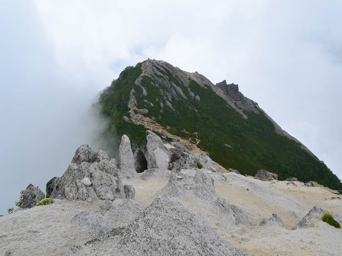
Walk from the back of Chikuu-Komagatake shrine. Cross a hanging bridge over Ojira river canyon. The trail starts from here and leads through the forest zone for a while. Sasano-daora junction is reached at the point where a trail from the Yokote area merges. The area is on a large scree slope. There is a road sign showing that it takes 7 hours from this point to the summit of Mt. Kaikoma-gatake. Take a short break. The trail continues through Kumazasa. The steep slope of Kuroto o’ne is known as Ha’cho uphill. After passing Maebyoubu-no-kashira, the trail becomes narrow and rocky. Cliffs are on both sides of the trail and use of chains is necessary. Proceed with caution. After passing the area using chains and ladders, Touri-tengu is reached.
The fifth station, halfway to Mt. Kaikoma-gatake, will be reached when proceeding on the north slope of Mt. Kuroto-yama. Start climbing on Byoubu-iwa after passing the remains of the Go-goume koya Fifth station Mountain hut. Caution must be employed when using chains and ladders. Shichijo-daiichi-koya Mountain hut is reached when the trail passes a forest area. It is recommended to stay the night at the hut.
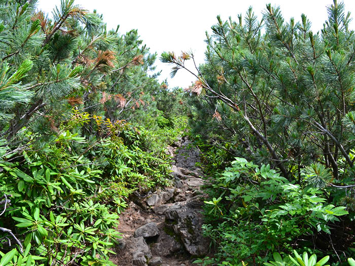
From the hut, enter into a Betula Ermani forest. After passing the forest, you will reach to a tree-line. Hike through a Pinus Pumila zone then Hachigoume-goraigei-ba is reached. The big summit of Mt. Kaikoma-gatake can be seen. The whiteness of the mountain made of granite is impressive. From Hachigoume-goraigei-jyou to the summit, the trail becomes graveled with granite. There is no hazardous spot even though some areas require use of chains.
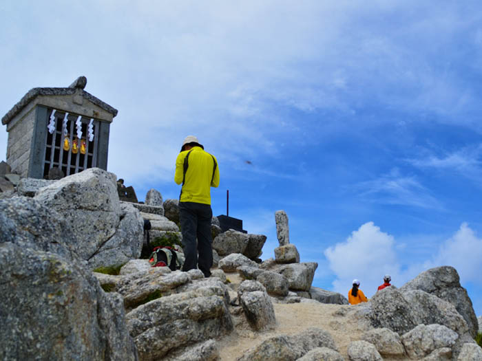
The path leads to the east peak. The beautiful Komagatake Shrine stands at the peak, where a trail from Kitazawa pass merges. After a short uphill, the summit of Mt. Kaikoma-gatake is reached. Under a sunny sky, the reflection of sunshine on the white granite is almost too bright. The view is phenomenal with Mt. Yatsu-gatake, Mt. Senjyo-gatake, Mt. Kita-dake, Mt. Fuji-yama, and the Northern Japan Alps. Hours can be spent easily by looking at the view.
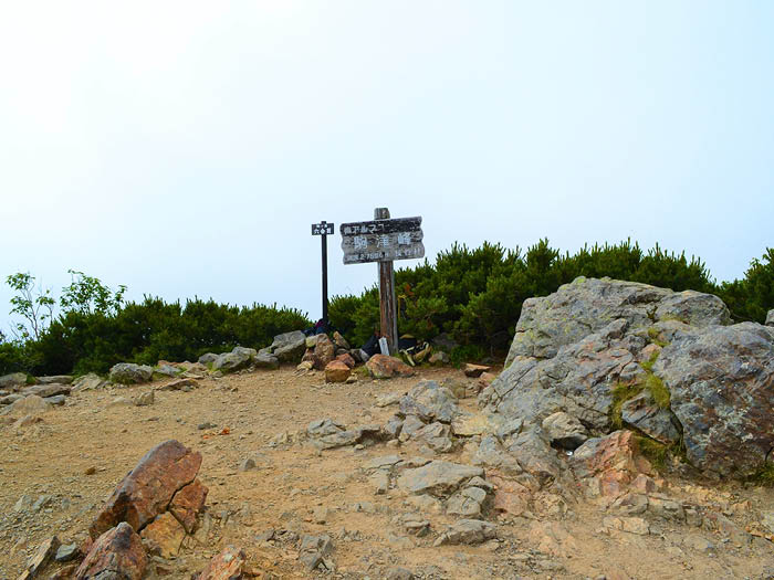
You can descend the same route back, however, it is recommended to hike down to Kitazawa pass unless you drive to the trailhead. Follow the route marked on the granite plateau. There will be a junction which leads to Marishiten. A visit there is recommended to visit if you have the time. It takes about 20 minutes for a round trip from the junction. The trail becomes rocky as you proceed. After passing Rokuman-goku, the trail begins a climb up the rocky zone. Proceed with caution. The trail leads to the plateau, Komatsu-mine, where Mt. Kaikoma-gatake can be seen clearly. Take a short break here and continue descending through a Pinus Pumila zone. After a short uphill, Mt. Futago-yama is reached. From the mountain, hike down through the forest zone (not much to view here) with no views to Kitazawa pass.