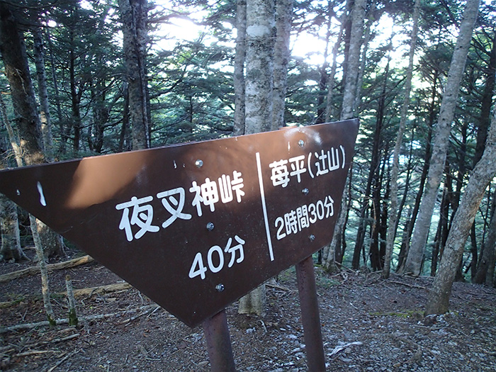
Yashajin Touge Route
②Yashajin pass trailhead ~ Yasyajin koya Mountain hut ~ Ichigo-daira ~ Mt. Yakushi-dake ~ Kannon-daira ~ Saino-kawara ~ Gozaiishi-kosen
Technical level: C
Physical strength level: 5
Difficulty level: ⛰️⛰️
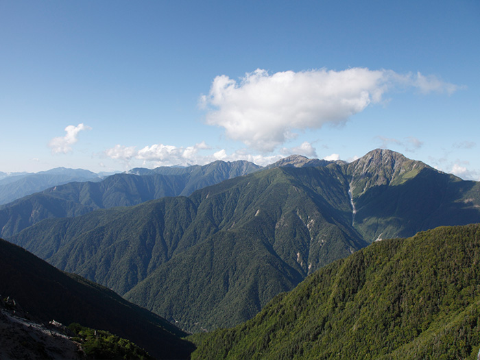
Elevation is gained all at once from Yasyajin touge pass
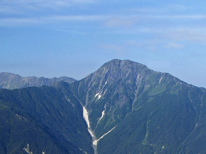
After gaining elevation, ascend while enjoying a great view of Mt. Kita-dake here and there.
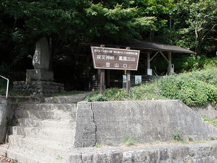
Access to Yashajin Touge Pass
Access to Gozaishi-Kosen
●Hiking Data
Schedule: One night two days
Walking hours: 12 hours 25 minutes
Walking distance: 18.0 km
Difference in elevation: 2,068 m
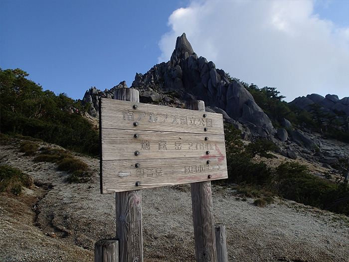
Yasyajin pass trailhead

Elevation 1,380m
↓ 1hour
Yashajin pass
Elevation 1,770m
↓ 1hour 30 minutes
Tsuetate Pass sign
Elevation 2,170m
↓ 1hour 40 minutes
Ichigo-daira
Elevation 2,524m
↓ 30 minutes
Minami-omuro-koya Mountain hut
Elevation 2,420m
↓ 1hour 30 minutes
Mt. Yakushi-dake
Elevation 2,780m
↓ 1hour
Mt. Kannon-dake
Elevation 2,840m
↓ 1hour
Sai-no-kawara
Elevation 2,750m
↓ 2 hours 20 minutes
Mt. Tsubakuro-atama-yama
Elevation 2,104m
↓ 2 hours 10 minutes
Gozaishi-Kosen
Elevation 1,080m
Route Guide
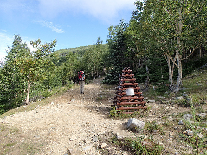
Get off of a bus heading to Hirogawara at Yasyajin pass trail head. A wide trail starts from here. A big tree, called Gohon-matsu, is standing and the remains of a charcoal kiln are found along the trail. It should be an easy walk on a wide trail. The plateau is reached in about one hour. Yasyajin koya Mountain hut is found at the corner of the plateau. Yasyajin pass is reached just ahead of the hut. The view of Shirane Three mountains, having Mt.Kita-dake in the center, can be enjoyed. The trail continues on a ridgeline covered by larch forests. It is not a steep slope but when you feel tired, you must rest while standing.
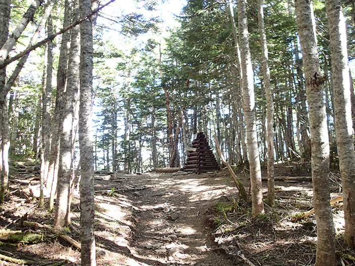
Mt. Kita-dake can be spotted through the trees. After passing the Tsuetate pass sign, tree growth becomes stunted. Shirane three mountains comes clearly into sight. After an open trail with a nice view, the trail enters into a Betula Ermani forest zone. After a gradual slope, Ichigo-daira is reached. From here, the trail traverses the northeast slope of Mt. Tsuji-yama. Minami-omuro-koya Mountain hut is reached shortly. Replenish your water supply at the hut.
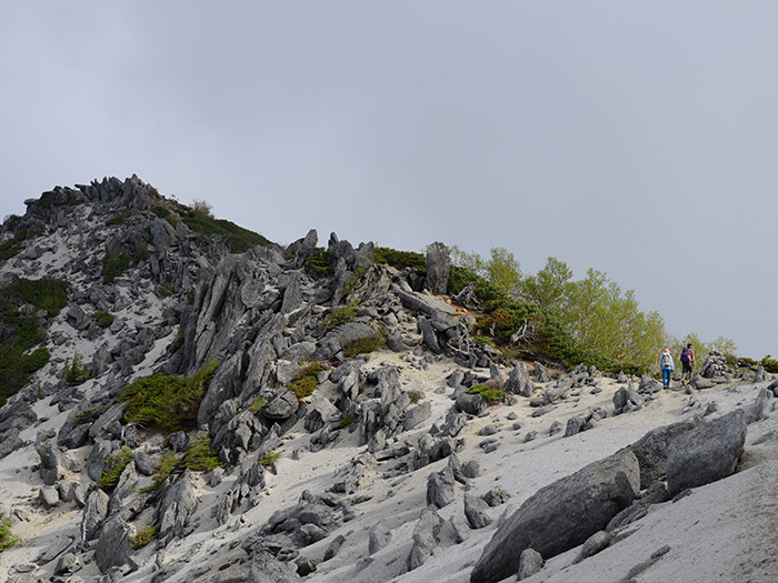
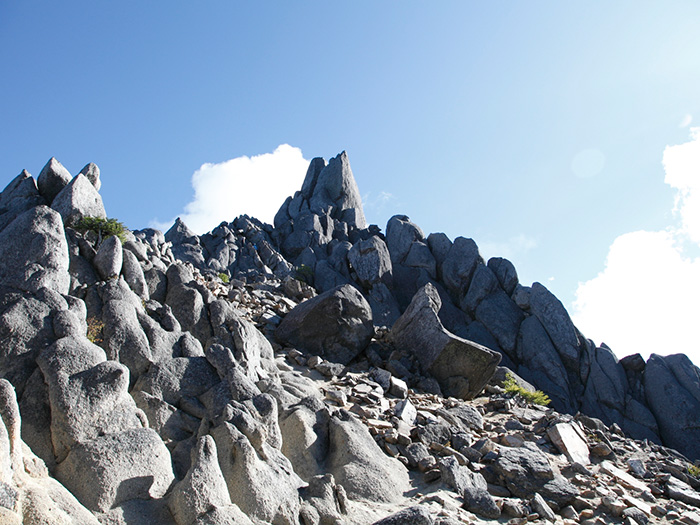
Enter the trail from the back of the hut. The slope is steep but short so hike at a steady pace. When the tree growth become stunted and the tree line is passed, Mt. Sunabarai-dake is reached. The view from the summit is nice and wide and huge rocks are piled up. After a break, descend on the graveled trail. Yakushi-dake-koya Mountain hut is reached. The summit of Mt. Yakushi-dake is reached after climbing the trail through Pinus Pumila forest from the hut. The view of Shirane Three Mountains, Mt. Yatsu-gatake, and Mt. Fuji-yama is fantastic at the summit. Hike north on the ridgeline. Mt. Kannon-dake, the highest peak of the Houo Three Mountains is reached in 45 minutes after one has enjoyed a scenic hike on rocks and sandstones. From Mt. Kannon-dake, descend the slope carefully. Pass a trail heading to Houo-koya Mountain hut along the path and proceed on the rocky trail.
There are many stone statues, Jizo, worshipped as a goddess of pregnancy. The Obelisk, also called Jizo-botoke, can be seen straight ahead. Descend to Houou koya Mountain hut from Sai-no-kawara. The hut is reached once the trail descends the sandstone slope and passes the Betula Ermani forest area.
Descend a ridgeline to Gozaishi-kosen for this route. Follow the ridgeline carefully. The summit of Mt. Tsubakuro-no-kashira yama is reached when the rail becomes covered by Tsuga diversifolia and bamboos leaves. There will be no clear view at the summit. Take a break and continue descending. From Mt. Asahi-dake, where a stone pillar stands, descend a steep slope. When the slope becomes less inclined, Nishi-no-daira is reached. Cross a logging road and follow the path to Gozaishi-Kosen