Kaerazuno-ken Route
Mt. Shirouma-dake ~ Mt. Yariga-take ~ Tengu sansou Mountain hut ~ Kaerazu-kiretto ~ Mt. Karamatsu-dake ~ Karamatsu-dake summit hut ~ Happou-ike sanso Mountain hut
Technical level: D
Physical strength level: 6
Difficulty level: ⛰️⛰️⛰️⛰️
A challenging route that hikers long for
This is a challenging route to hike Kaerazu-no-ken where lots of use of chains and ladders are required. For the summer season, there will be traffic and it could take up to 3 hours to hike through Kaerazu-no-ken
Access to
Happo-o’ne &-Happo-ike-sanso
Mountain hut
●Hiking Data
Schedule: One night two days (From Mt. Shirouma-dake)
Walking hours: 18 hours 20 minutes
(Sarukura~Mt. Shirouma-dake : 6 hours 55 minutes Mt. Shirouma-dake~kaerazu-V-shaped rock formation: 5 hours 5 minutes Kaerazu-V-shaped rock formation ~ Karamatu-dake summit hut: 3 hours 20 minutes, Karamatsu-dake summit hut ~ Happou-ike sanso Mountain hut: 3 hours
Waling hours: 21.4 km
(Sarukura~Mt. Shirouma-dake ~ Mt. Karamatsu-dake ~ Happou-ike sasou Mountain hut
Difference in elevation: 2,885 m
Mt. Shirouma-dake

Elevation 2,932m
↓ 2 hours 25 minutes
Mt. Yariga-take
Elevation 2,903m
↓ 40 minutes
Tengu sansou Mountain hut
Elevation 2,730m
↓ 2 hours
Kaerazu-V-shaped rock formation

Elevation 2,411m
↓ 3 hours
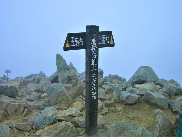
Mt. Karamastsu-dake
Elevation 2,695m
↓ 20 minutes
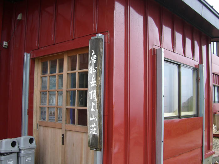
Karamatsu-dake summit hut
Elevation 2,620m
↓ 3 hours
Happou-ike sanso Mountain hut
Elevation 1,830m

Route Guide
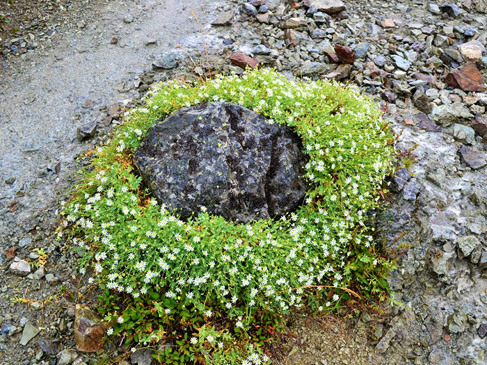
During a ridgeline hike from Mt. Shirouma-dake to Mt. Karamatsu-dake the great view and Alpine plants can be admired. However, an uphill from Kaerazu-V-shaped rock formation to Mt. Karamatsu-dake will be quite a challenging. The climb requires use of chains and ladders on a narrow rocky ridgeline. It takes about 3 hours and great caution must be employed. Beginners must be accompanied by experts. There will be no route to escape. The most challenging point is the starting point of Tengu-no-o-kudari.
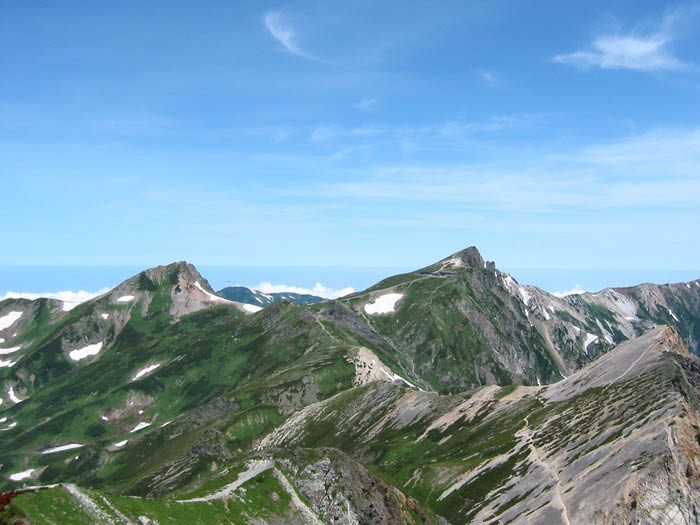
From the summit of Mt. Shirouma-dake, walk on a ridgeline to Mt. Hakuba-yari-gatake. To Mt. Shakushi-dake, take Maki-michi, an alternative route from the saddle. This route merges into the path descending from the ridgeline of Mt. Shakushi-dake. The saddle of Mt.Yari-gatake is reached in a short time. Pass Koyari then climb up to the summit of Mt. Hakuba-yari-gatake. This is a summit with a great view.
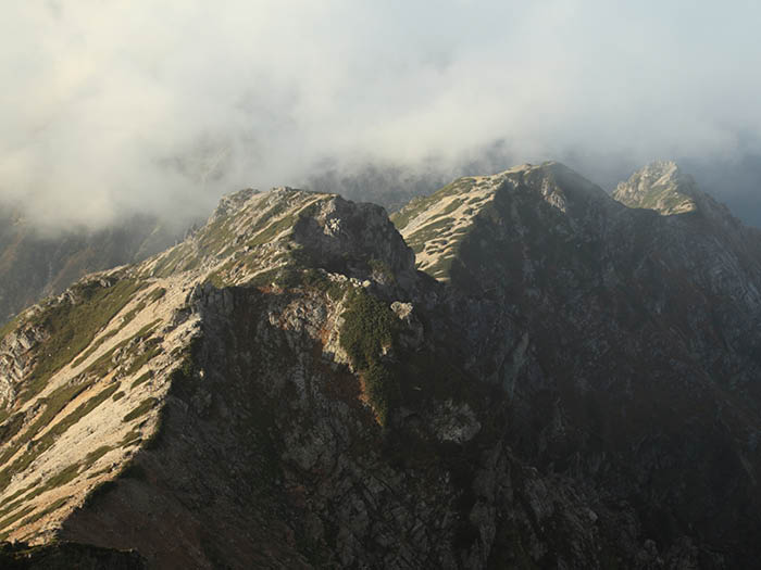
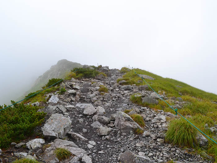
Descend the ridgeline all at once, then merge into another ridgeline. The path to the right goes to Hakuba-yari hot spring. Take another path that goes straight to Tengu sansou Mountain hut. A ridgeline walk from Tengu-no-atama to Tengu-no-o-kudari will be fairly easy and enjoyable, however, there is a variance in elevation of 300m. Walk at a steady pace to avoid over exhaustion. During the high season, there might be some traffic in this area so plan accordingly. After passing Tengu-no-o-kudari, Kaerazu-V-shaped rock formation is reached.
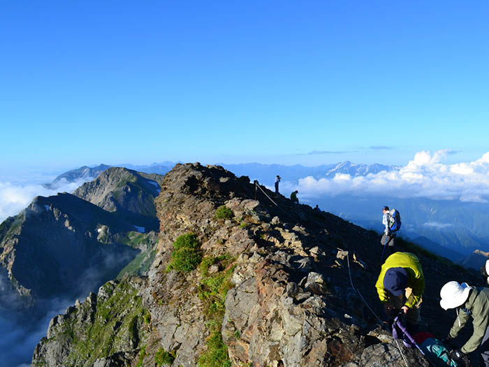
From Kaerazu-V-shaped rock formation, the trail continues with ups and downs, requiring the use of chains and ladders. The direction is inked on rocks. Stay focused and maintain a three-points-support approach (where three points out of four points, which are your hands and your feet, must be in contact and support your body weight while proceeding on a rock wall). Don’t forget to wear a helmet. Ichi-mine peak is approached by a ridgeline then a big rock Ni-mine peak stands in front of you. Follow a course where you might find some relief, with secure cracks in rocks for hands and feet. Chains are attached to rocks for your safety in hazardous zones. Cross a bridge and continue the narrow path. It is impossible to pass each other so look out for hikers coming in your direction
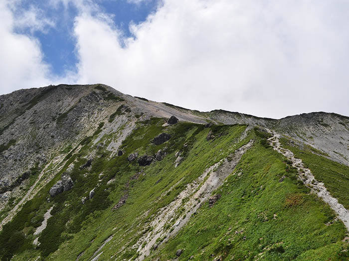
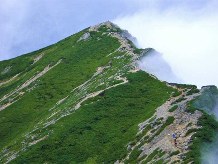
After the narrow path, Ni-mine peak is reached at the end of a rocky slope. Take a break at the wide summit. Proceed on an easy slope ridgeline and pass a Pinus Pumila zone then Mitsu-mine peak is reached. Follow a fairly easy path to the summit of Mt. Karamatsu-dake.
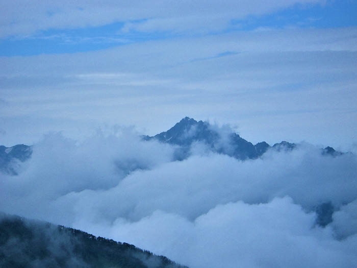
Looking back, the challenging route that you have ascended can be seen. A fantastic view of Mt. Goryu-dake spreads right in front of you. Descend to Karamatsu-dake summit hut, where a stay for the night is recommended. On the next day, descend on Happou o’ne ridgeline to Happou sansou Mountain hut. From there, take gondolas down to Hakuba-happou.