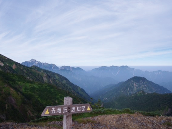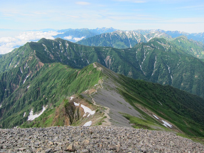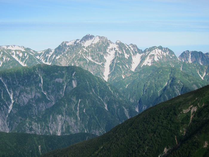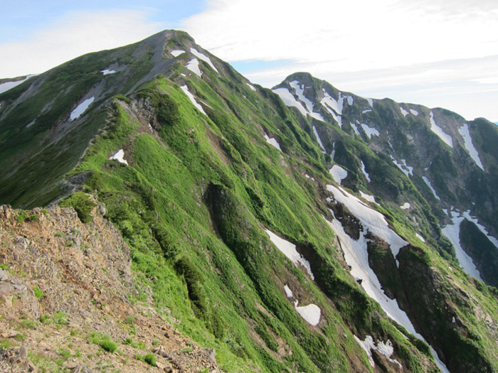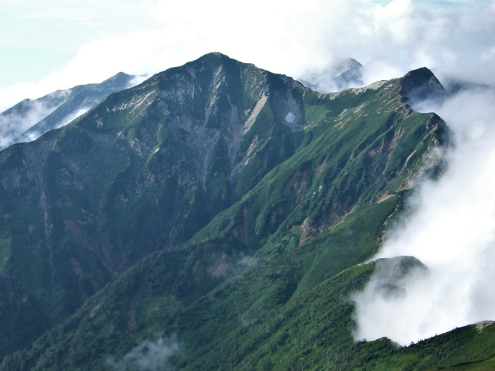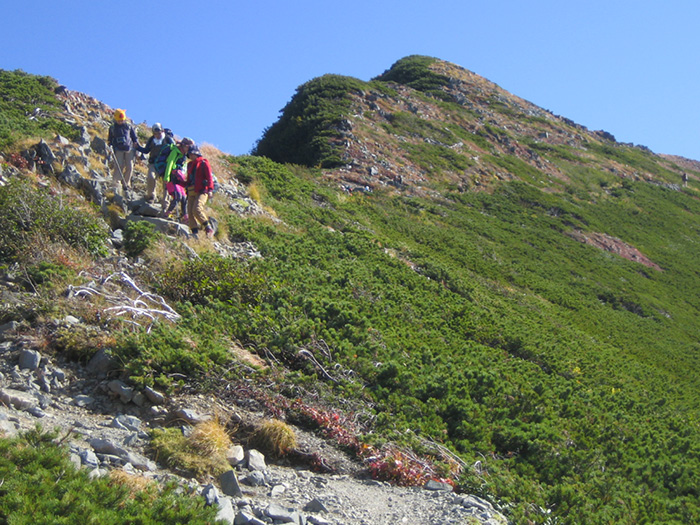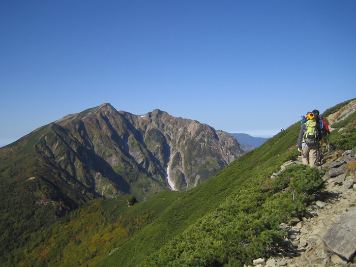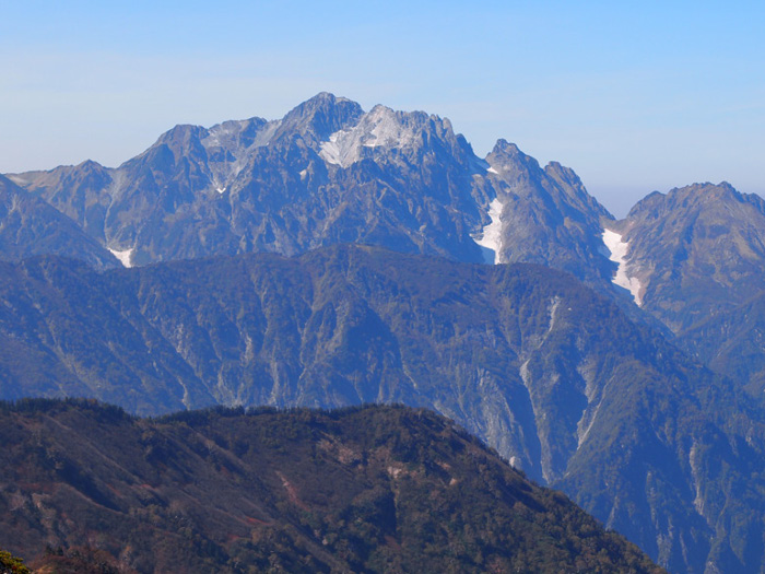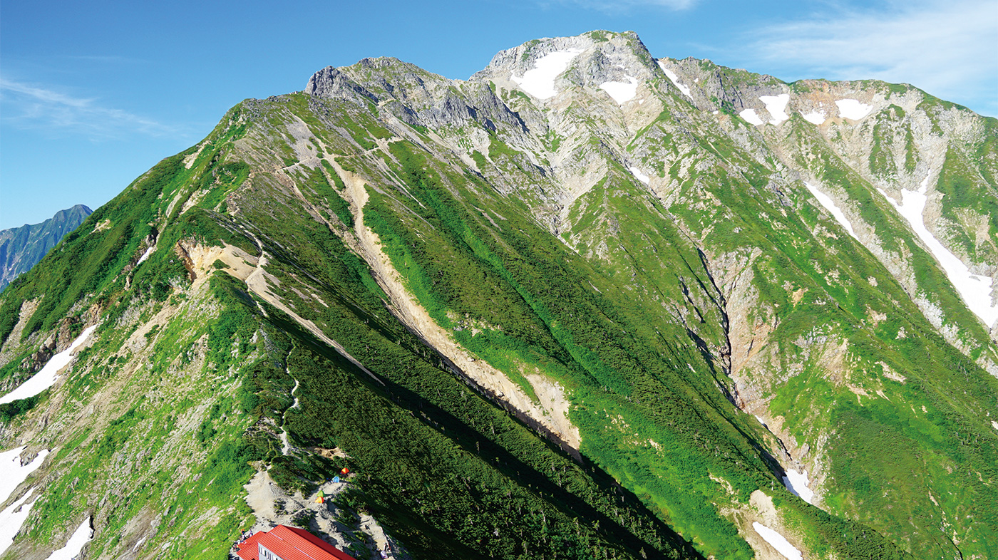
The voluminous mountain, Mt. Goryu-dake can be seen from the Azumino area and Tateyama Mountains. There is a V shaped cut in the mountain range between Mt. Goryu-dake and Mt. Kashima-yari-gatake known as “Hachimine”, which triggers one’s willingness to climb. On the east side, there are 10 rock ridges, which all fall to Shiradake-sawa and these are ridges that many rock climbers long for. In the local area, they used to be called Warabishi-no-atama by the way they looked or Mt. Goryu-dake owing to a resemblance with Takeda-bishi. The most popular course is a route asending from Happo o’ne to Mt. Karamatsu-dake then descending on Toomi o’ne. Another route from Mt. Kashima-yari-gatake includes the Hachimine V-shaped cut ridge Route – this may scare you but it will be a great memory.
Mt. Goryu-dake: Elevation 2,814 m
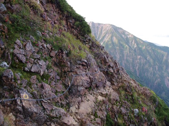
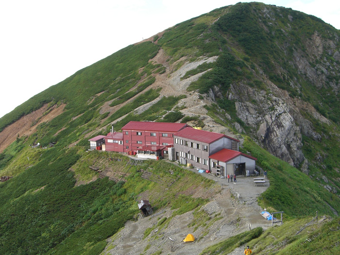
Mt. Goryu-dake. One might imagine a masculine shape for the mountain by the name alone. It is actually a powerful mountain, however, the approaches from Happo o’ne or Tomi o’ne are accessible for anyone. A ridgeline walk from Mt. Kashima-yari-gatake is challenging. From the north peak of Mt. Kashima-yari-gatake to Kiretto koya Mountain hut, the rocky ridgeline walk requires the use of ladders and chains. It will be a downhill with a 300 m variance in elevation. In general, more accidents happen in rocky zones when descending than ascending. Make sure to wear a helmet and proceed at a steady pace.
Trailhead vicinity weather
Weekly weather forecast zone:Northern Nagano Prefecture
| DAY | WEATHER | LOWEST | HIGHEST |
|---|---|---|---|
| 7/2 | 22℃ | 30℃ | |
| 7/3 | 22℃ | 32℃ | |
| 7/4 | 22℃ | 33℃ | |
| 7/5 | 22℃ | 34℃ | |
| 7/6 | 22℃ | 33℃ | |
| 7/7 | 22℃ | 33℃ |
This is a publication of the calculated figures for weather predictions and is not the weather forecast. There are instances where there will be big differences in the values stated for the mountains, in accord with the topography as well as sunlight, etc. so please take care.
72 hours weather information:Able Hakuba Goryu Ski Resort, Oaza-Kamishiro, Hakuba-mura, Kitaazumi-gun, Nagano, Japan
| Date and time |
7/1 6:00 |
7/1 7:00 |
7/1 8:00 |
7/1 9:00 |
7/1 10:00 |
7/1 11:00 |
7/1 12:00 |
7/1 13:00 |
7/1 14:00 |
7/1 15:00 |
7/1 16:00 |
7/1 17:00 |
7/1 18:00 |
7/1 19:00 |
7/1 20:00 |
7/1 21:00 |
7/1 22:00 |
7/1 23:00 |
7/2 0:00 |
7/2 1:00 |
7/2 2:00 |
7/2 3:00 |
7/2 4:00 |
7/2 5:00 |
7/2 6:00 |
7/2 7:00 |
7/2 8:00 |
7/2 9:00 |
7/2 10:00 |
7/2 11:00 |
7/2 12:00 |
7/2 13:00 |
7/2 14:00 |
7/2 15:00 |
7/2 16:00 |
7/2 17:00 |
7/2 18:00 |
7/2 19:00 |
7/2 20:00 |
7/2 21:00 |
7/2 22:00 |
7/2 23:00 |
7/3 0:00 |
7/3 1:00 |
7/3 2:00 |
7/3 3:00 |
7/3 4:00 |
7/3 5:00 |
7/3 6:00 |
7/3 7:00 |
7/3 8:00 |
7/3 9:00 |
7/3 10:00 |
7/3 11:00 |
7/3 12:00 |
7/3 13:00 |
7/3 14:00 |
7/3 15:00 |
7/3 16:00 |
7/3 17:00 |
7/3 18:00 |
7/3 19:00 |
7/3 20:00 |
7/3 21:00 |
7/3 22:00 |
7/3 23:00 |
7/4 0:00 |
|---|---|---|---|---|---|---|---|---|---|---|---|---|---|---|---|---|---|---|---|---|---|---|---|---|---|---|---|---|---|---|---|---|---|---|---|---|---|---|---|---|---|---|---|---|---|---|---|---|---|---|---|---|---|---|---|---|---|---|---|---|---|---|---|---|---|---|---|
| Weather | |||||||||||||||||||||||||||||||||||||||||||||||||||||||||||||||||||
| Temperature | 19℃ | 20℃ | 21℃ | 23℃ | 24℃ | 24℃ | 24℃ | 24℃ | 23℃ | 23℃ | 24℃ | 24℃ | 23℃ | 22℃ | 20℃ | 20℃ | 19℃ | 19℃ | 19℃ | 18℃ | 18℃ | 18℃ | 18℃ | 18℃ | 18℃ | 18℃ | 18℃ | 19℃ | 20℃ | 21℃ | 22℃ | 23℃ | 24℃ | 23℃ | 23℃ | 23℃ | 22℃ | 22℃ | 20℃ | 20℃ | 19℃ | 19℃ | 18℃ | 18℃ | 18℃ | 18℃ | 19℃ | 19℃ | 19℃ | 19℃ | 20℃ | 21℃ | 22℃ | 22℃ | 22℃ | 22℃ | 22℃ | 21℃ | 21℃ | 21℃ | 21℃ | 21℃ | 20℃ | 19℃ | 19℃ | 19℃ | 18℃ |
| Precipitation | 0mm/h | 0mm/h | 0mm/h | 0mm/h | 0mm/h | 0mm/h | 0mm/h | 0mm/h | 0mm/h | 0mm/h | 0mm/h | 0mm/h | 0mm/h | 0mm/h | 0mm/h | ※ 16時間以降は表示されません | |||||||||||||||||||||||||||||||||||||||||||||||||||
| Wind direction |
west 1m/s |
west 1m/s |
0m/s |
0m/s |
0m/s |
0m/s |
west 1m/s |
west 1m/s |
west 1m/s |
west 1m/s |
west 1m/s |
west 1m/s |
west 1m/s |
0m/s |
west 1m/s |
west 1m/s |
west 1m/s |
west 1m/s |
west 1m/s |
west 1m/s |
west 2m/s |
west 2m/s |
west 2m/s |
west 2m/s |
west 2m/s |
west 1m/s |
west 1m/s |
west 1m/s |
0m/s |
0m/s |
0m/s |
0m/s |
west 1m/s |
west 1m/s |
west 1m/s |
west 1m/s |
west 1m/s |
0m/s |
west 1m/s |
west 1m/s |
west 1m/s |
west 1m/s |
west 1m/s |
west 1m/s |
west 2m/s |
west 1m/s |
west 1m/s |
west 1m/s |
west 1m/s |
west 1m/s |
0m/s |
0m/s |
0m/s |
0m/s |
0m/s |
0m/s |
0m/s |
0m/s |
0m/s |
0m/s |
west 1m/s |
0m/s |
west 1m/s |
west 1m/s |
west 1m/s |
west 1m/s |
west 1m/s |
※The weather information will be information on 5km square including the relevant point.
※天気予報マークは一次細分区域から表示しています
