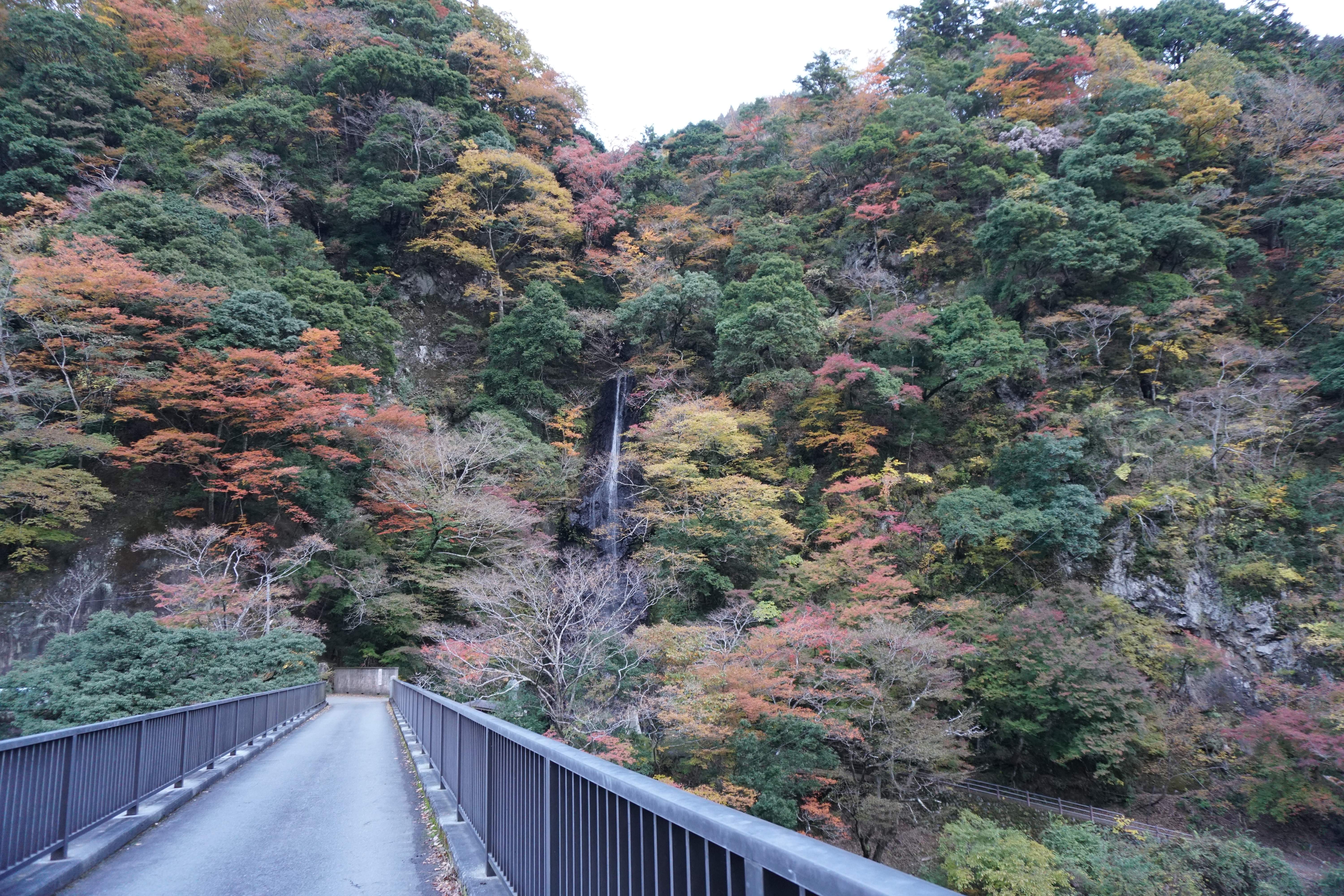
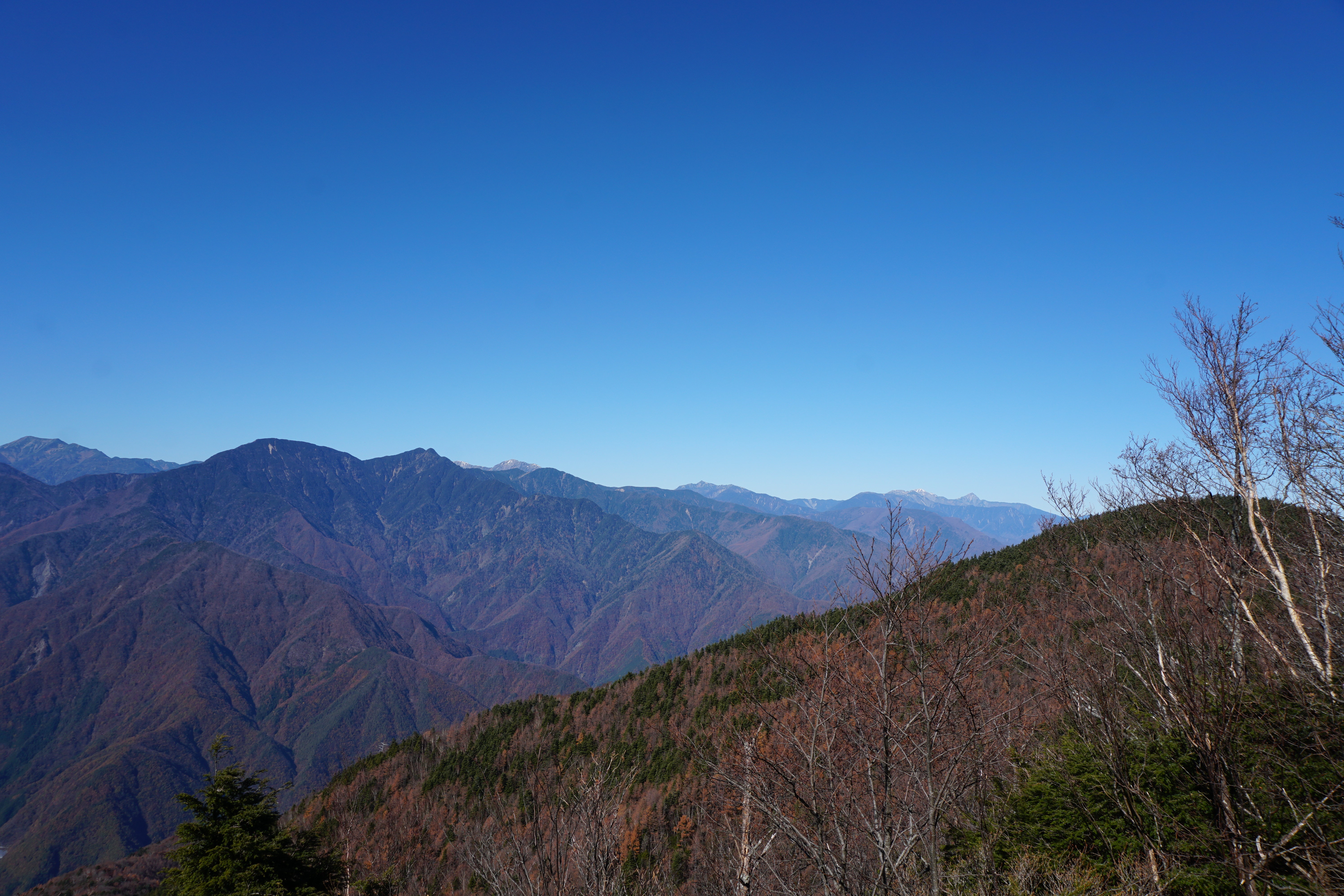
Abe-oku is an area beyond the Abe River, just as its name implies. Shizuoka City is also home to places such as Hatanagi and Sawarajima, which serve as trailheads to the main ridges of the Southern Alps and lie deep within the area where the headwaters of the Oi River can be found, but tracing back to the source of the Abe River, which is a major river in Shizuoka City along with the Oi River, will bring you to the Abe-oku area. The main mountain range in Abe-oku is surrounded by the towns of Hayakawa, Minobu, and Nanbu, all located in Yamanashi Prefecture close to the Shizuoka border and hidden away approximately 40 – 50 km from the center of Shizuoka City. The mountains stand at an elevation of around 2,000 meters and the ridgelines and peaks are covered in trees, but the occasional glimpses of Mt. Fuji or the Southern Alps offer stunning views that are difficult to see from other areas.
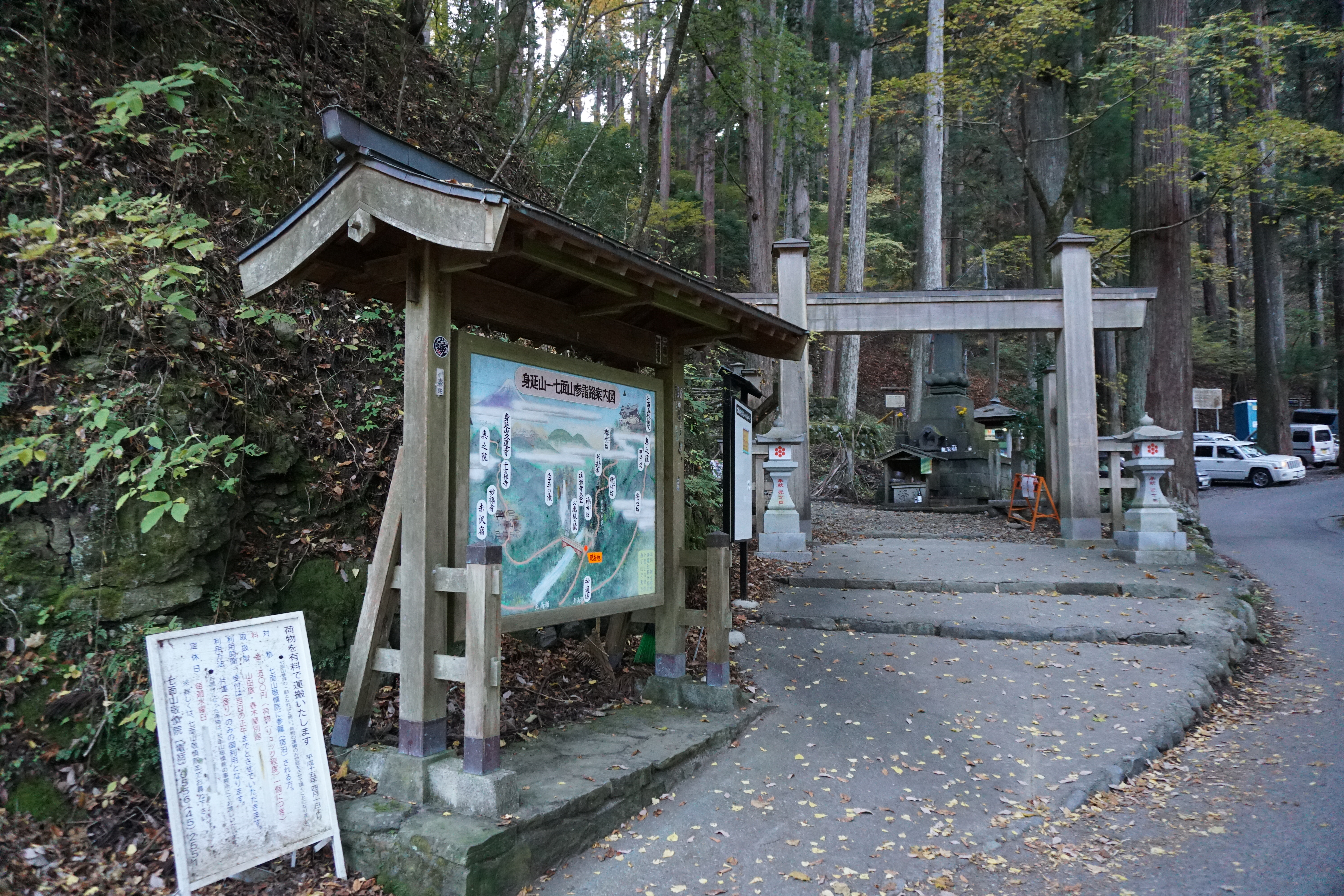
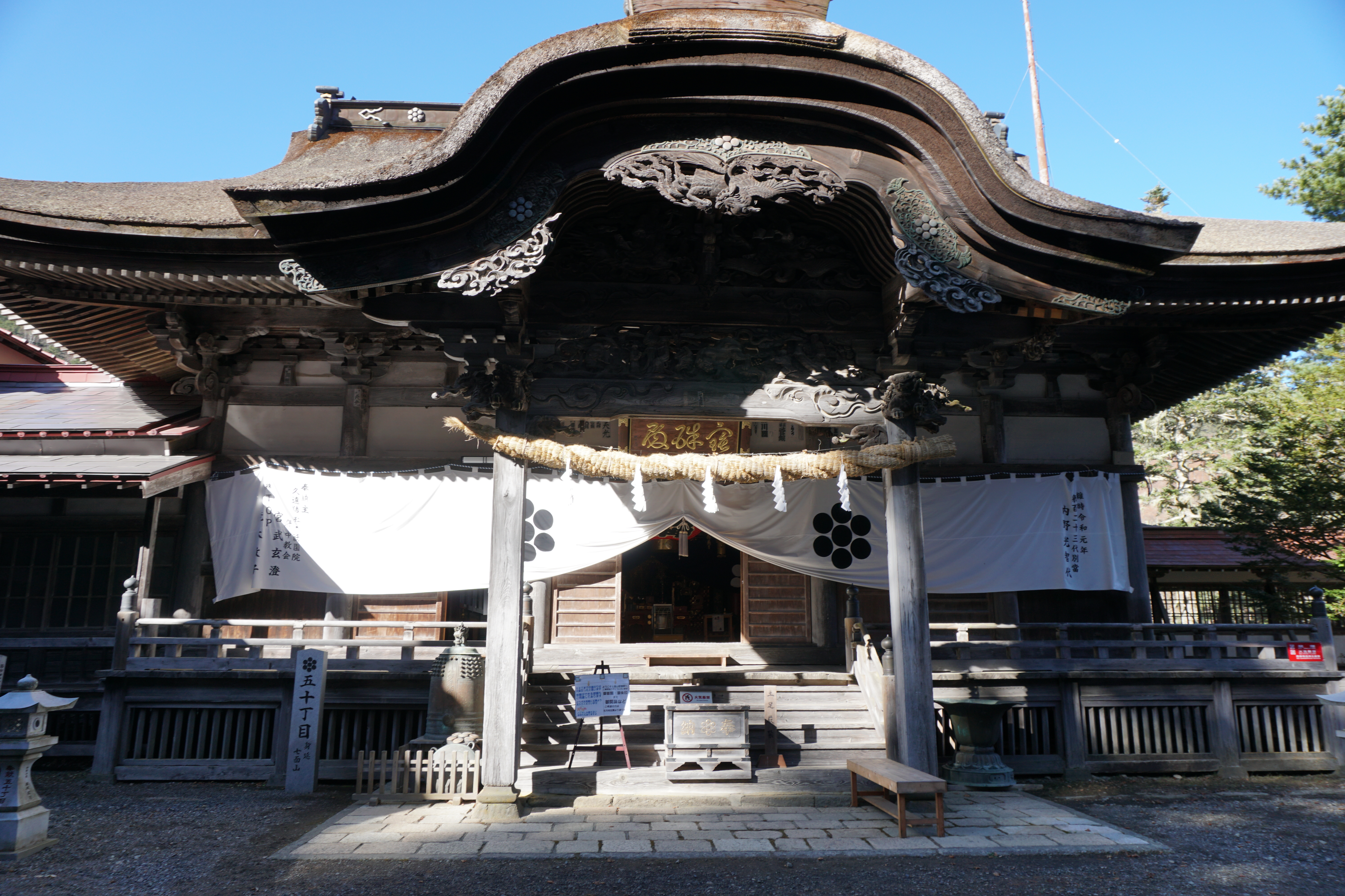
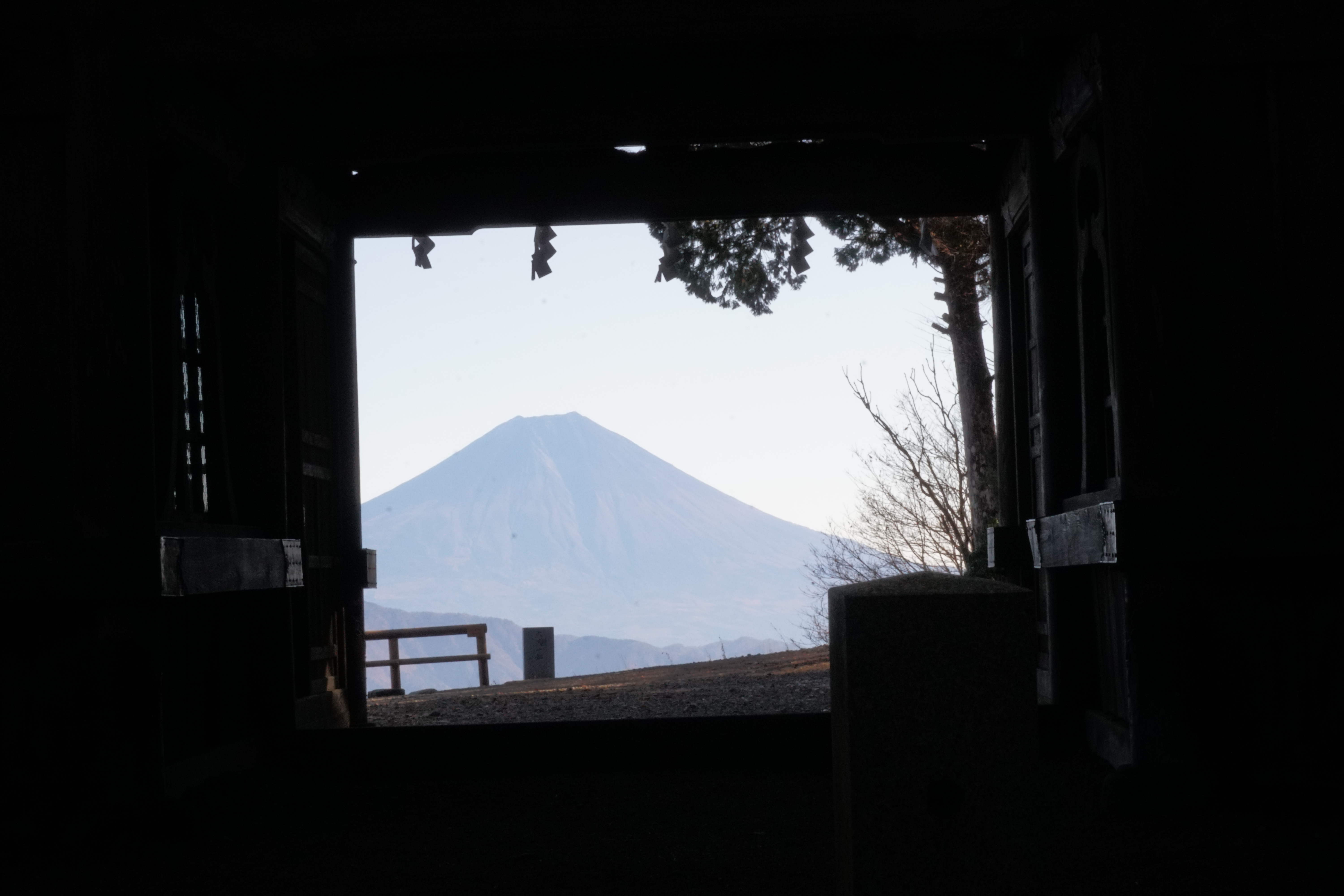
If you head further north from Abe-oku, you will come upon Mt. Shichimen-san, which is one of Japan’s 200 famous mountains. Though you may not be familiar with it, along with Mt. Minobu, Mt. Shichimen-san is a sacred place for followers of the Lotus Sutra as the holy mountain where Nichiro, a senior disciple of the high priest Nichiren, enshrined Shichimen-Daimyojin at Keishin-in Temple, an enormous temple complex located at an elevation of 1,700 meters just below the mountain’s summit. Large numbers of Nichiren Buddhism followers from all over Japan come here, as do hikers, to visit the faith’s main dojo (worship hall). Even those without any religious affiliation feel the presence of a divine spirit in the moment the sight of Mt. Fuji at sunrise comes into view from the sanmon gate.
●Mt. Yambushi:Elevation 2,013m Climbing
●Mt. Hachikourei :Elevation 1,918m Climbing
●Mt. Shichimen-san:Elebation 1,989m Climbing
The main approach to Abe-oku is from Ume-gashima Onsen in Shizuoka City. You can drive from the Ikawa side of the mountain over Mt. Sasayama all the way to Hyakujo mountain pass and can climb to the Yanbushi peak in just over 30 minutes from there. However, we will introduce the route that takes you from Nishi-hikage-zawa, up Mt. Yanbushi, through Mt. Oyarei and Mt. Hakkorei, and descends through Ume-gashima Onsen.
The generally taken routes to the sacred peak of Mt. Shichimen-san are the kitasando route starting in Hayakawa Town in Yamanashi Prefecture or through Mt. Minobu, which is reached from the Hagoromo trailhead at Shiraito Falls standing at the headwaters of the Haruki River, which lies beyond Akasawa-juku, a designated Important Cultural Buildings Preservation District. Here we will introduce the omotesando (temple approach) road route.
Trailhead vicinity weather
Weekly weather forecast zone:Yamanashi Midwest Region
| DAY | WEATHER | LOWEST | HIGHEST |
|---|---|---|---|
| 7/14 | 23℃ | 31℃ | |
| 7/15 | 24℃ | 28℃ | |
| 7/16 | 24℃ | 30℃ | |
| 7/17 | 25℃ | 31℃ | |
| 7/18 | 24℃ | 35℃ | |
| 7/19 | 24℃ | 36℃ |
This is a publication of the calculated figures for weather predictions and is not the weather forecast. There are instances where there will be big differences in the values stated for the mountains, in accord with the topography as well as sunlight, etc. so please take care.
72 hours weather information:248, Kouju, Hayakawa-cho, Minamikoma-gun, Yamanashi
| Date and time |
7/13 17:00 |
7/13 18:00 |
7/13 19:00 |
7/13 20:00 |
7/13 21:00 |
7/13 22:00 |
7/13 23:00 |
7/14 0:00 |
7/14 1:00 |
7/14 2:00 |
7/14 3:00 |
7/14 4:00 |
7/14 5:00 |
7/14 6:00 |
7/14 7:00 |
7/14 8:00 |
7/14 9:00 |
7/14 10:00 |
7/14 11:00 |
7/14 12:00 |
7/14 13:00 |
7/14 14:00 |
7/14 15:00 |
7/14 16:00 |
7/14 17:00 |
7/14 18:00 |
7/14 19:00 |
7/14 20:00 |
7/14 21:00 |
7/14 22:00 |
7/14 23:00 |
7/15 0:00 |
7/15 1:00 |
7/15 2:00 |
7/15 3:00 |
7/15 4:00 |
7/15 5:00 |
7/15 6:00 |
7/15 7:00 |
7/15 8:00 |
7/15 9:00 |
7/15 10:00 |
7/15 11:00 |
7/15 12:00 |
7/15 13:00 |
7/15 14:00 |
7/15 15:00 |
7/15 16:00 |
7/15 17:00 |
7/15 18:00 |
7/15 19:00 |
7/15 20:00 |
7/15 21:00 |
7/15 22:00 |
7/15 23:00 |
7/16 0:00 |
|---|---|---|---|---|---|---|---|---|---|---|---|---|---|---|---|---|---|---|---|---|---|---|---|---|---|---|---|---|---|---|---|---|---|---|---|---|---|---|---|---|---|---|---|---|---|---|---|---|---|---|---|---|---|---|---|---|
| Weather | ||||||||||||||||||||||||||||||||||||||||||||||||||||||||
| Temperature | 26℃ | 24℃ | 23℃ | 22℃ | 21℃ | 20℃ | 20℃ | 20℃ | 19℃ | 19℃ | 19℃ | 19℃ | 19℃ | 19℃ | 20℃ | 21℃ | 23℃ | 24℃ | 24℃ | 24℃ | 25℃ | 26℃ | 27℃ | 27℃ | 26℃ | 24℃ | 24℃ | 23℃ | 21℃ | 21℃ | 22℃ | 22℃ | 22℃ | 22℃ | 22℃ | 21℃ | 20℃ | 21℃ | 21℃ | 21℃ | 21℃ | 21℃ | 21℃ | 22℃ | 22℃ | 22℃ | 22℃ | 21℃ | 21℃ | 22℃ | 21℃ | 21℃ | 20℃ | 20℃ | 19℃ | 20℃ |
| Precipitation | 0mm/h | 0mm/h | 0mm/h | 0mm/h | 0mm/h | 0mm/h | 0mm/h | 0mm/h | 0mm/h | 0mm/h | 0mm/h | 0mm/h | 0mm/h | 0mm/h | 0mm/h | ※ 16時間以降は表示されません | ||||||||||||||||||||||||||||||||||||||||
| Wind direction |
south 2m/s |
south 2m/s |
south 1m/s |
south 1m/s |
south 1m/s |
south 1m/s |
south 1m/s |
south 1m/s |
south 1m/s |
south 1m/s |
south 1m/s |
south 1m/s |
south 1m/s |
south 1m/s |
south 1m/s |
south 1m/s |
south 1m/s |
south 1m/s |
south 1m/s |
south 1m/s |
south 1m/s |
south 1m/s |
south 1m/s |
south 2m/s |
south 2m/s |
south 2m/s |
south 2m/s |
south 2m/s |
south 1m/s |
south 1m/s |
south 2m/s |
south 2m/s |
south 2m/s |
south 2m/s |
south 2m/s |
south 2m/s |
south 1m/s |
south 1m/s |
south 2m/s |
south 2m/s |
south 1m/s |
south 2m/s |
south 2m/s |
south 2m/s |
south 1m/s |
south 1m/s |
south 1m/s |
south 2m/s |
south 1m/s |
south 1m/s |
south 1m/s |
south 1m/s |
south 1m/s |
south 1m/s |
south 1m/s |
south 1m/s |
※The weather information will be information on 5km square including the relevant point.
※天気予報マークは一次細分区域から表示しています
Landscape of the Abe-oku