【CONTENTS】The birth of the Japan Alps

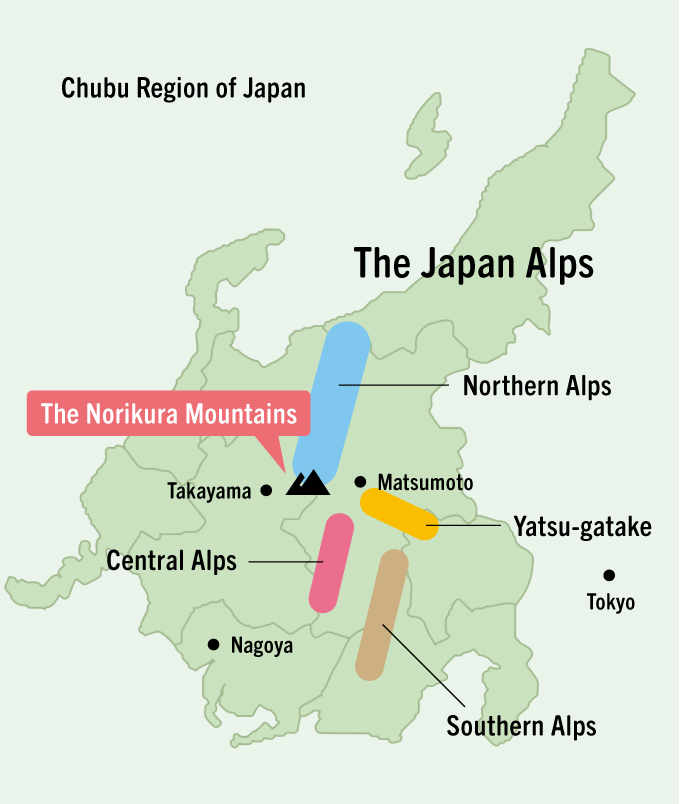
The Japan Alps are located in the center of Honshu and comprised of three mountain ranges; the Northern, Central, and Southern Alps. All three ranges exceed the forest line with peaks standing at elevations above 3000 meters and stretch from north to south across approximately 100 kilometers. During the glacial periods 20,000 and 60,000 years ago, mountain glaciers formed at high elevations, but because the glacial erosion was limited, the undulations of the main ridgeline were small and mountain climbing trails developed along the main ridgeline. The Japan Alps are among the most recent mountain ranges formed in the world, and all three ranges emerged due to the effect of compressive stress in an east-west direction on the oceanic plates subduction beneath the Japan island arc in the Quaternary Period more than 2.5 million years ago. Before 2.5 million years ago, all of the areas were hills less than 1000m above sea level.
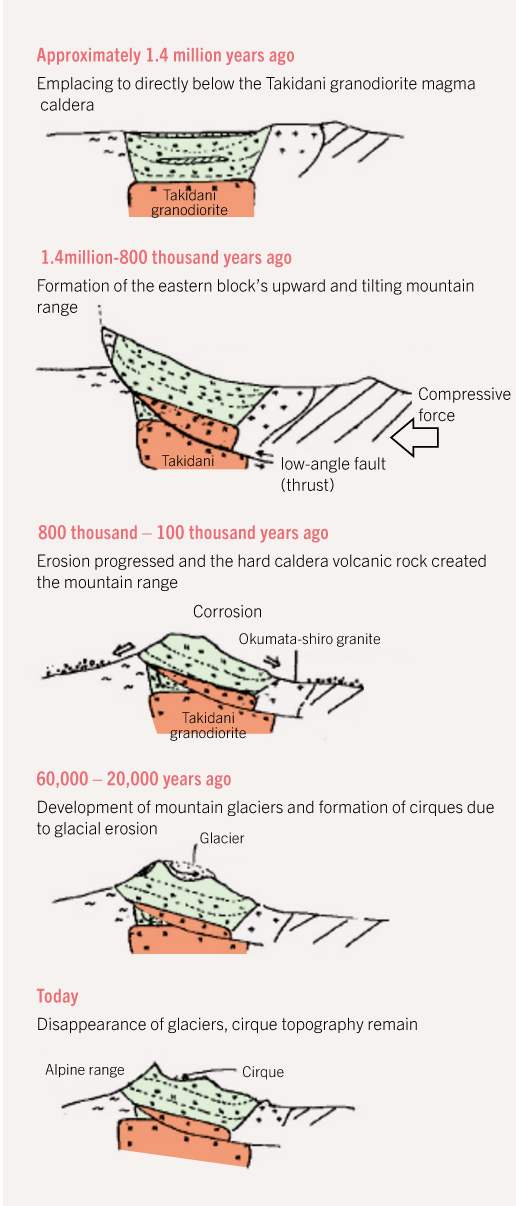
Figure 1. Formation of the Northern Alps Yari-Hotaka Mountains
The large caldera volcano in the Yari-Hotaka mountain range was active 1.75 million years ago. At that time, the magma that had risen up to just a few kilometers below the earth’s surface, weakening the crust and creating a reverse fault and subsequent detachment fault in the middle of the crust. A tilting uplift emerged with the upward motion of the hangingside (Yari-Hotaka mountain range) along the reverse fault. The hard caldera volcanic rock rose and was left behind with the erosion that took place over the next several hundred thousand years, and the mountain glaciers that appeared 60,000 and 20,000 years ago created a series of sharp rocky ridges.


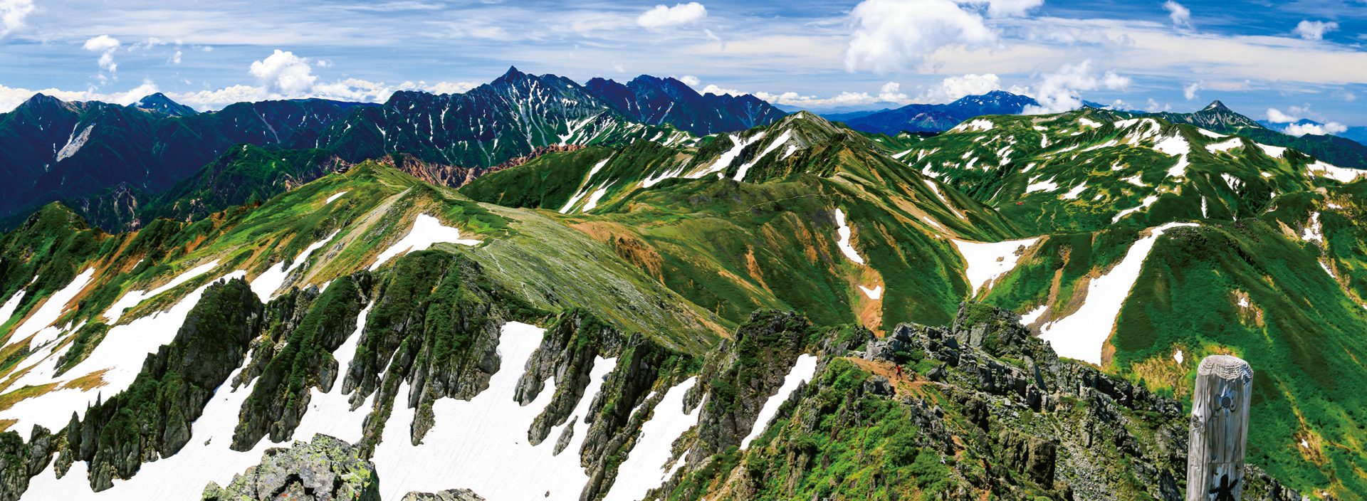
The Northern Alps as seen from Mt. Suisho-dake: The beautiful landscape continues on as far as the eye can see. The uniform height of the mountain ridges reflects the almost identical buoyancy of the earth’s crust beneath the mountain range, and the restricted erosion of the mountain glaciers.
Geology and uplifting of the Northern Alps
The Northern Alps can be broadly divided into the Paleozoic accretionary complex of the northern portion, the Late Cretaceous granite and volcanic rock of the central portion, and the Jurassic accretionary complex of the southern portion, accompanied by Quaternary caldera- granite complexes and the Norikura volcanic chain which includes active volcanoes. The mountains began forming 2.3 million years ago with a gradual wide area warping followed by a violent uplift accompanying a tilting to the east along the eastern side of the range between 1.4 and 0.8 million years ago (Figure 1). This was then followed by another rise with a tilting to the west on the western side of the mountain range.

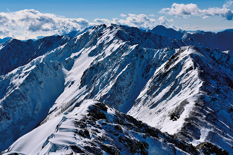
Northern portion of the Southern Alps with continuous ridges close to 3000 meters in elevation: A mean uplift rate of 4mm/y has been observed on the west side of the Southern Alps. It is possible that there has been an even bigger uplift in the central axis of the mountain range
Geology and uplifting of the Central and Southern Alps
The Central Alps are made up of Late Cretaceous granitoids, and their uplifting began approximately 800 thousand years ago. There are several active faults that run north and south along the eastern and western edges of the mountain range. These fault are reverse faults that dip toward the central axis of the mountain range. What caused the mountains to grow was the uplifting and displacement becoming greater, the closer it was to the central axis of the range. The Southern Alps are mainly made up of Jurassic and Cretaceous to Paleogene accretionary complex. In the north, the accretionary complex runs north and south, and in the south, it runs northeast to southwest. The curve in this structure was formed during the northern progression of the Philippine Sea Plate. The Southern Alps began to uplift 1.4 million years ago due to the western tilting of the low-angle, large-scale reverse fault that tilts west and runs along the eastern side of the mountain range. It continues to uplift, even today.
