Hiking Kiriga-mine for Autumn Leaves Viewing
A round trip to Kiriga-mine in Autumn Mt. Kuruma-yama ~ Mt. Chochomi-yama ~ Monomi-ishi ~ Yashimagahara Shitsugen ~ Sawando ~ Mt. Kuruma-yama Kata ~ Mt. Kuruma-yama
Technical level: A
Physical strength level: 1
A round trip going around a grass field and a wetland above the clouds
A very attractive route with great views
●Hiking Data
Schedule: One day or One night and Two days
Walking hours: 4 hours and 45 minutes
(Up: 1 hour 20 minutes Down: 3 hours 25 minutes)
Walking distance: 11 km
Variance in elevation: 280 m
Lift Sancho station
Elevation 1,915m
↓ 5 minutes
Mt. Kuruma-yama
Elevation 1,924m
↓ 40 minutes
Mt. Chochomi-yama
Elevation 1,836m
↓ 20 minutes
Monomi-ishi
Elevation 1,780m
↓ 1 hour and 5 minutes
Yashima-gahara plateau
Elevation 1,640m
↓ 1 hour and 15 minutes
Sawando
Elevation 1,650m
↓ 30 minutes
Mt. Kuruma-yama Kata
Elevation 1,800m
↓ 45 minutes
Mt. Kuruma-yama
Elevation 1,924m
↓ 5 minutes
Lift Sancho station
Elevation 1,915m
Route Guide
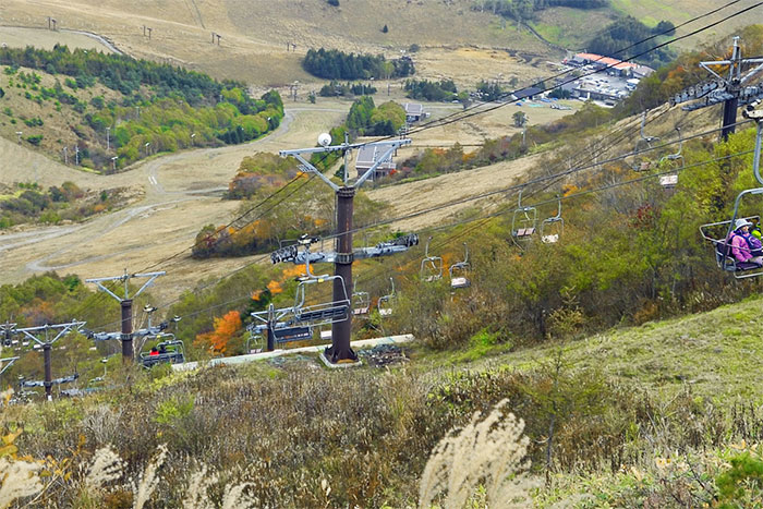
This route starts from Kurumayama plateau. Transfer lifts and get off at Sancho- station from the second lift, which takes you to a spot directly below the summit of Mt. Kuruma-yama. The route is the same as the Mt. Kuruma-yama Kata route introduced on another of these pages, therefore, you may start from Mt. Kuruma-yama Kata. If you drive yourself, it should not be any problem, however, if you take a shuttle bus, they only run on the weekends from Autumn to Winter with just a few number of buses. Therefore, it is recommended that if you wish to use public transportation, you should ride a bus to Kuruma-yama plateau, which runs the whole year.
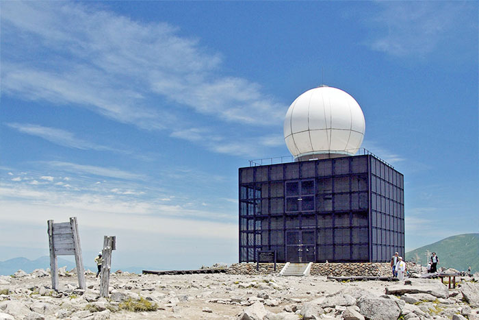
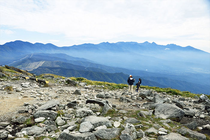
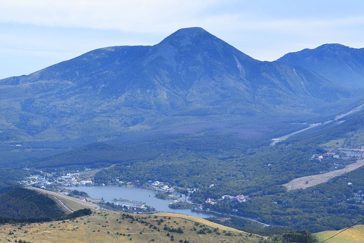
After one uphill from Sancho station, the summit of Mt. Kuruma-yama is reached when Kuruma-yama Shrine comes into view. A big weather tracking radar stands on the wide and flat summit. Mt. Tateshina-yama and Mt. Yatsuga-take can be seen right in front of you. High mountains in Chubu area such as the South, Central, and North Alps, and Mt. Fuji also can be viewed as well.
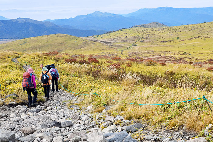
After fully enjoying the great view, return towards the lift station and descend to Kuruma-yama nokkoshi. The area is a gradual slope and covered by yellow and bright brown colored grasses. Ascend on a gradual ridgeline from Kuruma-yama nokkoshi, then pass Mt. Chochomi-yama to Monomi-ishi. If you look back, Mt. Kuruma-yama with the radar on the summit and Mt. Tateshina-yama above the grassfield can be seen.
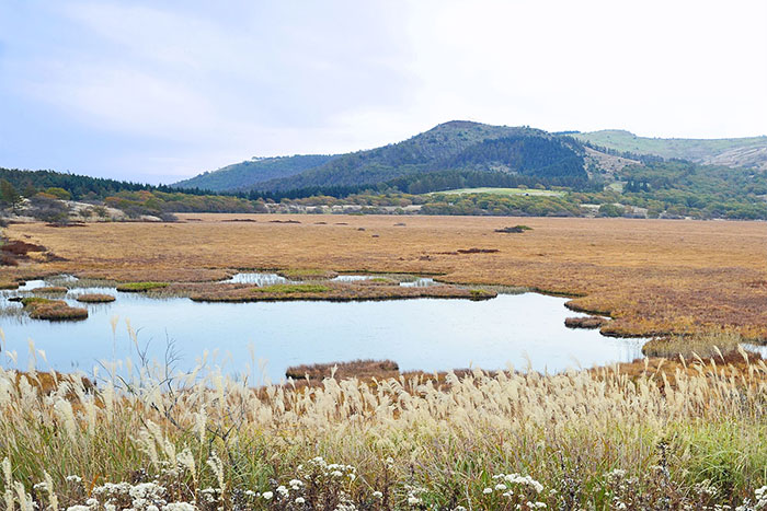
The promenade ends at Monomi-ishi with sharp stones piled up, which is a rare feature for the Kiriga-mine area. Descend on a gradual slope and enter a deciduous broad-leafed tree forest containing trees such as Mongolian oaks. Once past the forest, Yashima-gahara Shitsugen will be reached. Yashima-gahara Shitsugen has a diameter of 1 km. It is older than Oze-gahara, which is said to have been accumulated over ten thousand years.
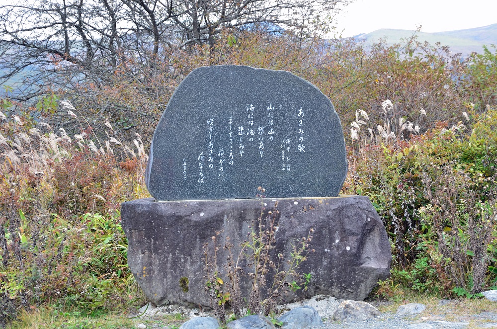
Kamaga-ike is reached shortly if you walk counterclockwise on a trail around the swamp. Yashimaga-ike, the next spot, is where you can view the pond, the swamp and Kiriga-mine from the slope. On the west side of the hill, “Azami no Uta” monument stands and Azami-no-kan, a visitor center, toilets and parking lots locate further west.
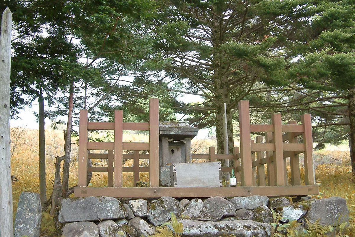
Continue to hike around the swamp after passing Yashimaga-ike. Hute Misayama, the old Misayama shrine in the forest, and the remains of the old Misayama will be reached. Where the remains lie is the spot where a festival used to be held in the middle ages. During the Kamakura era, samurai from all over the country were dedicated to horseback archery. The stairs on the slope are said to be the remain of Sajiki, a seated area for festivals/shows viewing.
From the remains, proceed to the logging road on the east, and turn right at the road. The road merges into a promenade and Mt. Kuruma-yama Kata is reached when you ascend back on the trail from Sawando. Ascend on the grass slope and ride a lift from Mt. Kuruma-yama to Kuruma-yama plateau. There is another route which you walk from Sawando, pass through Kuruma-yama Shitsugen to Kuruma-yama nokkoshi then descend on the north side of Kuruma-yama plateau ski place and walk to Kuruma-yama plateau. The number of walking hours is 20 minutes longer than the route to the summit of Mt. Kuruma-yama via Mt. Kuruma-yama Kata, however, the variance in elevation is 100 m less and the uphills are more gradual.
The best season for autumn leaves high in the mountains is early October and the middle of October for the middle of the mountains. There are fewer trees in high places that change color, however, the color of the grassfields turns yellow and bright brown and the clear color of Eriphorum Graciles Addes accents to them. The air in autumn is clearer, which makes the mountains in the far distance more visible. You may enjoy a panoramic view of the mountains, which is one of the features of Kiriga-mine.