Myoujin-ike course
Kami-kochi bus terminal ~ Kappa bridge ~ Dakesawa-shitsugen~ Myoujin-ike ~ Myoujin bridge ~ (the left bank) ~ Konashi-daira ~ Kami-kouchi visitor center ~ Kappa Bridge ~ Kami-kouchi bus terminal
This route is another Kami-kouchi popular hiking course, which is comparable with Taisho-ike hiking course. With limited variance in elevation, the course can also be casually enjoyed with family and friends
●Course data
Walking hours: 2 hours 10 minutes (Outbound 75 minutes Inbound 55 minutes)
Walking distance: 6.9 km (Outbound 4.0 km Inbound 2.9 km)
Variance in elevation: 20 m
Kami-kouchi bus terminal
↓ 5 minutes
Kappa bridge (the right bank)


↓ 15 minutes
Dakezawa-shitsugen swamp

↓ 45 minutes
Myoujinike (Myoujin bridge)
↓ 10 minutes
Myoujin (the left bank・Konashi-daira)

↓ 45 minutes
Kami-kouchi visitor center
↓ 3 minutes
Kappa bridge
↓ 5 minutes
Kami-kouchi bus terminal
Route Guide
This route is 7 km in length, starting from the bus terminal and takes about 2 hours and 10 minutes.
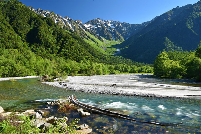
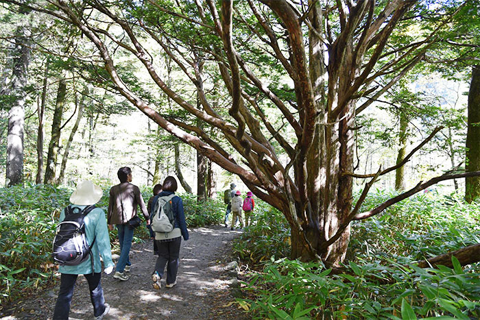
Cross Kappa bridge and go up along the Azusa river. Your view becomes suddenly open and a panoramic view of Azusa river and the Hodaka mountains comes into sight. Pass the lookout and proceed to a nature research path through yew trees. Dakezawa-shitsugen swamp will be reached shortly.
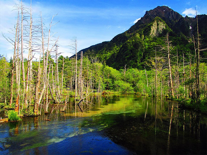
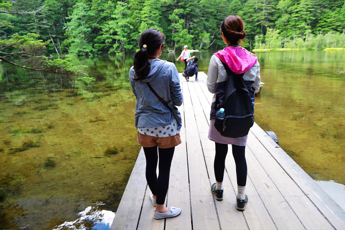
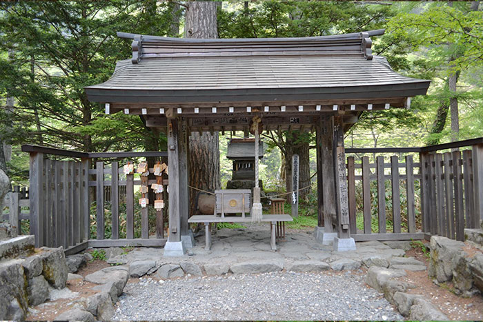
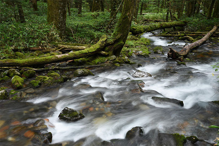
Along the promenade, Eriophorum gracile and Hypericum ascyron are in bloom. From the deck opening to the swamp, Mt. Roppyaku-san can be seen in the far distance and a fantastic view of dead trees standing on a clear and beautiful water surface can be enjoyed. Leave the trail to Dakezawa and proceed through a coniferous forest zone where mossy stones, beautiful streams and a history of its forests can be observed. The trail goes through a bright forest at streamside. The pond is close when you reach the promenade, crossing a stream from Myoujin-ike. Myoujin ike resides inside of the Hodaka shrine Okuno-miya, which is a comprehensive guard of the North Japan Alps. The pond consists of two ponds, a silent Ichino-ike and Nino-ike, whose beauty is better referred to as ature art, reminding one of Japanese gardens. The south peak of Mt. Myoujin-dake can be spotted above your head and the water surface surrounded by coniferous forest gives you a dignified impression. (Admission to the shrine costs 500 yen for adults and 200 yen for elementary school students.).
Leave the shrine and cross Myoujin bridge. Myoujin (kan) is reached shortly. In early spring, Anemone flaccida will be in bloom around the area. The trail on the left leads to Tokugou pass and the Tokusawa area. It takes about 2 hours to Tokusawa for a round trip. The place, previously a farm, is famous for a bright grassland (a camping ground) with a great view of Mt. Maehodaka-dake. It is recommended that you visit if time allows. For this course, try a right at Myoujin junction and go back to Konashi-da-ra on the left bank promenade while passing by many hikers. The view of Mt. Myoujin-dake can be enjoyed along the walk. Please visit the visitor center just before you reach Kappa bridge. After passing the shortest and the most beautiful river, known as the Shimizu river, Kappa bridge is reached shortly.