The Taisho-ike Course
Kappa bridge (bus terminal) -Taisho-ike round trip Kami-kouchi bus terminal ~ Kappa Bridge ~ Weston monument ~ Hodaka bridge/Tashiro bridge ~ (Nature research path「Rinkan course」) ~ Tashiro-ike ~ Taisho-ike ~ Tashiro swamp ~ (Nature research path 「Azusa river course」) ~ Nakanose-enchi ~ (Azusa river - the left bank course) ~ bus terminal
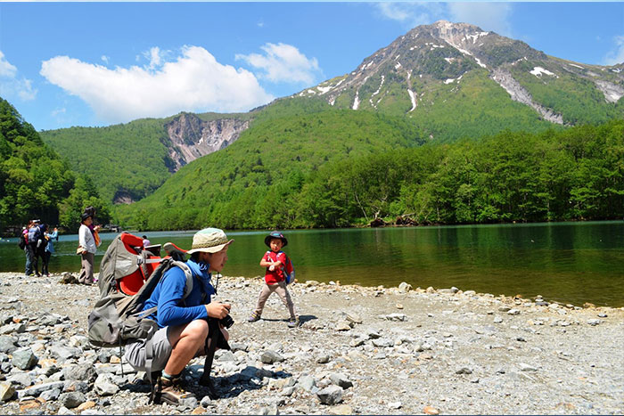
This course from Kami-kouchi to Tashiro swamp and Taisho-ike, is a resort hiking course, representative of Japan, which can be casually enjoyed with family and friends.
●Course Information
Walking hours: 2 hours 30 minutes (Outbound 80 minutes Inbound 70 minutes)
Walking distance: 7.9 km (Outbound 4.2 km Inbound 3.6 km)
Variance in elevation: 10 m
Kami-kouchi bus terminal
↓ 5 minutes
Kappa bridge


↓ 20 minutes
Weston monument

↓ 10 minutes
Hodaka bridge/Tashiro bridge
(Nature research path「Rinkan course」)
↓ 20 minutes
Tashiro-ike
↓ 25 minutes
Taisyo-ike
↓ 25 minutes
Tashiro swamp
(Nature research path「Azusa river course」)
↓ 20 minutes
Nakanose-enchi
(Azusa river the left bank course)
↓ 25 minutes
Bus terminal
Route Guide
This route is 8 km in length, beginning at the bus terminal and takes about 2 hours and 30 minutes. Another popular course begins at Taisho-ike bus stop (the second to last shuttle bus stop before the bus terminal) and this course goes up to Kappa bridge (about 1 hour and 15 minutes).
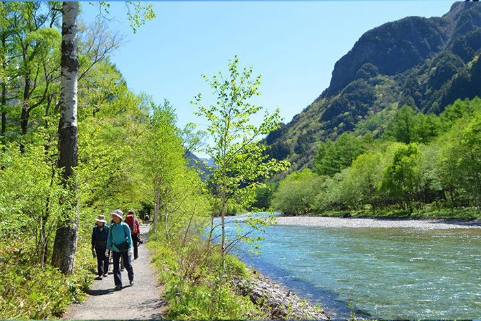
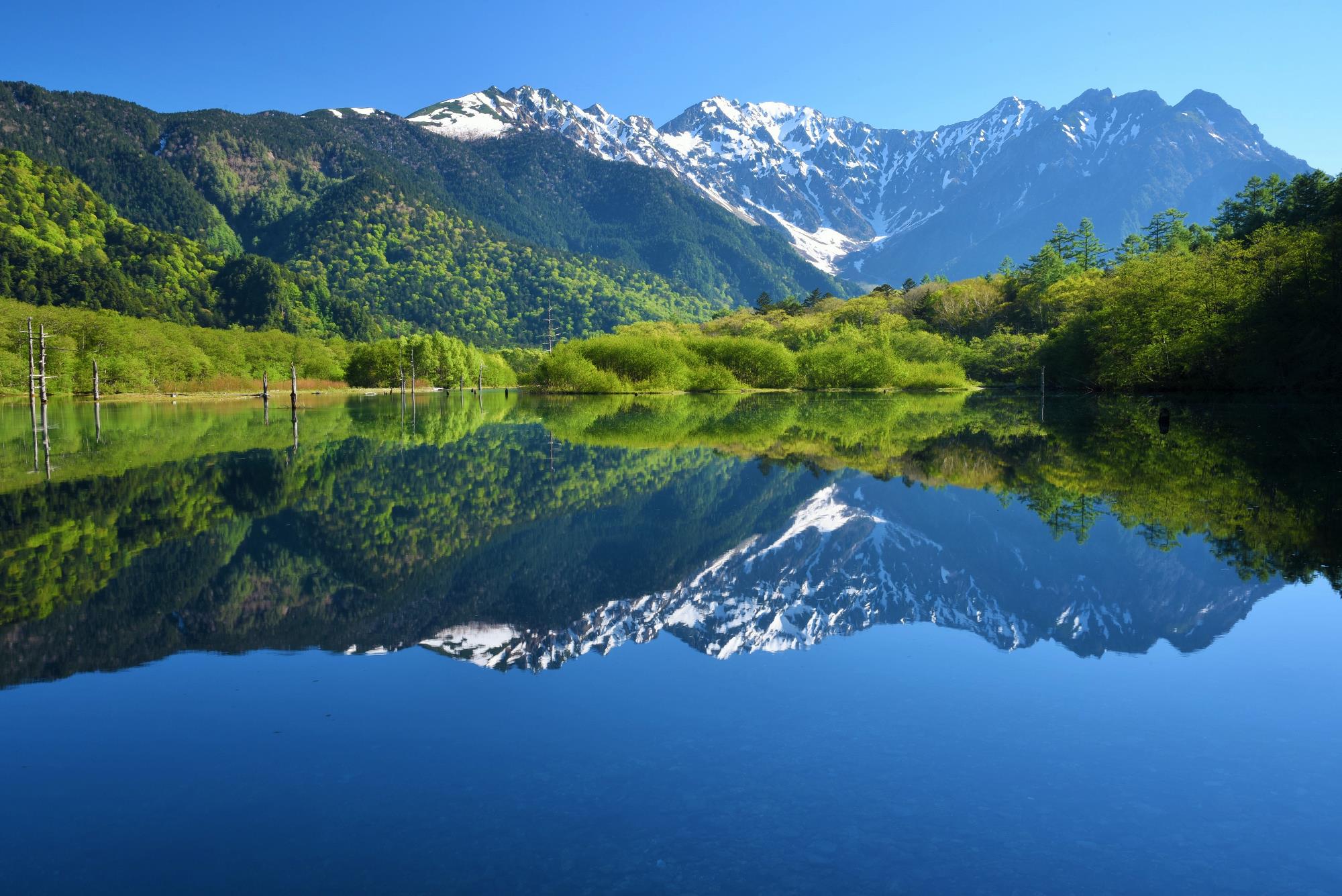
Follow the path along the Azusa river from the bus terminal then and Kappa bridge is reached in about 5 minutes. Cross the bridge and go up along the right bank of the Azusa river to the Weston monument. The path is partially paved and easy to walk. The view of the Azusa river and Mt. Yake-dake can be enjoyed along the river walk. It is a beautiful view of the green Larch leaves n spring and golden yellow colored autumn leaves in late Fall along the other side of the riverbank. Tashiro bridge can be reached after passing the monument and proceeding on the promenade along the Azusa river, where the ridgelines of Mt. Kasumi-zawa-dake and Mt. Roppyaku-zan can be viewed on the other side of the river. Proceed to the forest zone after crossing the bridge. The trail becomes a nature research path from this point. It divides into the “Azusa river course”, which leads to the riverside of the Azusa river, and to the “Rinkan course”. Through the Rinkan course, beautiful flowers through mossy forests can be enjoyed. The Rinkan course merges into the Azusa river course. The Tashiro swamp will shortly be reached after passing the forest zone.
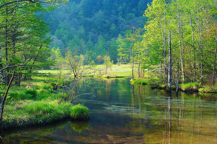
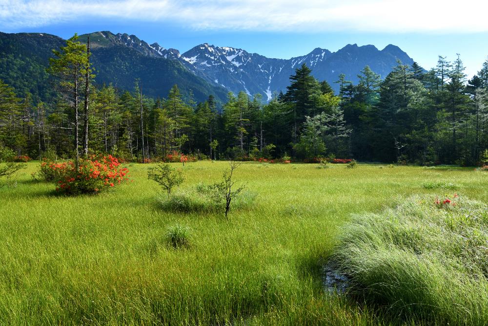
Lotus Azalea and Eriophorum gracile can be appreciated from the middle of June to early July at the swamp. The view of Tashiro-ike, a beautiful pond of
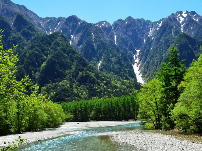
underground water, is fantastic as well. From here, pass the swamp, the forest zone, the riverside, and cross the bridge across the wetland. Then Taisho-ike, where mallards and waterfowl play, will be reached. From the pond, the view of the Hodaka mountains with their high ridgelines can be enjoyed.
The gorgeous view of Mt. Yake-dake can not be missed neither. On the way back, take the Azusa river course while looking at the wetland on your right, where Nikko sedge and Icho-baikamo are in bloom. Wooden signs posting backgrounds of plants can be found along the course on the way back. Do not cross the bridge but pass Nakanose-enchi and proceed into the trail on the left bank of the river, where flowers such as Nibana-ichiyakusou are in bloom. The bus terminal appears on your right after passing a big curve where a view of the Azusa river in the front and the Hodaka mountains, is beautiful.