Walking along the historical pathway connecting Kai and Ina valleys

From Hokkemichi to Mt. Nyukasa-yama
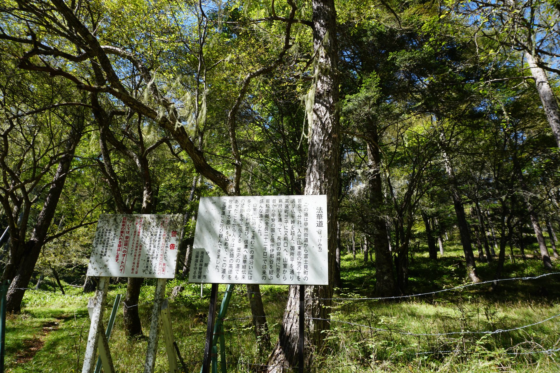
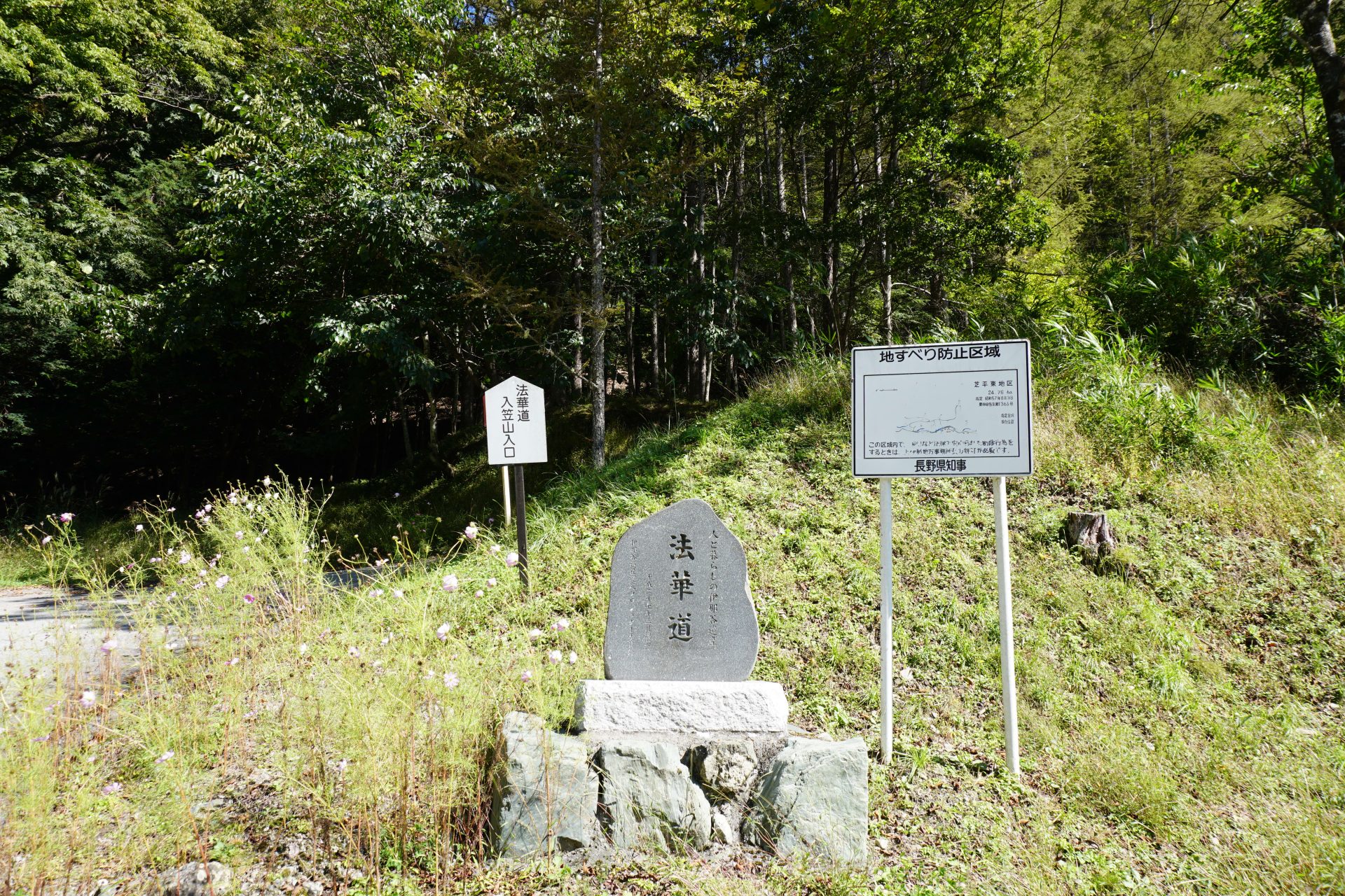
Hokkemichi is an ancient road named after a Nichiren shu priest, Nicho Shonin saint, who later became the head priest of Minobu mountain(Head temple of Nichiren shu). It is said to be the road that led from the Kai-Shinano border (today’s Fujimi Town, Nagano Prefecture) south through Mount Nyukasa at the northern end of the Alps to the Ina Road.
In the Heian period (794-1185), there were several farms in Kai Province (present-day Yamanashi Prefecture) that were used by the Imperial Court, and it is said that Kai sakoma were transported to Kyoto via the Higashiyama Road, passing near this Hokkemichi Road (an ancient road called Ishido-gozan). In any case, it is said that there was a road in this area that people had been crossing since long before the Middle Ages.
Shibira, Takato, Ina City, which is the starting point of the Hokkemichi Road on the Ina side, once prospered due to the mining of high-quality limestone, but is now uninhabited due to natural disasters since the Showa period (1926-1989). Mr. Atsushi Kitahara, a native of Shibira, and other local volunteers worked hard to maintain the Hokkemichi Road, and now we can walk along this ancient road and think of the people of the past.
Hokke-michi Historic Site
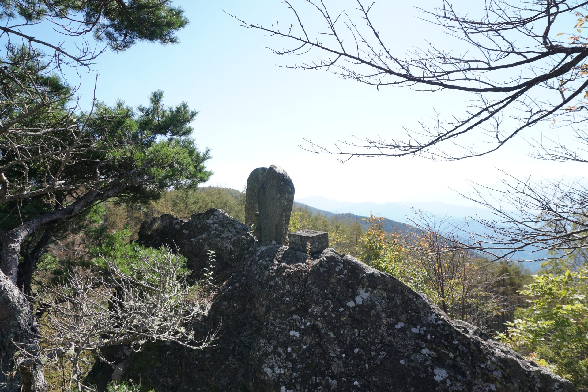
Koza Iwa

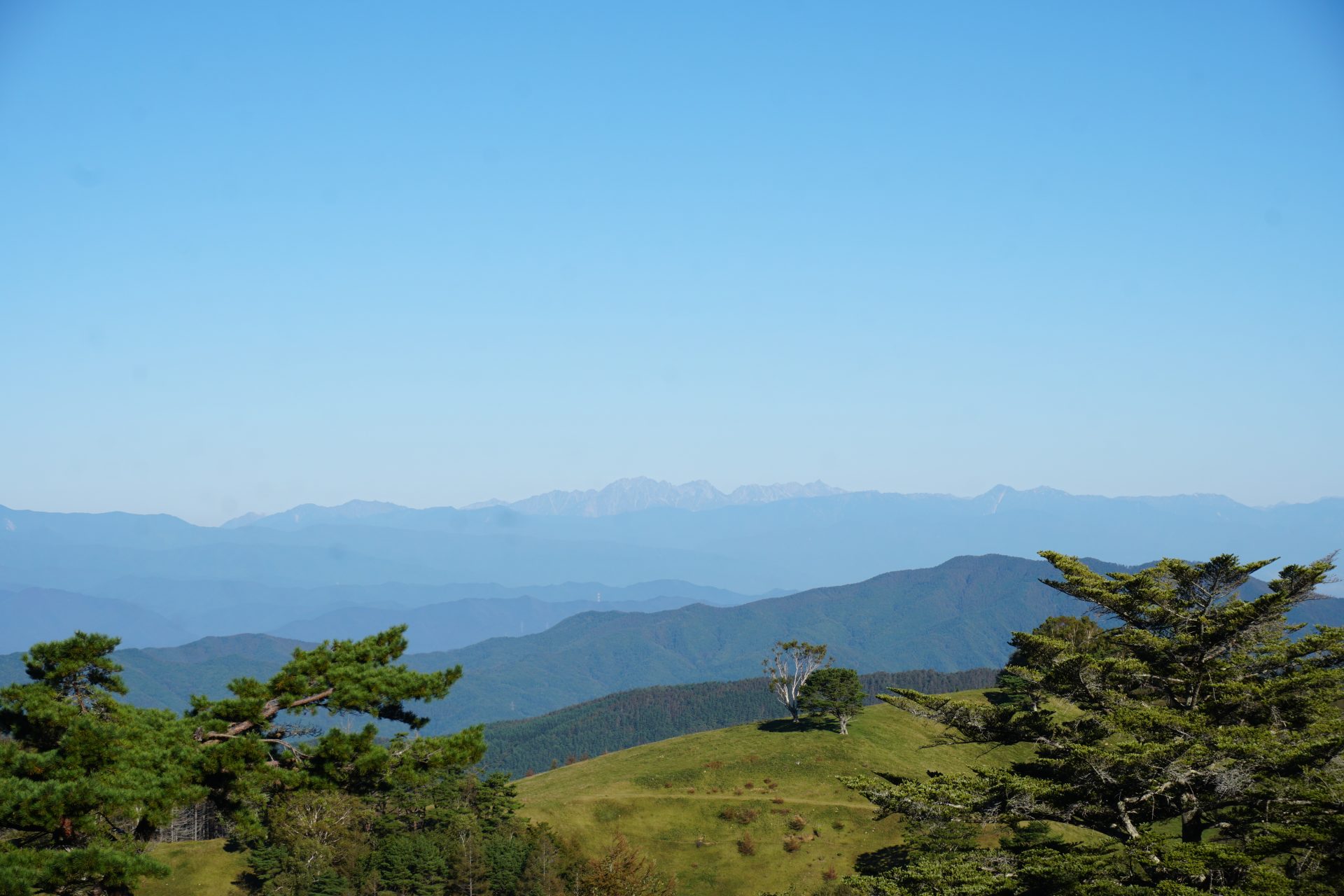
Kozaiwa is the highlight of the Hokkemichi. It is said that Nicho Shonin saint, the reincarnation of Nichiren Shonin saint, the Dharma Lord of Minobu Mountain, preached the Dharma for seven days and seven nights with his followers. The site is wide open to the west and offers a good view of the mountains of the Central Alps.

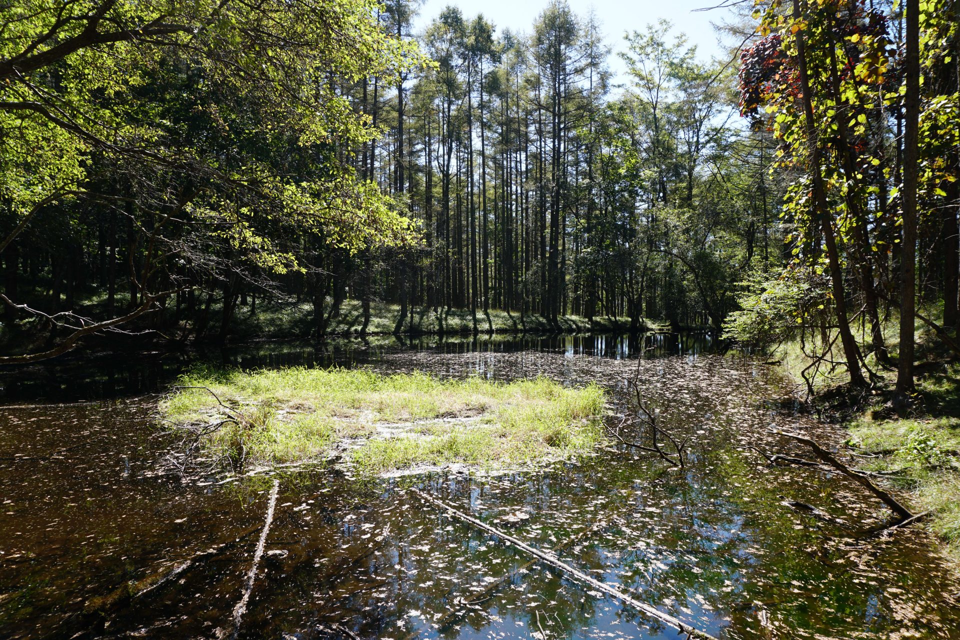
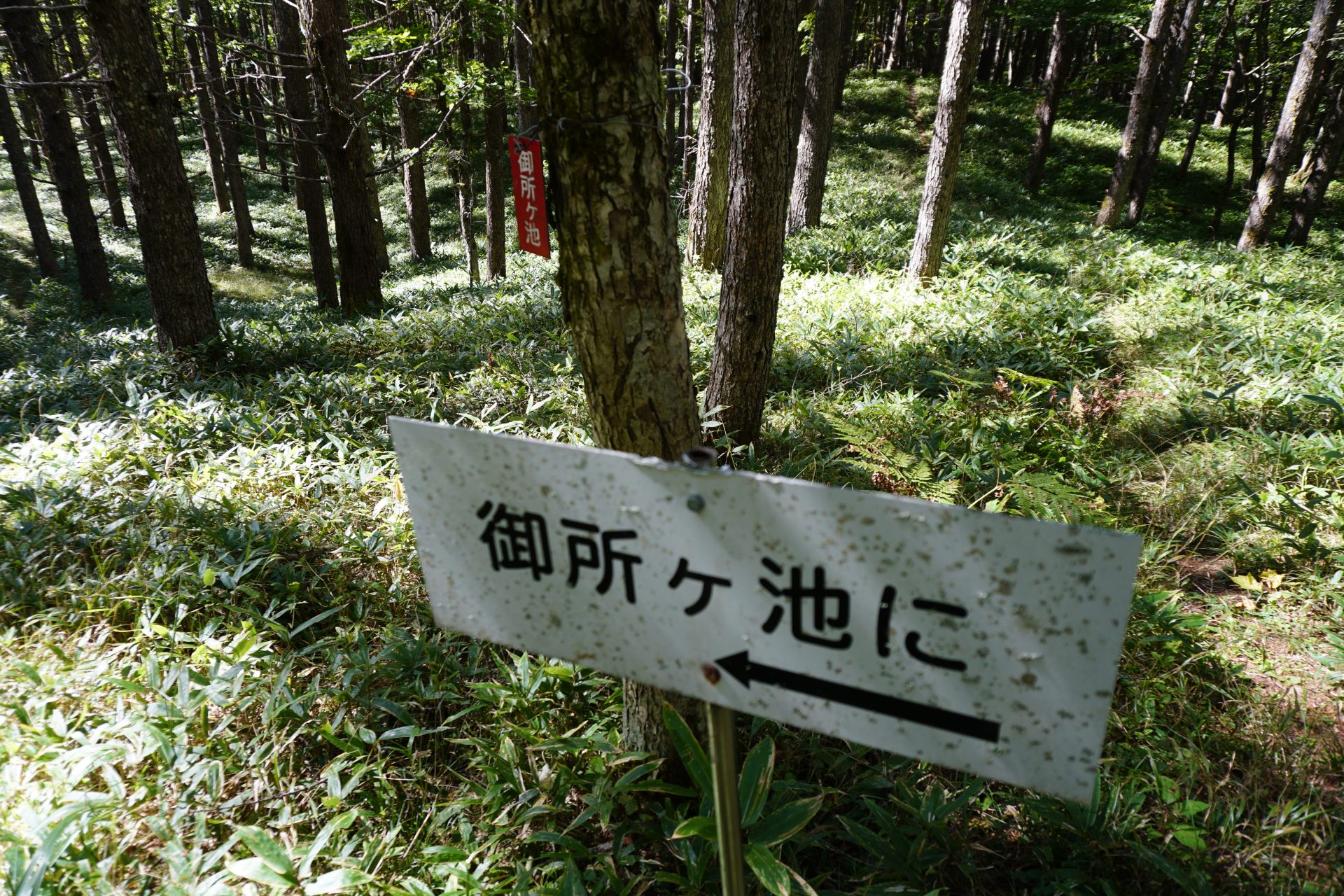
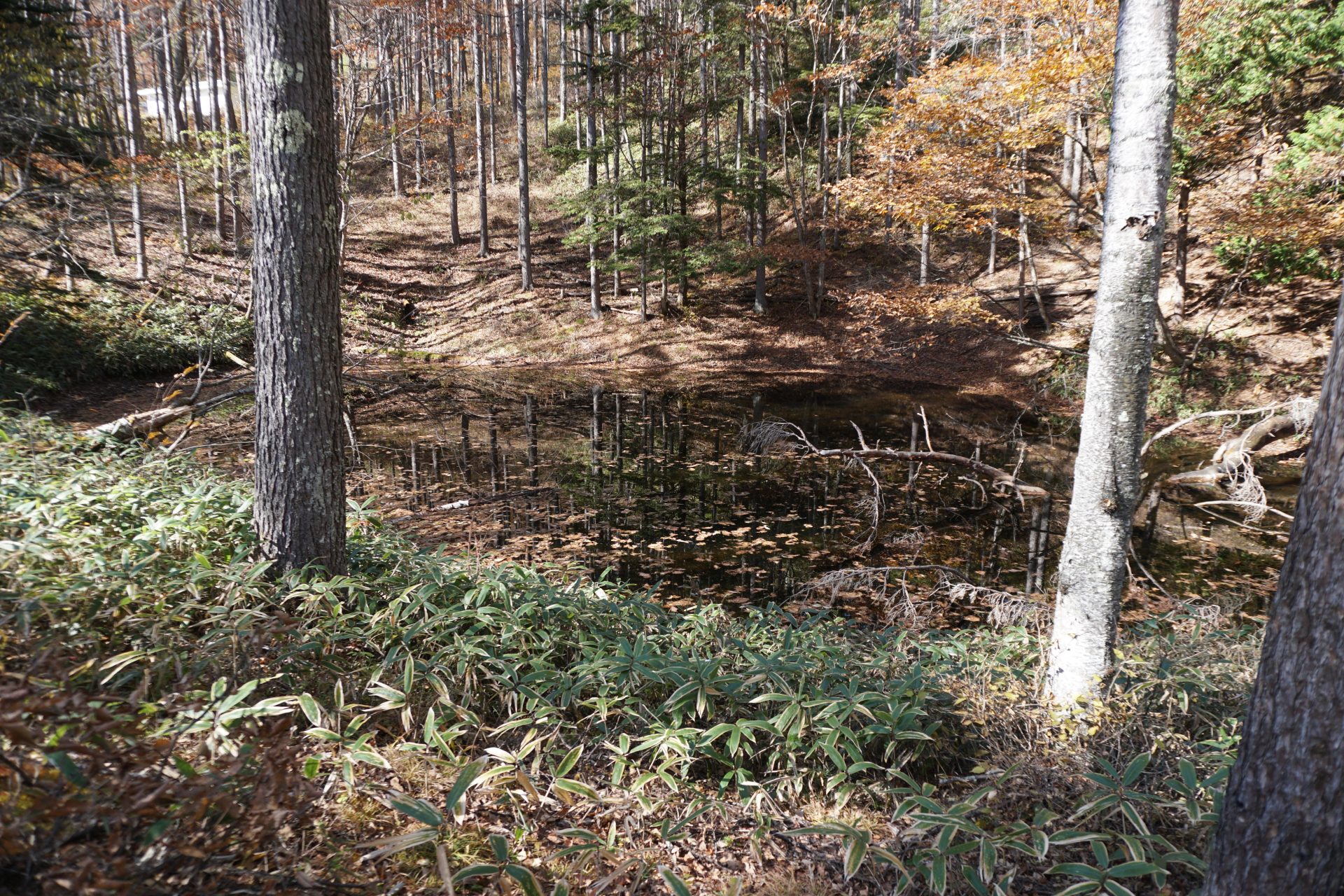
Gosho-gaike Pond

As the name “Gosho (means imperial palace) ” suggests, Gosho-gaike is said to be the place where Prince Munera, the son of Emperor Godaigo, was sheltered during the Nanbokucho Period. This theory is disputed by Misawa, the manager of Nyukasa Farm, and others, who believe that the prince was surrounded by the Suwa clan, who were behind the Hojo clan’s son, Hojo Tokiyuki, who was the cause of the Nakasendai no ran (mayhem). In any case, it seems certain that this area played an important role in the Middle Ages.

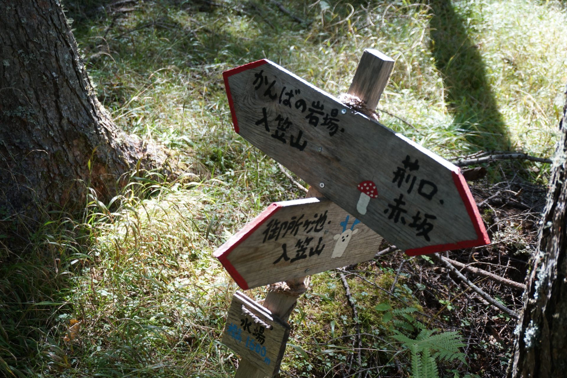
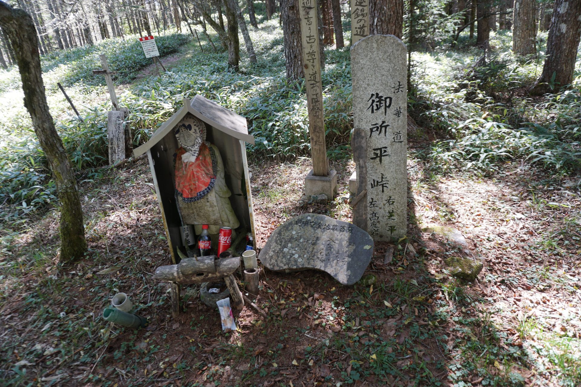
Gosho-daira Pass
Gosho-daira Pass was considered to be in the vicinity of Gosho. It is now a junction leading to Kozaiwa, Shibira and Nyukasa Ranch, where a Jizo-son (a stone statue of a Buddhist kinsman) is said to have been carried by Mr. Kitahara, who devoted himself to the revival of Hokkemichi (the path of the Buddhist priest).

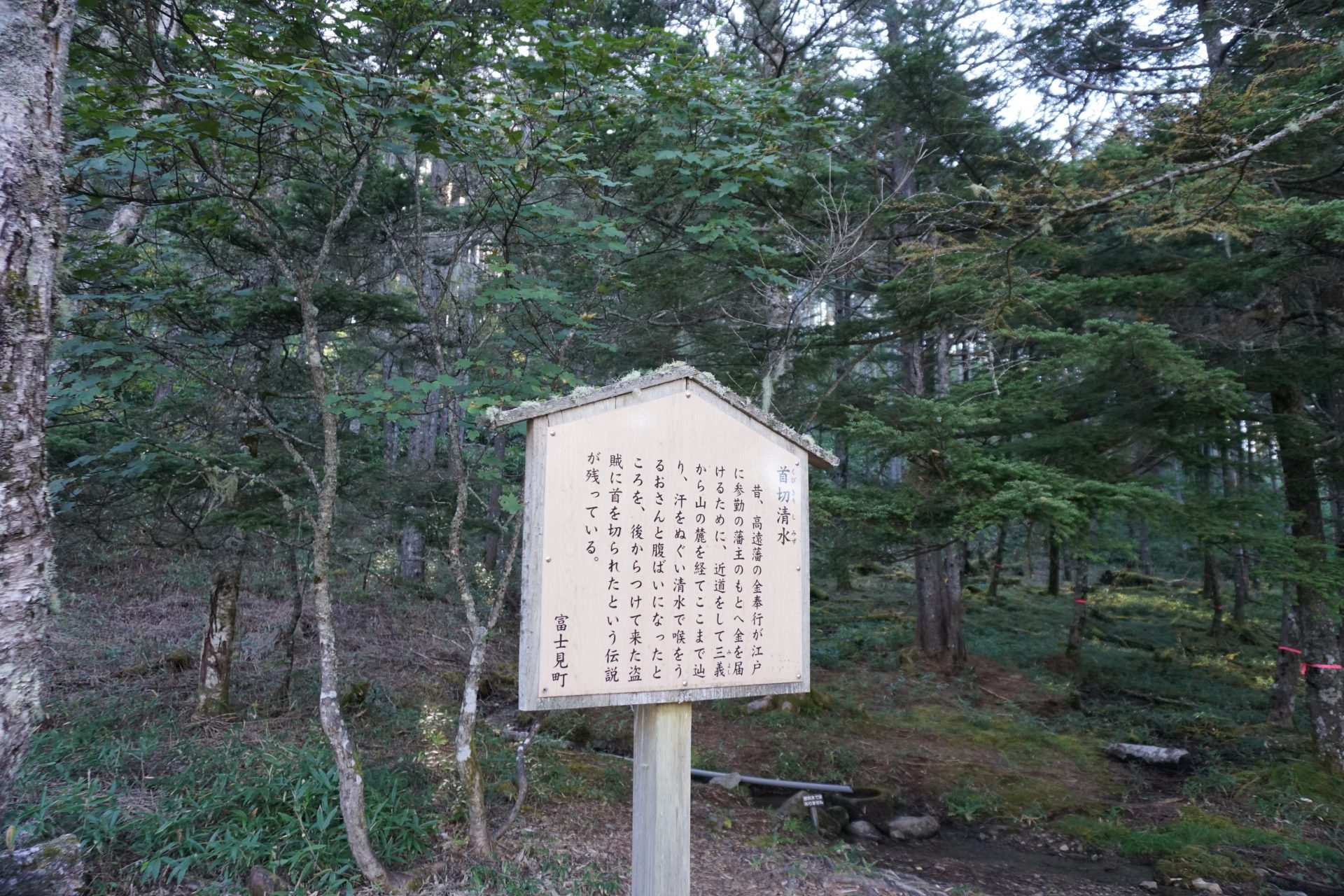
Decapitated Water
This is a story from the Edo period. Legend has it that a gold magistrate of the Takato clan was beheaded by bandits when he tried to drink the spring water here. In any case, it can be said that people used to come and go here frequently in the past.

Hotoke-daira Pass
This is the boundary between Ina City and Fujimi Town, and is located beside the trail to the decapitated water of Mt. Nyukasa-yama. It is said that the Hokkemichi Road was connected from east to west from here. The southern foot of Mt. Nyukasa-yama is the land of Irikasa Ranch, but there is no trace, including the forest road on the Fujimi side of the mountain.

Ruins of Sansho Hut
Ruins of an old shelter hut. It is thought to have been a shelter for wayfarers, rather than a hut for climbers.

Habaki-ate
A shinbakin, or shin guard, was wrapped around the shin and tied with a string to make it easier to move when traveling or working.

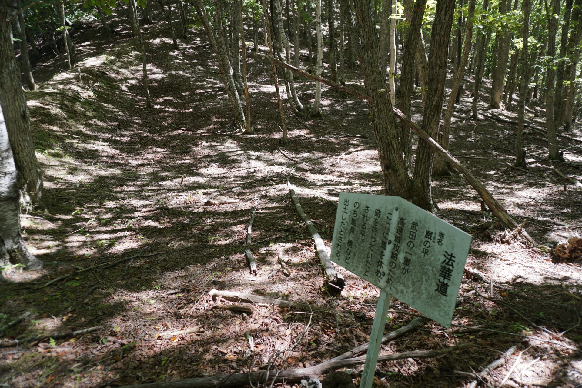
Umayano-taira
It is said that during the Warring States Period, the horses of Takeda’s cavalry army rested here, and later related items were found. Indeed, a slightly wider flat area can be seen.

Jiji-baba no Ishi
This stone was considered a guardian stone for travelers, and it seems that people prayed for the safety of their journey by piling up stones like a cairn.

Rains of Monzeki Yashiki
It is said that this area used to be a hunting ground for the Suwa Shrine, and as a connection to this area, six houses with magnificent gates were built, which is said to have started the village.

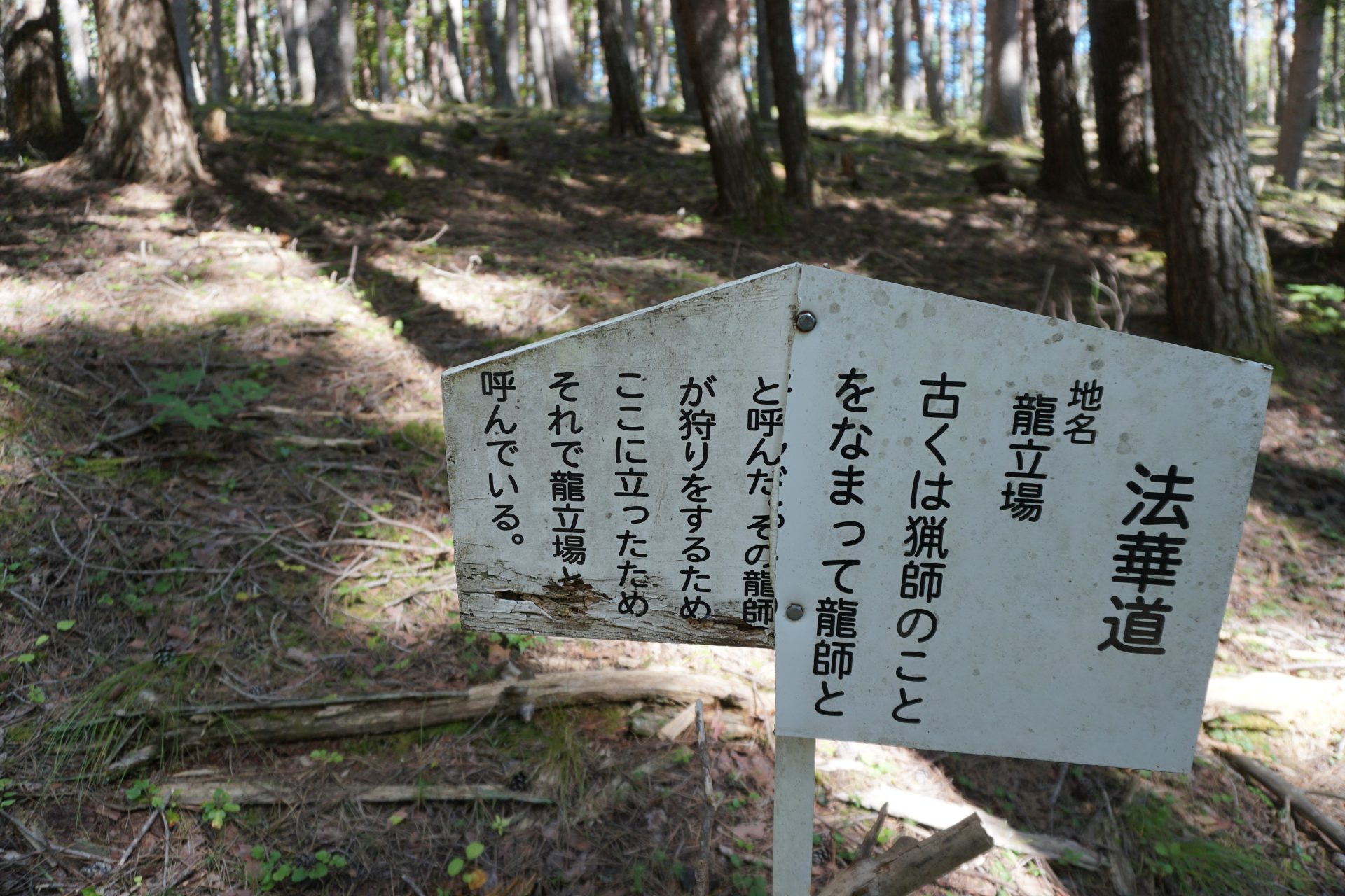
Ryu-tachiba
In this area, hunters are called “Ryu” (dragon), and the hunting ground was called “Ryu-jyutai” (dragon stand).

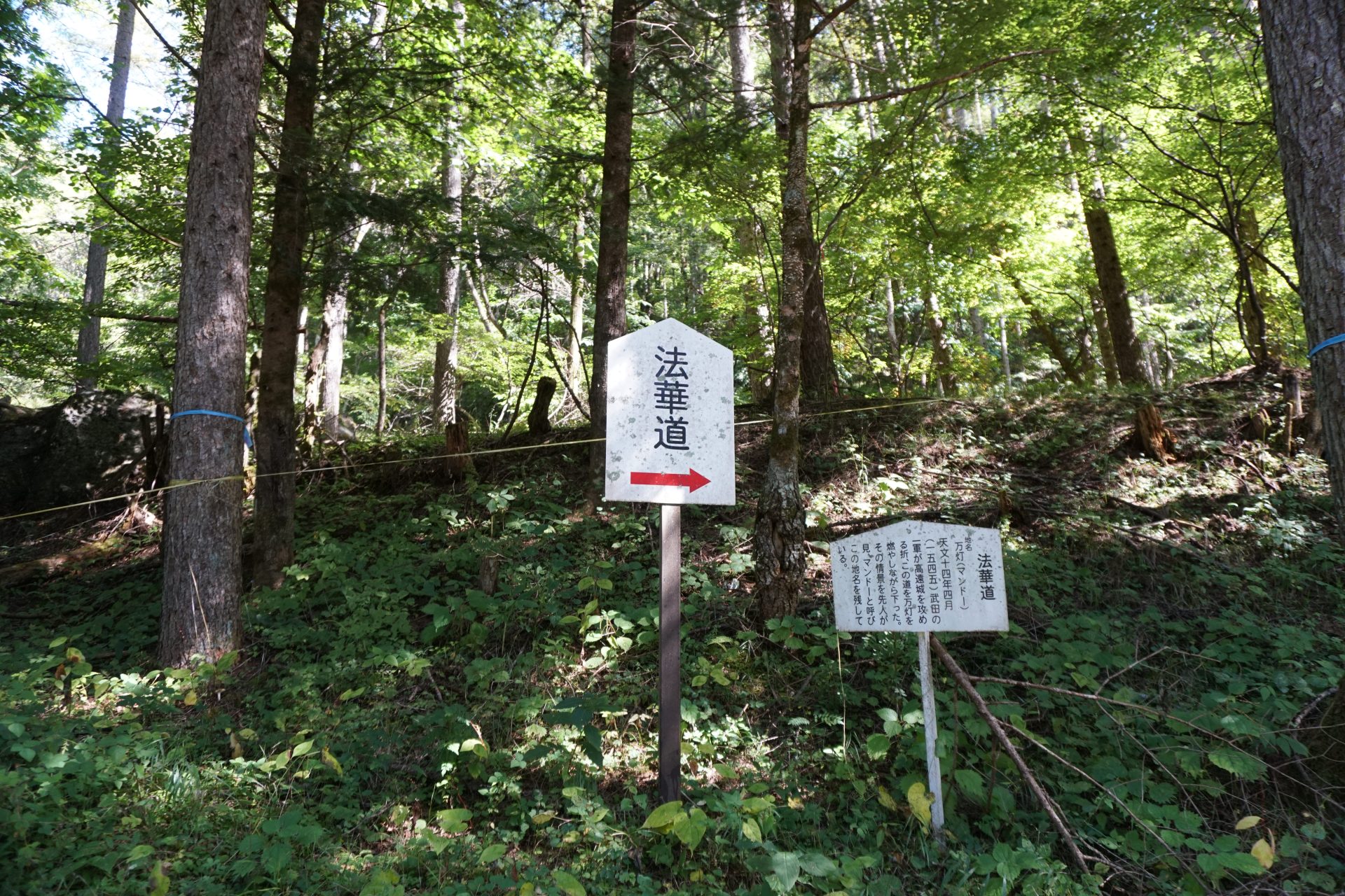
Manto
Manto” is the name of a place where Shingen, when he attacked Takato Castle, held up many torches and marched on the castle, which made him look like an army of 10,000 cavalrymen, and the people of Shibira were afraid of him.

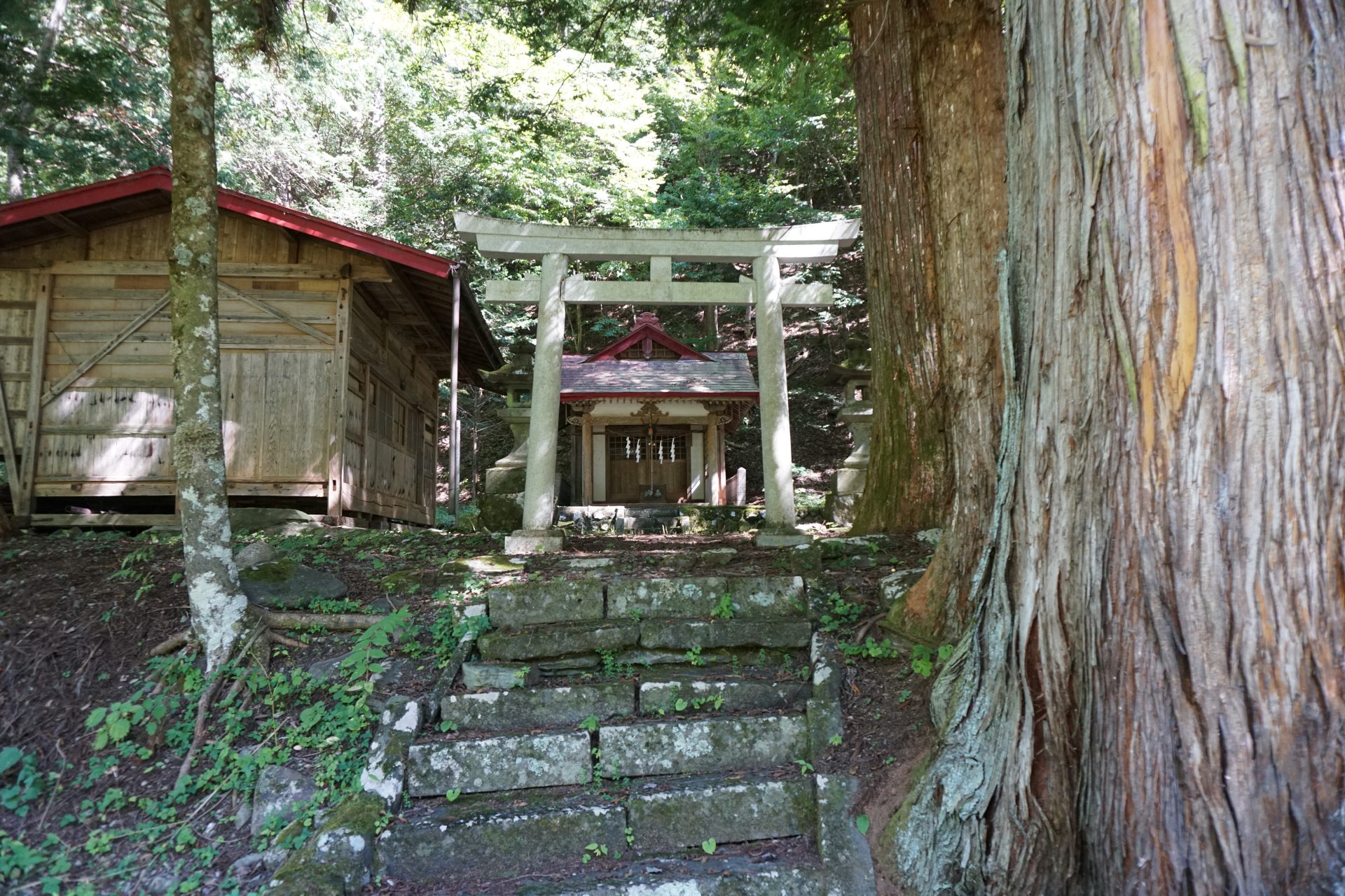
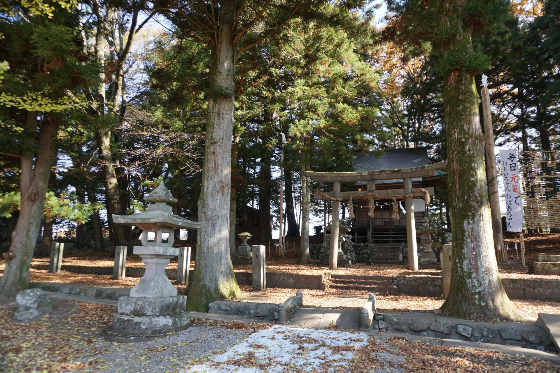
Suwa Shrine
According to records, the Suwa Shrine was dedicated in the late Heian period (794-1185), which reminds us of the long history of Shibira village.

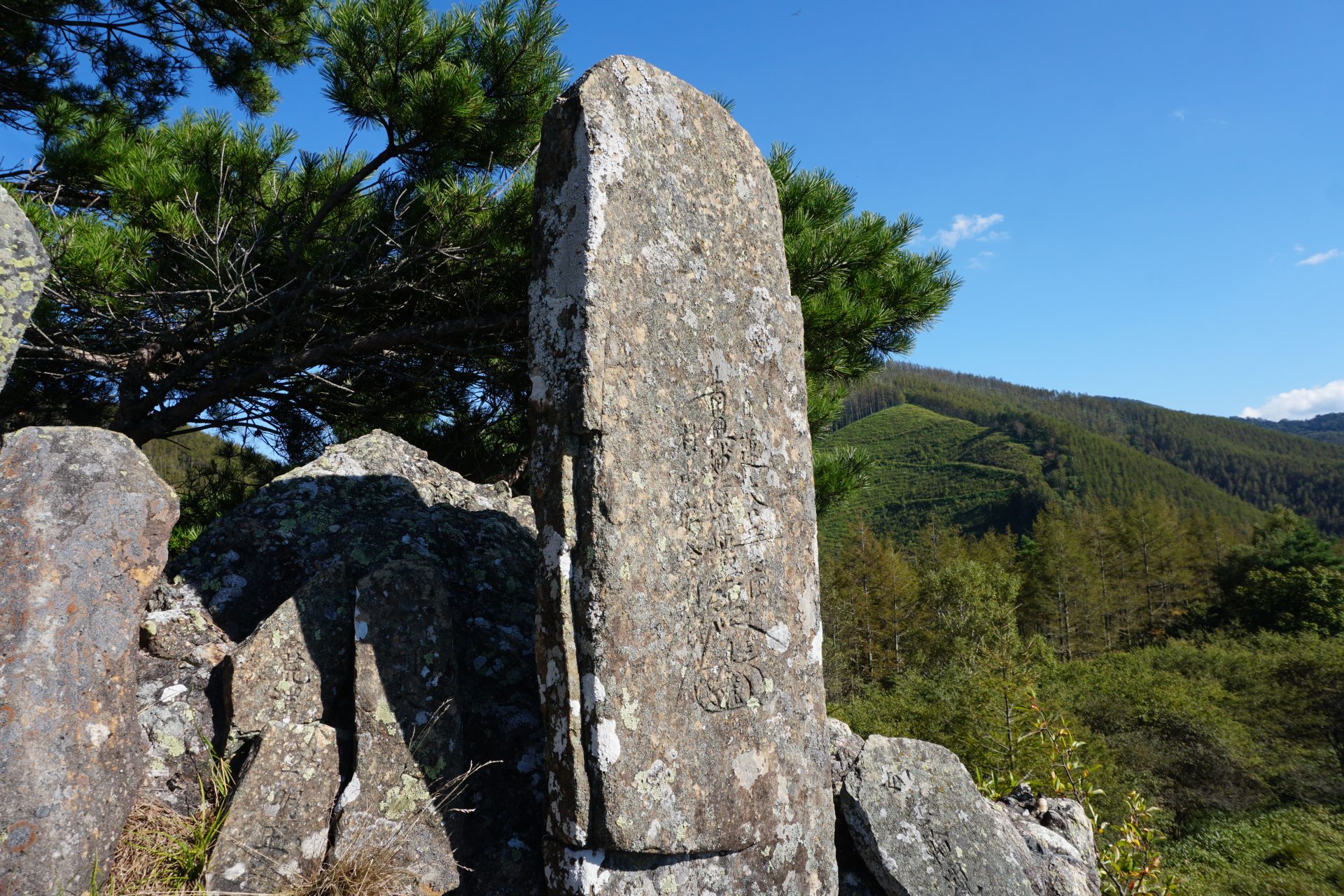
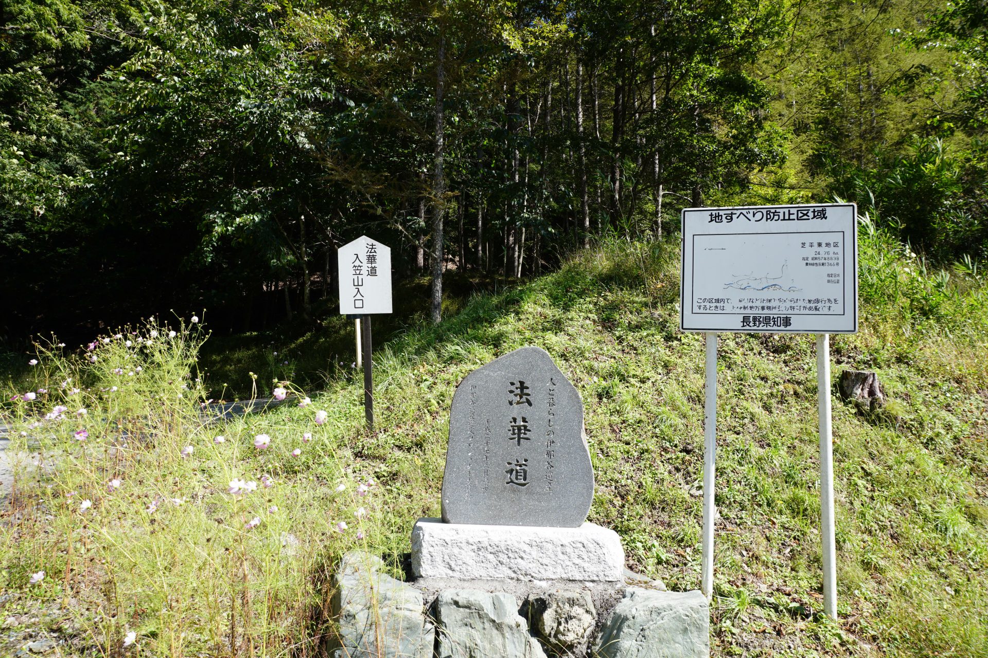
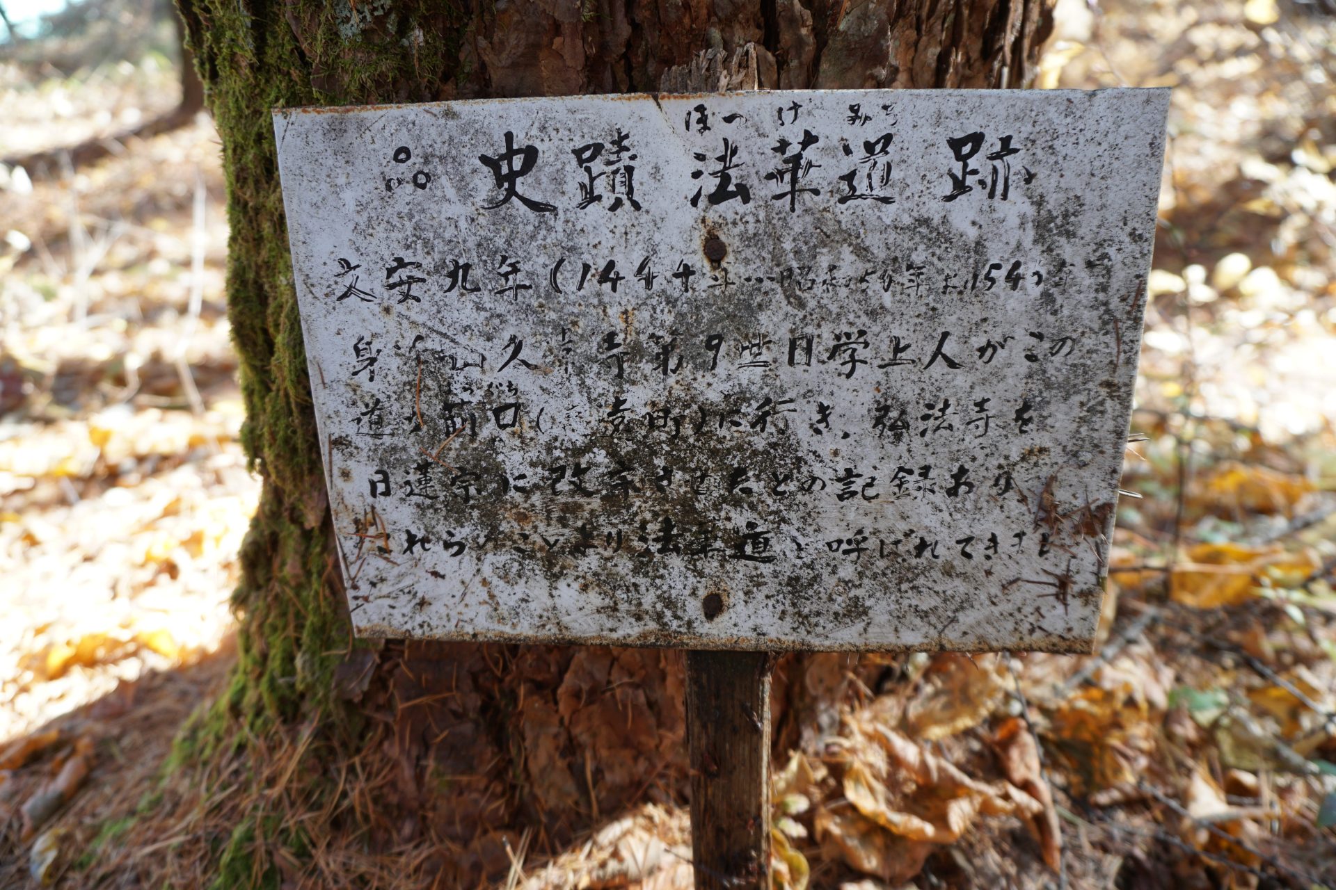
Hokkemichi Monument
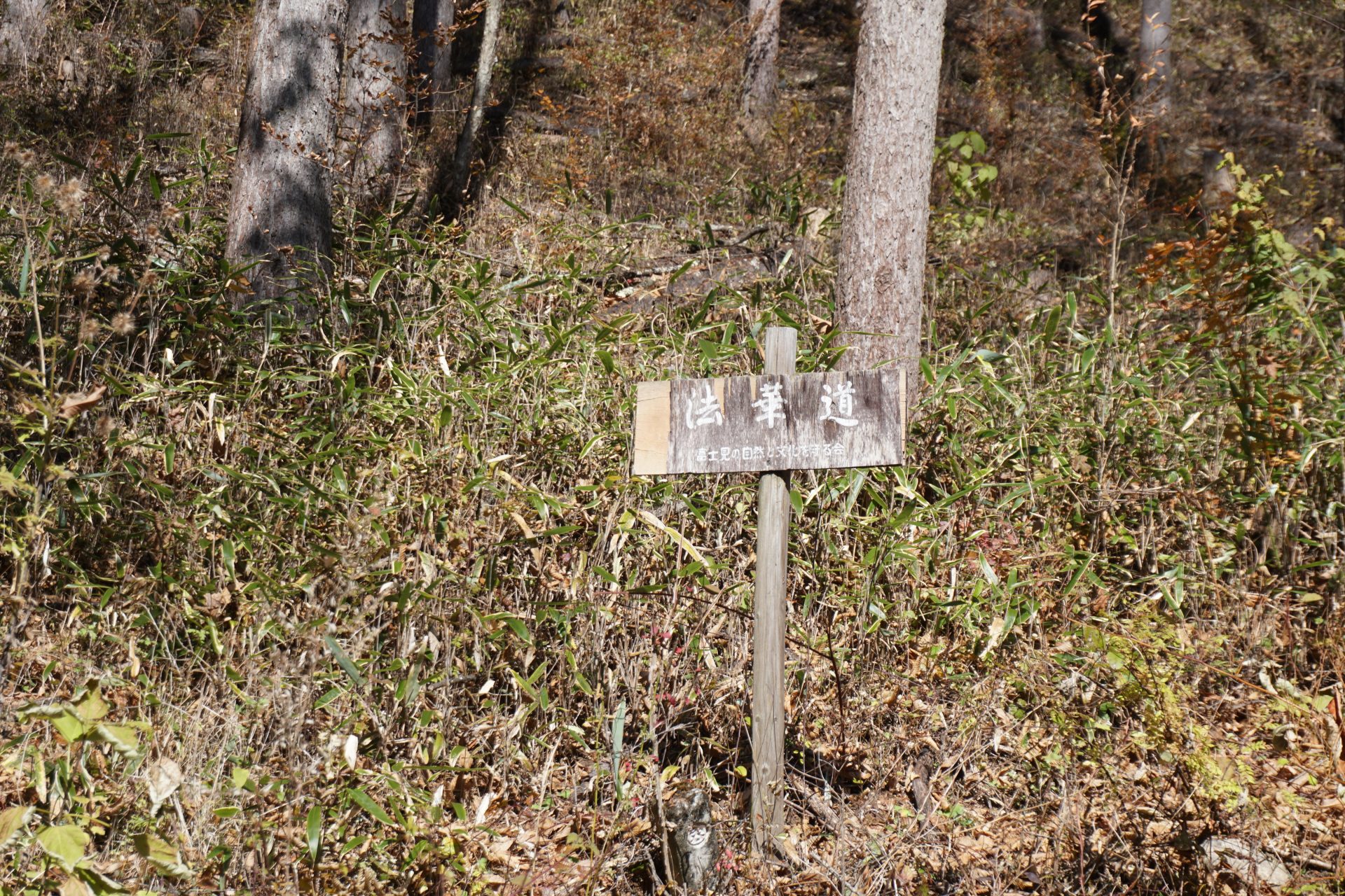
Mr. Kitahara and other local people have devoted themselves to the revival of Hokkemichi, and Ina City has officially designated Hokkemichi as an ancient road.

Gumyou-ji Temple
This temple is said to have sheltered Prince Muneyoshi during the Nanbokucho Period (1568-1568), built a mansion in the mountains with his followers, and dug a pond. In the Muromachi period (1336-1573), the temple was converted to a Nichiren sect temple by Nichigaku Shonin saint, a priest of the Nichiren sect of Buddhism at Minobusan, but it suffered some disasters during the Warring States period, including being burned down by the forces of Nobunaga Oda. The temple is also known as a golf temple, where a professional golfer went out of his way to pray at the temple and soon after won the championship.

Ensho-ji Temple
This temple is related to Hokkemichi, which was originally a Yakushido built in the early Heian period and was converted to Buddhism by Nichijo Shonin saint, a priest of Nichiren-shu who preached at Koza-iwa during the Muromachi period (1336-1573). The road in front of the temple is Hokkemichi Road, which leads to Akiba Road via Hase. From mid-May, the temple is in its Peony season, which attracts many tourists as the “Peony Temple”.
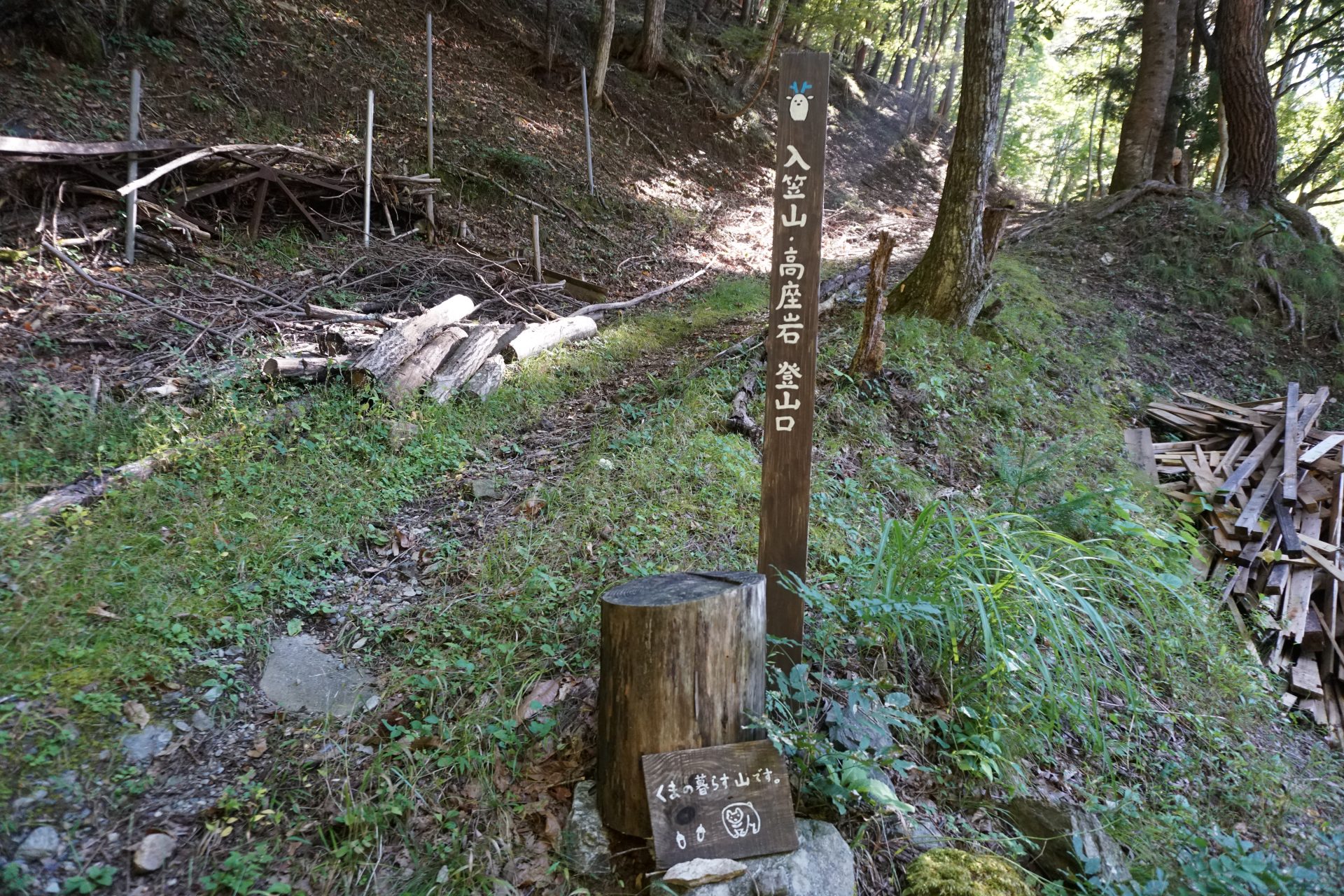
Hokkemichi Route Information
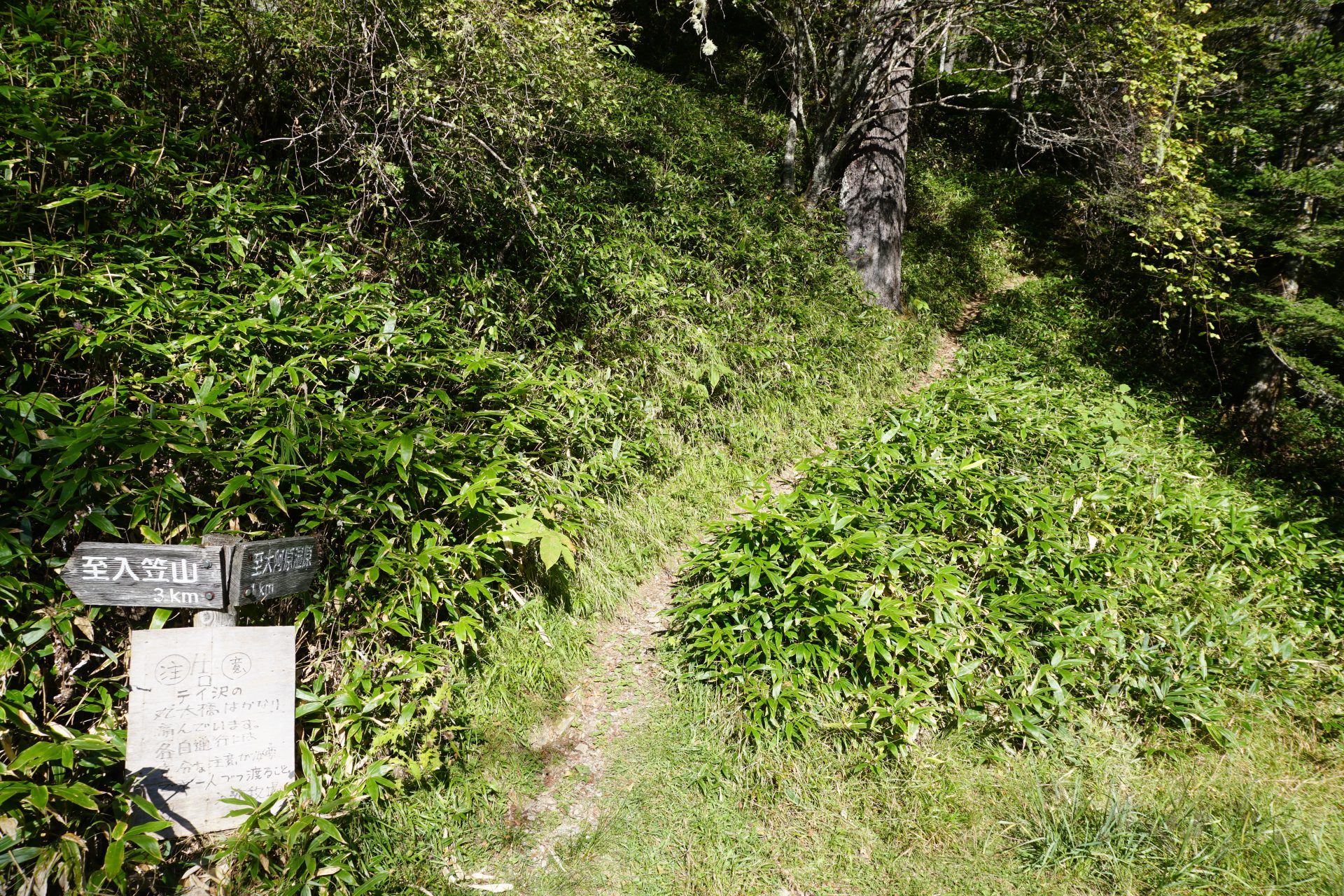
There seem to be two possible routes from the Ina-Takato side of Hokkemichi, one starting from Shibira along the Yamamuro River and the other from Akasaka, a village a little closer to Takato. Although the Shibira route has more historical sites, there is no clear historical basis for either route. Here we present the route from Akasaka as an ascent and the Shibira route as a descent. There are no technical or physical difficulties, but the route from Akasaka is somewhat unclear in some places, so please proceed with caution and look at a map.
The Hokkemichi route from the Fujimi-cho side on the east side is not clear.
It seems to be due to the fact that the route lost its purpose as a road in the Edo period (1603-1867), when the development of roads between cities progressed and the surrounding villages began to manage their forests. In present-day Fujimi-cho Wakamiya, which is believed to be the entrance to Hokkemichi, there are no historical sites that indicate Hokkemichi as a route, although there are a few traces left along the old Kamakura Road. In Fujimi Town, as in Ina City, the assumed route seems to have been verified, but none of them seem to be certain. Therefore, it cannot be called an ancient Hokkemichi, but please refer to it as an approach route from Fujimi side to Mt. Nyukasa-yama.
●Akasaka Route Mountaineering Data
Technical level: 2
Physical strength level: 4
Difficulty level:★★★
Itinerary: Round trip is 1 night and 2 days; day trip is also possible if you are able to walk.
Walking time: 12.3km From Akasaka to Irikasashi Farm via Mt. Nyukasa.
Walking distance: 6 hours of climbing
Accumulated elevation gain:+1,146m−443m
Hokkedo Akasaka Route Akasaka ~ Waterhole ~ Kamba Rock ~ Goshodaira Pass ~ Koza Rock ~ Ohahara Wetland ~ Mt. Irukasa ~ Irukasa Farm
Ina Takato Akasaka Parking space

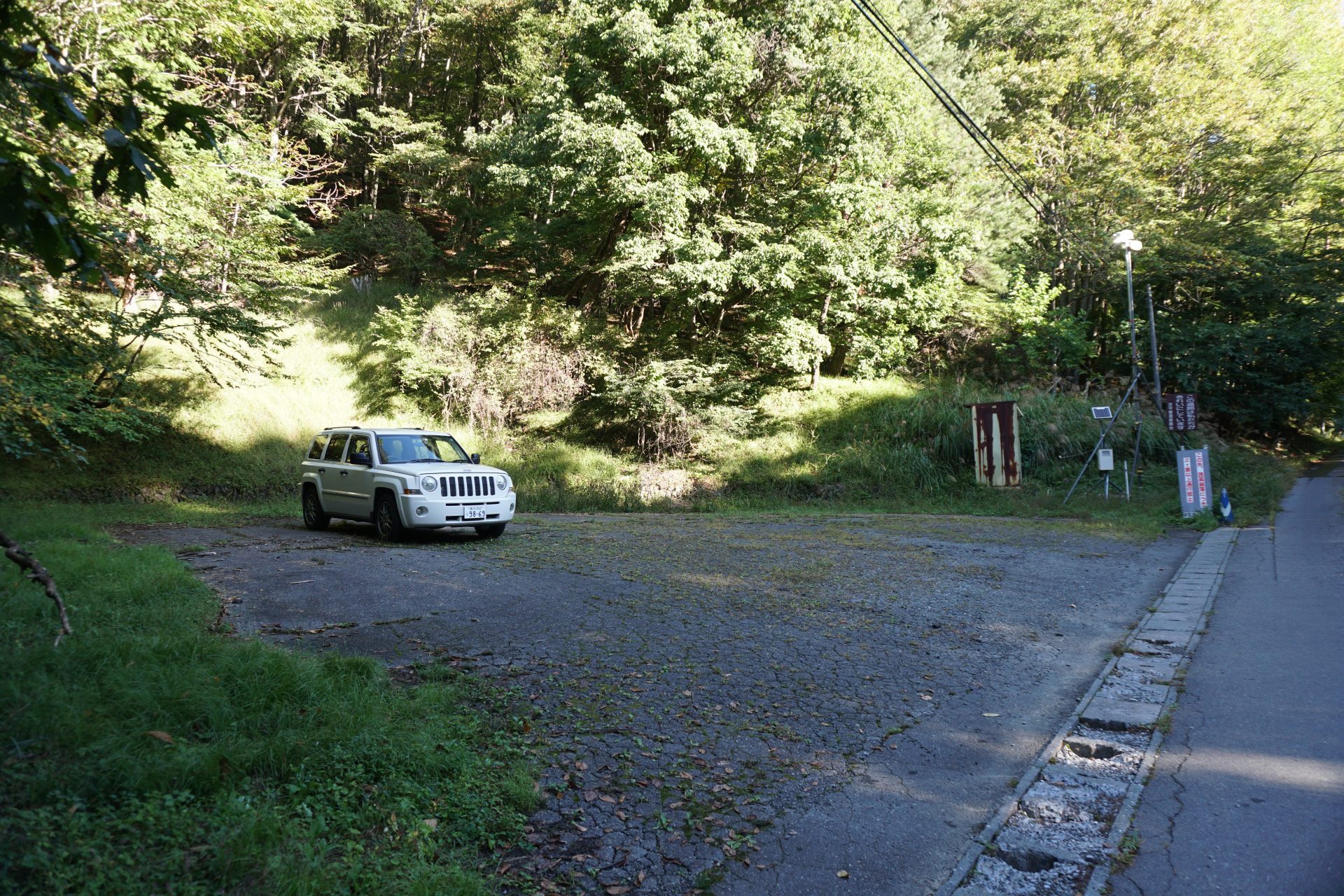
Elevation 1,022m
↓ 20 minutes
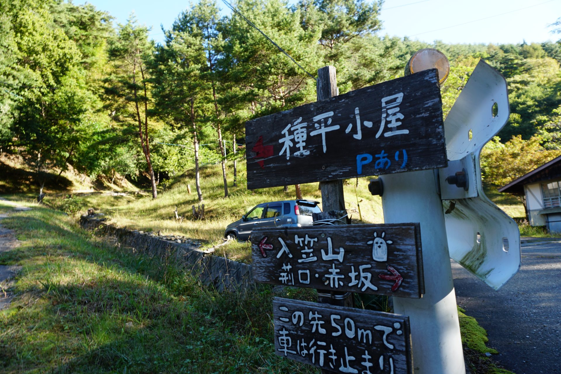
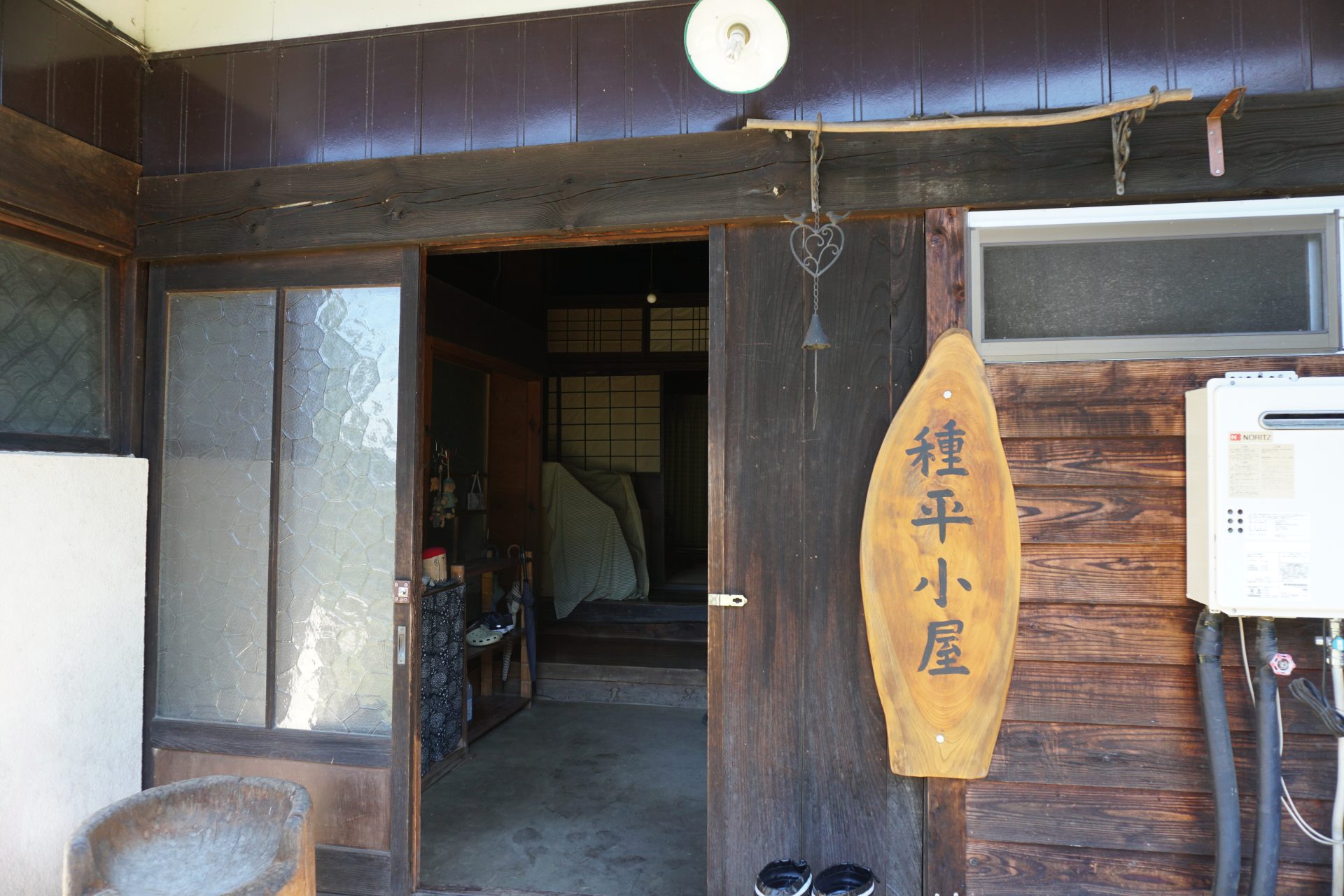
Tanehira hut
Elevation 1,120m
↓ 40 minutes
Water hole 1
Elevation 1,290m
↓ 1hour 20 minutes
Water hole 2

Elevation 1,589m
↓ 40 minutes
Kamba rock


Elevation 1,697m
↓ 10 minutes
Gosho-daira Pass
Elevation 1,787m
↓ 15 minutes
Koza-iwa
Elevation 1,786m
↓ 15 minutes
Teizawa entrance
Elevation 1,680m
↓ 55 minutes
O-ahara marshland

Elevation 1,820m
↓ 20 minutes
Hotoke-daira Pass
Elevation 1,842m
↓ 25 minutes
Mt. Nyukasa-yama
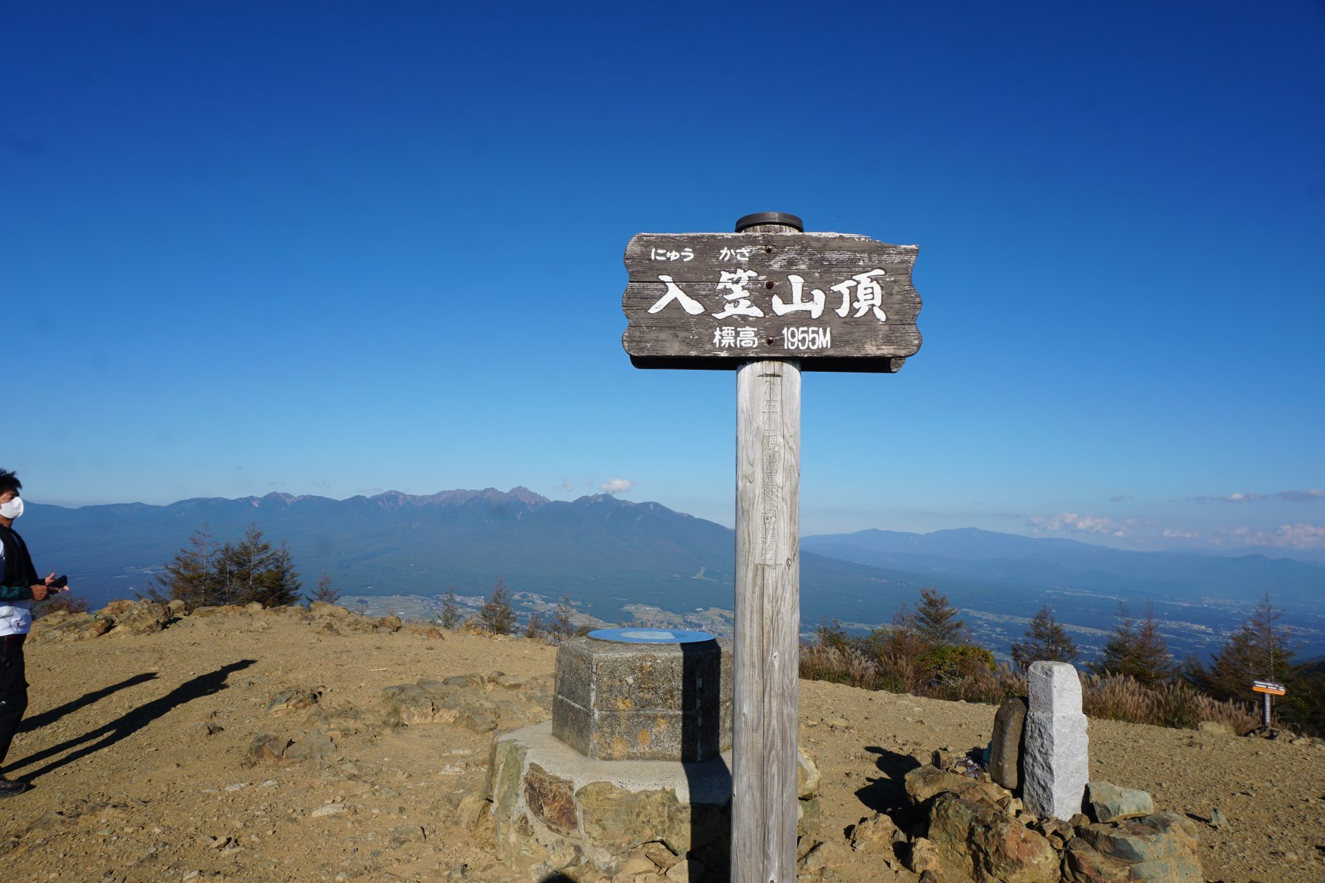
Elevation 1,955m
↓ 15 minutes
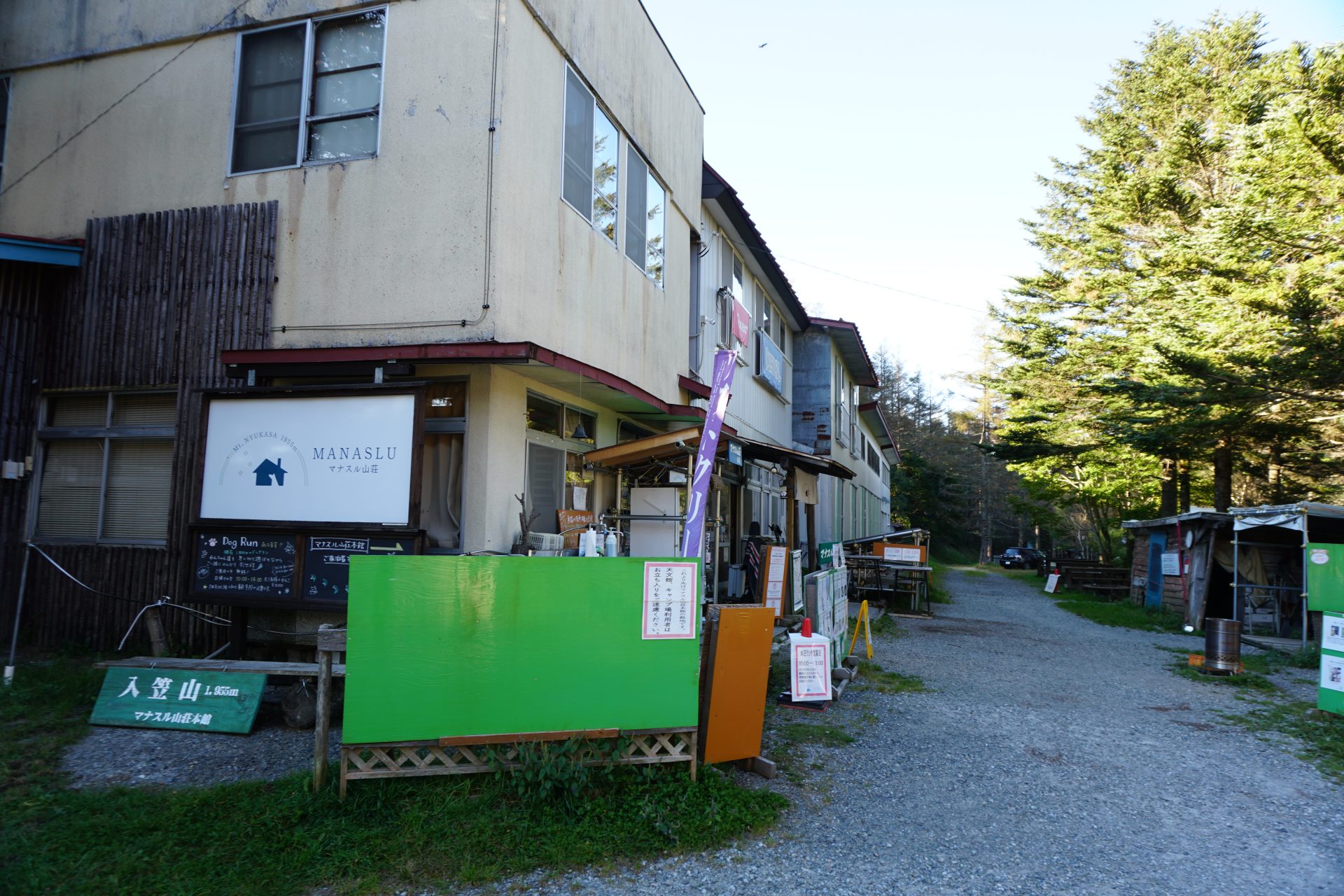
Manaslu Mt. hut

Elevation 1,791m
↓ 25 minutes
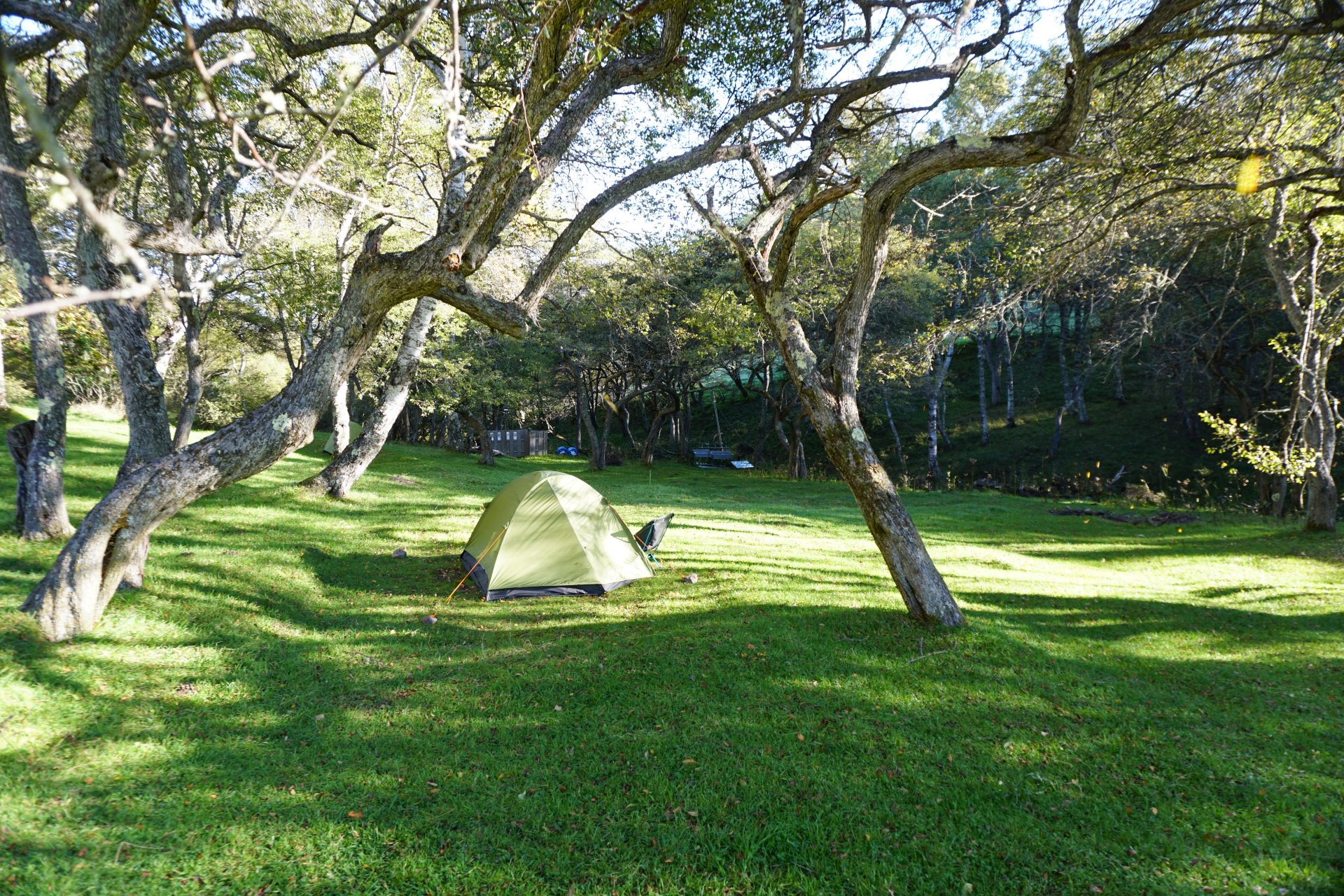
Nyukasa Ranch
Elevation 1,724m
Route Guide
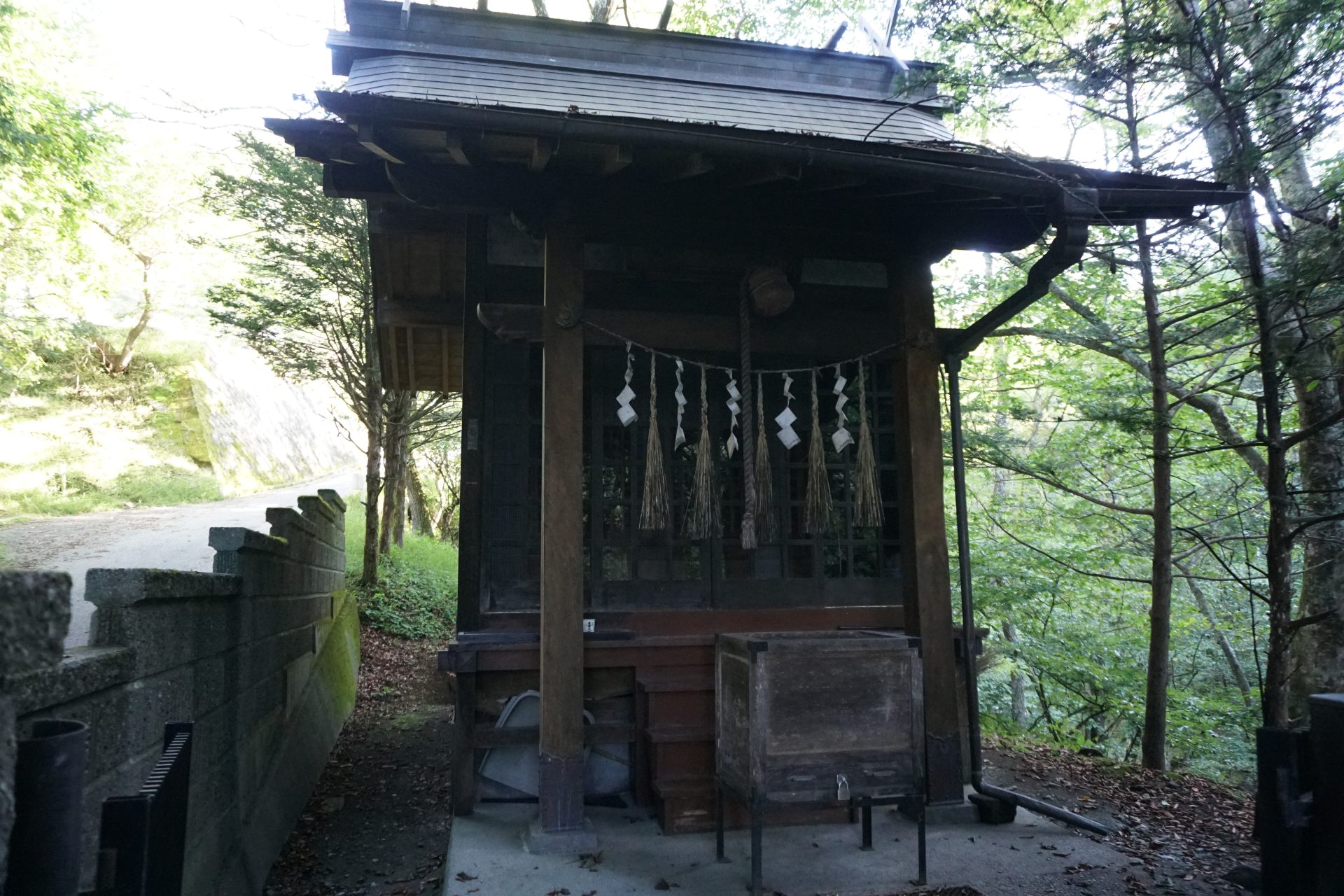
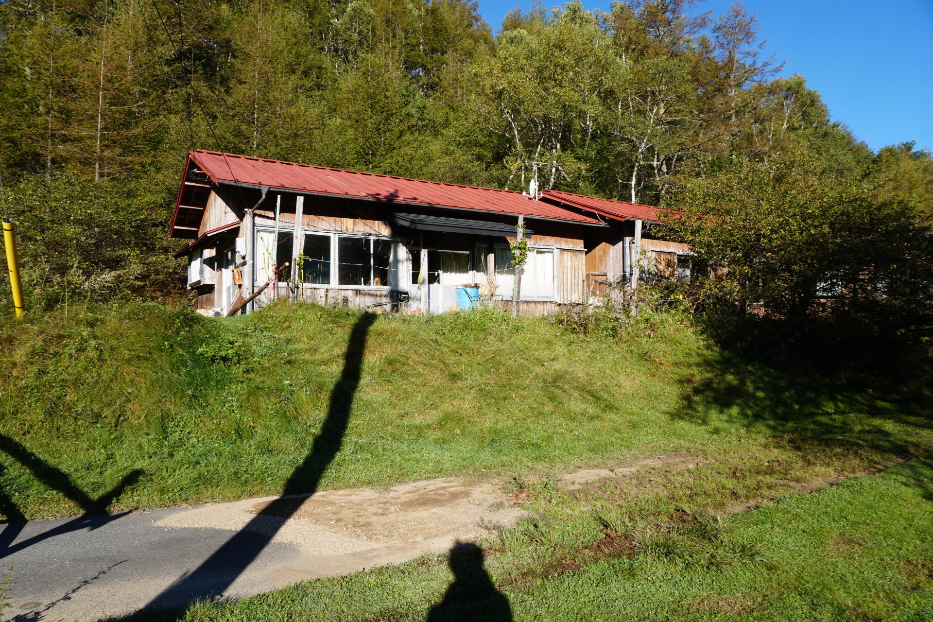
Akasaka Route: Park your car along the prefectural road and cross the Yamamuro River to the trailhead. Walk along the paved road for a while and you will see Myokendo on your right. Walk a little further and you will see the Tanehei Hut on your left. This hut is relatively new, but unfortunately it is no longer in operation.
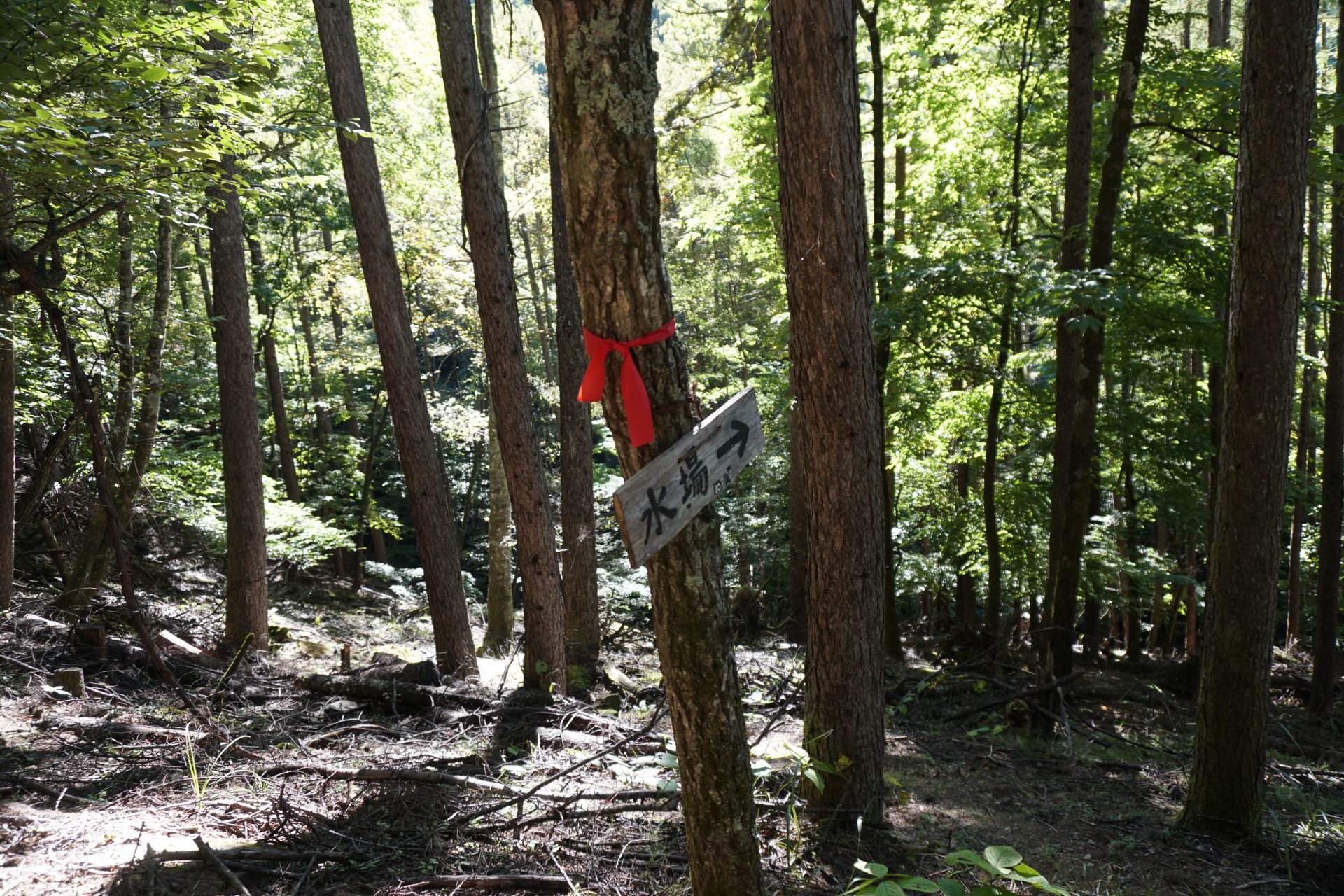
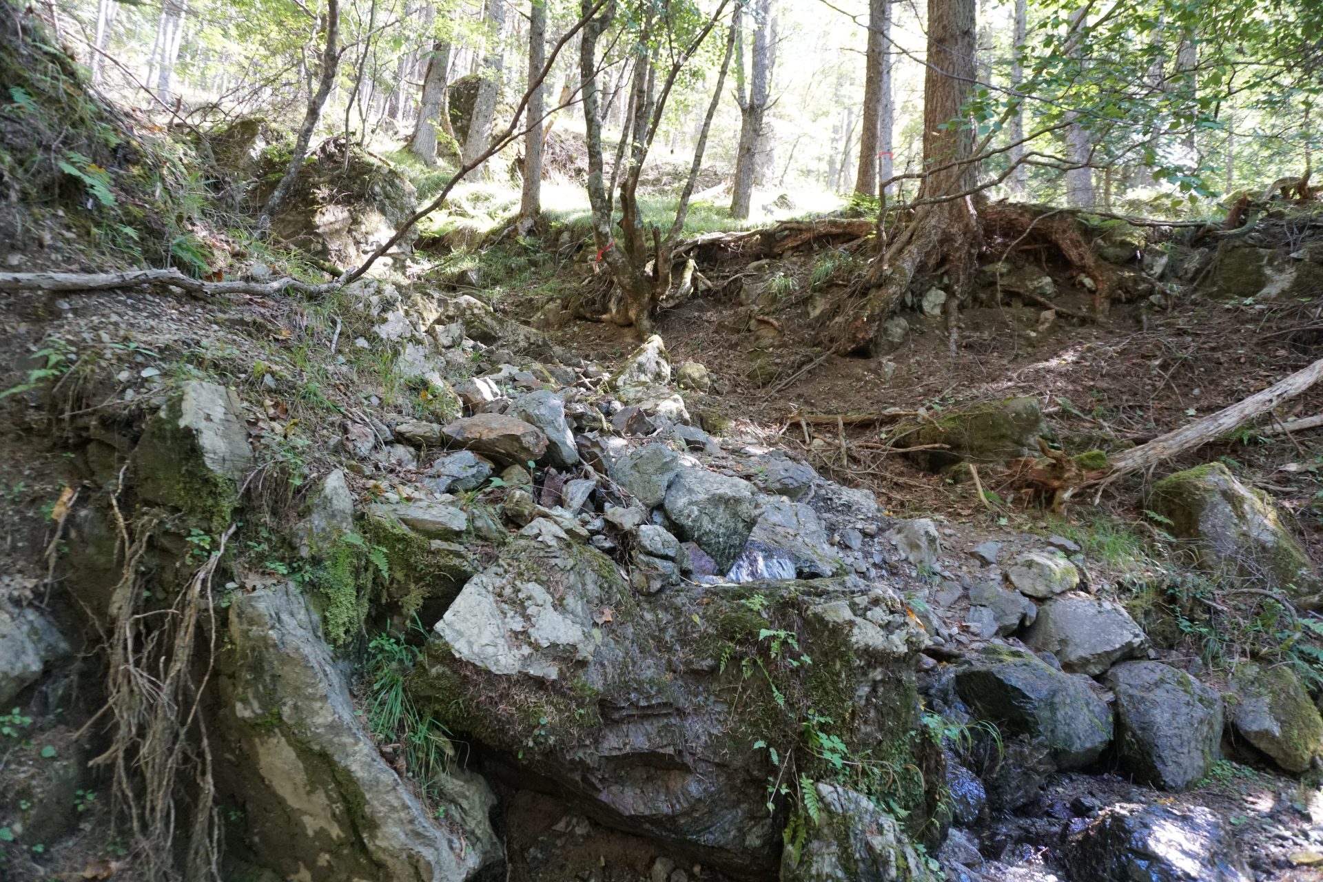
Behind this hut is the entrance to Mt. Nyukasa-yama, which is considered a candidate for one of the Hokkemichi. Tanehei Hut has placed signs at key points, but the trail to the halfway point has few footprints and is not an easy trail to follow. In particular, the route after crossing the waterhole is unclear and very difficult to follow. We had to rely on ribbons attached to trees and a map from the GSI (Geospatial Information Authority of Japan), and managed to get up to the forest road.
After continuing on the forest road, you will come to a narrow trail that leads to a ridge, where you will see a sign for Tanehei Hut. A short walk up this trail will lead you to an open area with a view of the Central Alps (just a little off the trail). A second water spot appears in the woods.From here, the trail splits into two paths, one going toward Gosho-gaike Pond and the other toward Kamba Iwa. We decided to stop by the Gosho-gaike direction on our way back and continued on toward Kamba-iwa. A little further on from the water, you will see the remains of a charcoal hut, and although it is a little difficult to see the route ahead, turn left at a right angle and climb steeply up a mossy rocky slope. There may have been a path straight ahead to Koza-iwa, but there is no route in that direction at present. The only steep part of the route is in front of Kamba-iwa, and if you persevere, you will reach a huge rock called "Kamba-iwa”.
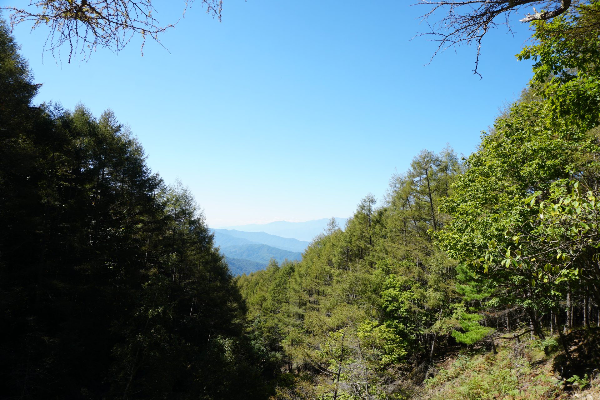
From here, the view toward Kisokoma can be seen beautifully.
After passing this rock and following a relatively gentle path through the woods, you will finally reach Gosho-daira. At the junction with Gosho-daira, turn right at the confluence from Shibira, and you will see an Ojizo-sama statue, said to have been carried by Kitahara-san (the man who revived Hokkemichi), erected at the junction with Koza-iwa.
At this junction, turn right toward Koza-iwa. It takes about 10-15 minutes to reach Koza-iwa after a slight up-and-down walk. From here, the view of the Ina Valley and Nishikoma (Kisokoma) mountains is spectacular.
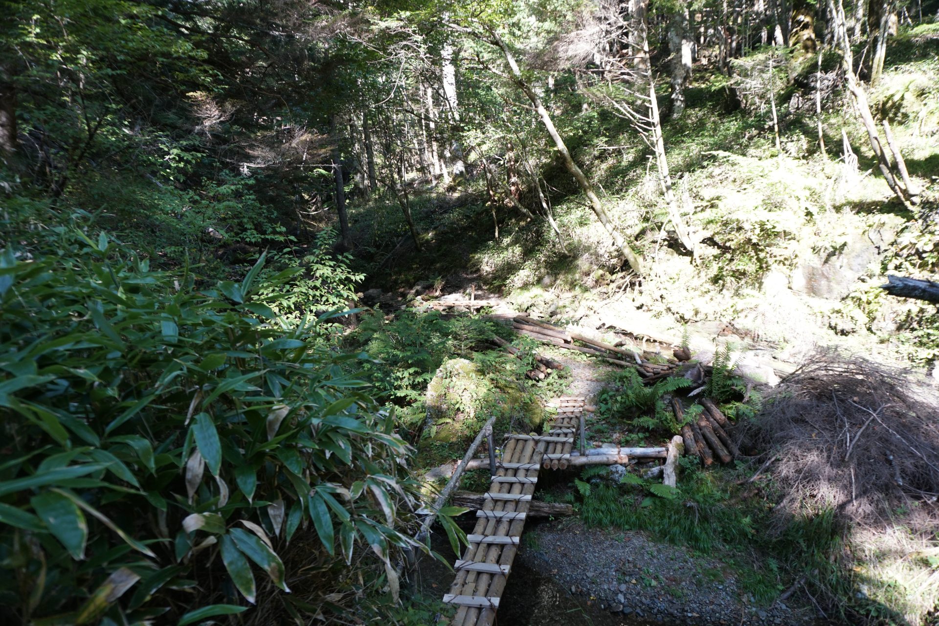
From here, we will turn off the Hokkemichi and follow the Kitahara Shindo (Kitahara New Road), a road not shown on the map made by Kitahara-san and Misawa-san (manager of Nyukasa Ranch), down to the Oguro river forest road, and then up the Teisawa river to the O-ahara Marshland. This too is not on the map. There are several fine handmade bridges over the clear stream. It is best not to cross the bridges when the stream flow is high.
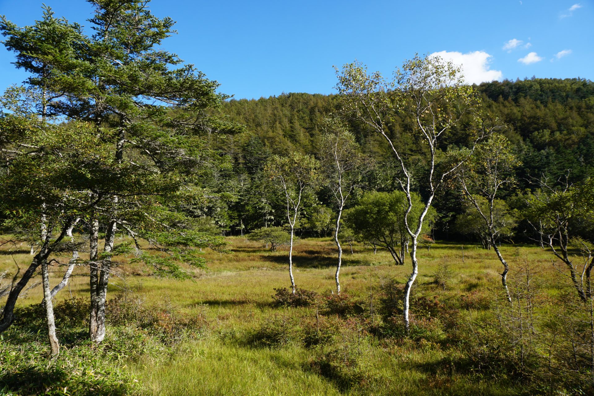
After 30-40 minutes, you will reach the O-ahara Marshland. Although it is not a large marshland, you can walk along a wooden path through a beautiful marshland reminiscent of Oze marshland, and you will feel as if you are enjoying a luxurious experience because there are few people here. After passing through the marshland, you will reach a road from the Fujimi side.
Turn left on this road and walk toward Mt. Nyukasa-yama.After a short distance, you will come to a place with a scary name: "Kubikiri Shimizu" (Decapitated Water). A little further on, you will see a trail to Mt. Nyukasa-yama on the left, which will take you to the Hotoke-daira Pass. The Hokkemichi trail seems to have a through road coming out of the Koza-iwa rock, but that road is currently impassable due to its unclear route.
From Hotoke-daira Pass, turn off the Hokkemichi Road and head for Mt. Nyukasa-yama.
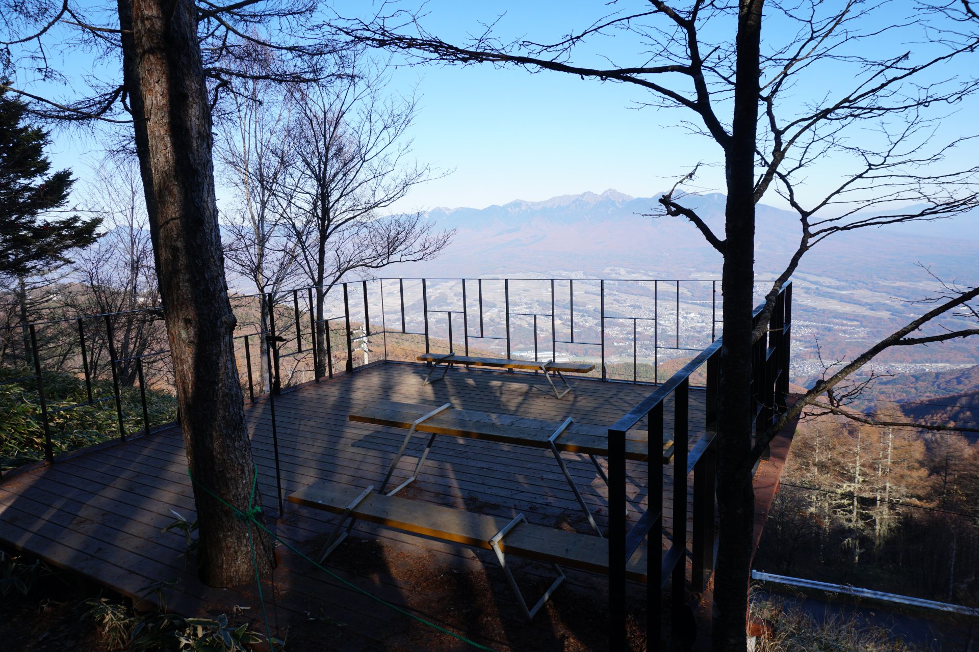
Mt. Nyukasa-yama is one of the 300 famous Mountains and offers a spectacular 360-degree view. Fuji is beautiful, but this place has a unique view of the Yatsu-gatake Mountains, especially as it looms right in front of you.
After the summit view, which is hard to leave, we descended toward Manaslu mountain hut. It takes about 15 minutes to reach Manaslu mountain hut. It is another 40 minutes to the gondola station of Fujimi Kogen Panorama Resort.
Turn left at the roadway in front of Manaslu mountain hut and walk gently downhill for about 20 to 30 minutes to reach your destination, Nyukasa Ranch. On the way, you will see the well-known "Lady's Hill," which has been used for various photo shoots as a scenic spot. The vast ranchland is surrounded by the Hotaka mountain range and other Alpine peaks, and the view is so spectacular that you may forget that you are in Japan.
Hokkemichi Road down Nyukasa Ranch – Gosho-gaike Pond – Umayano taira - Ryu tachida - Manto - Suwa Shrine - Akasaka
●Shibira Route Mountaineering Data
Itinerary: 2 days and 1 night, day trip is possible if you are fit.
Walking distance: Down 9.3km
Walking time: Down 3 hours 5 minutes
Accumulated elevation gain:Down route +243m-946m
Nyukasa Ranch
Elevation 1,724m
↓ 20 minutes
Gosho-daira pass
Elevation 1,787m
↓ 20 minutes
Gosho-gaike
Elevation 1,645m
↓ 30 minutes
Ruins of Sansho Hut
Elevation 1,610m
↓ 15 minutes
Umaya no taira
Elevation 1,490m
↓ 25 minutes
Ryu tachiba
Elevation 1,346m
↓ 20 minutes
Manto
Elevation 1,150m
↓ 5 minutes
Suwa shrine
Elevation 1,129m
↓ 40 minutes
Akasaka
Elevation 1,022m
Shibira Route: From Nyukasa Ranch, continue down the Hokkemichi Road. There are more historical sites left here than on the Akasaka side, where the Hokkemichi path was developed by Mr. Kitahara and others, and signs have been placed around the historical sites that are said to exist in Shibira.
Only Gosho-gaike pond is off the trailhead, and the path is somewhat obscure. From Gosho-daira, follow the forest road for about 20 minutes and you will see a sign for Gosho-gaike pond descending to the left. On the way out from Akasaka, from the second water spot, there is a path that turns left toward Gosho-gaike pond. After descending to the left and continuing for a while, you will see a sign, turn left, and in a few minutes you will reach Gosho-gaike pond in the woods. We do not know whether the pond is associated with Prince Muneyoshi or Hojo Tokiyuki, but as we gaze for a while at the dragonflies flitting across the quiet surface of the lake in a world without sound, we feel as if our thoughts are drawn to the heart of a person who had to hide himself in such a place nearly 700 years ago.
Returning to the path that leads into Gosho-gaike, we take a shortcut to the forest road, using the road that leads toward Shibira. Soon after, you will turn left on a narrow trail, which will become the Hokkemichi trail from Shibira. After entering the narrow trail, historic sites such as the ruins of Sansho Hut, Umaya no taira, Jijibaba-no-ishi, Monji Yashiki, and Ryu-tachiba appear every 5 to 10 minutes.
After about an hour from Gosho-gaike, turn left at Ryu-tachiba and walk down the steep mountain path. After crossing a narrow forest road and descending through an area maintained by forestry workers, the trail joins a large forest road. From here, a relatively gentle path leads to Shibira, crossing Manto on the way. 30-40 minutes from Ryu-tachiba, you will come to a decaying shrine of Suwa Shrine. Here, a large monument of "Hokkemichi" (the way of the Lotus) set up by Ina City is placed.
The descent is a two-and-a-half to three-hour hike from Gosho-daira. If you use this trail for the ascent, please allow about 20-30% extra time to Gosho-daira. From here, you will walk about 3 km on a gently descending prefectural road to Akasaka. The prefectural road is narrow, so be careful of cars.
Hokkemichi Fujimi-cho Route (reference route) Wakamiya - Mt. Nyukasa-yama
●Hokkemichi Fujimi-cho Route (reference route) Wakamiya – Mt. Nyukasa-yama
Itinerary: Day trip (descent by gondola at Fujimi Kogen)
Walking distance: 12.3 km up the Hokke Road
Walking time :4 hours and 40 minutes uphill (+50 minutes to the gondola station)
Cumulative elevation gain :+1,206m -387m
Wakamiya

Elevation 952m
↓ 1 hour10 minutes
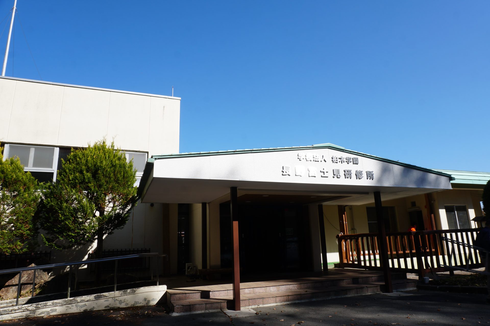
Kashiwagi Academy training center
Elevation 1,160m
↓ 1 hour
Ike-no-to
Elevation 1,430m
↓ 20 minutes
Sawairiguti trailhead
Elevation 1,452m
↓ 50 minutes
Hokkemichi Junction
Elevation 1,734m
↓ 45 minutes
Yatsu-gatake View
Elevation 1,840m
↓ 15 minutes
Hotoke-daira
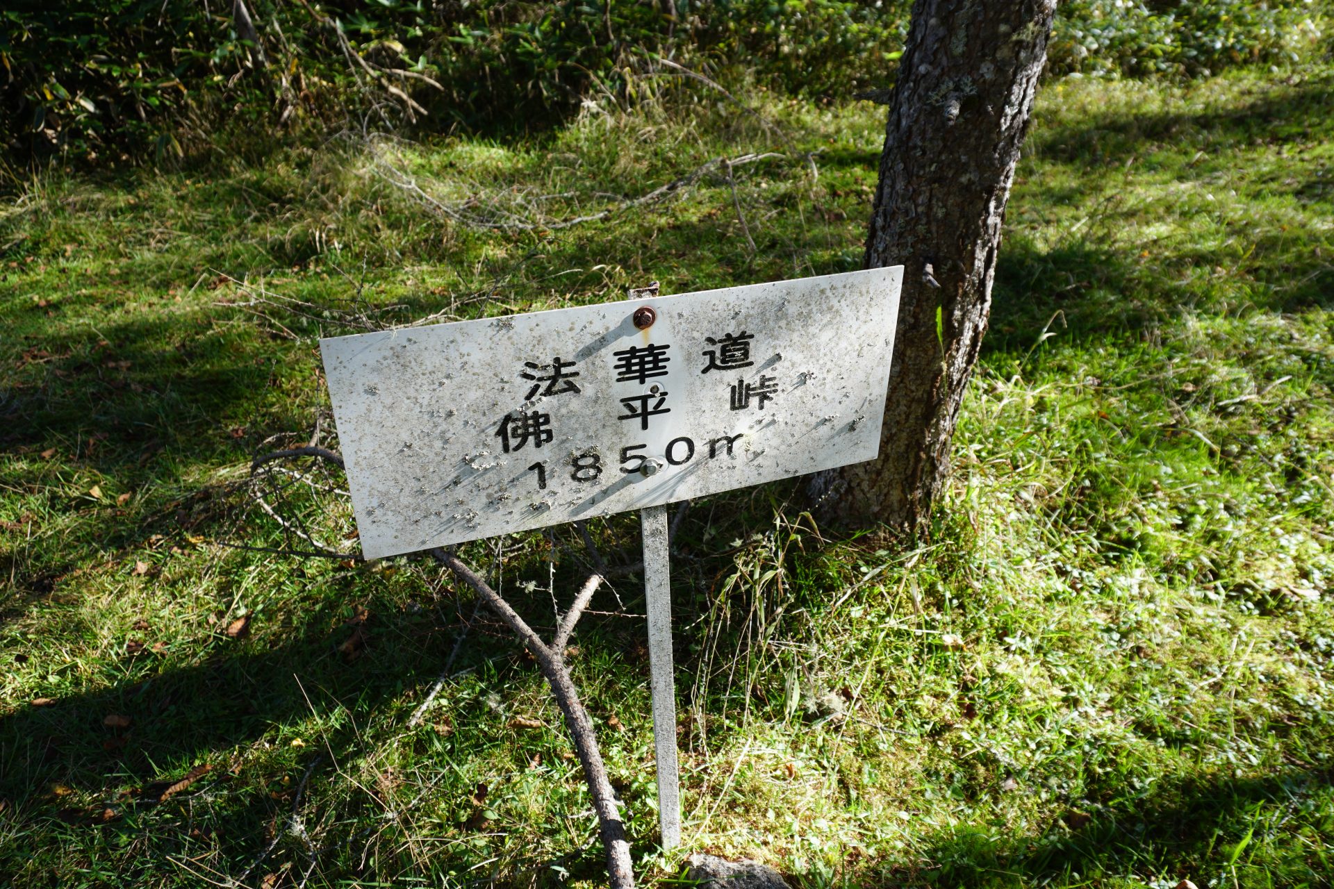
Elevation 1,845m
↓ 25 minutes
Mt. Nyukasa-yama
Elevation 1,955m
Fujimi Route: The start is Hachimangu Shrine in Wakamiya, Fujimi-cho. From here, follow the old road, which is said to be the old Kamakura Road, for a while and then enter the dirt road, which is said to be the starting point of the route. After a while, you will come to a fork in the road along the Muchi-gawa river, where you will find old stone pagodas and other structures left in a haphazard manner.
It seems that they were collected for reuse as stone materials rather than as historical sites. We will go back and follow the paved path leading to the summit of Mt. Nyukasa-yama from around 1000m altitude. Following this road up for about an hour, you will come to a training center of a school corporation called Kashiwagi Gakuen. Behind the training center, you will find a sign that says "Kodo Hokkamichi used to be here”. This area certainly feels like an ancient road if you say so.
From here, you will return to the paved road and climb along the road until you reach a large paved parking lot. From here, you will head for a place called Ikenohu. The map shows a path off the pavement, but there are many work roads for thinning in this area, and not only is it hard to tell if it is a Hokkemichi path or not, it is also hard to see where the path is going, so it is not clear where you are going.
After following the paved road for a while, you will come to a T-junction, where a sign for Hokkemichi Road suddenly appears (although it is highly possible that you could not find it until now). After leaving the paved road and going along what a appears to be an animal trail for a while, you will connect to a slightly upper paved road, and after going along for a while, you will reach a pond called Ike-no-to. This pond is similar in size and atmosphere to the Goshoike Pond on the Ina side of the Hokke Road and is surrounded by a serene landscape.
From here, follow the Hokkemichi Road sign again. After a short distance on the paved road, you will come to a parking lot at the entrance to the stream, which is the current starting point of the trail. The trail from here seems to overlap with the Hokkemichi Road in some places, and it is assumed that this trail leads to the head-cutting spring water from the middle of the road. However, the headwaters of the Muchigawa River, which is the valley line, have been repeatedly landslided, and the valley is so deeply carved that no atmosphere or trace of an ancient trail for people to enter remains at all. We have no choice but to continue on the current trail and join the boardwalk that leads to the Irikasa wetlands and the flower garden at the Nyukasa-yama trailhead. From here, the trail climbs up the eastern slope of Mt. Nyukasa-yama, and after about 40-50 minutes you will reach Hotoke-daira pass, where the Hokkemichi trail is said to have once been. Now there is either a paved road or a boardwalk that leads through the flower garden, so there is no trace of the old road.