Ura Ginza Panorama Route
①Takase dam ~ Eboshi-koya Mountain hut ~ Masago junction ~ Mt. Suisho-dake ~ Mt. Washiba-dake ~ Mt. Sugorku-dake ~ Senjo-nokkoshi ~ Mt. Yari-gatake ~ Yokoo ~ Kamikochi
Technical level: C
Physical strength: 10
Difficulty level: ⛰️⛰️⛰️⛰️⛰️
A route which ascends the steep Bunatate-o’ne ridgeline, and is a hike on the Ura-ginza traverse.
Access to Takase Dam & Nanakura-sanso mountain Hut
●Hiking Data
Schedule: Four nights and five days
Walking hours: 32 hours 45 minutes
(to Mt. Washiba-dake: 14 hours 20 minutes/From Mt. Washiba-dake to Kamikochi: 18 hours 25 minutes)
Walking distance: 49.1 km
Difference in elevation: 4,614 m
Takase dam


Elevation 1,270m
↓ 5 hours 20 minutes
Eboshi-koya Mountain hut
Elevation 2,551m
↓ 4 hours
Masago junction
Elevation 2,862m
↓ 2 hours 40 minutes
Mt. Suisho-dake
Elevation 2,986m
↓ 2 hours 20 minutes
Mt. Washiba-dake
Elevation 2,924m
↓ 3 hours 15 minutes
Mt. Sugoroku-dake
Elevation 2,860m
↓ 4 hours 40 minutes
Senjo-nokkoshi
Elevation 2,720m
↓ 2 hours
Mt. Yari-gatake
Elevation 3,179m
↓ 5 hours 20 minutes
Yokoo
Elevation 1,620m
↓ 3 hours 10 minutes
Kamikochi
Elevation 1,500m


Route Guide
The course duration is set for four nights and five days, however, if you are a fast hiker, it is possible to do it in three nights. The course duration does not take the weather into consideration. It is highly recommended to have one extra night in your schedule to adapt to changes in the weather. Bunatate ridgeline is well known for its steepness, however, the trail is well maintained. Walk at a steady pace especially at the beginning of the hiking. That should help you avoid over-exhaustion.
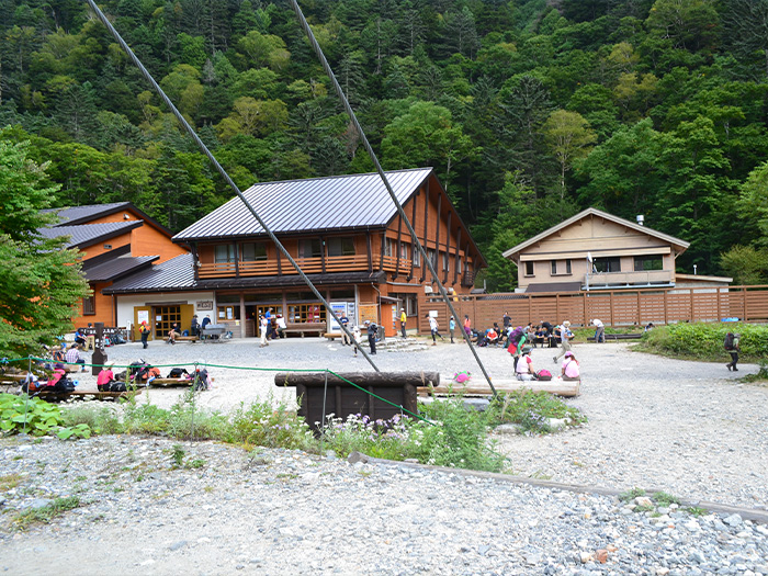
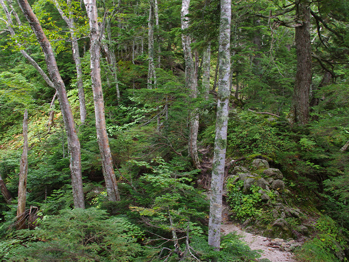
After passing Fudou-sawa tunnel and crossing a hanging bridge, a camping site is reached. Cross Nigori-sawa and walk along the right bank. The trailhead is reached shortly. Ascend in a zigzag pattern. Pass a huge rock, called Gonta-otoshi then enter a coniferous forest. The trail goes around the collapsed zone and reaches the triangulation point. After passing Tanuki-iwa, the trail merges into a ridgeline. It is recommended that you stay at Eboshi-koya Mountain hut, located on the ridgeline. After check-in, if time allows, make a round trip to Mt. Eboshi-dake.
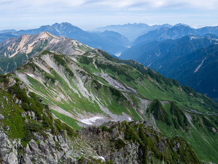
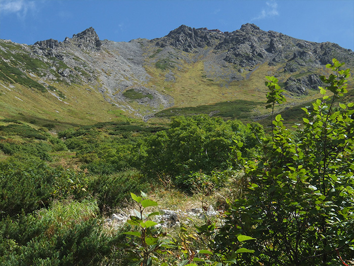
Start early on the next day. Head out to Mt. Noguchi-goro-dake. It must be a comfortable hike despite a few ups and downs. Go around the summit of Mt. Mitsu-dake. It is recommended that you walk on the Ohana-batake route during the summer. White sand on the trail shines in the summer. Mt. Yari-gatake and the Hotaka mountains can be seen on the left. After passing Noguchi-goro-koya Mountain hut, the ridgeline becomes rocky with huge rocks piled up. The summit of Mt. Noguchi-goro is reached after passing these rocks. From here, head to Mt. Suisho-dake. It is a fairly gradual slope and includes a a few ups and downs. It will be a refreshing hike with a great view. Suisho-koya Mountain hut stands where the trail meets Yomiuri-shindo. After checking-in, make a round trip to Mt. Suisho-dake. It takes about 1 hour and 10 minutes for the whole round trip. The view of Mt. Yari-gatake and the Hotaka mountains is stunning at the summit. If time allows, it might not be a bad idea to proceed to Mitsumata-sanso Mountain hut.
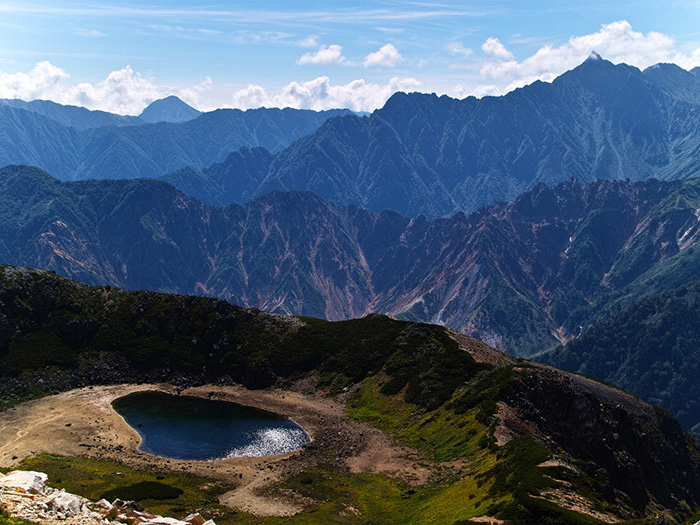
The trail descends from Mt. Suisho-dake to Warimo-kita junction. From the junction, head to Mt. Washiba-dake. Climb the ridgeline guided by a rope. There are some traversing spots along the trail so caution must be employed. The view of Mt. Yari-gatake from the summit of Mt. Washiba-dake is phenomenal. The Mitsumata-sanso Mountain hut locates at the end of the steep downhill of the ridgeline. Proceed to Mt. Mitumata-renge-dake. The mountain is located at the borderline of Toyama, Gifu and Nagano prefectures. Follow the ridgeline to Mt. Sugoroku-dake. The view of Mt. Yari-gatake and the Hodaka mountains is great from the summit. It is recommended that you stay at Sugoroku-koya Mountain hut, located at the junction of the trail from Shin-hotaka Onsen.
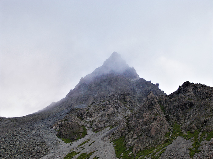
From Sugoroku—koya Mountain hut, head to Mt. Yari-gatake. Walk on Nishikama o’ne, a rocky ridgeline. This is the ridgeline which many hikers long for. Pay attention to your feet. After passing Iou-nokkoshi, the tip of Mt. Yari-gatake appears in your direction. Walk at a steady pace. Go around the summit of Mt. Samata-dake. Yari-gatake-sanso Mountain hut is close when Senjo-nokkoshi is reached. If you arrive early, it is recommended that you make a roundtrip to the summit after checking-in. It takes about 1 hour and the trail is very rocky. There are many ladders and chains mounted on the rocks. The trail separates into ascending and descending trails so there is no need to rush. The summit of Mt. Yari-gatake is narrow but the view is 360 degrees.
On the next day, if the weather permits, it is recommended that you challenge the summit for one more time. However, you have to be ready to wait in line due to the heavy human traffic in the morning. From Mt. Yari-gatake, descend towards Tengu-hara. After passing O-magari and Yarisawa, Yoko is reached. From that point, it becomes an easy hike on a gradual trail to Kamikochi.