Nishi-hotaka-dake Kamikochi Route
② From Kamikochi: Imperial Hotel bus stop ~ Nishi-hotaka-dake trailhead ~ Hosui ~ Nishiho Sanso mountain hut ~ Nishiho Doppyo ~ Mt. Nishi-hotaka-dake ~ Nishiho Doppyo ~ Nishiho Sanso mountain hut~ Kamikochi
Technical level: C
Physical strength level: 4
Difficulty level: ★★★
Climb Mt. Nishi-hotaka-dake from Kamikochi.
※Please wear a helmet in the core area.
The trail entrance is located just south of the Kamikochi Onsen Hotel. It takes a little time and energy, but you can approach Nishiho’s rocky ridge zone from here without having to detour to the ropeway a long way from Kamikochi.
●Hiking Data
Schedule: 1 night and 2 days
Walking hours: 12 hours 25 minutes (ascent: 4 hours to Nishiho Sanso, 7 hours 20 minutes to Mt. Nishihotaka, descent: 5 hours 5 minutes to Kamikochi)
Walking distance: 12.7 km
Highest peak: Mt. Nishi-hotaka-dake (2,909 m)
Difference in elevation: 1,474 m (Downward Difference in elevation – 1,474 m)
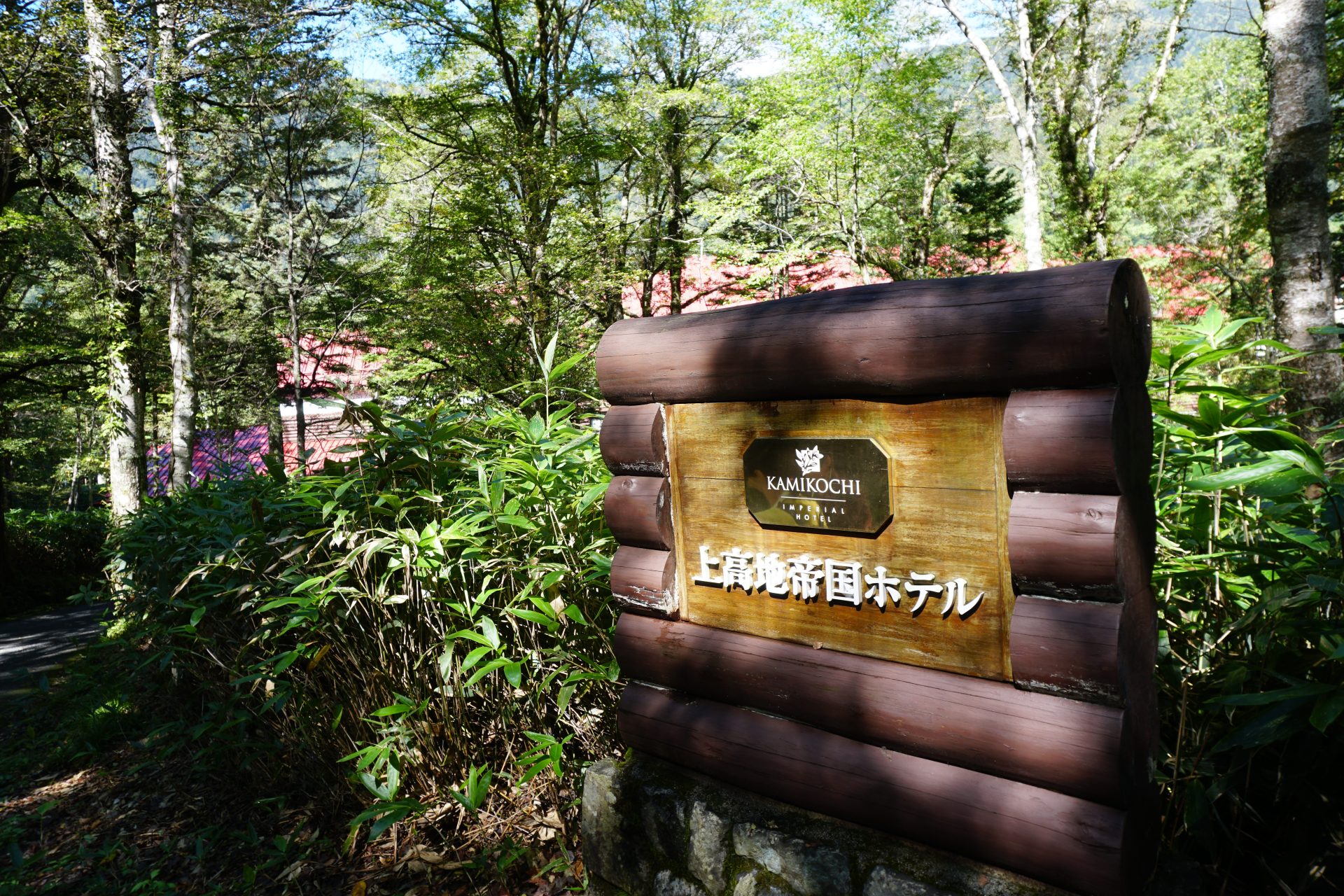
Kamikochi Imperial Hotel bus stop

Elevation 1,515m
↓ 10 minutes
Nishi-hotaka-dake Kamikochi trailhead
Elevation 2,367m
↓ 1 hour 20 minutes
Dead tree fallen tree field
Elevation 1,680m
↓ 1 hour 20 minutes
Hosui
Elevation 1,960m
↓ 1 hour
Wooded wetland
Elevation 2,210m
↓ 40 minutes
Mt. Yake-dake branch
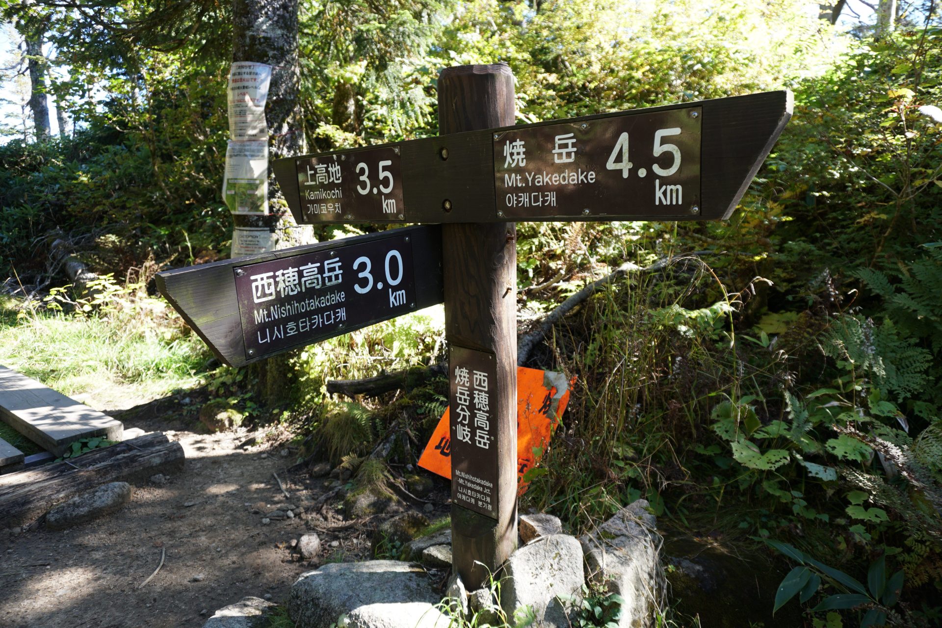
Elevation 2,301m
↓ 15 minutes
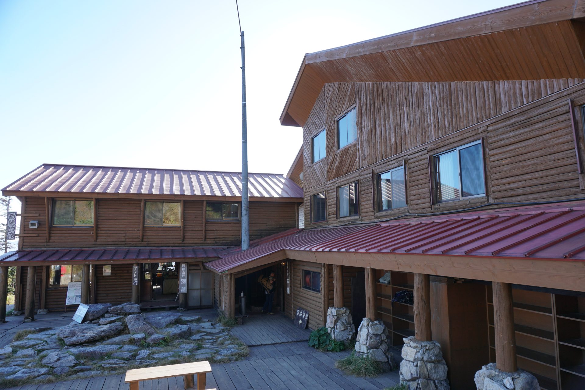
Nishiho Sanso mountain hut
Elevation 2,367m
↓ 20 minutes
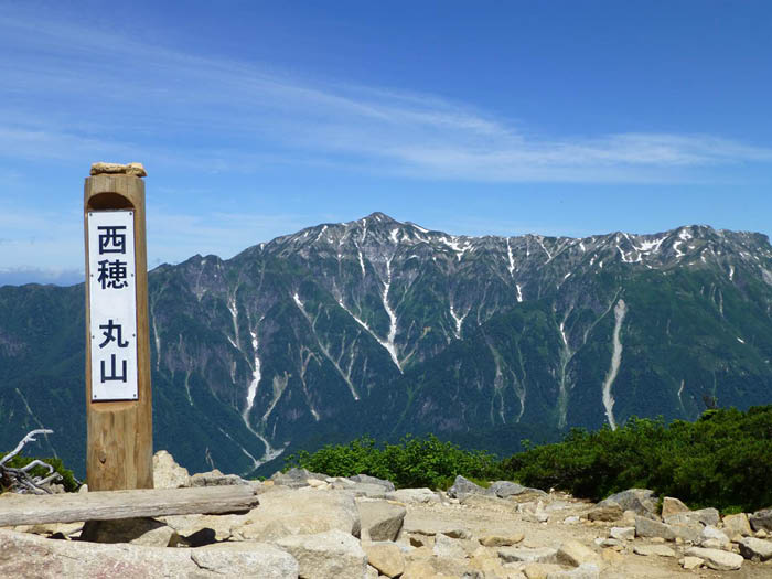
Maruyama
Elevation 2,452m
↓ 1 hour
Nishiho Doppyo
Elevation 2,701m
↓ 2 hours
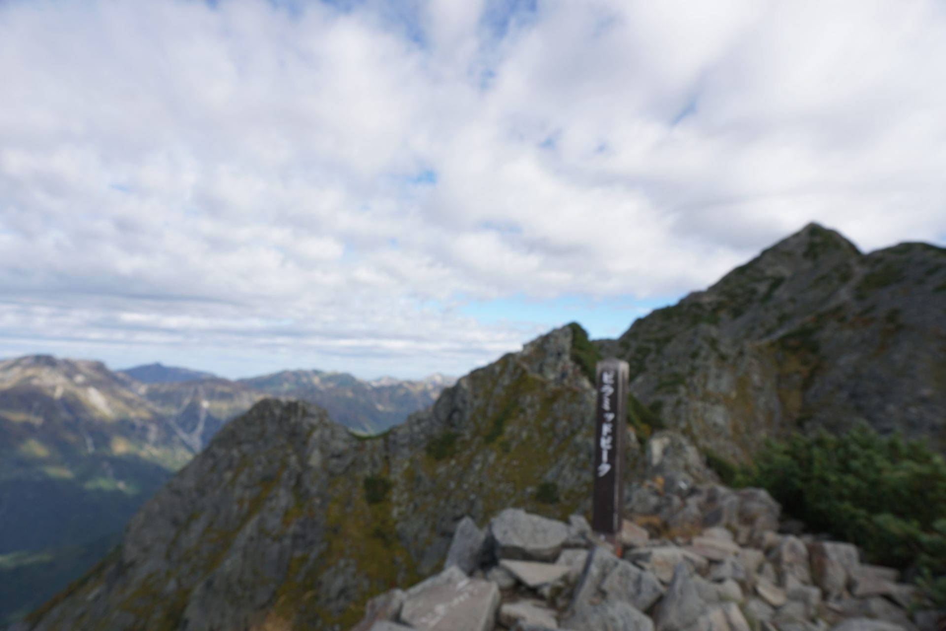
Pyramid peak
Elevation 2,773m
↓ 1 hour 15 minutes
Mt. Nishi-hotaka-dake

Elevation 2,909m
↓ 1 hour 30 minutes
Nishiho Doppyo
Elevation 2,701m
↓ 45 minutes
Nishiho Sanso mountain hut
Elevation 2,367m
↓ 1 hour
Kamikochi Bus Terminal
Elevation 1,500m


Route Guide
(From Kamikochi)
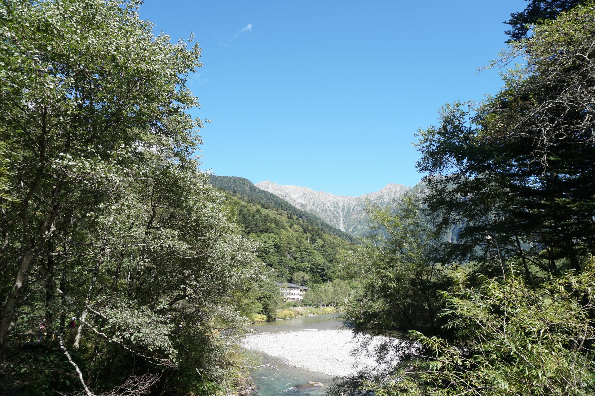
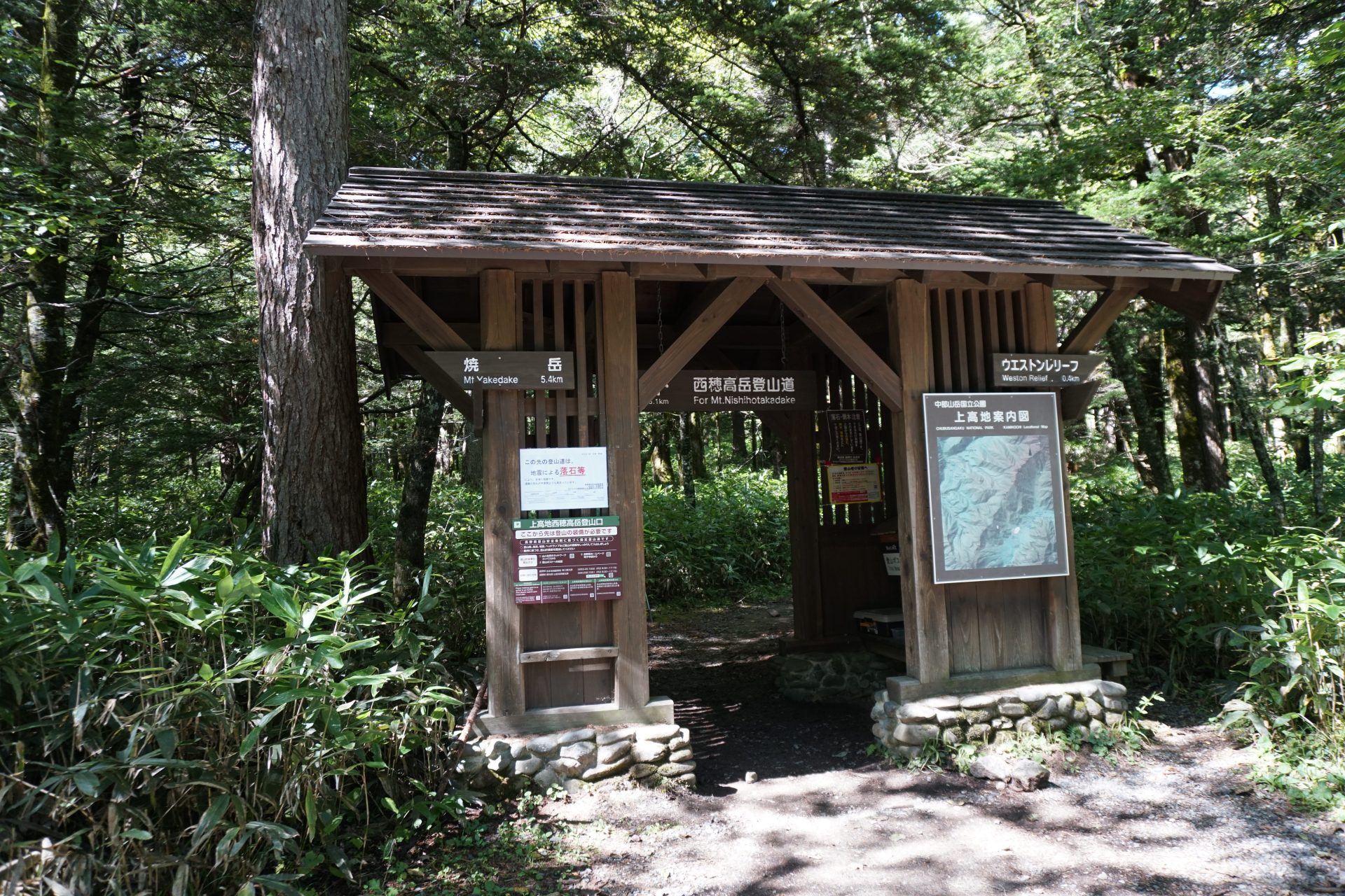
Get off the bus at the Imperial Hotel and follow the road beside the hotel toward Tashiro Bridge. This area is a typical walking route in Kamikochi and is crowded with many people during the season. After crossing two bridges, Tashiro Bridge and Hotaka Bridge, you will see a magnificent gate in front of you, which is the Mt. Nishi-hotaka-dake Kamikochi trailhead.
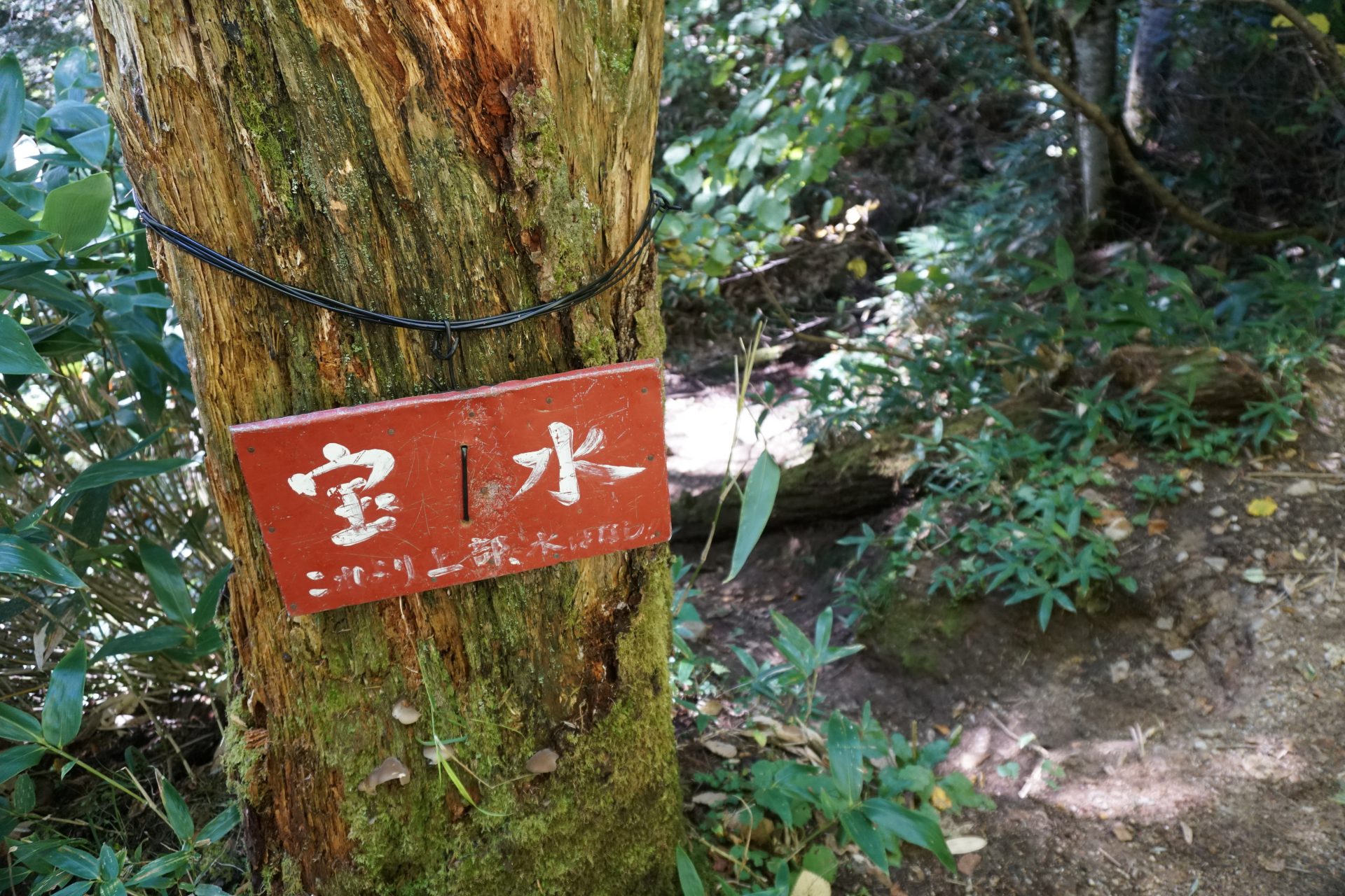
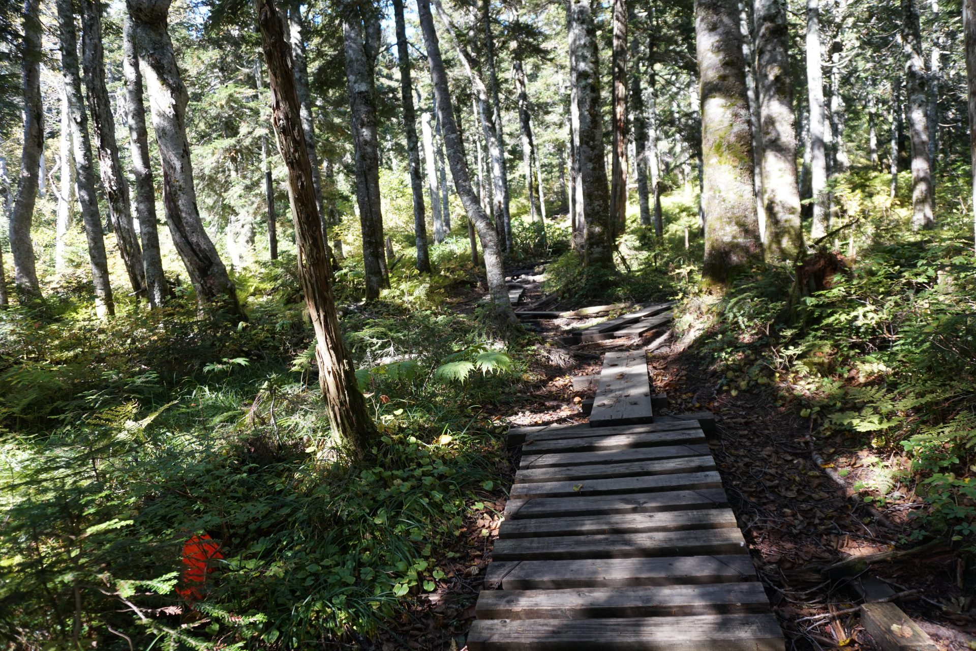
After submitting the mountaineering report, you will start walking through the greenery. The trail is gentle for a while and goes up along the stream, but after about 30 minutes of walking, the steep climb up to the ridge finally begins. After another 20 minutes, you will reach an open area with dead and fallen trees. For some reason, it is a relief to reach an open area since the route is basically blind. Still, the steep ascent of the ridge continues. After about an hour and a half from the trailhead, we reached a place that looked like the ridge line of Nakaone, a branch vein, and the path became a little gentler. After a while, you will reach a waterhole called Hosui. Take a short rest.
From here, another steep climb continues for a while, but after about an hour from Hosui, you will suddenly reach a flat forest and marshland. Of course, visibility is limited in this marshland, but the wooden path is well maintained, making for a pleasant walk. After crossing the marshland, you will finally reach the main ridge of Hotaka, where the Mt. Yake-dake and Mt. Nishi-hotaka-dake branches meet, and after another 15 minutes' walk, you will reach Nishiho Sanso mountain hut. The peaks of Mt. Kasumi-sawa-dake and Mt. Roppyaku-san are in sight across the Kamikochi area in front of you.
(Same as the ropeway route from Nishiho Sanso mountain hut)
From Maruyama, continue on a path with beautiful flower gardens. Because of the frequent lightning strikes in the Mt. Nishi-hotaka-dake area, there are fewer scree areas than in other areas of the mountain. In the unlikely event that thunderclouds appear, we recommend that you descend the mountain immediately.
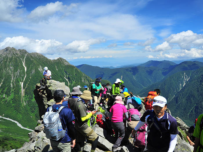
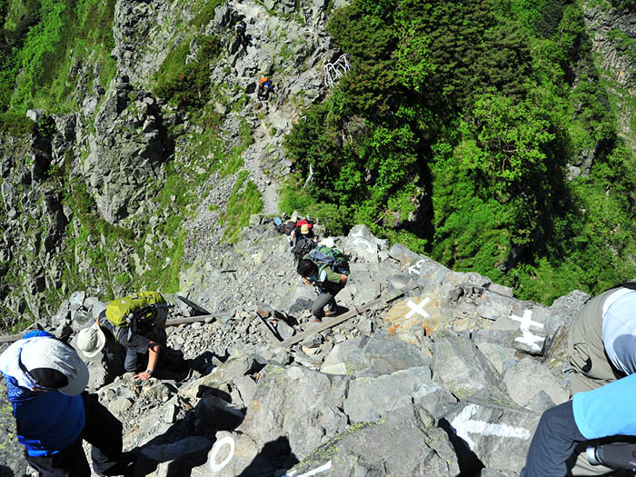
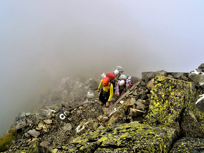
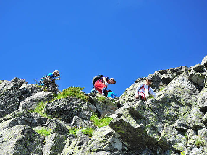
To get to the summit, zigzag up the rocky, gullied trail. However, if you are afraid of this ascent, you cannot continue walking from the Doppyo onward. Therefore, we frequently see people turning back around here. The view from the top of the summit is unobstructed, but it is a rocky area, so do not walk around. You may be able to see climbers climbing Jutarō-shindō trail, which is known for its steepness. If it is all you can do to get to the Doppyo, take it easy and turn back. From this point on, the level goes up a notch.
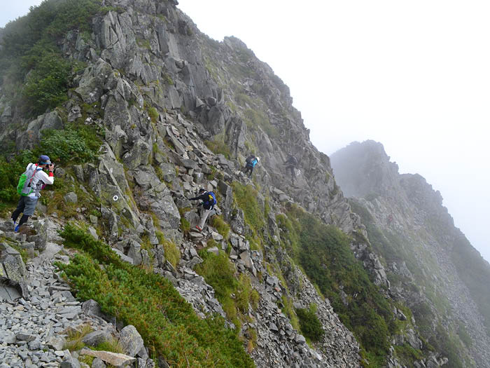
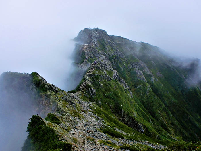
From the summit of the Doppyo, you will enter a collapsible, narrow ridge path. Soon you will be walking along a ridge that is cut off on both sides. Further up and down the knife edge of the ridge is Pyramid Peak, from which you can see Mae-hotaka-dake, the Jutaro-shindo trail leading to it, and the Dake-sawa Hutte. After passing Pyramid Peak, you will be on a narrow rock ridge with ups and downs, so be careful. In mid-summer, many people enter the mountain, so be especially careful when passing each other. Follow the "→" and "〇" painted markings on the rocky terrain. Slips and falls often occur when people do not follow these rules, so do not use your own judgment. A rocky area with a long scree slope will appear on the right side.
Continue calmly following the paint marks. Soon you will enter a gully with steep ups and downs. While maintaining a three-point secure posture, climb over the fourth and third peaks, and after two peaks, carefully continue over the rocks to reach the summit of Mt. Nishi-hotaka-dake. If the weather permits, we will be able to see a magnificent view of the Hotaka mountain range. After enjoying the view and taking a well-deserved rest, we will faithfully return to the outward route.
When descending to Kamikochi, if there is enough time, we will go to Kamikochi Bus Terminal instead of the Imperial Hotel. Please note that the buses from Kamikochi may not be able to be boarded in front of the Imperial Hotel because they are fully booked. You may also want to stop by the Kamikochi Onsen Hotel or Lumiesta, located near the descent entrance, for a day trip to work up perspiration.
Also, recently, more and more people are heading for the JANDARUMU from Mt. Nishi-hotaka-dake. However, if you are scared or have a hard time to MT. Nishi-hotaka-dake, it will be difficult to conquer the JANDARUMU. Even if you are with a friend, you should turn back. Furthermore, solo climbing of the JANDARUMU should also be avoided. In recent years, the number of people challenging the JANDARUMU has been increasing due to the number of videos on SNS, but at the same time, the number of people in distress has also been increasing.
Even if you have the ability to climb the JANDARUMU, ask an experienced expert or a mountain guide to lead you.