Nishi-hotaka-dake Ropeway Route
Shin-hotaka Ropeway Sancho station - Nishiho Sanso mountain hut - Nishiho Doppyo - Mt. Nishi-hotaka-dake - Nishiho Doppyo - Nishiho Sanso mountain hut - Shin-hotaka Ropeway Sancho station
Technical level: C
Physical strength level: 3
Difficulty level: ★★★
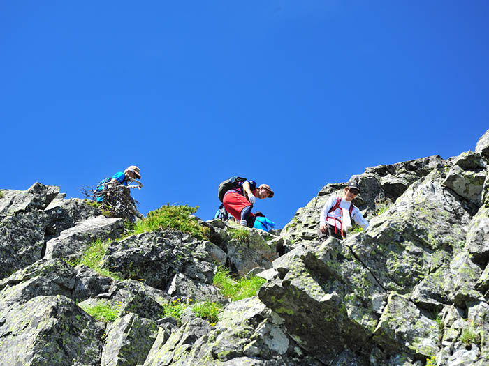
Enjoy walking along the rocky ridges of Mt. Nishi-hodaka-dake
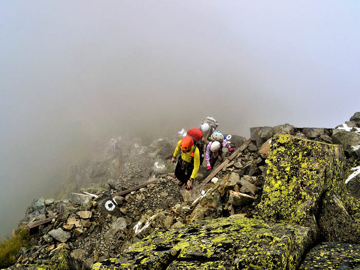
Take the ropeway up to the summit of Mt. Nishi-hotaka-dake. First, let’s climb up to the Mt. Nishi-hotaka-dake doppyo.※Please wear a helmet in the core area.
The ridge route from Mt. Nishi-hotaka-dake to Mt. Okuh-otaka-dake is not a well-maintained climbing route, but a difficult rock ridge route for advanced climbers.
●Hiking Data
Schedule: Overnight and day trips are possible for advanced students.
Walking hours: 8 hours 5 minutes (ascent: 1 hour 30 minutes to Nishiho Sanso mountain hut, 4 hours 50 minutes to Mt. Nishi-hotaka-dake, descent: 3 hours 15 minutes to ropeway station)
Walking distance: 7.7 km
Difference in elevation: 870m (Downward Difference in elevation – 870m)
Ropeway Sancho station (Nishi-hotaka entrance)

Elevation 2,156m
↓ 1 hour 30 minutes
Nishiho Sanso mountain hut
Elevation 2,367m
↓ 20 minutes
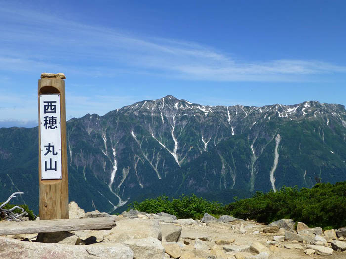
Maruyama
Elevation 2,452m
↓ 1 hour
Nishiho Doppyo

Elevation 2,701m
↓ 45 minutes
Pyramid Peak
Elevation 2,773m
↓ 1 hour
Mt. Nishi-hotaka-dake
Elevation 2,909m
↓ 1 hour 30 minutes
Nishiho Doppyo
Elevation 2,701m
↓ 45 minutes
Nishiho Sanso mountain hut
Elevation 2,367m
↓ 1 hour
Ropeway Sancho station(Nishihotakaguchi)
Elevation 2,156m


Route Guide
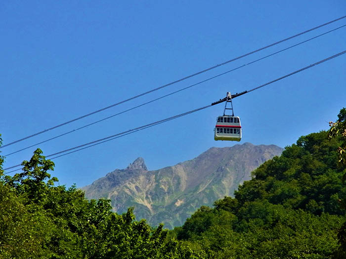
From Shin Hotaka Onsen, the ropeway will take you to Nishi-hotaka-guchi entrance, gaining altitude at once. From Nishi-hotaka-guchi entrance to Nishiho Sanso mountain hut, you will walk through a forested area without a view. The elevation gain is 200 meters and the walking time is 1 hour and 30 minutes. The ridge line of Mt. Nishi-hotaka-dake can be seen through the trees.
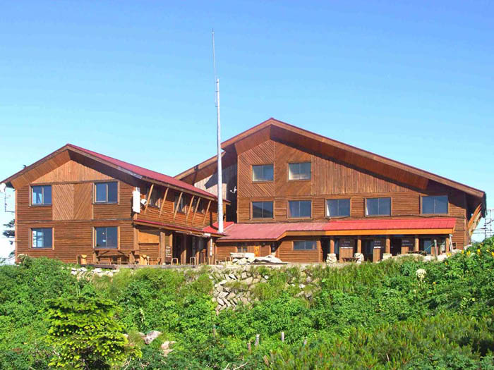
As the trail enters the coniferous forest, where Dake-kamba and Nana-kamado (Japanese white birch) are prominent, the gradient becomes steeper, so keep taking breaks and stopping to rest. After passing through a high pine forest, you will arrive at Nishiho Sanso mountain hut. If you continue straight ahead, you can do a day trip to mt. Nishi-hotaka-dake. However, only intermediate or advanced climbers are allowed to do so. Beginners should stay overnight at Nishiho Sanso mountain hut and do the summit piste. Nishiho Sanso mountain hut is open all year round, and many experts stay there. You may have a chance to hear about their experiences.
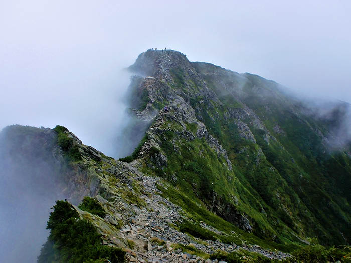
From Nishiho Sanso mountain hut, climb lightly up the rocky terrain and continue on through the Japanese pines. 10 minutes later, you will see the beautiful peak of Mt. Nishi-hotaka-dake. The sharp peak seen in front of it is Pyramid Peak, which is one more toward the summit of Mt. Nishi-hotaka-dake than Doppyo.. Many hikers enjoy the view from the summit of Maruyama, and the alpine flora is spectacular. When the gradient slackens, you will reach the summit of Maruyama. Many hikers and tourists are taking commemorative photos.
From Maruyama, continue on a path with beautiful flower gardens. Because of the frequent lightning strikes in the Mt. Nishi-hotaka-dake area, there are fewer scree areas than in other areas of the mountain. In the unlikely event that thunderclouds appear, we recommend that you descend the mountain immediately.
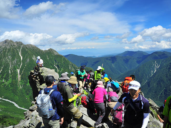
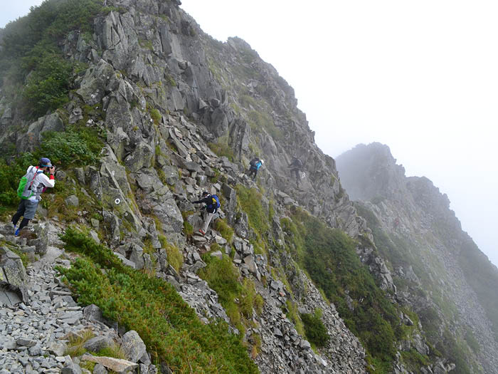
To get to the summit, zigzag up the rocky, gullied trail. However, if you are afraid of this ascent, you cannot continue walking from the Doppyo onward. Therefore, we frequently see people turning back around here. The view from the top of the summit is unobstructed, but it is a rocky area, so do not walk around. You may be able to see climbers climbing Jutarō-shindō trail, which is known for its steepness. If it is all you can do to get to the Doppyo, take it easy and turn back. From this point on, the level goes up a notch.
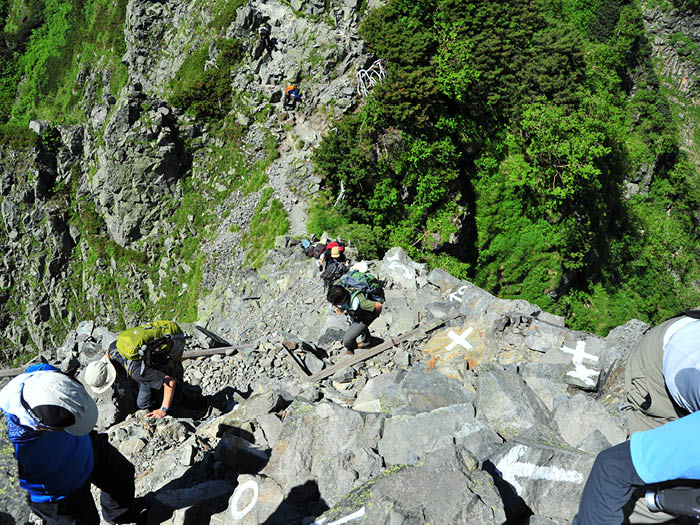
From the summit of the Doppyo, you will enter a collapsible, narrow ridge path. Soon you will be walking along a ridge that is cut off on both sides. Further up and down the knife edge of the ridge is Pyramid Peak, from which you can see Mt. Mae-hotaka-dake, the Jutaro-shindo trail leading to it, and the Dake-sawa Hutte. After passing Pyramid Peak, you will be on a narrow rock ridge with ups and downs, so be careful. In mid-summer, many people enter the mountain, so be especially careful when passing each other. Follow the "→" and "〇" painted markings on the rocky terrain. Slips and falls often occur when people do not follow these rules, so do not use your own judgment. A rocky area with a long scree slope will appear on the right side.