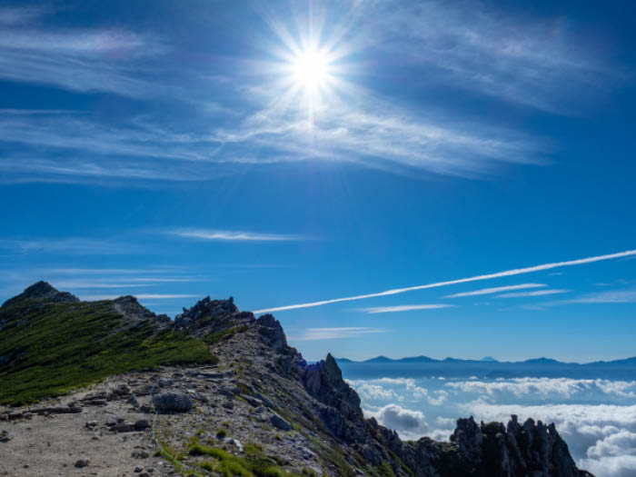
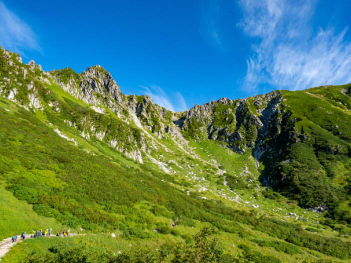
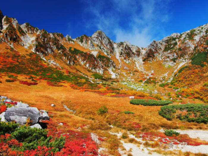
A main peak of the Central Japan Alps, Mt. Kisokoma-gatake, stands at an elevation of 2,956m. There are no mountains higher than an elevation of 3,000m in the area. Therefore, that makes Mt. Kisokoma-gatake the main peak and the highest peak of the Central Japan Alps. In the Ina area, people call Mt. Kisokoma-gatake ‘Nishi West-komagatake’ indicating a relation of sorts to Mt. Kaikoma-gatake. It is said that a unique mountain worship began in a combination with Buddhism. The Central Japan Alps are known as the Kiso Mountains, the Northern Japan Alps are known as the Hida mountains, and the Southern Japan Alps are known as the Akaishi mountains. The length is 100 km from North to South. These mountains are reverse faults, mountains created by crustal movement. Besides Mt. Kisokoma-gatake, Mt. Houken-dake, Mt. Utsugi-dake, Mt. Minamikoma-gatake, Mt. Ena-san, Mt. Kyou-gatake and Mt. Minamikiso-gatake are also famous mountains. Compared to the Northern Japan Alps and the Southern Japan Alps, the mountainous area is smaller, however, wide views from long ridgelines and the variety of the Alpine plants of the Central Japan Alps rival those of the Northern and Southern Japan Alps. Ptarmigans are spotted in the mountains recently as well. Let’s go hike the Central Japan Alps this summer!
Mt. Kisokoma-gatake: Elevation 2,956m
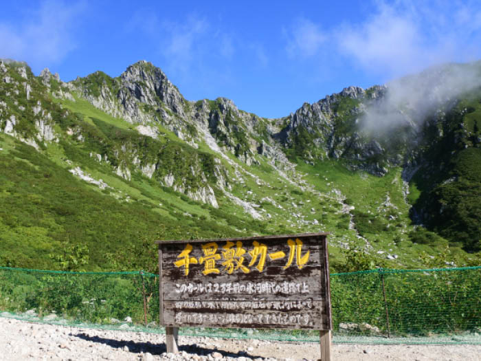
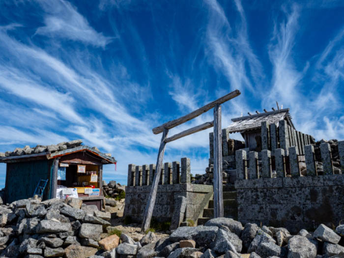
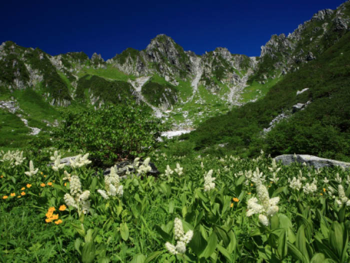
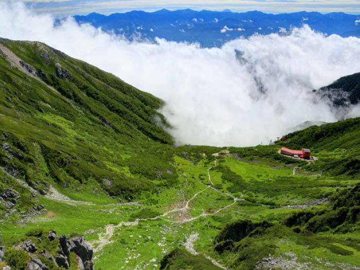
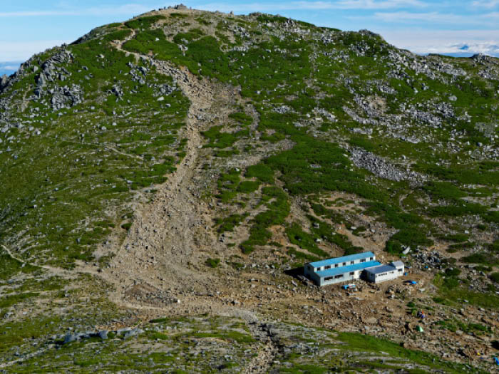
There are some different courses to the summit of Mt. Kisokoma-gatake. A trail from Sirabi-daora with use of the Koma-gatake ropeway is the most popular route. During the busiest hiking season in summer,the cue for the ropeway ride might take 1 or 2 hours so plan accordingly. Nearby Senjo-jiki station of the Kama-gatake ropeway, the curl shaped plateaus spread out with a wide variety of alpine plants such as Hakusan-ichige, Kobai-sou, Shinano-kinbai and black lilly. Along the trail to the summit, Himeusuyuki-sou, Dicentra, and Minuartia can be admired. The Senjo-jiki route using the Koma-gatake ropeway and another route on the main ridgeline from Mt. Kisokoma-gatake to Mt. Utsugi-dake via Mt. Houken-dake are introduced here.
Trailhead vicinity weather
Weekly weather forecast zone:Central Nagano Prefecture
| DAY | WEATHER | LOWEST | HIGHEST |
|---|---|---|---|
| 7/12 | 22℃ | 31℃ | |
| 7/13 | 22℃ | 33℃ | |
| 7/14 | 23℃ | 32℃ | |
| 7/15 | 23℃ | 32℃ | |
| 7/16 | 24℃ | 32℃ | |
| 7/17 | 24℃ | 32℃ |
This is a publication of the calculated figures for weather predictions and is not the weather forecast. There are instances where there will be big differences in the values stated for the mountains, in accord with the topography as well as sunlight, etc. so please take care.
72 hours weather information:Chijatajiki Hotel, 1 Ako, Komagane City, Nagano Prefecture
| Date and time |
7/11 17:00 |
7/11 18:00 |
7/11 19:00 |
7/11 20:00 |
7/11 21:00 |
7/11 22:00 |
7/11 23:00 |
7/12 0:00 |
7/12 1:00 |
7/12 2:00 |
7/12 3:00 |
7/12 4:00 |
7/12 5:00 |
7/12 6:00 |
7/12 7:00 |
7/12 8:00 |
7/12 9:00 |
7/12 10:00 |
7/12 11:00 |
7/12 12:00 |
7/12 13:00 |
7/12 14:00 |
7/12 15:00 |
7/12 16:00 |
7/12 17:00 |
7/12 18:00 |
7/12 19:00 |
7/12 20:00 |
7/12 21:00 |
7/12 22:00 |
7/12 23:00 |
7/13 0:00 |
7/13 1:00 |
7/13 2:00 |
7/13 3:00 |
7/13 4:00 |
7/13 5:00 |
7/13 6:00 |
7/13 7:00 |
7/13 8:00 |
7/13 9:00 |
7/13 10:00 |
7/13 11:00 |
7/13 12:00 |
7/13 13:00 |
7/13 14:00 |
7/13 15:00 |
7/13 16:00 |
7/13 17:00 |
7/13 18:00 |
7/13 19:00 |
7/13 20:00 |
7/13 21:00 |
7/13 22:00 |
7/13 23:00 |
7/14 0:00 |
|---|---|---|---|---|---|---|---|---|---|---|---|---|---|---|---|---|---|---|---|---|---|---|---|---|---|---|---|---|---|---|---|---|---|---|---|---|---|---|---|---|---|---|---|---|---|---|---|---|---|---|---|---|---|---|---|---|
| Weather | ||||||||||||||||||||||||||||||||||||||||||||||||||||||||
| Temperature | 18℃ | 18℃ | 17℃ | 17℃ | 17℃ | 17℃ | 16℃ | 16℃ | 16℃ | 16℃ | 16℃ | 16℃ | 15℃ | 15℃ | 15℃ | 16℃ | 17℃ | 19℃ | 20℃ | 21℃ | 22℃ | 22℃ | 22℃ | 21℃ | 21℃ | 19℃ | 18℃ | 17℃ | 17℃ | 16℃ | 16℃ | 16℃ | 15℃ | 15℃ | 15℃ | 15℃ | 15℃ | 15℃ | 16℃ | 18℃ | 19℃ | 20℃ | 21℃ | 21℃ | 22℃ | 23℃ | 23℃ | 22℃ | 22℃ | 21℃ | 20℃ | 18℃ | 18℃ | 18℃ | 17℃ | 17℃ |
| Precipitation | 0.4mm/h | 0.4mm/h | 0.4mm/h | 0.4mm/h | 0.4mm/h | 0mm/h | 2mm/h | 0.4mm/h | 0.4mm/h | 0.4mm/h | 0mm/h | 0mm/h | 0mm/h | 0mm/h | 0mm/h | ※ 16時間以降は表示されません | ||||||||||||||||||||||||||||||||||||||||
| Wind direction |
south 2m/s |
south 1m/s |
south 1m/s |
south 1m/s |
south 1m/s |
south 1m/s |
south 1m/s |
south 1m/s |
south 1m/s |
south 1m/s |
south 1m/s |
south 1m/s |
south 1m/s |
south 1m/s |
south 1m/s |
south 1m/s |
0m/s |
south 1m/s |
south 1m/s |
south 1m/s |
south 1m/s |
south 2m/s |
south 2m/s |
south 2m/s |
south 2m/s |
south 2m/s |
south 2m/s |
south 2m/s |
south 2m/s |
south 2m/s |
south 2m/s |
south 1m/s |
south 1m/s |
south 1m/s |
0m/s |
0m/s |
0m/s |
0m/s |
0m/s |
0m/s |
south 1m/s |
south 1m/s |
south 1m/s |
south 1m/s |
south 1m/s |
south 2m/s |
south 2m/s |
south 2m/s |
south 2m/s |
south 2m/s |
south 2m/s |
south 2m/s |
south 1m/s |
south 1m/s |
south 1m/s |
south 1m/s |
※The weather information will be information on 5km square including the relevant point.
※天気予報マークは一次細分区域から表示しています
View of Mt. Kisokoma-gatake