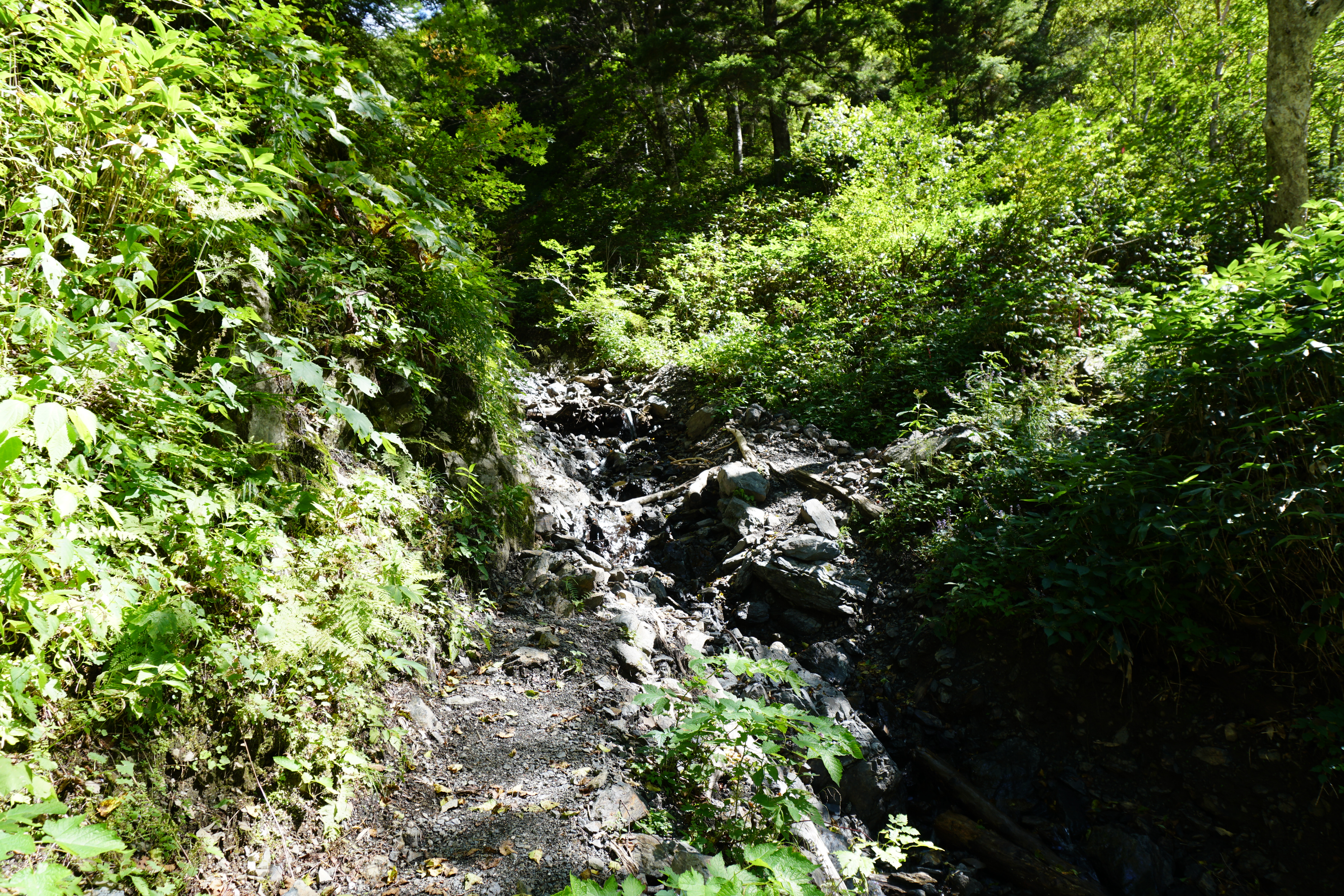
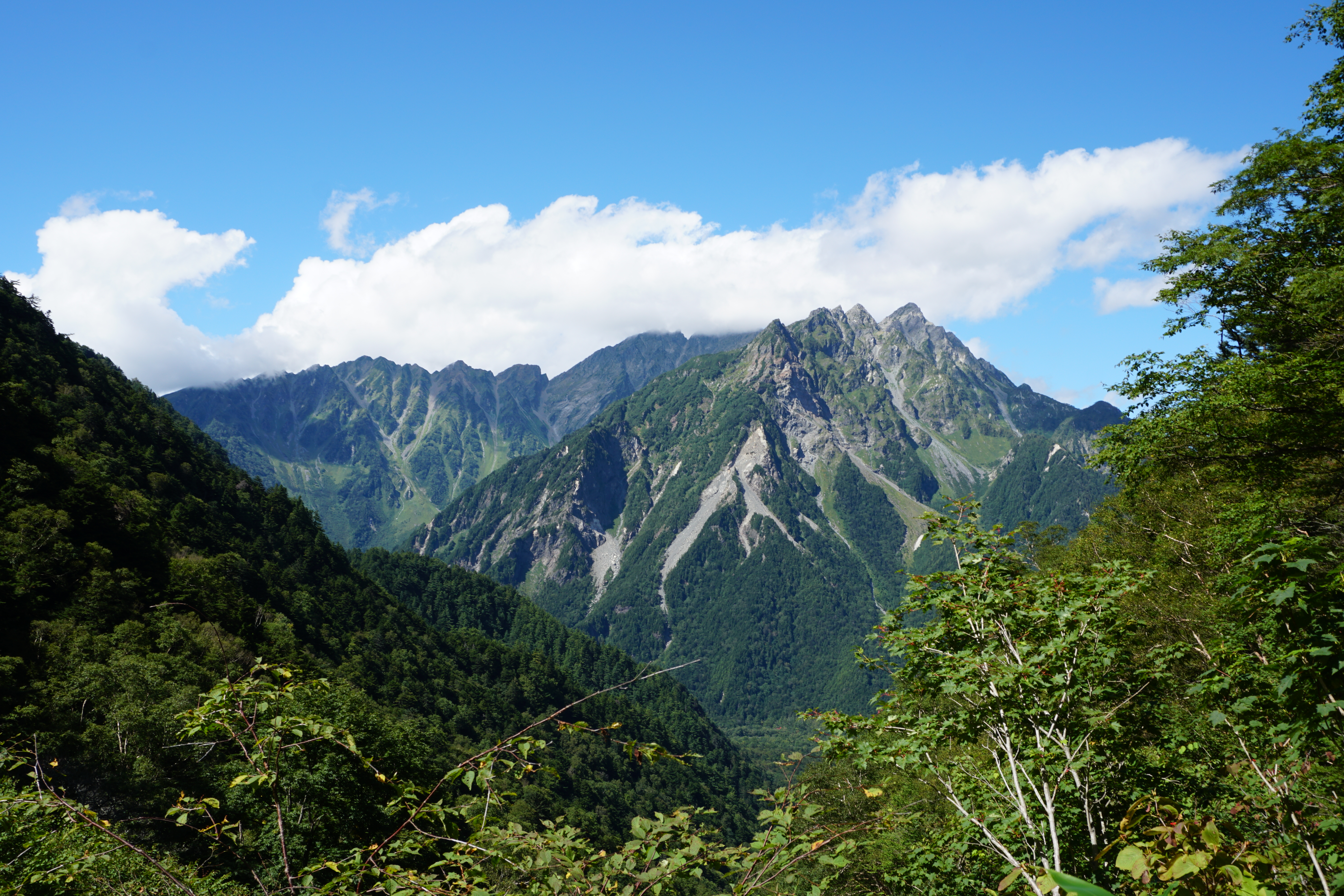
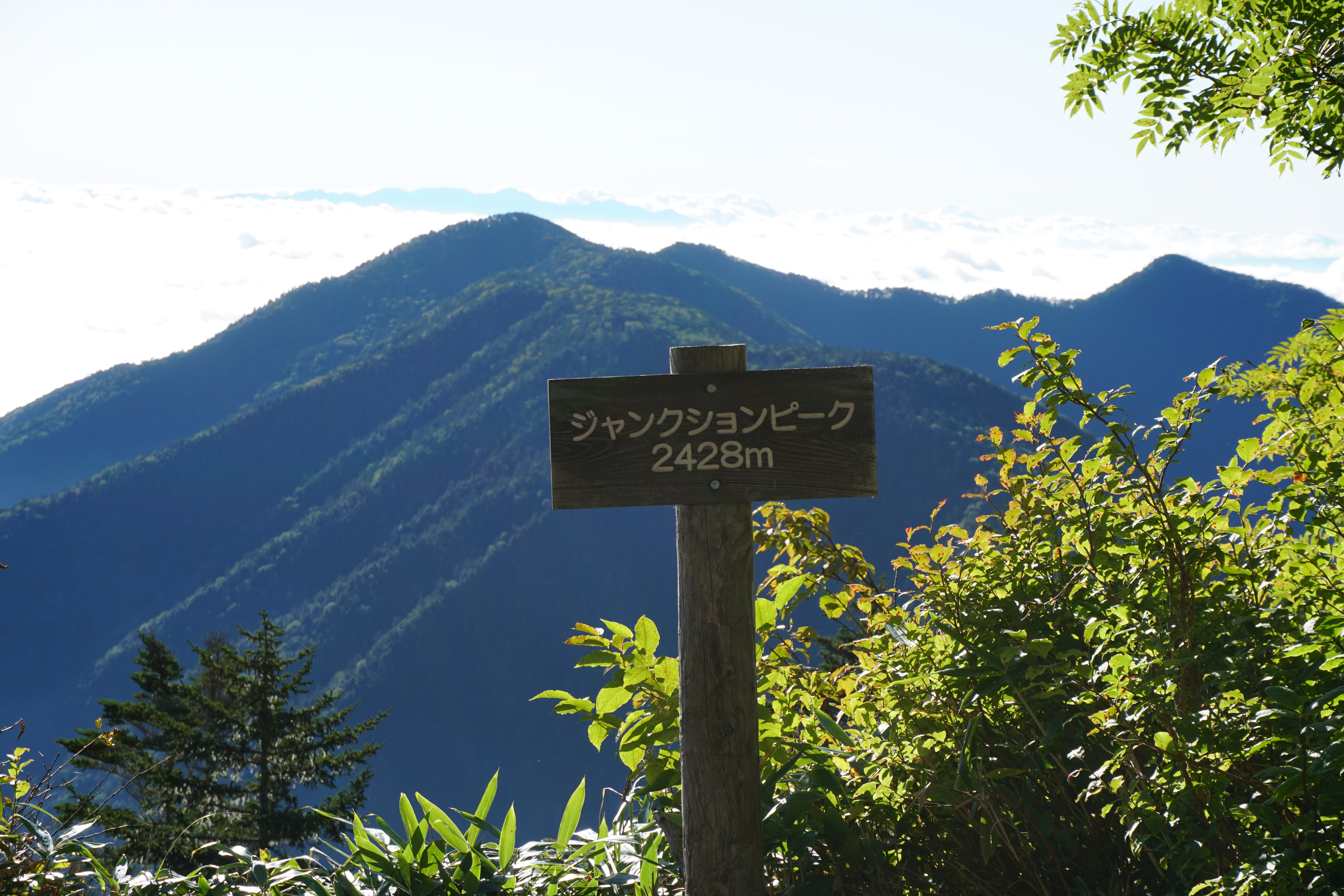
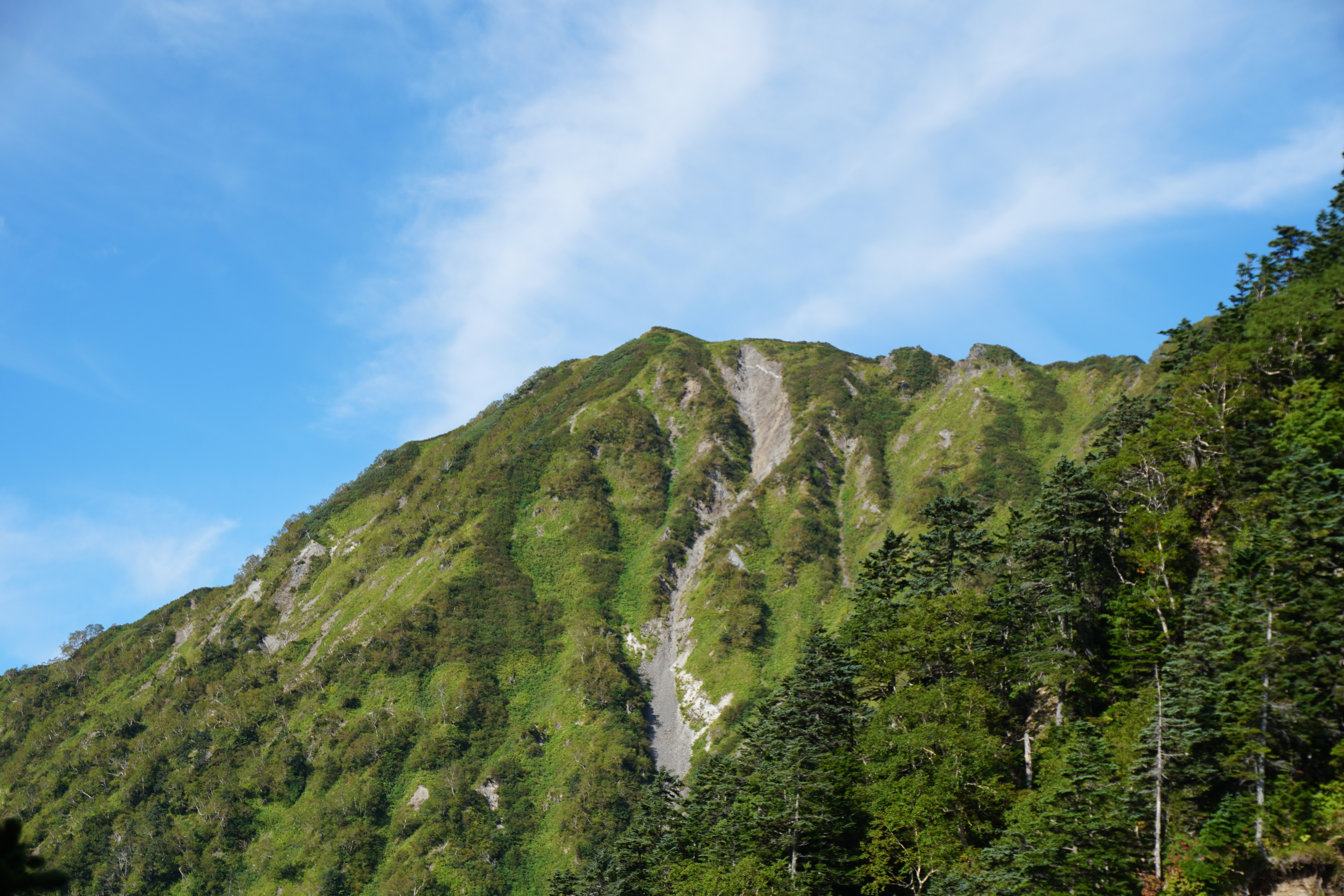
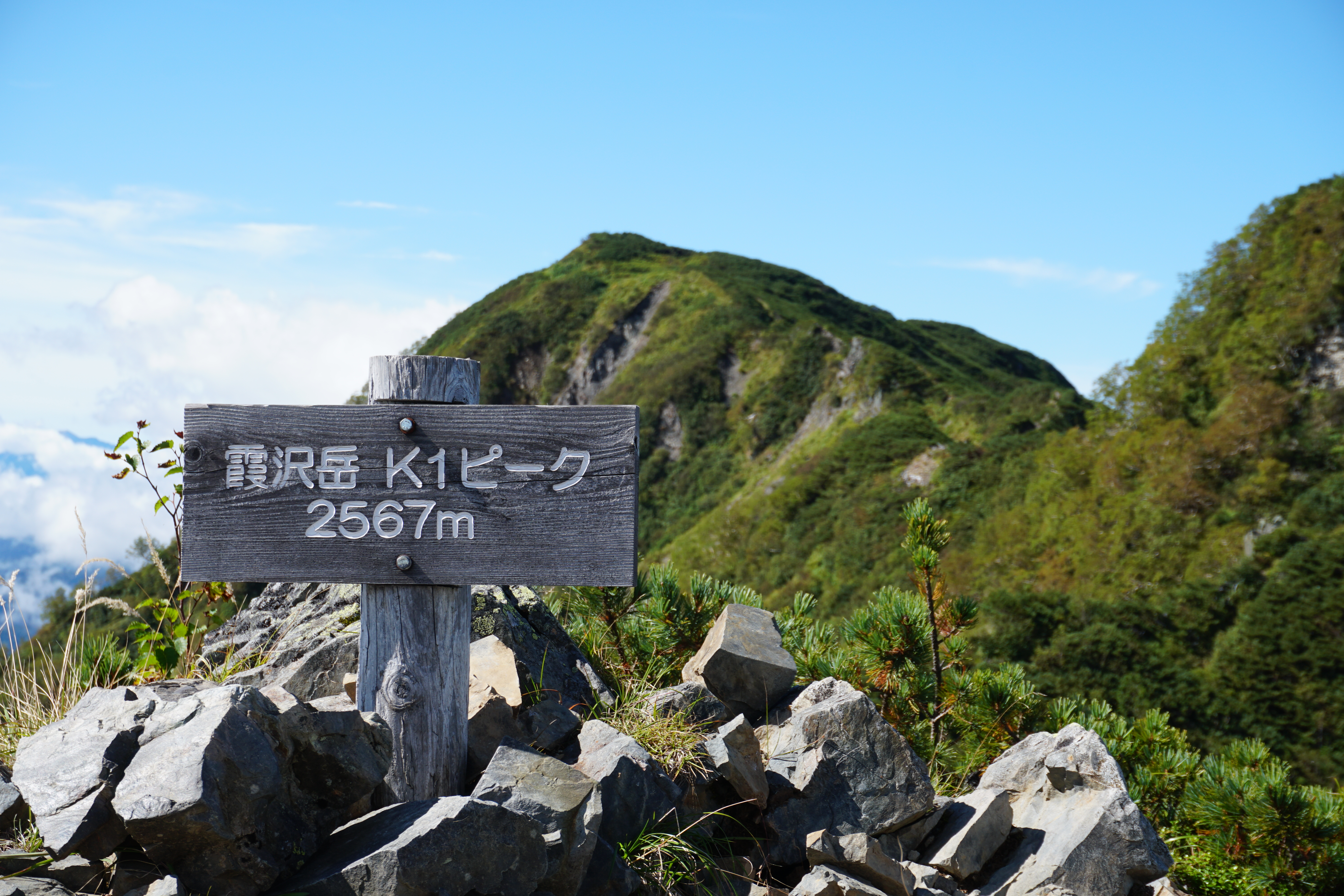
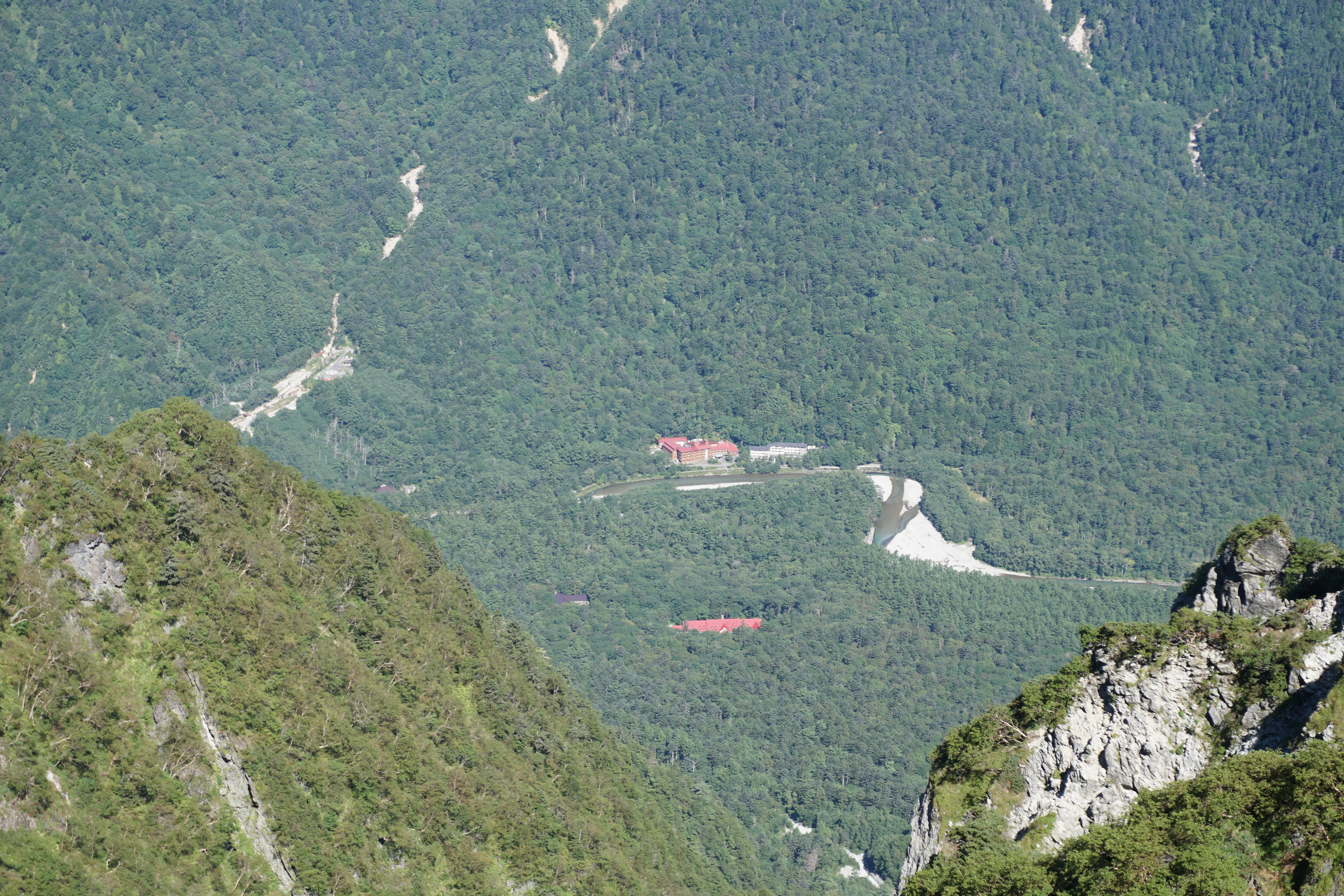
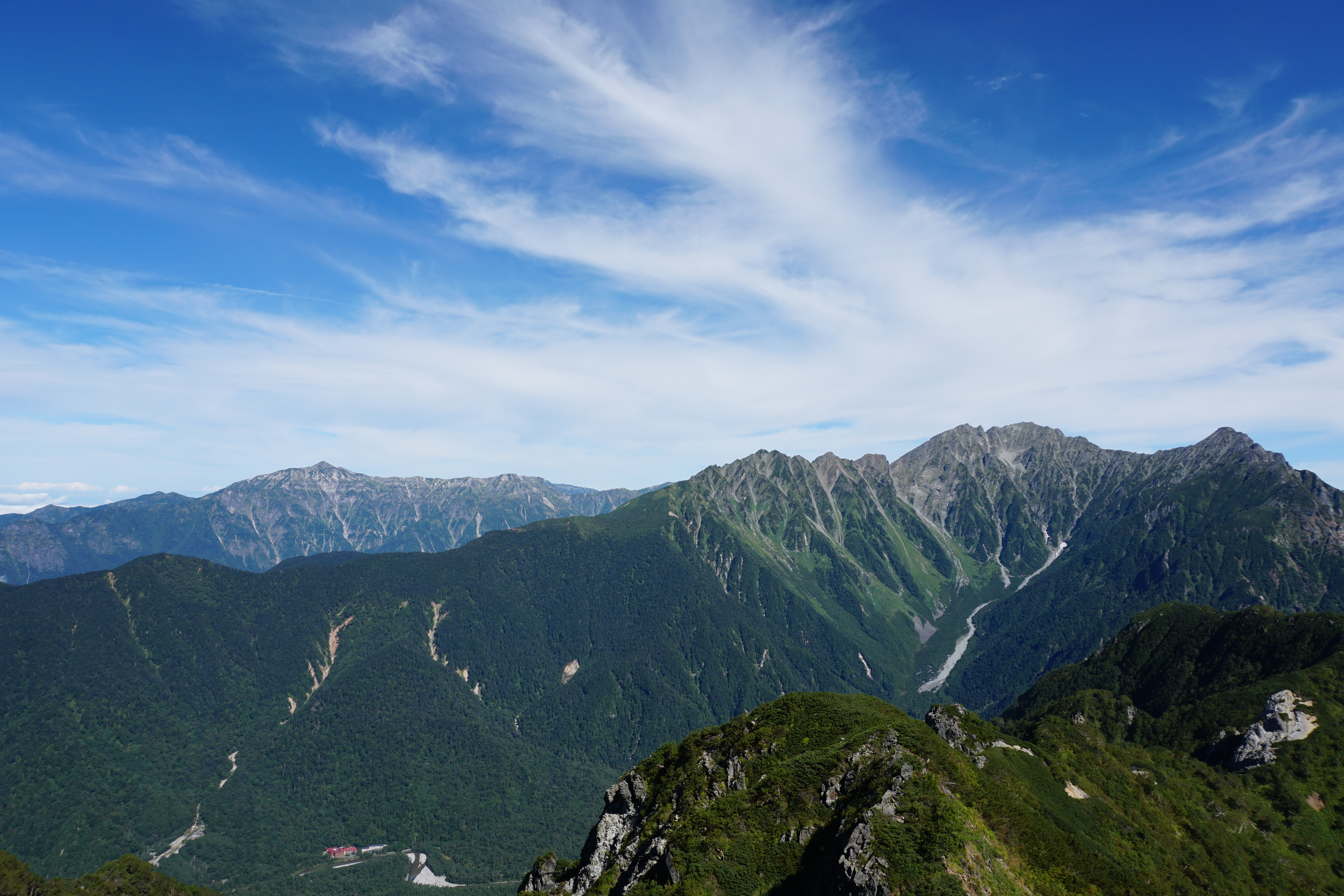
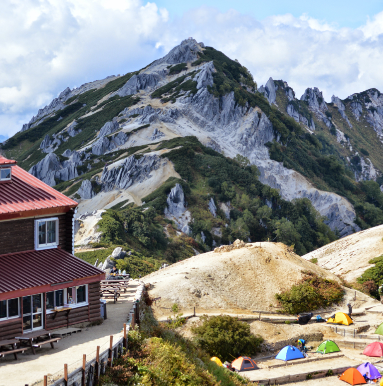
With an elevation of 2,646 meters, this mountain stands to the south of Kamikochi. The mountain’s name is derived from the Kasumizawa mountain spring that starts on the east face of the mountain and merges with the Azusagawa River at Sawando. Fifty years ago, there were no general climbing paths, and along with Mt. Roppyaku-san, it was called the unexplored region of Kamikochi inhabited by bears and Japanese serow. At the time, it seems people waded through the mountain stream in front of the Imperial Hotel to climb the mountain. Today, you can climb the route from Tokugo Pass, but the path is narrow and steep and gully-shaped for much of it, making it unsuitable for beginners. However, the view of the Hotaka mountain range from the summit is breathtaking. When combined with the view of Kamikochi spreading below, it is as if you are looking at a painting. In addition, there are few visitors here making this summit one of tranquility, even today.

※Due to the heavy rainfall on July 1, some of the trails leading from Kamikochi to the mountains have become very difficult to access. Please contact the mountain huts to confirm the detailed situation before you go out.
Mt. Kasumizawa-dake: Elevation 2,646m
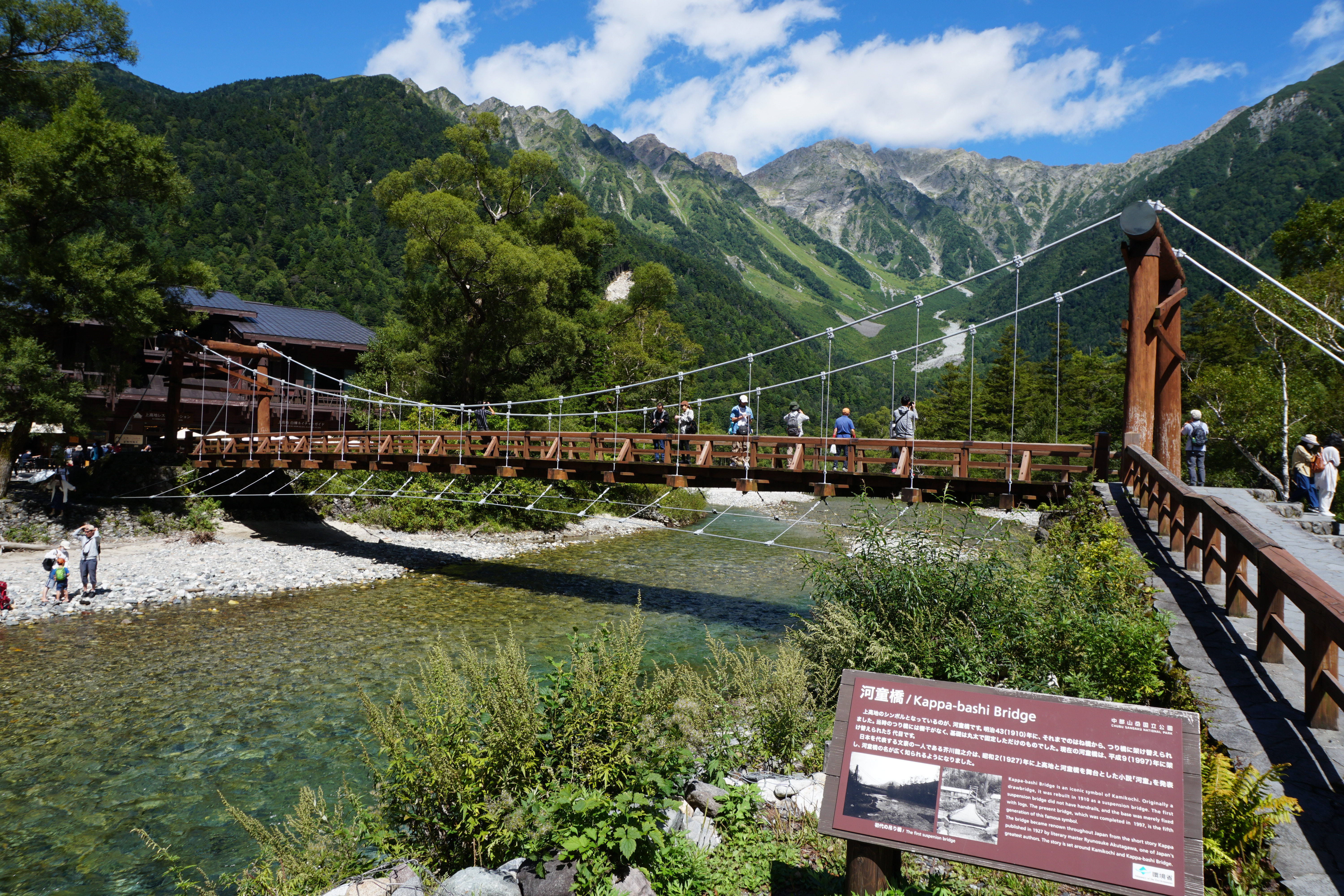
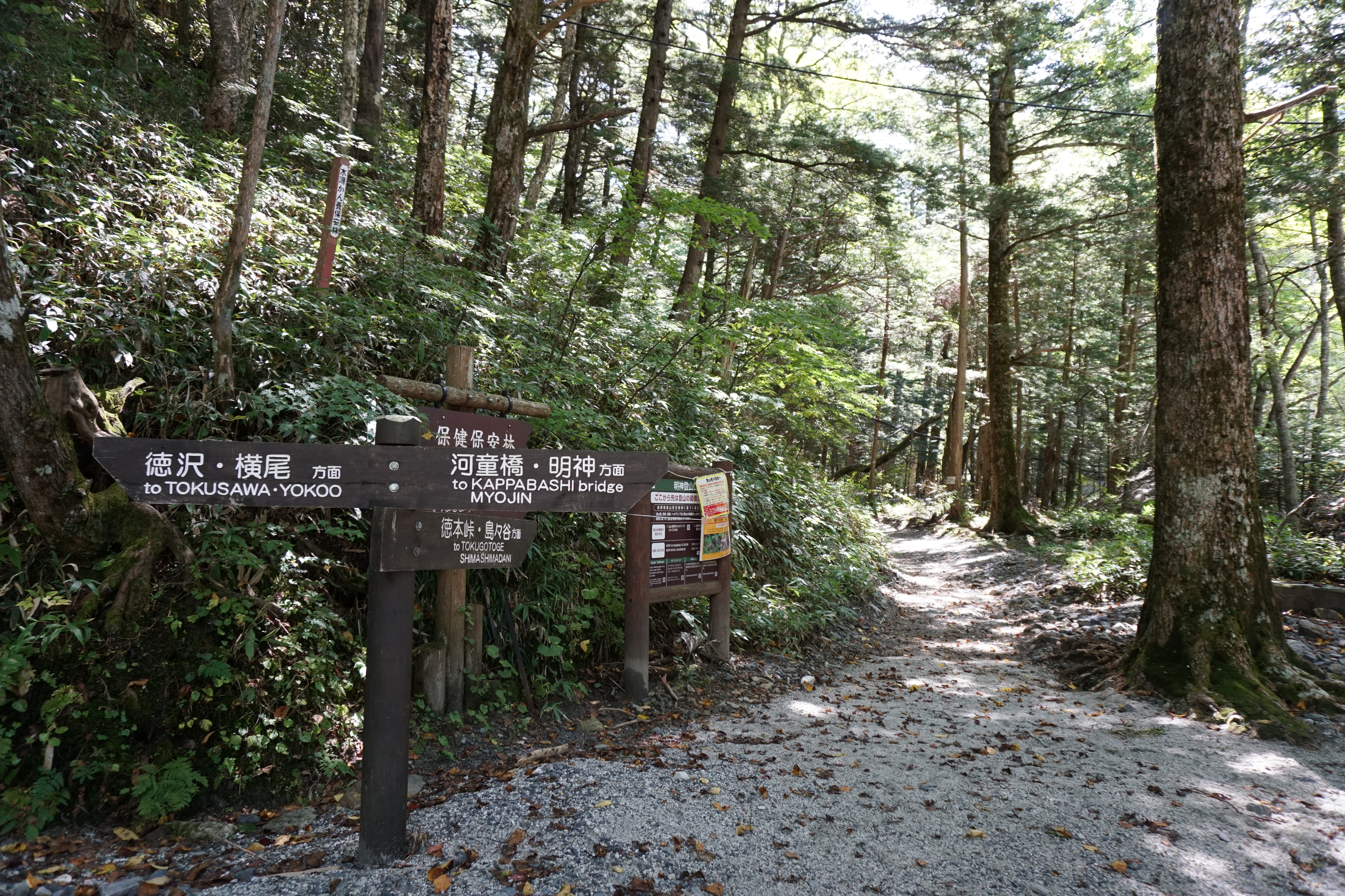
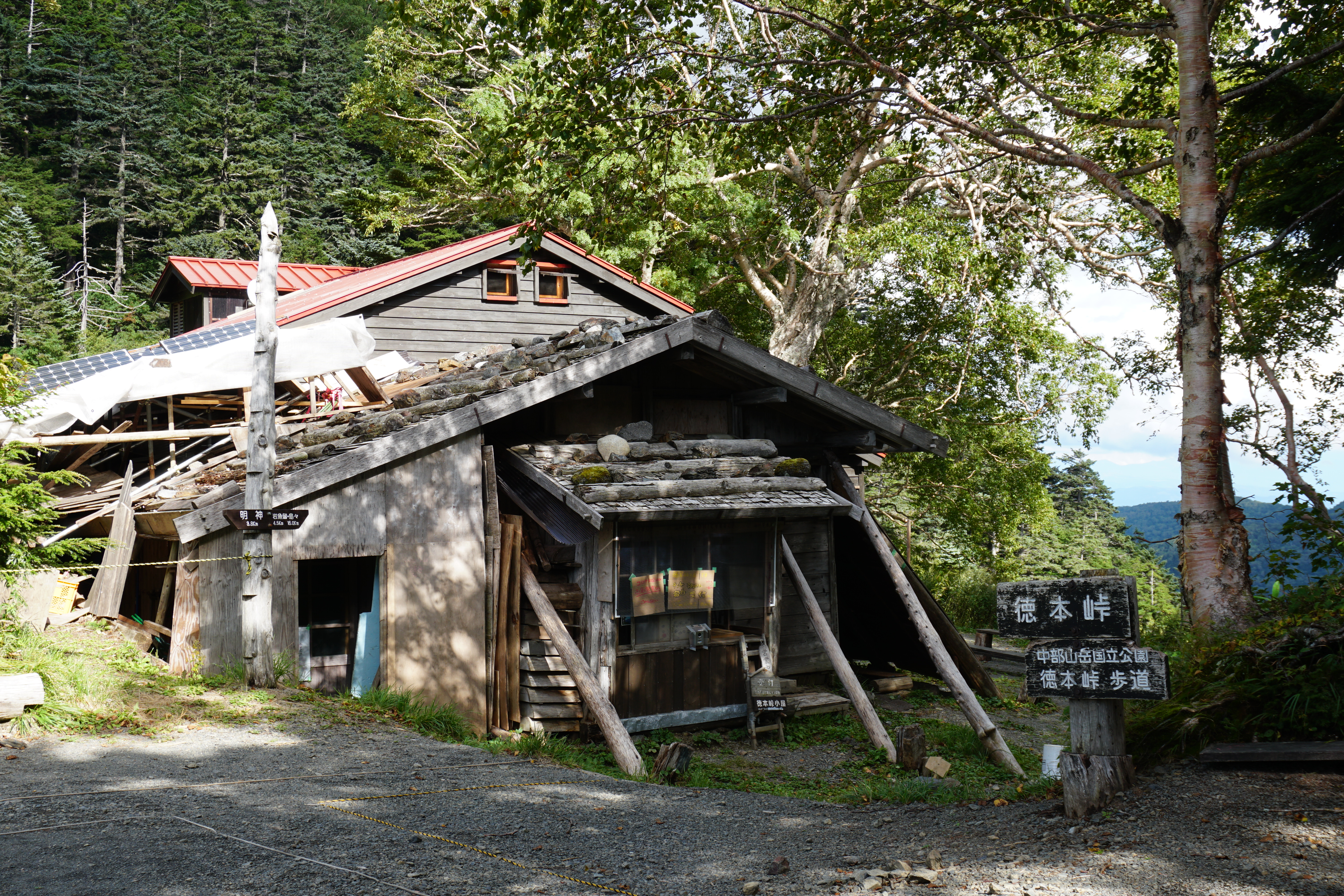
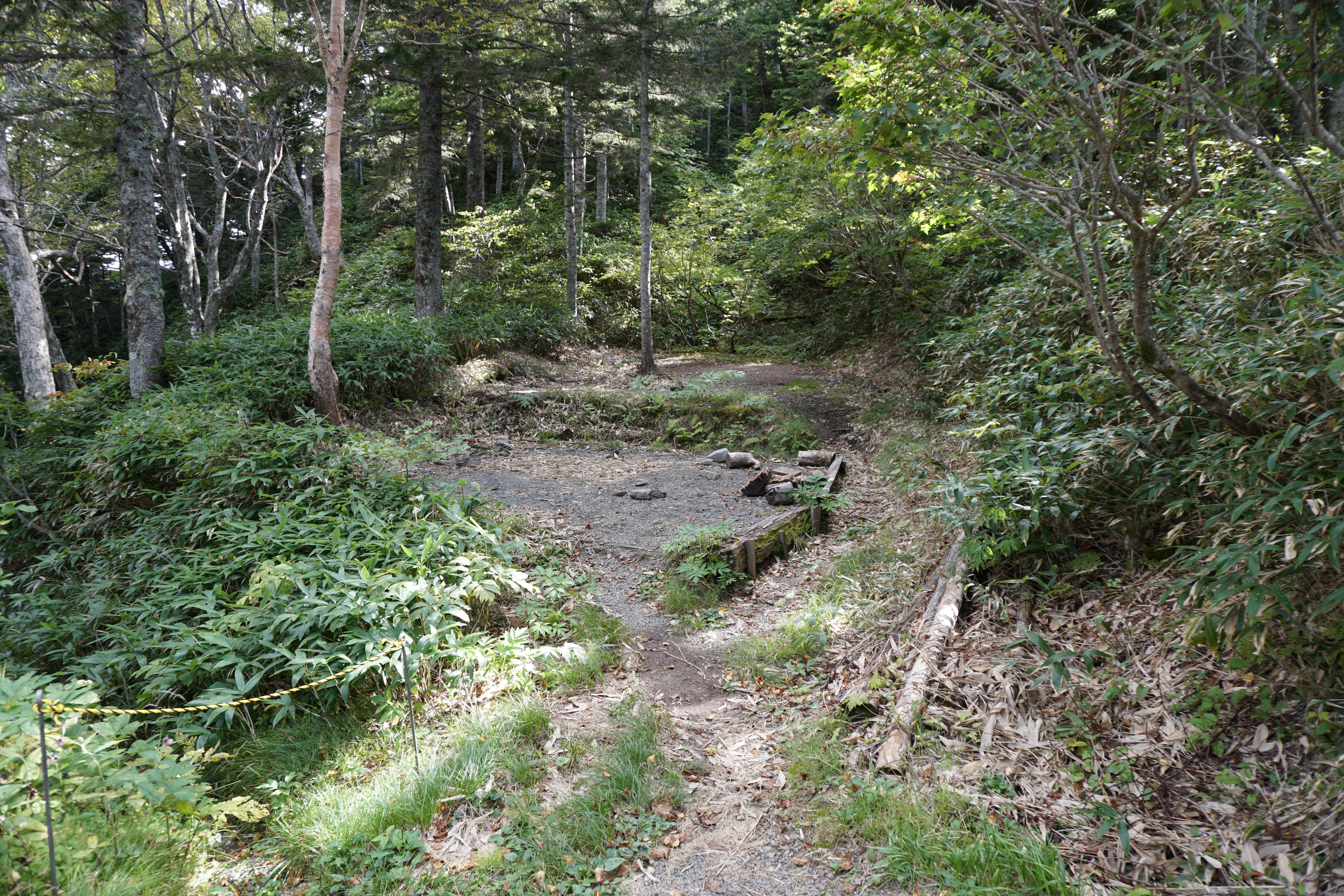
The trail to Mt. Kasumizawa-dake extends from the Tokugo Pass. The main course to Tokugo Pass is the direct ascent from Myojin. Tokugo Pass is the dividing point between the Shima-shima-tani, a tributary of the Azusagawa River, and Myojin Shirasawa stream. The pass flourished as a key point on the way to Kamikochi until a bus service traveling from the road along the Azusagawa River to Kamikochi was introduced in 1933. Tokugo Pass mountain hut stands here and is known, even today, as a gathering place for fans of the area. It remains an important base when heading to Mt. Kasumizawa-dake. You can still sometimes see people following this ancient road from Shima-shima through Tokugo Pass and traveling on to Kamikochi.
Trailhead vicinity weather
Weekly weather forecast zone:Central Nagano Prefecture
| DAY | WEATHER | LOWEST | HIGHEST |
|---|---|---|---|
| 7/20 | 23℃ | 35℃ | |
| 7/21 | 23℃ | 34℃ | |
| 7/22 | 23℃ | 34℃ | |
| 7/23 | 23℃ | 33℃ | |
| 7/24 | 22℃ | 33℃ | |
| 7/25 | 22℃ | 33℃ |
This is a publication of the calculated figures for weather predictions and is not the weather forecast. There are instances where there will be big differences in the values stated for the mountains, in accord with the topography as well as sunlight, etc. so please take care.
72 hours weather information:Azumi Kamikochi Kappa Bridge, Matsumoto City, Nagano Prefecture
| Date and time |
7/19 8:00 |
7/19 9:00 |
7/19 10:00 |
7/19 11:00 |
7/19 12:00 |
7/19 13:00 |
7/19 14:00 |
7/19 15:00 |
7/19 16:00 |
7/19 17:00 |
7/19 18:00 |
7/19 19:00 |
7/19 20:00 |
7/19 21:00 |
7/19 22:00 |
7/19 23:00 |
7/20 0:00 |
7/20 1:00 |
7/20 2:00 |
7/20 3:00 |
7/20 4:00 |
7/20 5:00 |
7/20 6:00 |
7/20 7:00 |
7/20 8:00 |
7/20 9:00 |
7/20 10:00 |
7/20 11:00 |
7/20 12:00 |
7/20 13:00 |
7/20 14:00 |
7/20 15:00 |
7/20 16:00 |
7/20 17:00 |
7/20 18:00 |
7/20 19:00 |
7/20 20:00 |
7/20 21:00 |
7/20 22:00 |
7/20 23:00 |
7/21 0:00 |
7/21 1:00 |
7/21 2:00 |
7/21 3:00 |
7/21 4:00 |
7/21 5:00 |
7/21 6:00 |
7/21 7:00 |
7/21 8:00 |
7/21 9:00 |
7/21 10:00 |
7/21 11:00 |
7/21 12:00 |
7/21 13:00 |
7/21 14:00 |
7/21 15:00 |
7/21 16:00 |
7/21 17:00 |
7/21 18:00 |
7/21 19:00 |
7/21 20:00 |
7/21 21:00 |
7/21 22:00 |
7/21 23:00 |
7/22 0:00 |
|---|---|---|---|---|---|---|---|---|---|---|---|---|---|---|---|---|---|---|---|---|---|---|---|---|---|---|---|---|---|---|---|---|---|---|---|---|---|---|---|---|---|---|---|---|---|---|---|---|---|---|---|---|---|---|---|---|---|---|---|---|---|---|---|---|---|
| Weather | |||||||||||||||||||||||||||||||||||||||||||||||||||||||||||||||||
| Temperature | 15℃ | 17℃ | 19℃ | 20℃ | 20℃ | 20℃ | 20℃ | 20℃ | 19℃ | 19℃ | 18℃ | 17℃ | 16℃ | 16℃ | 15℃ | 15℃ | 15℃ | 14℃ | 14℃ | 13℃ | 13℃ | 13℃ | 13℃ | 14℃ | 16℃ | 18℃ | 19℃ | 20℃ | 21℃ | 21℃ | 21℃ | 21℃ | 21℃ | 20℃ | 19℃ | 19℃ | 17℃ | 17℃ | 16℃ | 16℃ | 15℃ | 15℃ | 15℃ | 14℃ | 14℃ | 14℃ | 14℃ | 15℃ | 17℃ | 19℃ | 20℃ | 20℃ | 20℃ | 20℃ | 19℃ | 19℃ | 19℃ | 18℃ | 18℃ | 18℃ | 17℃ | 17℃ | 17℃ | 16℃ | 16℃ |
| Precipitation | 0mm/h | 0mm/h | 0mm/h | 0mm/h | 0mm/h | 0mm/h | 0mm/h | 0mm/h | 0mm/h | 0mm/h | 0mm/h | 0mm/h | 0mm/h | 0mm/h | 0mm/h | ※ 16時間以降は表示されません | |||||||||||||||||||||||||||||||||||||||||||||||||
| Wind direction |
northeast 1m/s |
northeast 1m/s |
northeast 1m/s |
northeast 1m/s |
northeast 2m/s |
northeast 2m/s |
northeast 2m/s |
northeast 2m/s |
northeast 2m/s |
northeast 2m/s |
northeast 1m/s |
northeast 1m/s |
northeast 1m/s |
northeast 1m/s |
northeast 1m/s |
northeast 1m/s |
northeast 1m/s |
northeast 1m/s |
northeast 1m/s |
northeast 1m/s |
northeast 1m/s |
northeast 1m/s |
northeast 1m/s |
northeast 1m/s |
0m/s |
northeast 1m/s |
northeast 1m/s |
northeast 1m/s |
northeast 2m/s |
northeast 2m/s |
northeast 2m/s |
northeast 2m/s |
northeast 1m/s |
northeast 1m/s |
northeast 1m/s |
northeast 1m/s |
northeast 1m/s |
northeast 1m/s |
northeast 1m/s |
northeast 1m/s |
northeast 1m/s |
northeast 1m/s |
northeast 1m/s |
northeast 1m/s |
northeast 1m/s |
northeast 1m/s |
northeast 1m/s |
northeast 1m/s |
northeast 1m/s |
0m/s |
northeast 1m/s |
northeast 1m/s |
northeast 1m/s |
northeast 1m/s |
northeast 1m/s |
northeast 1m/s |
northeast 1m/s |
northeast 1m/s |
northeast 1m/s |
northeast 1m/s |
0m/s |
northeast 1m/s |
northeast 1m/s |
northeast 1m/s |
northeast 1m/s |
※The weather information will be information on 5km square including the relevant point.
※天気予報マークは一次細分区域から表示しています
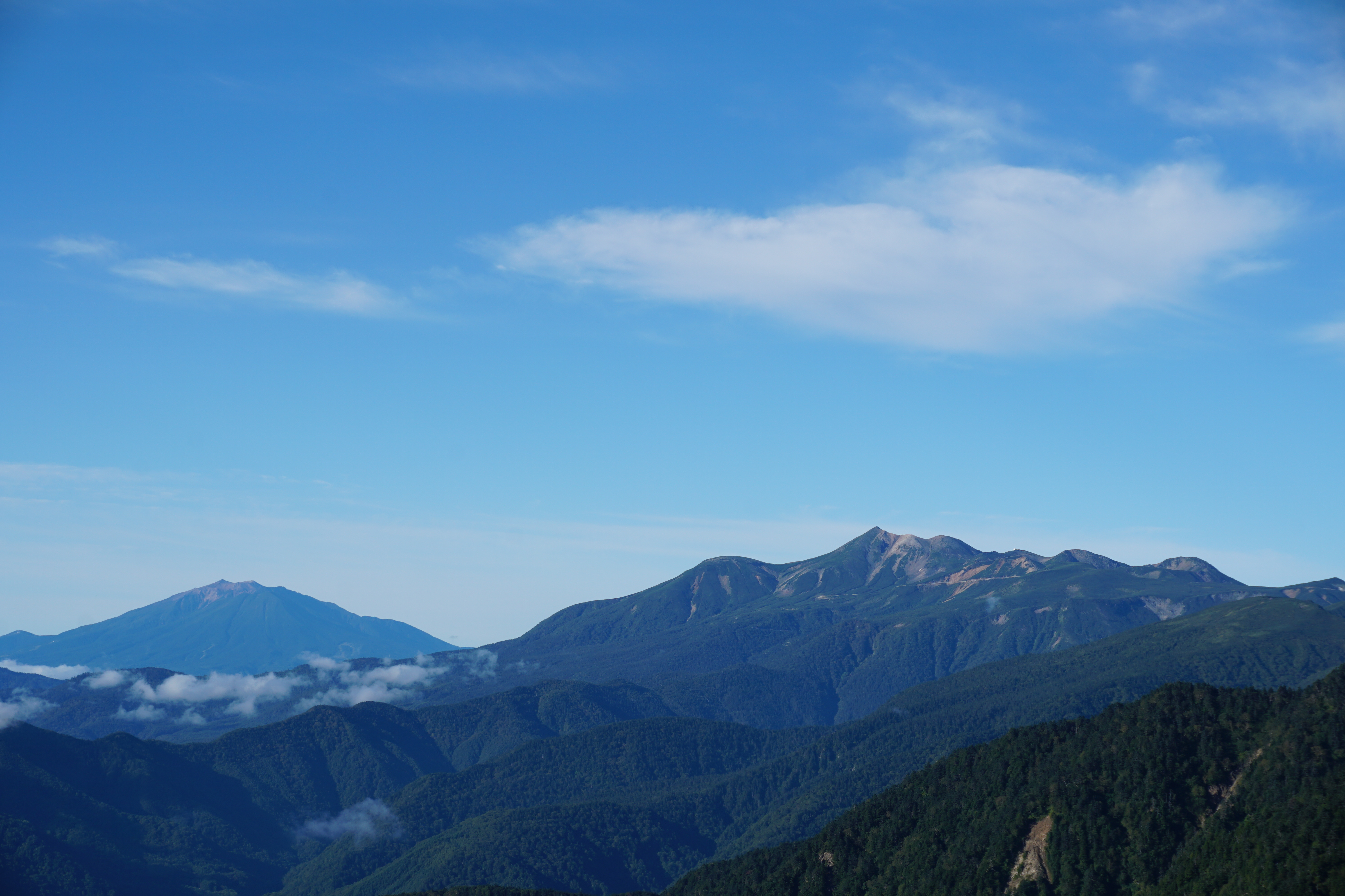
Landscape of Mt. Kasumizawa-dake