Hida Route※This is a route with many dangers. Avoid this route if you are a first timer.
Shin-hodaka Onsen Hot Spring ~ Shiradashi-sawa-deai (Oku-hodaka Trailhead) ~Nitsugi -koya Mountain Hut Ruins ~ Shiradashi-no-koru saddle (Hotaka-dake-sanso Mountain Hut) ~ Mt. Okuhodaka-dake
Technical level: C
Physical strength: 6
Difficulty: ★★★
The only route to Hotaka Mountains from Shin-hodaka Onsen hot spring
Because this route was used for carrying supplies to Hotaka-dake-sanso Mountain hut, it is a fairly stable trail, however, caution must be practiced under severe weather or when the water level is high. Depending on the situation, it may be better not to enter the mountain. The variance in elevation between Shin-hodaka Onsen hotspring and Shiradashi-no-koru is about 1,900 m. You will need nine hours to ascend that distance, therefore, it is recommended that you stay at Shin-hodaka Onsen hot spring the night before and depart before sunrise the next day. If you stay at Hotaka-daira-koya Mountain hut, you can reduce one hour from the walking hours on that day.
※Shiradashi-sawa to Oku-hotaka-dake was unusable due to the 2020 earthquake, but is now passable thanks to the efforts of Hotaka-dake sanso mountain hut, there are many unclear routes and falling rocks, and beginners are not allowed to pass. Please be sure to wear a helmet.
●Hiking data
Schedule: One night and two days (stay the night before)
Walking hours: 9 hours
Walking distance: 9.5 km
Cumulative elevation difference: 2,313 m
Shin-hodaka Onsen Hot Spring
Elevation 1,090m
↓ 2 hours
Shiradashi-sawa-deai (Mt. Oku-hotaka Trailhead)

Elevation 1,542m
↓ 2 hours
Shiradashi-sawa

Elevation 1,895m
↓ 1 hour
Nitsugi -koya Mountain Hut Ruins
Elevation 2,200m
↓ 3 hours 30 minutes
Shiradashi-no-koru saddle
Elevation 2,983m
↓ 50 minutes
Mt. Okuhodaka-take
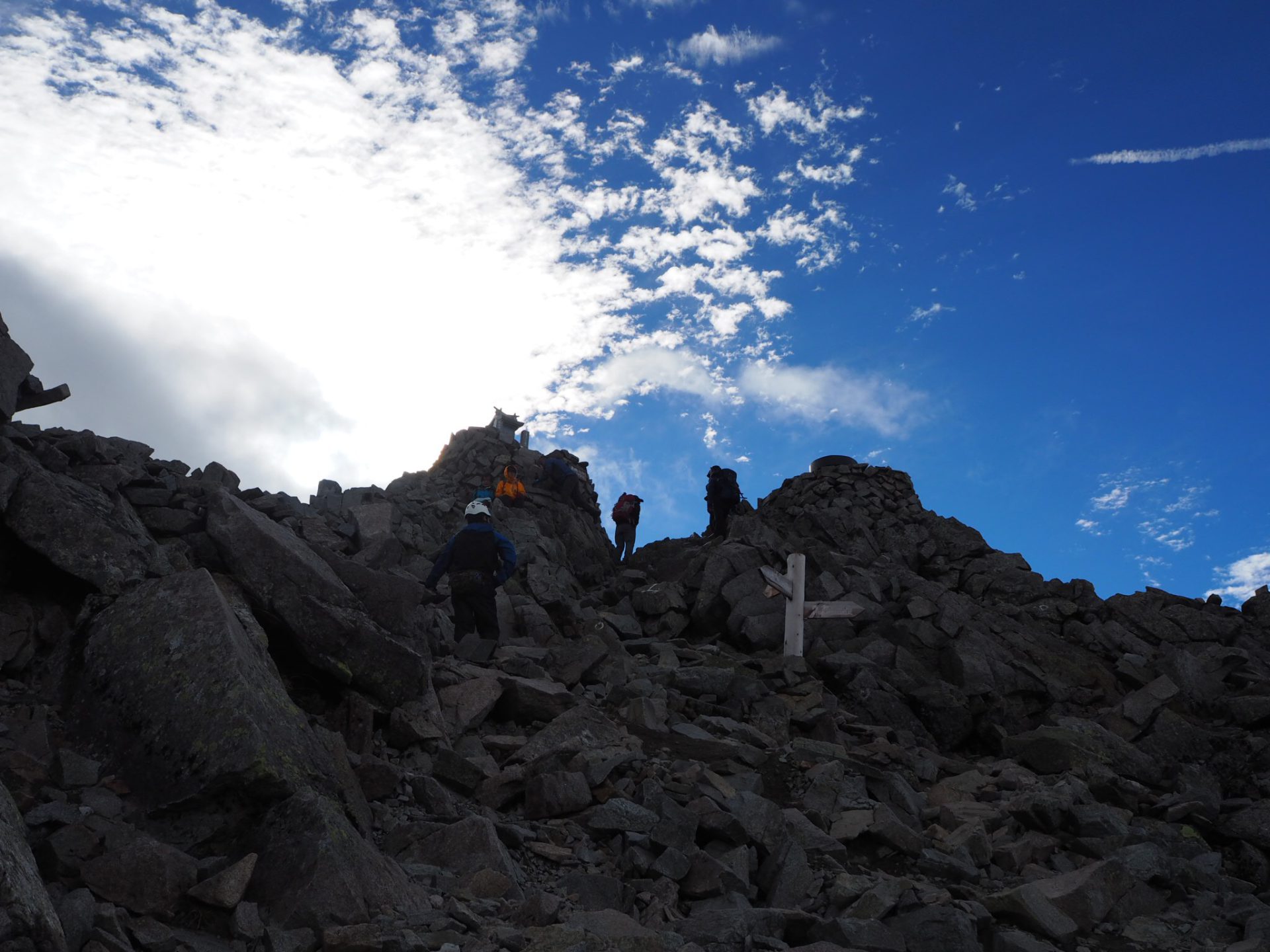
Elevation 3,190m


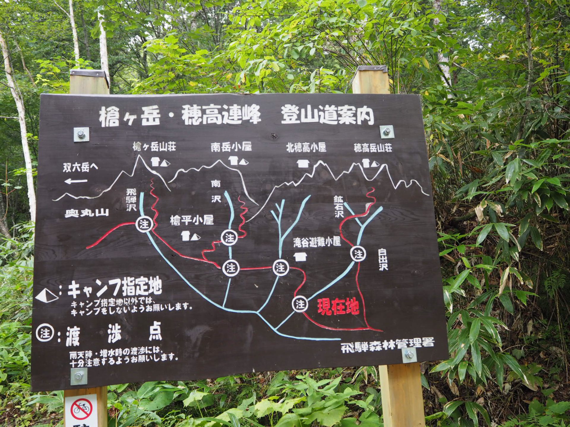
Route Guide
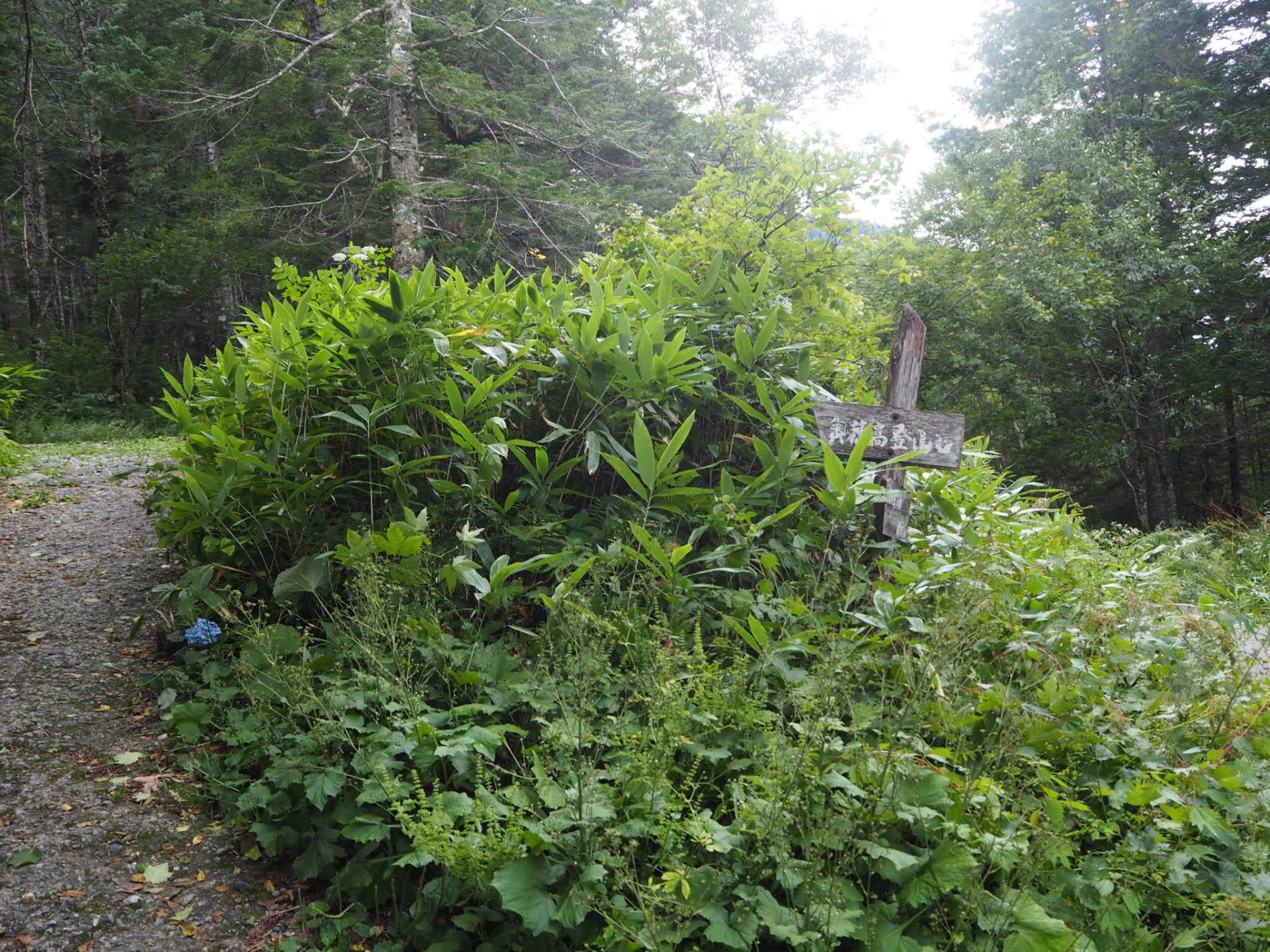
Start from Shin-hodaka Onsen hot spring. If you drive your car, you may use a parking lot for hikers in front of Shinzan-so Mountain hut. If the lot is full, you can park at a parking lot in Nabe-daira. Submit a hiking registration at the mountain visitor center. Proceed on Migimata logging road. In about one hour, Hotaka-daira-koya Mountain Hut will be reached. From here to the end of the logging road, Shiradashi-sawa-deai, you will hike on the logging road for one hour. The trail straight ahead leads you to Mt. Yari-gatake. To go to Shiradashi-no-koru, take the right trail.
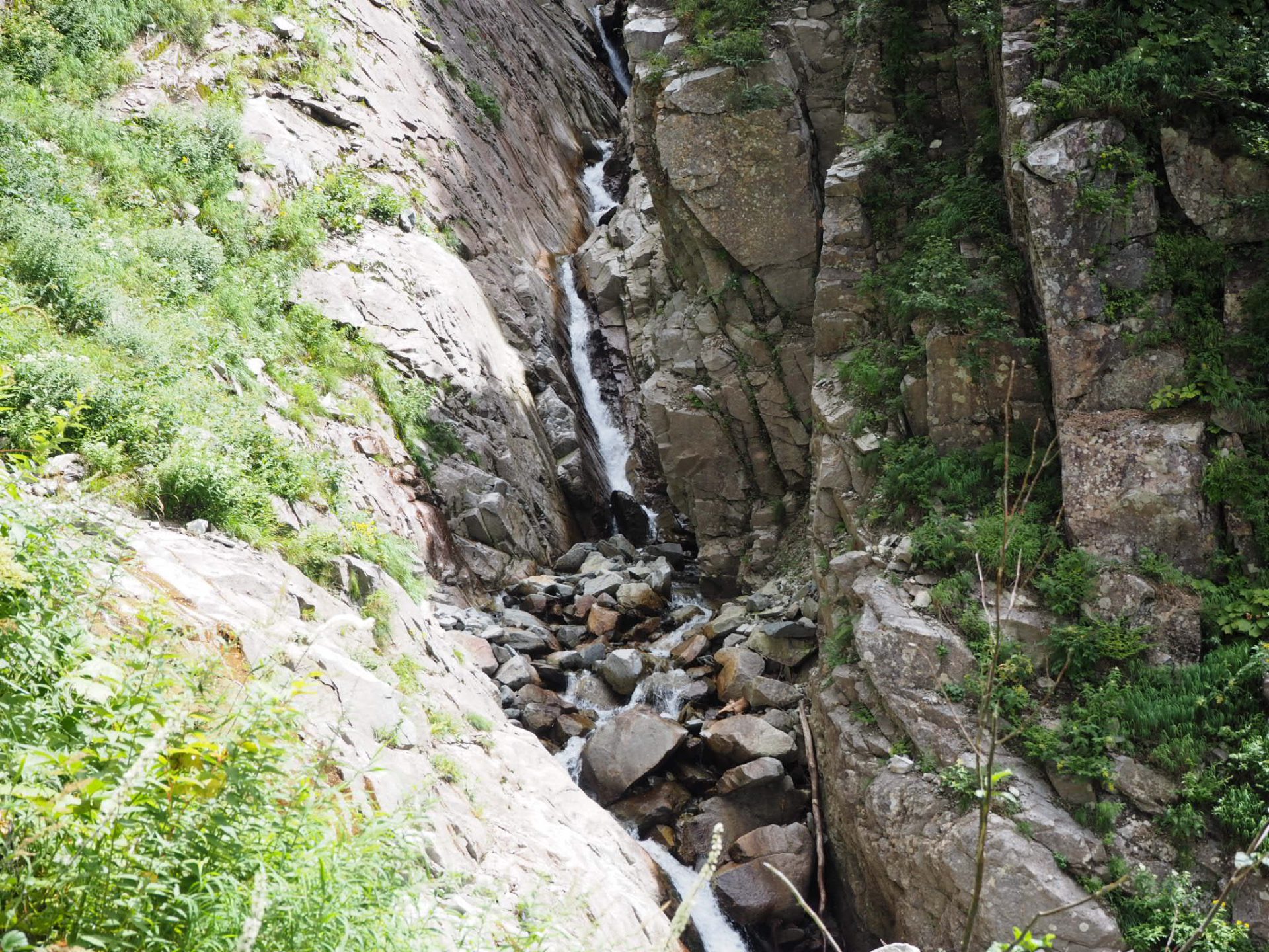
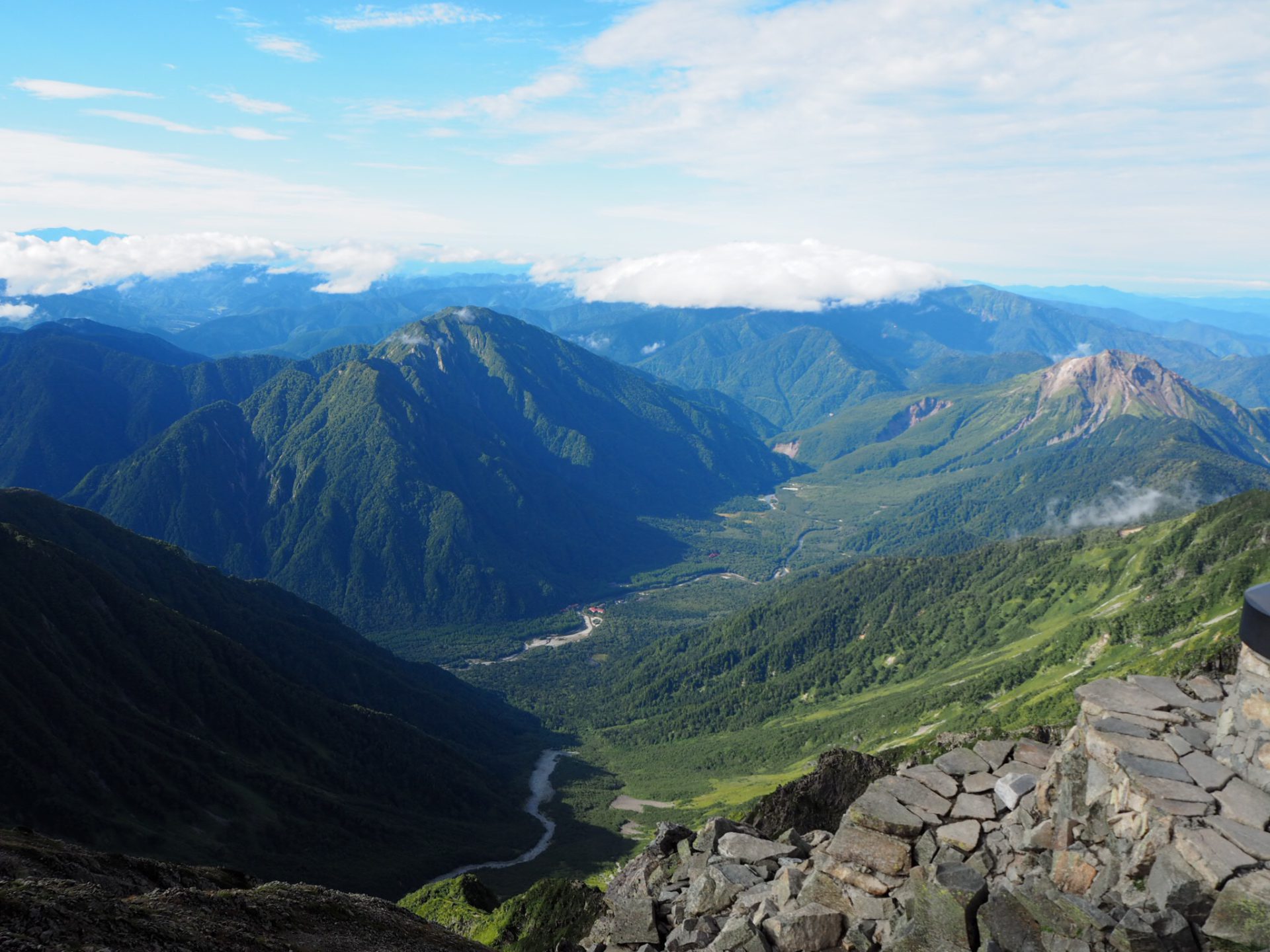
You will walk through the forest zone for a while. It is a monotonous uphill. Shiradashi-sawa can be seen at the lower left corner of your sight. Gendarum, which many hikers are longing for, can be seen way above your head. Gendarum, in French, means national military police. The name comes after its feature, which looks like it is standing on the ridgeline to protect the main peak of Mt. Okuhodaka-dake. In the back, the unique shape of Mt. Kasa-gatake can be seen. When you cross the ridgeline and move to the side of Shiradashi-sawa, the forest zone will end and Shiradashi-sawa-o-taki falls, bridging at the back of the valley, appears in your sight.
Cross Gare-sawa and descend to Shiradashi-sawa. Cross Jyutarou bridge to the other side of the river. The area around the crossing point is a canyon. When the water level is high, the bridge might get washed away. In those cases, do not force yourself to cross. After the crossing point, ascend a long ladder and enter Gankiri-michi. There are hazardous places along this trail. Be careful not to fall or slip and watch out for falling rocks. You can view Mt. Karasawa-dake or Taki-tani-dai-4 O’ne in your direction while ascending. When Ishikiri-michi finishes, cross Kou-seki-sawa and climb on the grass slope. The area is easy to get lost in, therefore, you must pay close attention to the paint marks to follow. Also, watch out for falling rocks.
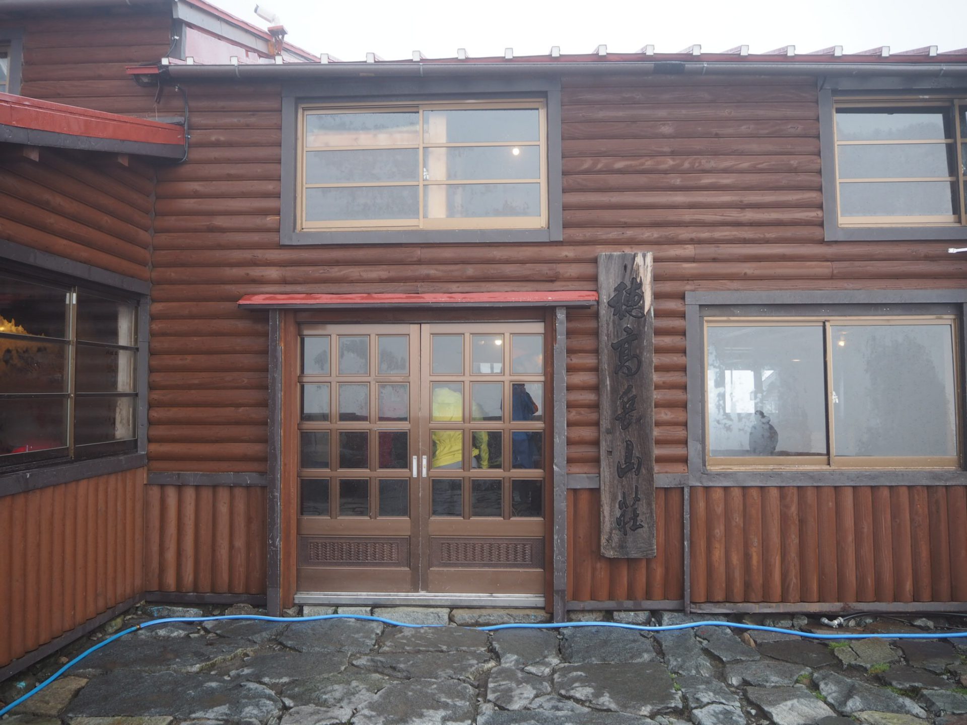
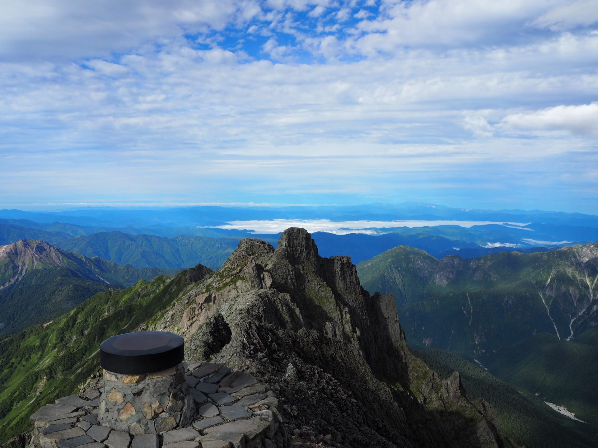
The trail turns into a long slope of the Shiradashi-sawa main line. In some areas, it is hard to follow the correct route, however, there should always be paint marks available. Follow those signs to proceed. If any case that you doubt your judgement, return to the location where you know for sure where you are, then try again. You will come to a big rock, painted as “Beru 1.30 minutes”. It is also painted as “Abinaiyo”. The big rock is called “Abinaiyo rock”. It is a good resting point. Climb the trail covered by rocks. When Mt. Kasaga-take, which can be seen behind you, comes to your eye level, Shiradashi-no-koru is close. When the view opens up and the building appears in your sight, that is Shiradashi-no-koru, where Hodaka-dake-sanso Mountain hut stands. The big rock wall close to you is the massive Mt.Okuhodaka-dake.