The Hotaka mountains include Mt. Oku-hotaka-dake, the third highest elevation among Japanese mountains. It can be said that the history of the climbing of the Hotaka mountains represents the history of modern Japanese mountain climbing. These Hotaka mountains were known for the difficulty to attain their summits. However, they are now looked on as mountains that anyone can enjoy hiking because trails and mountain huts have been well maintained, technology has developed, and the availability of hiking information has significantly improved. Mountain tour guides and mountain climbing workshops have contributed to the change as well. This does not necessary mean that these mountains have completely changed into easy places to hike. Many hikers die in this area. It is very important to bear in mind that this is an area requiring proper planning and preparation. You need to have the right gear, physical stamina, mental toughness and fine weather to approach the area. If you are lacking even one of these, even though you are at the trailhead, you should be brave enough not to enter the mountains.
Mt. Oku-hotaka-dake Elevation: 3,190m
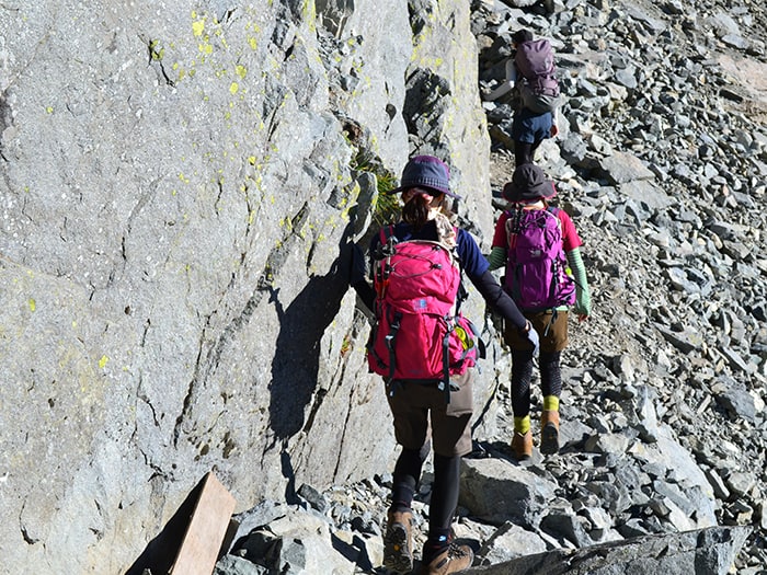
There are two basic trails to Mt. Oku-hotaka-dake. The most basic trail is the one from Kamikochi to Karasawa, which then climbs up the Seitengrat. Another route enters Dakesawa from Kamikochi then hikes up Jutaro-shindou trail. There is another route that hikes up the ridgeline with many rocky zones from Mt. Nishi-hotaka-dake but it is quite challenging both physically and technically. This is recommended only for experts.
The two basic courses are introduced here. As your hiking experience and skills improve, you might long to visit Mt. Oku-hotaka-dake and Mt. Mae-hotaka-dake. Many solo-hikers can be seen in this area and there are many ways to enjoy these mountains.
Trailhead vicinity weather
Weekly weather forecast zone:Hida region, Gifu prefecture
| DAY | WEATHER | LOWEST | HIGHEST |
|---|---|---|---|
| 7/10 | 27℃ | 36℃ | |
| 7/11 | 26℃ | 34℃ | |
| 7/12 | 26℃ | 33℃ | |
| 7/13 | 25℃ | 32℃ | |
| 7/14 | 25℃ | 30℃ | |
| 7/15 | 24℃ | 31℃ |
This is a publication of the calculated figures for weather predictions and is not the weather forecast. There are instances where there will be big differences in the values stated for the mountains, in accord with the topography as well as sunlight, etc. so please take care.
72 hours weather information:Kamikochi Kappa Bridge, Azumi, Matsumoto City, Nagano Prefecture
| Date and time |
7/9 19:00 |
7/9 20:00 |
7/9 21:00 |
7/9 22:00 |
7/9 23:00 |
7/10 0:00 |
7/10 1:00 |
7/10 2:00 |
7/10 3:00 |
7/10 4:00 |
7/10 5:00 |
7/10 6:00 |
7/10 7:00 |
7/10 8:00 |
7/10 9:00 |
7/10 10:00 |
7/10 11:00 |
7/10 12:00 |
7/10 13:00 |
7/10 14:00 |
7/10 15:00 |
7/10 16:00 |
7/10 17:00 |
7/10 18:00 |
7/10 19:00 |
7/10 20:00 |
7/10 21:00 |
7/10 22:00 |
7/10 23:00 |
7/11 0:00 |
7/11 1:00 |
7/11 2:00 |
7/11 3:00 |
7/11 4:00 |
7/11 5:00 |
7/11 6:00 |
7/11 7:00 |
7/11 8:00 |
7/11 9:00 |
7/11 10:00 |
7/11 11:00 |
7/11 12:00 |
7/11 13:00 |
7/11 14:00 |
7/11 15:00 |
7/11 16:00 |
7/11 17:00 |
7/11 18:00 |
7/11 19:00 |
7/11 20:00 |
7/11 21:00 |
7/11 22:00 |
7/11 23:00 |
7/12 0:00 |
|---|---|---|---|---|---|---|---|---|---|---|---|---|---|---|---|---|---|---|---|---|---|---|---|---|---|---|---|---|---|---|---|---|---|---|---|---|---|---|---|---|---|---|---|---|---|---|---|---|---|---|---|---|---|---|
| Weather | ||||||||||||||||||||||||||||||||||||||||||||||||||||||
| Temperature | 18℃ | 17℃ | 17℃ | 17℃ | 16℃ | 16℃ | 16℃ | 15℃ | 15℃ | 15℃ | 15℃ | 15℃ | 15℃ | 17℃ | 18℃ | 19℃ | 20℃ | 20℃ | 19℃ | 19℃ | 19℃ | 19℃ | 18℃ | 18℃ | 18℃ | 17℃ | 17℃ | 16℃ | 16℃ | 16℃ | 16℃ | 15℃ | 15℃ | 15℃ | 15℃ | 14℃ | 14℃ | 16℃ | 17℃ | 18℃ | 19℃ | 20℃ | 20℃ | 21℃ | 21℃ | 20℃ | 20℃ | 19℃ | 18℃ | 16℃ | 15℃ | 15℃ | 14℃ | 14℃ |
| Precipitation | 1mm/h | 0.4mm/h | 0mm/h | 0.4mm/h | 1mm/h | 0.4mm/h | 0.4mm/h | 0mm/h | 0mm/h | 0mm/h | 0mm/h | 0mm/h | 0mm/h | 0mm/h | 0mm/h | ※ 16時間以降は表示されません | ||||||||||||||||||||||||||||||||||||||
| Wind direction |
0m/s |
northwest 1m/s |
northwest 1m/s |
0m/s |
northwest 1m/s |
northwest 1m/s |
northwest 1m/s |
northwest 1m/s |
northwest 1m/s |
northwest 1m/s |
northwest 1m/s |
northwest 1m/s |
northwest 1m/s |
northwest 1m/s |
northwest 1m/s |
northwest 1m/s |
northwest 1m/s |
northwest 1m/s |
northwest 1m/s |
northwest 1m/s |
northwest 1m/s |
northwest 1m/s |
northwest 1m/s |
northwest 1m/s |
0m/s |
northwest 1m/s |
northwest 1m/s |
0m/s |
0m/s |
northwest 1m/s |
northwest 1m/s |
northwest 1m/s |
northwest 1m/s |
northwest 1m/s |
northwest 1m/s |
northwest 1m/s |
northwest 1m/s |
0m/s |
northwest 1m/s |
northwest 1m/s |
northwest 2m/s |
northwest 2m/s |
northwest 2m/s |
northwest 2m/s |
northwest 2m/s |
northwest 2m/s |
northwest 1m/s |
northwest 1m/s |
northwest 1m/s |
northwest 1m/s |
northwest 1m/s |
northwest 1m/s |
northwest 1m/s |
northwest 1m/s |
※The weather information will be information on 5km square including the relevant point.
※天気予報マークは一次細分区域から表示しています
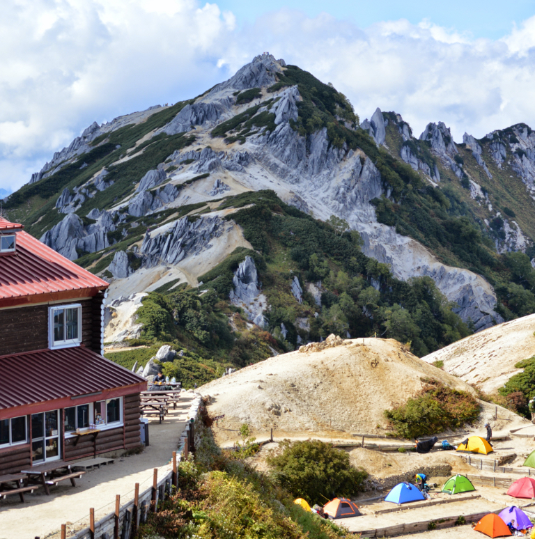
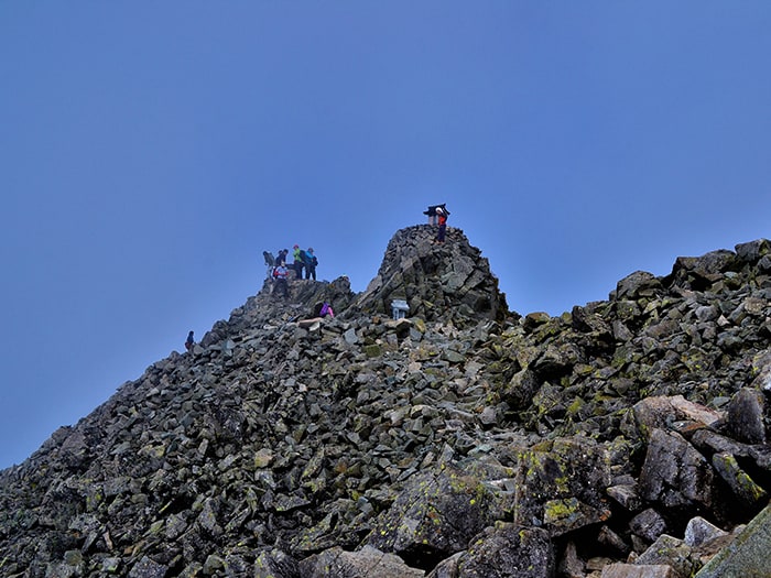
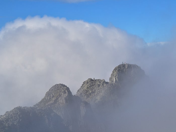
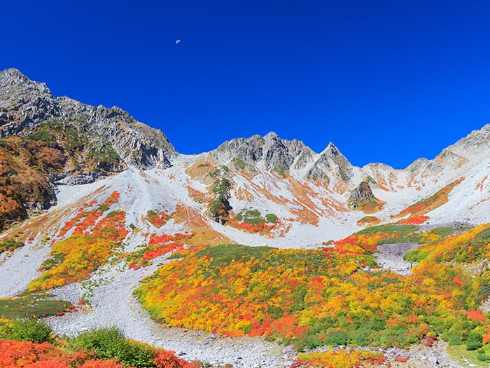
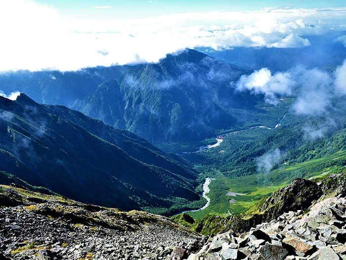
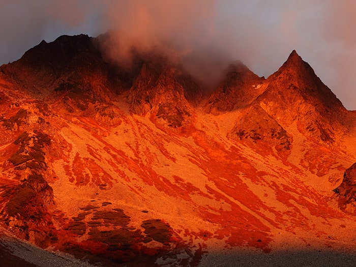
View of Mt. Okuhodaka-dake


Route Information
A-Basic course sorted by trailheads
From Karasawa
Kamikochi From Dakesawa
From Shin-hotaka Onsen
-
Nishi-hotaka-dake Kamikochi Route
③ Nishi-hotaka-guchi ~ Nishiho-sansou Mountain hut ~ Mt. Nishi-hotaka-dake ~ Nishiho-doppyou ~ Nishiho-sansou ~ Nishi-hotaka-guchi(Difficulty level: ⛰️⛰️⛰️) -
Hida Route※This is a route with many dangers. Avoid this route if you are a first timer.
④ Shin-hodaka Onsen Hot Spring ~ Shiradashi-sawa-deai (Oku-hodaka Trailhead) ~Nitsugi -koya Mountain Hut Ruins ~ Shiradashi-no-koru saddle (Hotaka-dake-sanso Mountain Hut) ~ Mt. Okuhodaka-dake(Difficulty level: ⛰️⛰️⛰️)