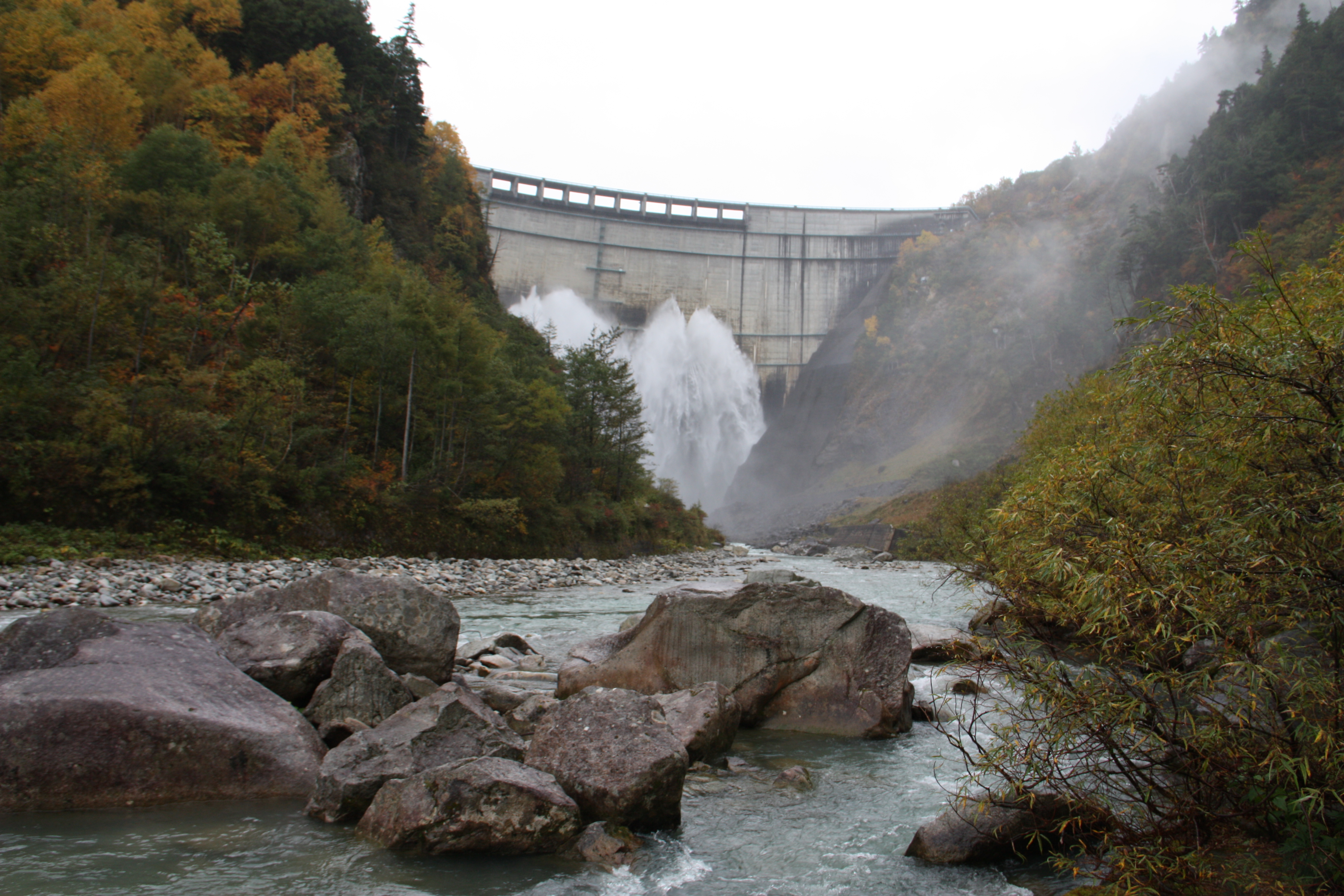
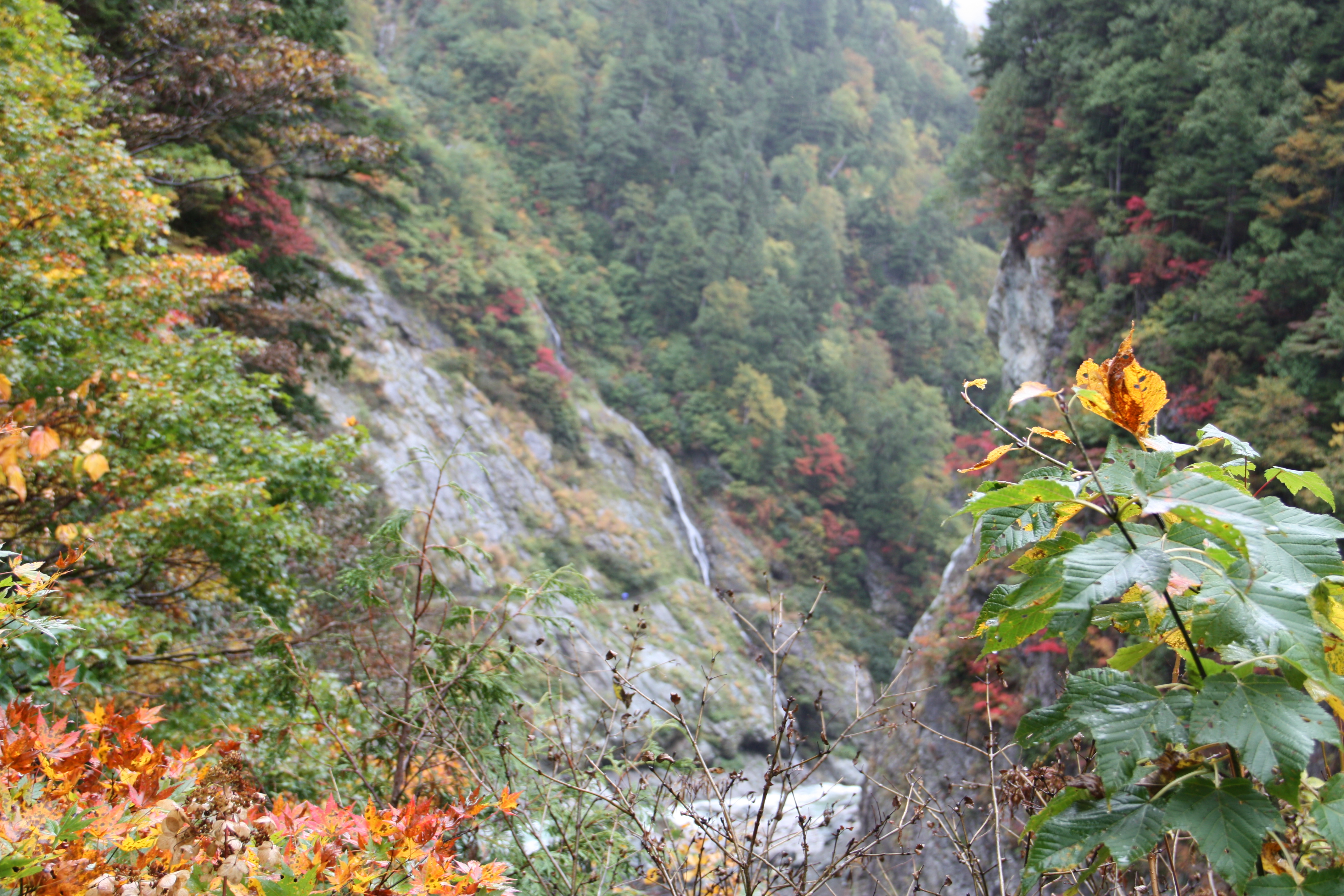
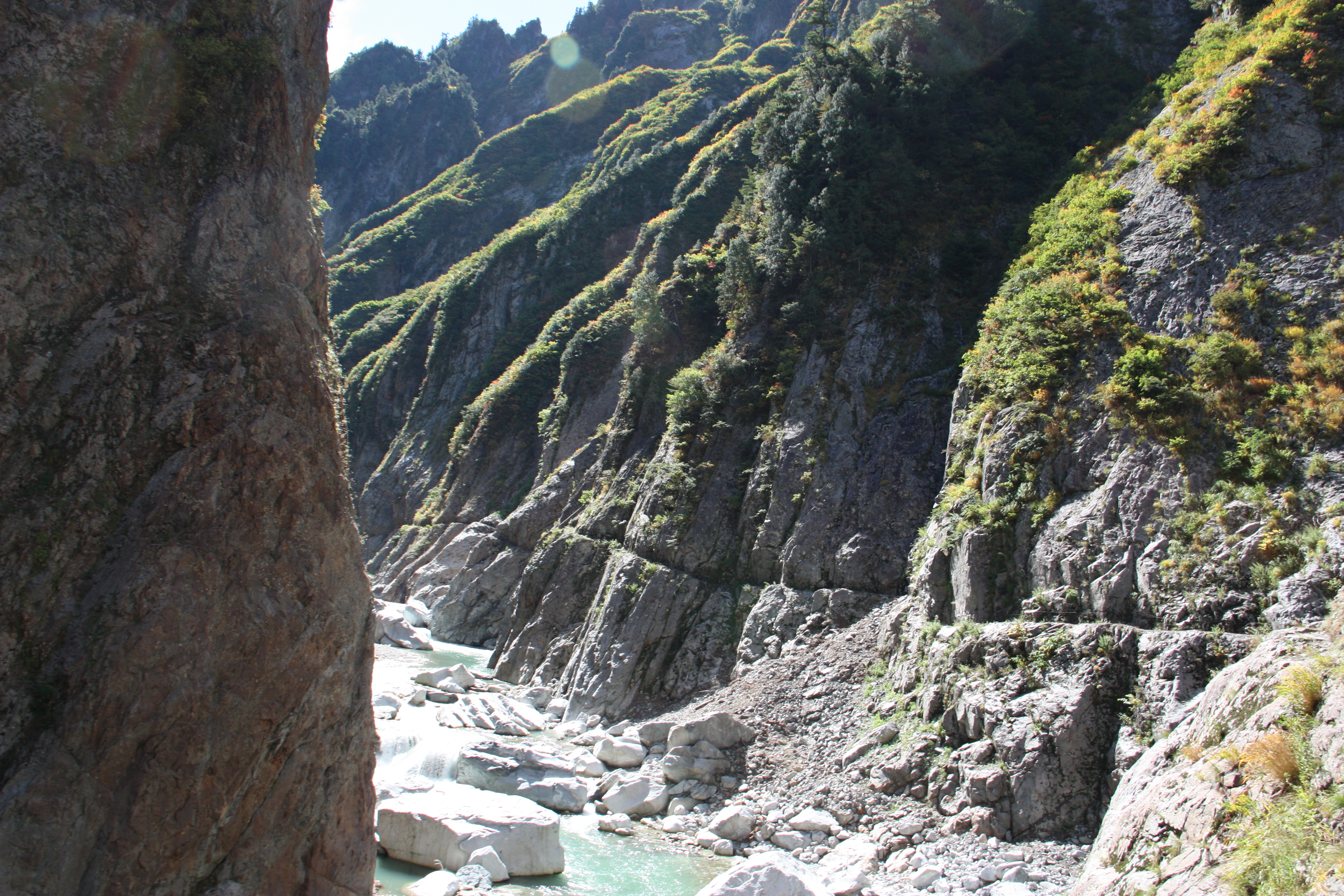
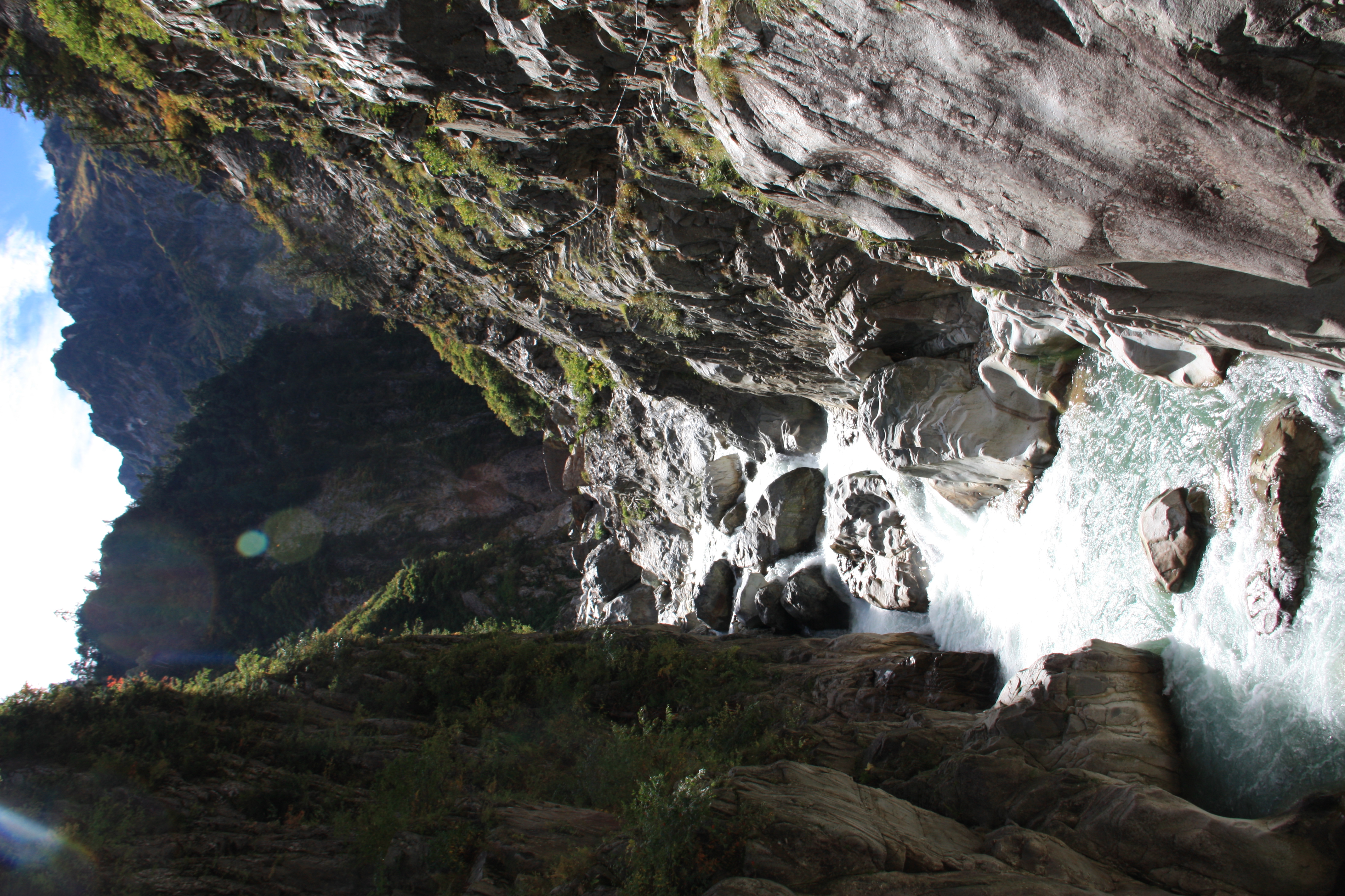
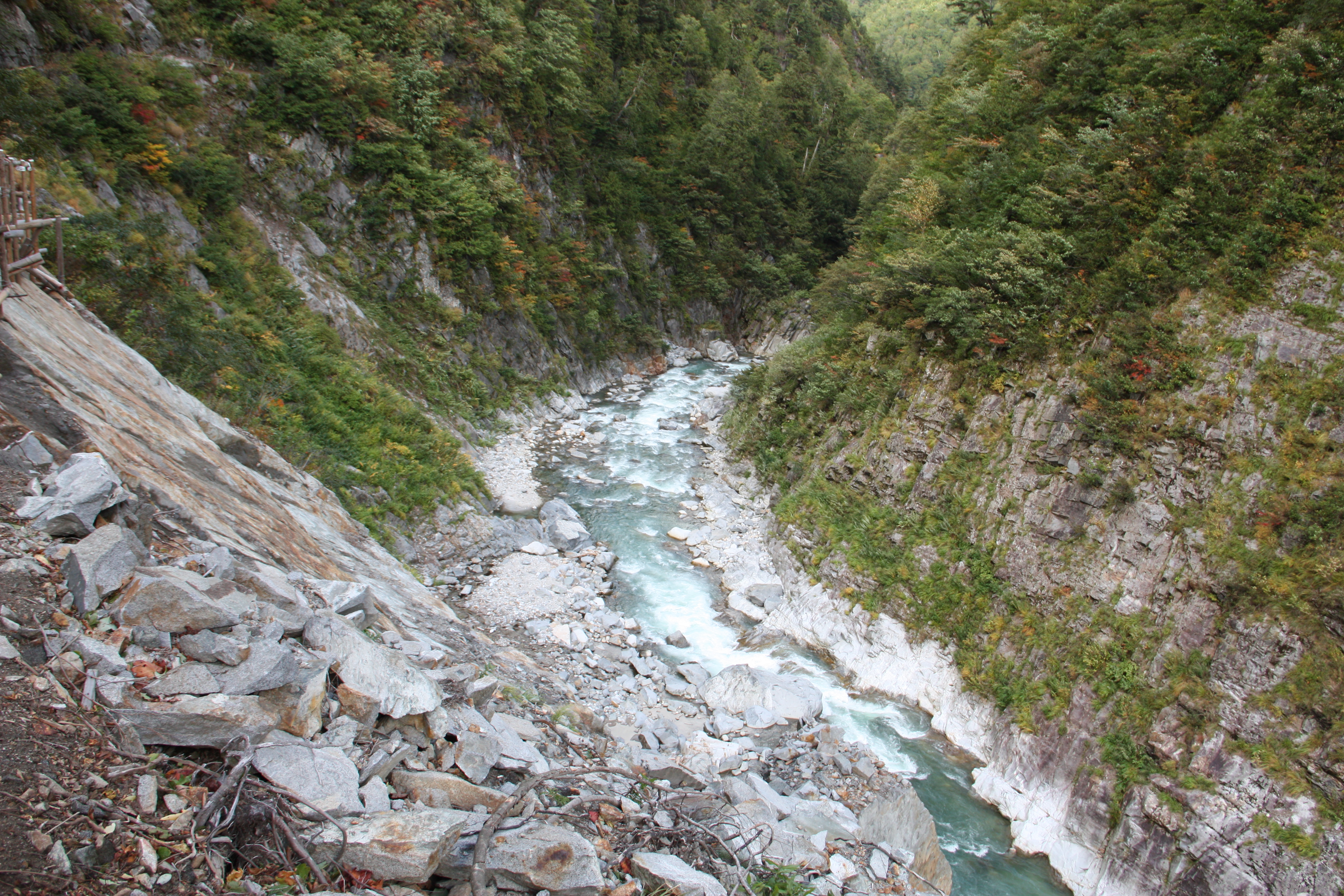
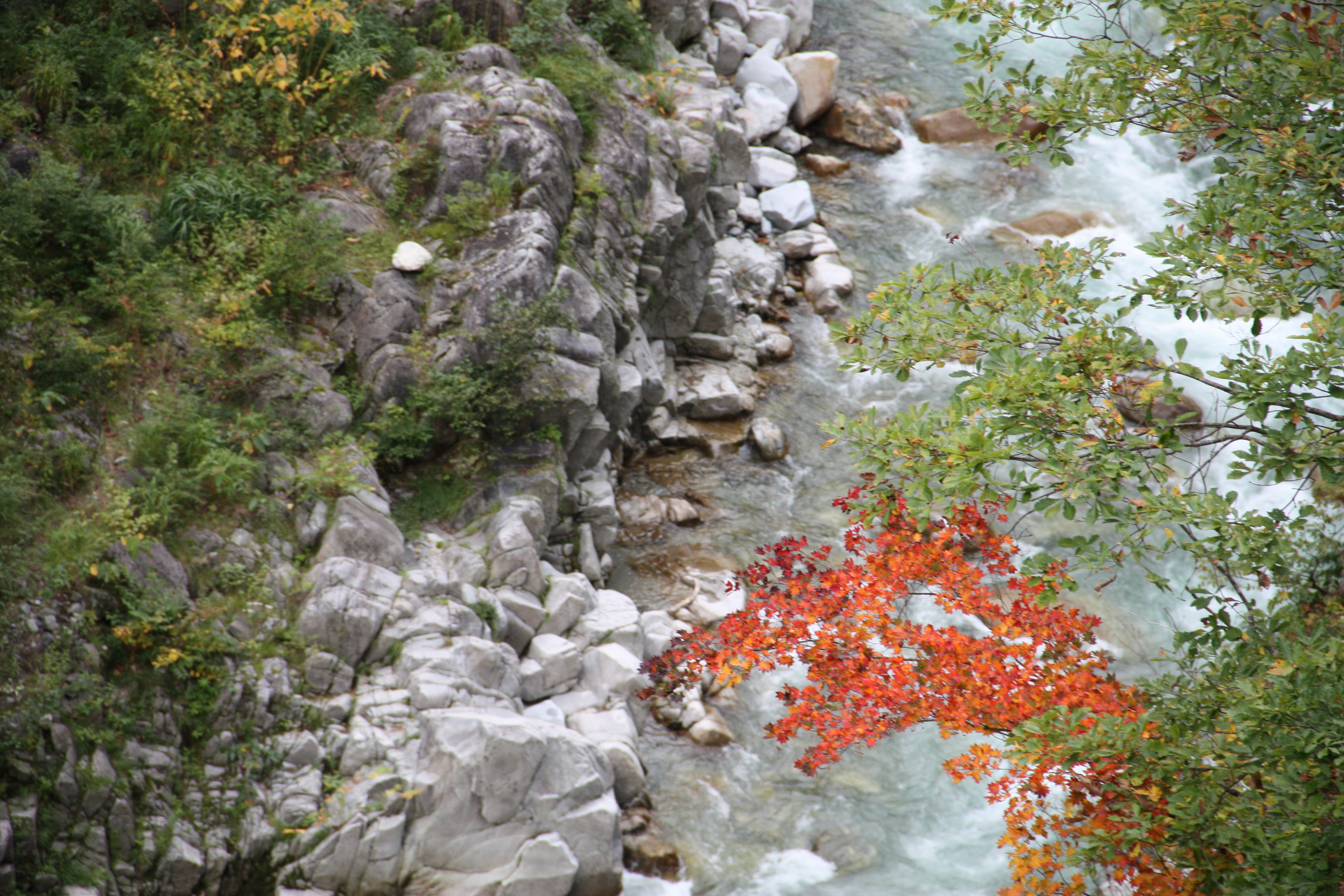
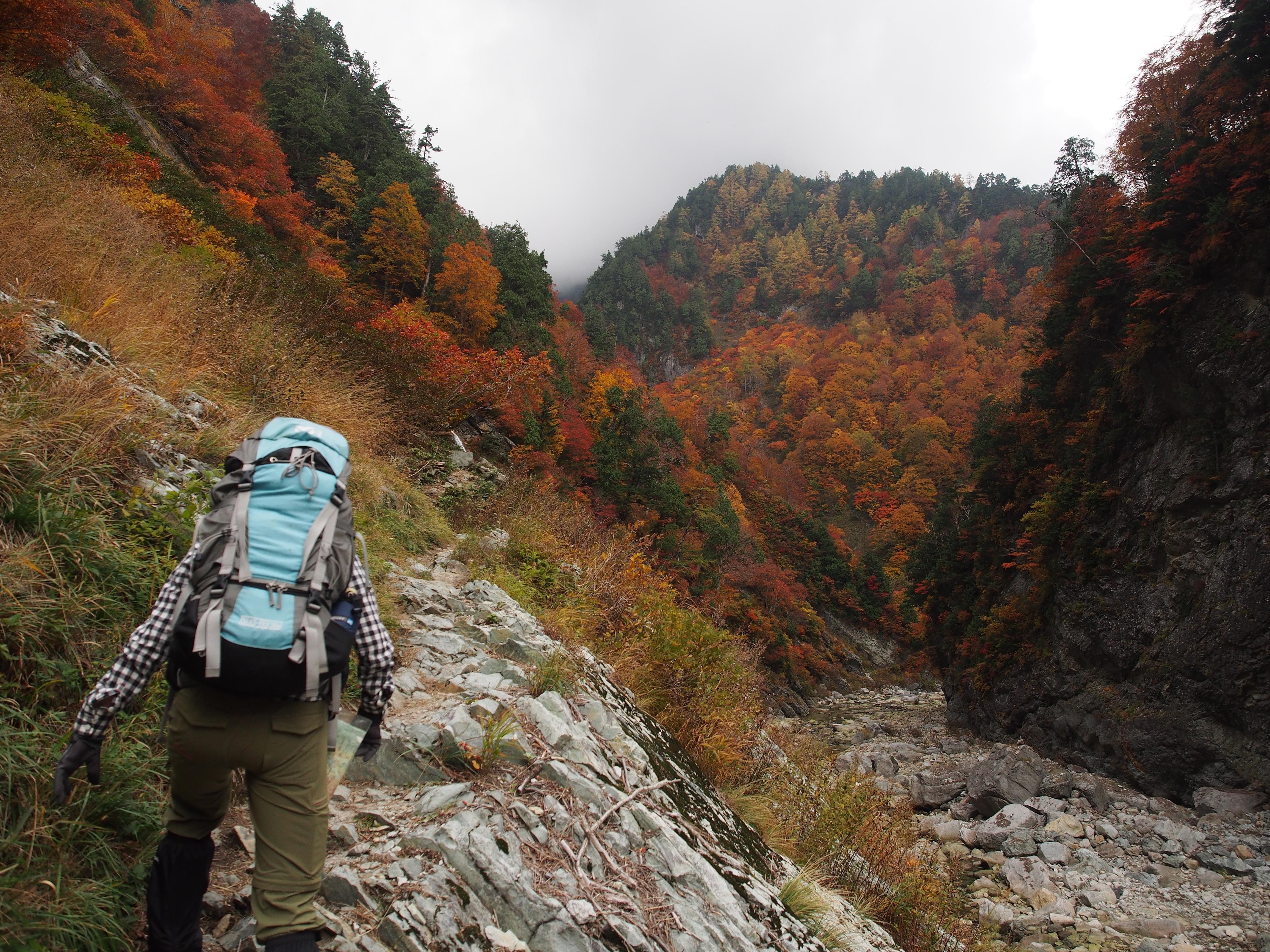
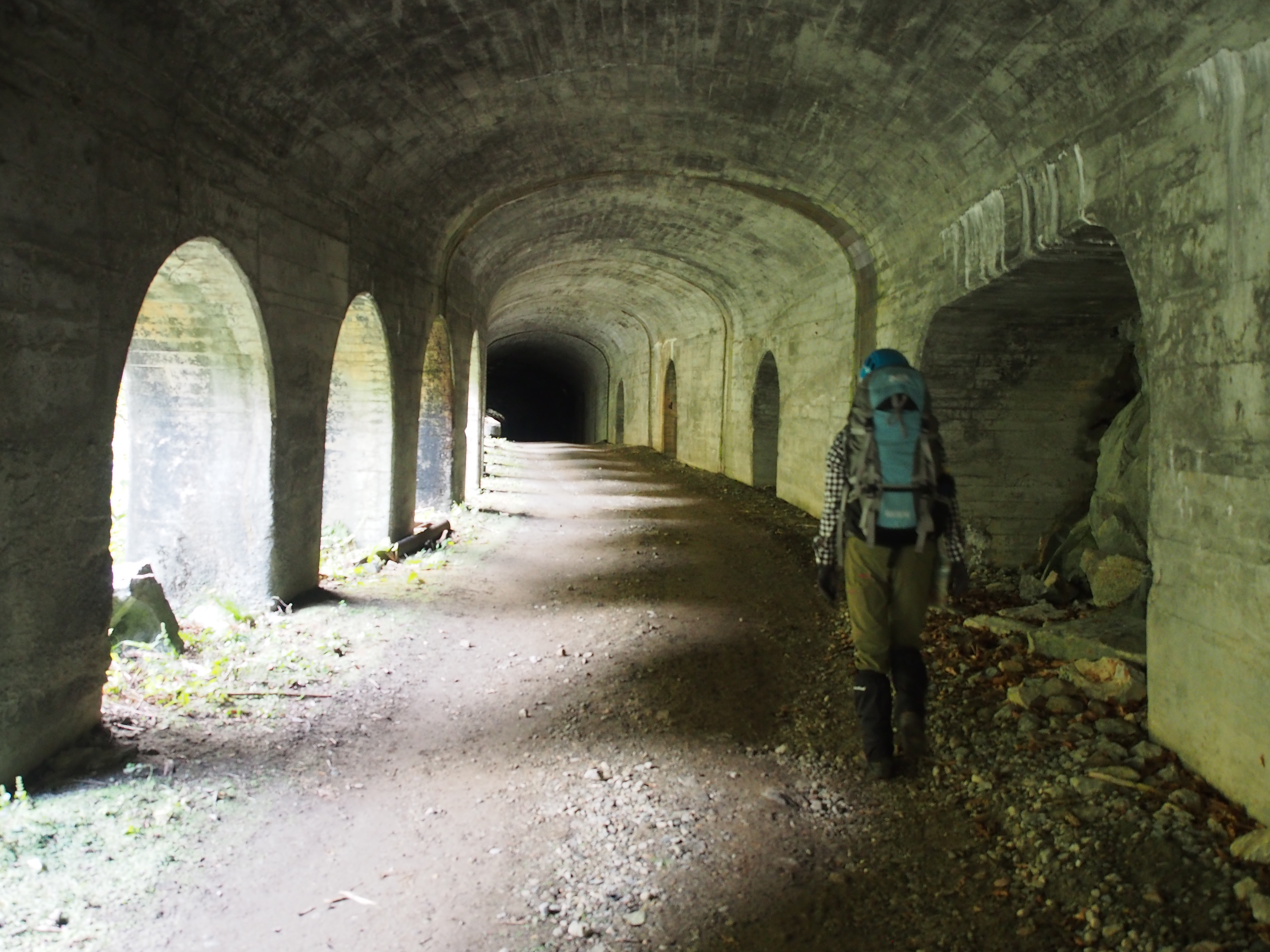
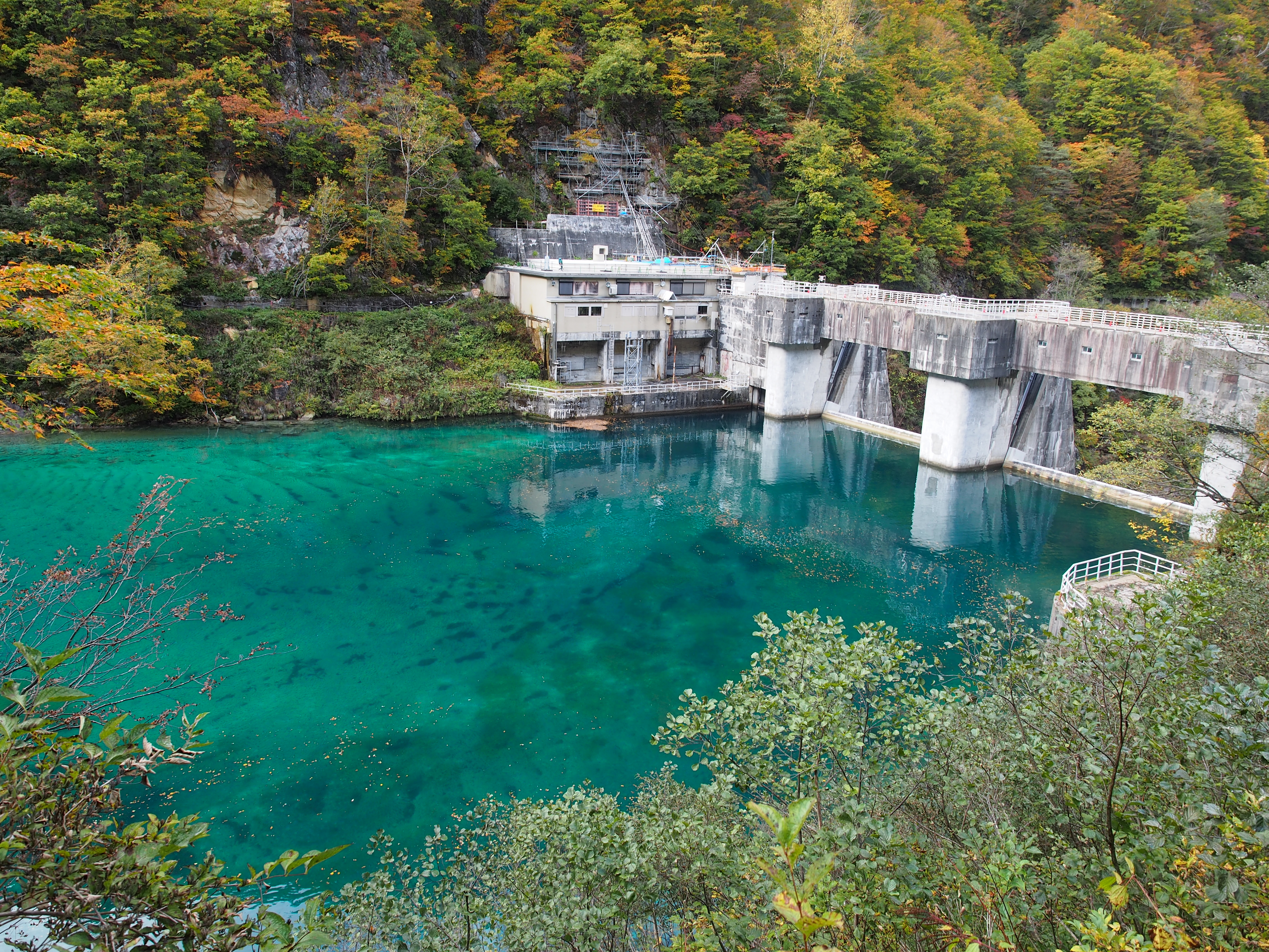
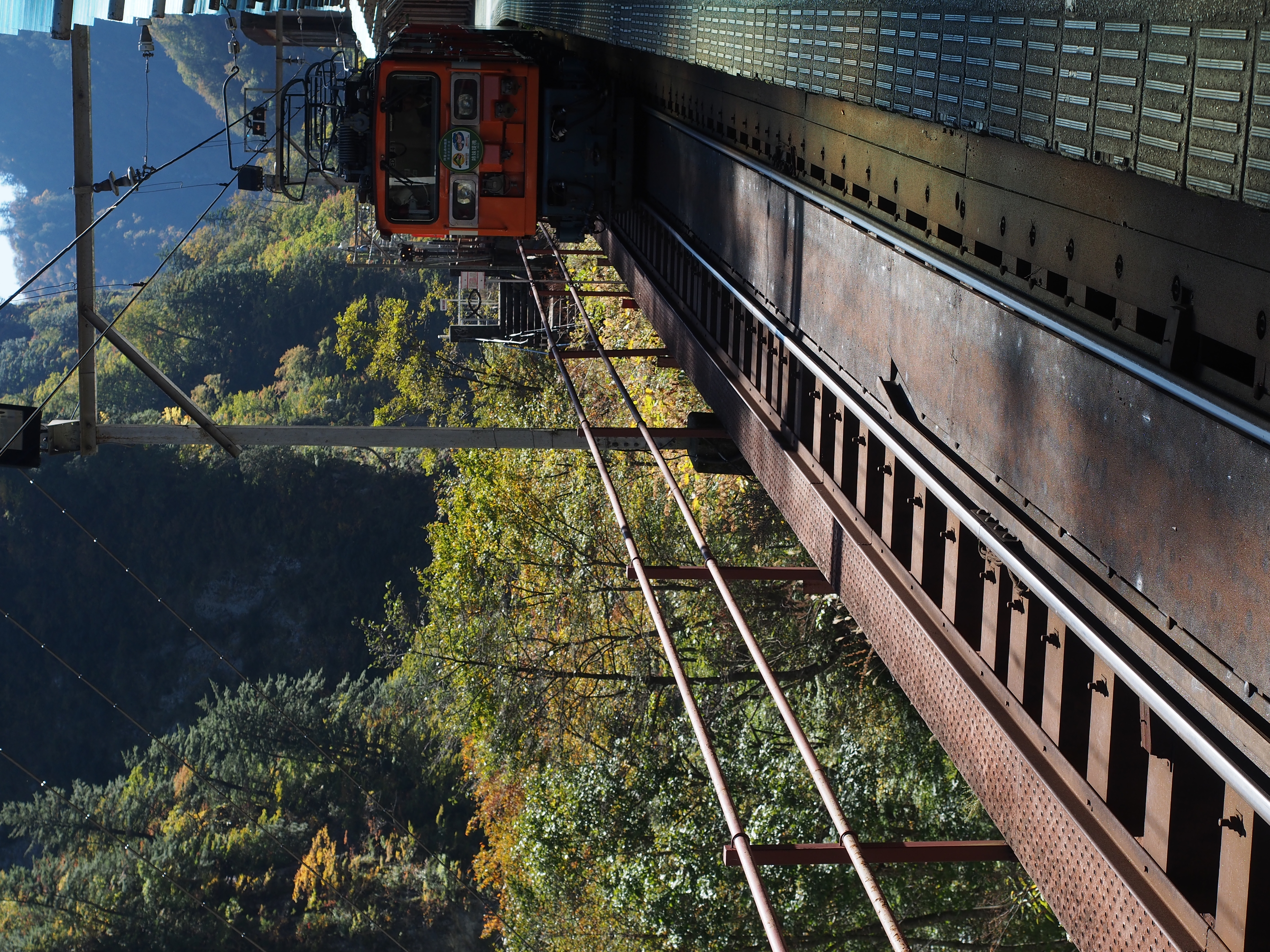
The V-shaped valley carved into the rock walls of the middle to upper reaches of the Kurobe River is known as Kurobe Gorge. The mountains on the west side of the Kurobe River are called the Tateyama Mountains, and the mountains on the east are the Ushiro-Tateyama Mountains. In other words, this gorge marks the border between the Tateyama and Ushiro-Tateyama mountain ranges. Kurobe Gorge is one of Japan’s three great gorges along with Kiyotsu Gorge and Osugidani Gorge. The area’s untouched natural scenery, its crude surfaces that dissuade people from getting close, and clear waters that run as far as the eye can see make it particularly alluring. It has also been selected as one of the top 100 unexplored areas of Japan.
Kurobekyokoku Climbing
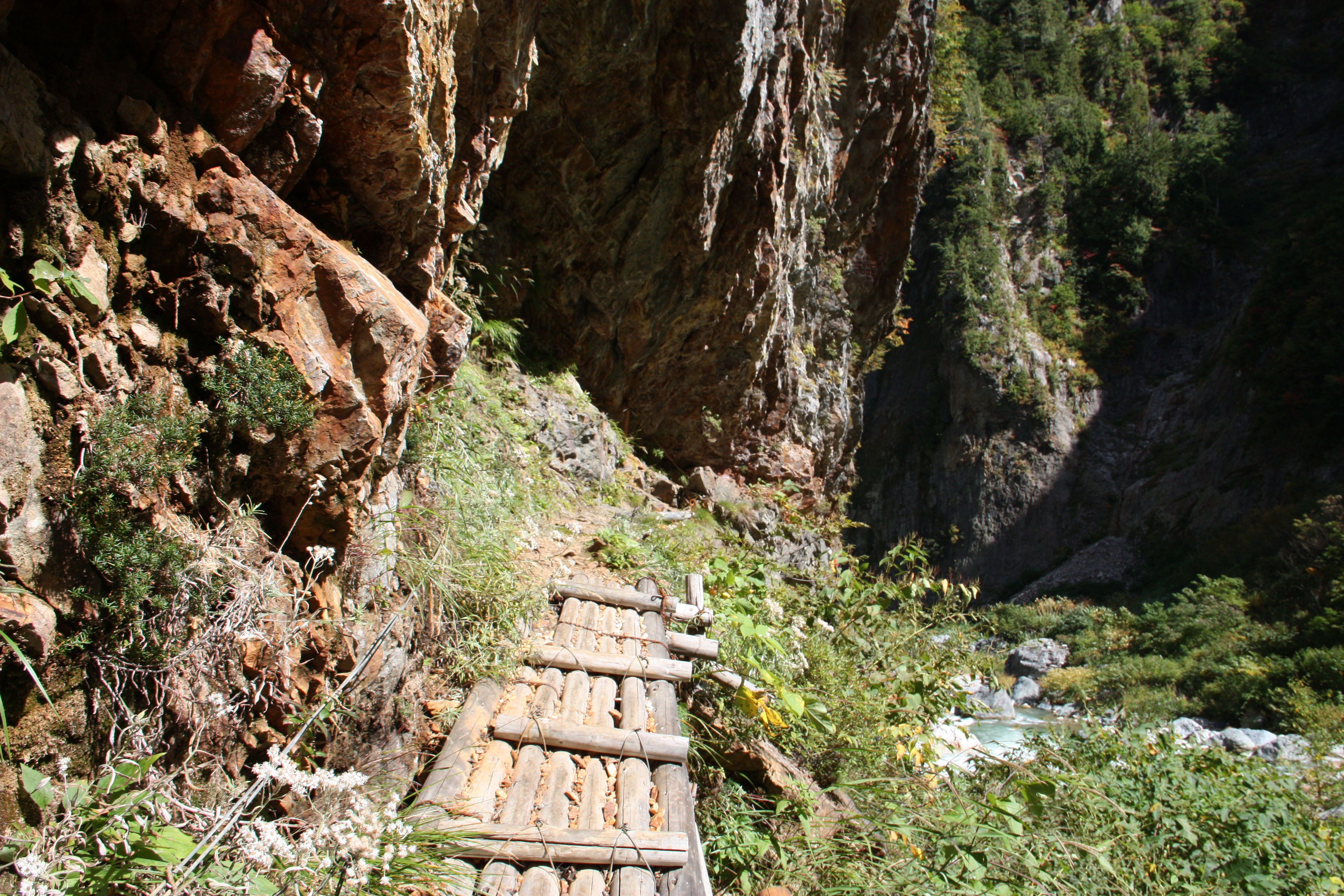
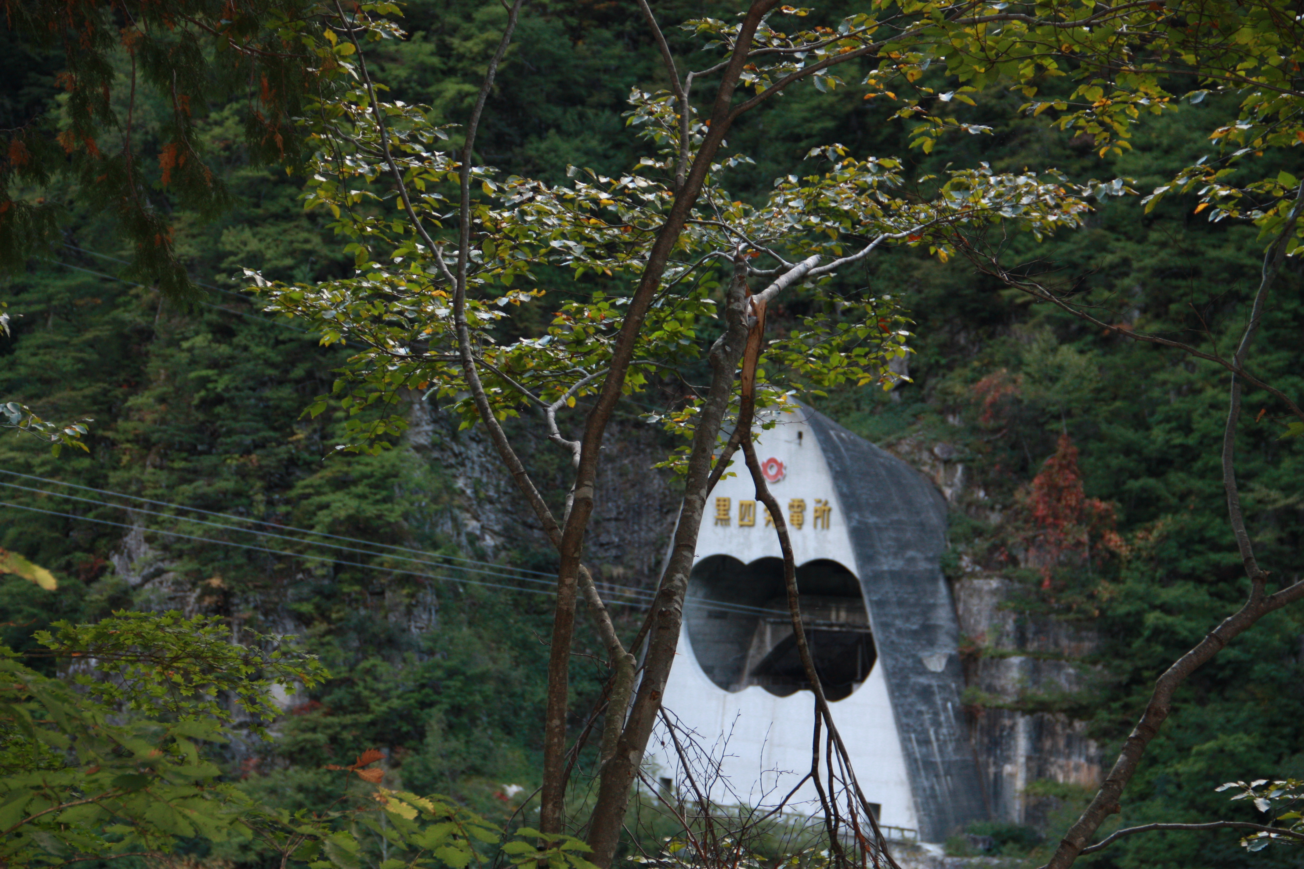
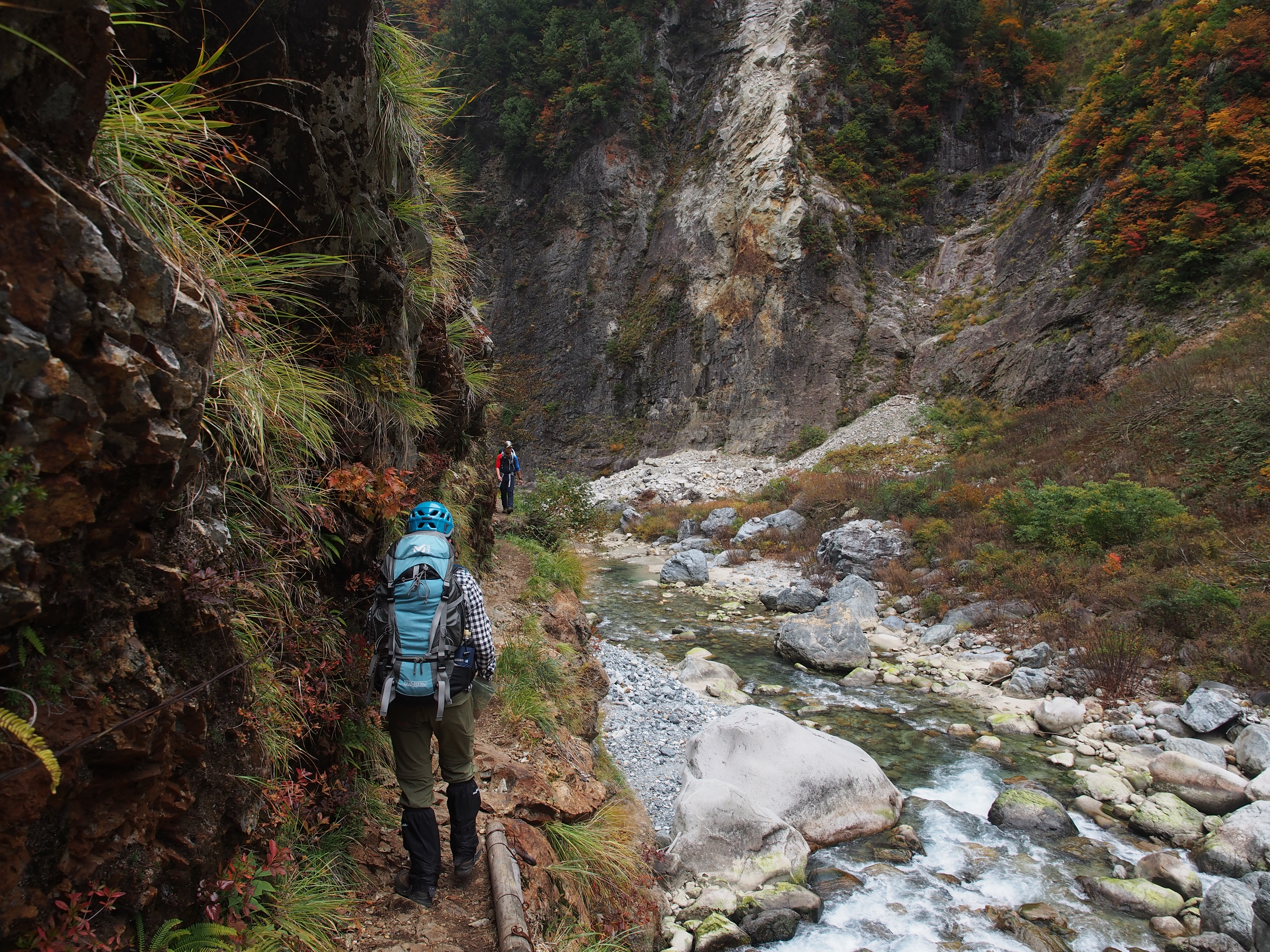
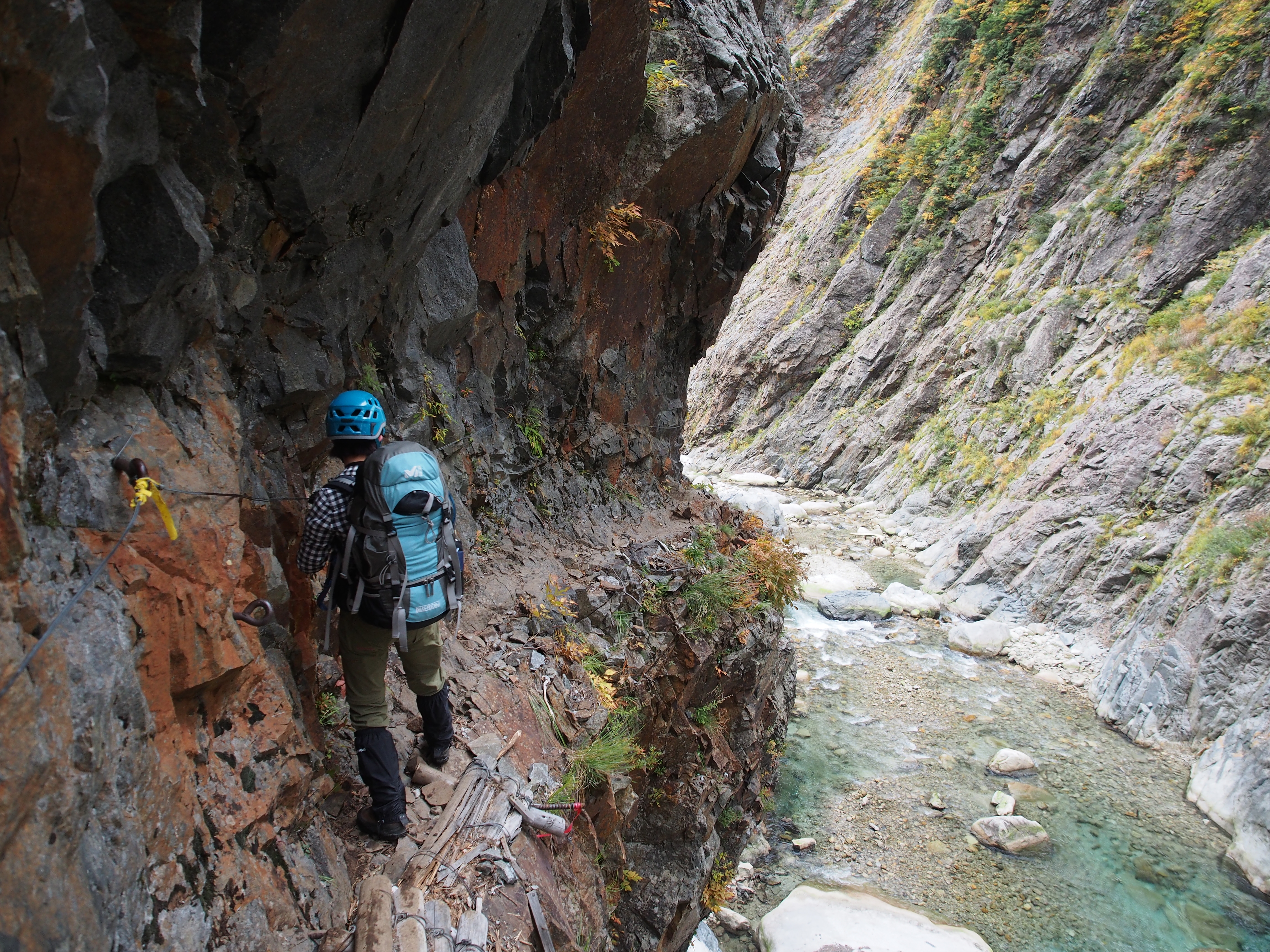
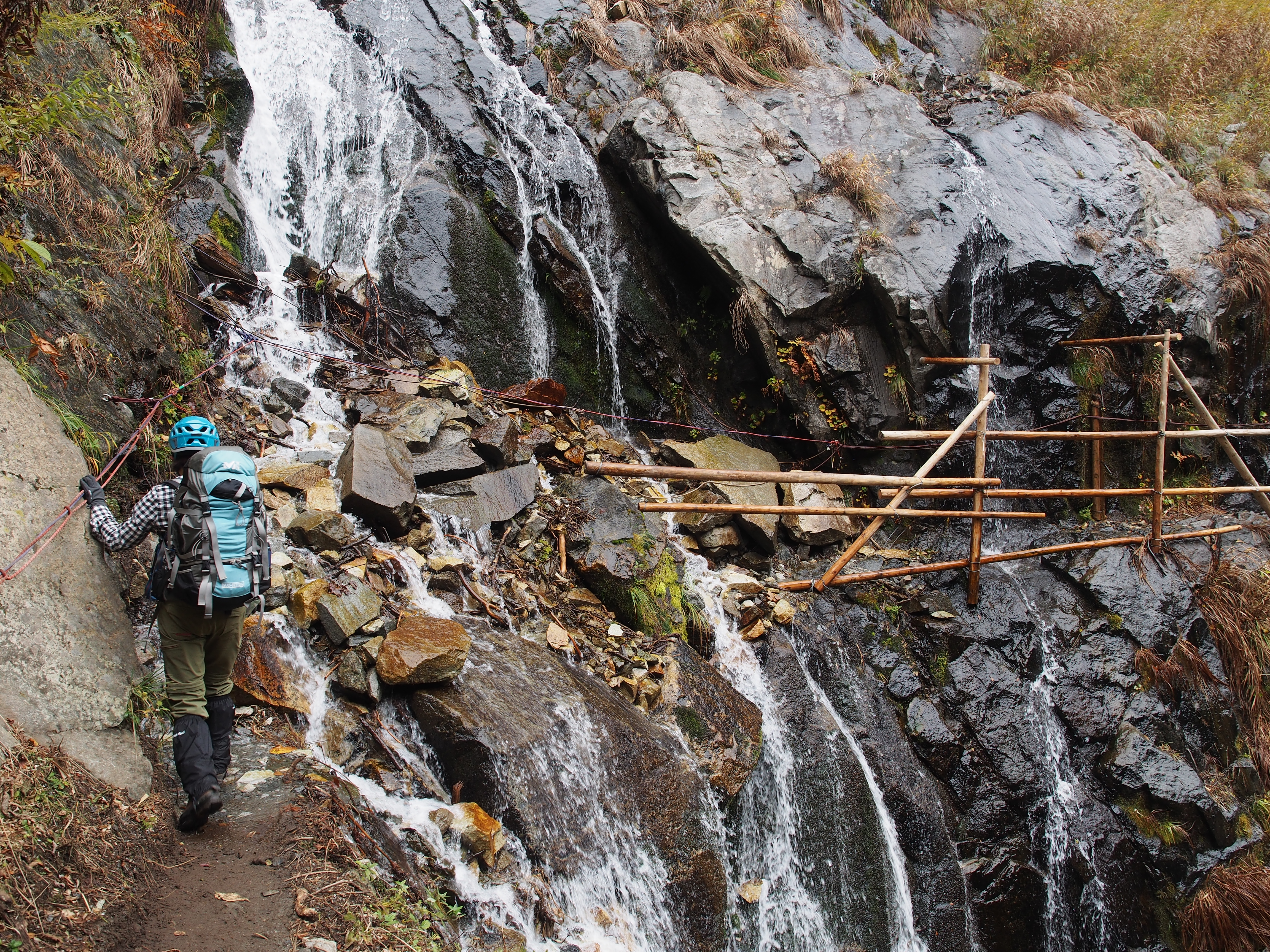
Lake Kurobe is the divider between the downstream portion called “Shimonoroka” meaning “lower corridor,” and the upstream portion called “Kaminoroka,” which means “upper corridor.” There is also an “Okunoroka” meaning “interior corridor,” which stretches from the Yakushizawa mountain hut to the river source. Before the completion of Kurobe Dam, there was also a “Nakanoroka” or central corridor, but it was submerged when the dam was completed. At present, Shimonoka is open to regular hikers, but slip-and-fall accidents frequently occur here too. If you slip and fall, it is highly likely to be fatal, so please make sure the weather, your physical health, and your equipment are all in the best possible condition before attempting the hike. Kaminoroka involves a lot of difficult river trekking and should only be attempted by the most advanced climbers. Okunoroka is also a course for advanced climbers that starts at Yakushizawa hut, heads to the river source, and stretches all the way to Mitsumata Sanso mountain hut.
Trailhead vicinity weather
Weekly weather forecast zone:Toyama Prefecture Eastern Region
| DAY | WEATHER | LOWEST | HIGHEST |
|---|---|---|---|
| 7/28 | 25℃ | 35℃ | |
| 7/29 | 25℃ | 34℃ | |
| 7/30 | 26℃ | 32℃ | |
| 7/31 | 25℃ | 32℃ | |
| 8/1 | 25℃ | 33℃ | |
| 8/2 | 25℃ | 35℃ |
This is a publication of the calculated figures for weather predictions and is not the weather forecast. There are instances where there will be big differences in the values stated for the mountains, in accord with the topography as well as sunlight, etc. so please take care.
72 hours weather information:Keyakidaira Okuyama, Kurobe, Unazuki-machi, Kurobe-shi, Toyama
| Date and time |
7/27 8:00 |
7/27 9:00 |
7/27 10:00 |
7/27 11:00 |
7/27 12:00 |
7/27 13:00 |
7/27 14:00 |
7/27 15:00 |
7/27 16:00 |
7/27 17:00 |
7/27 18:00 |
7/27 19:00 |
7/27 20:00 |
7/27 21:00 |
7/27 22:00 |
7/27 23:00 |
7/28 0:00 |
7/28 1:00 |
7/28 2:00 |
7/28 3:00 |
7/28 4:00 |
7/28 5:00 |
7/28 6:00 |
7/28 7:00 |
7/28 8:00 |
7/28 9:00 |
7/28 10:00 |
7/28 11:00 |
7/28 12:00 |
7/28 13:00 |
7/28 14:00 |
7/28 15:00 |
7/28 16:00 |
7/28 17:00 |
7/28 18:00 |
7/28 19:00 |
7/28 20:00 |
7/28 21:00 |
7/28 22:00 |
7/28 23:00 |
7/29 0:00 |
7/29 1:00 |
7/29 2:00 |
7/29 3:00 |
7/29 4:00 |
7/29 5:00 |
7/29 6:00 |
7/29 7:00 |
7/29 8:00 |
7/29 9:00 |
7/29 10:00 |
7/29 11:00 |
7/29 12:00 |
7/29 13:00 |
7/29 14:00 |
7/29 15:00 |
7/29 16:00 |
7/29 17:00 |
7/29 18:00 |
7/29 19:00 |
7/29 20:00 |
7/29 21:00 |
7/29 22:00 |
7/29 23:00 |
7/30 0:00 |
|---|---|---|---|---|---|---|---|---|---|---|---|---|---|---|---|---|---|---|---|---|---|---|---|---|---|---|---|---|---|---|---|---|---|---|---|---|---|---|---|---|---|---|---|---|---|---|---|---|---|---|---|---|---|---|---|---|---|---|---|---|---|---|---|---|---|
| Weather | |||||||||||||||||||||||||||||||||||||||||||||||||||||||||||||||||
| Temperature | 25℃ | 26℃ | 26℃ | 26℃ | 28℃ | 28℃ | 28℃ | 27℃ | 26℃ | 26℃ | 26℃ | 25℃ | 25℃ | 25℃ | 24℃ | 24℃ | 24℃ | 24℃ | 24℃ | 24℃ | 24℃ | 24℃ | 24℃ | 24℃ | 24℃ | 24℃ | 24℃ | 24℃ | 24℃ | 24℃ | 25℃ | 27℃ | 27℃ | 27℃ | 26℃ | 25℃ | 24℃ | 24℃ | 23℃ | 23℃ | 23℃ | 23℃ | 23℃ | 23℃ | 22℃ | 22℃ | 22℃ | 24℃ | 25℃ | 26℃ | 27℃ | 27℃ | 28℃ | 28℃ | 28℃ | 27℃ | 26℃ | 26℃ | 26℃ | 25℃ | 24℃ | 23℃ | 23℃ | 23℃ | 23℃ |
| Precipitation | 0mm/h | 0mm/h | 0mm/h | 0mm/h | 0mm/h | 0mm/h | 0mm/h | 0mm/h | 0mm/h | 0mm/h | 0mm/h | 0mm/h | 0mm/h | 0mm/h | 0mm/h | ※ 16時間以降は表示されません | |||||||||||||||||||||||||||||||||||||||||||||||||
| Wind direction |
west-southwest 1m/s |
west-southwest 1m/s |
west-southwest 1m/s |
west-southwest 1m/s |
west-southwest 1m/s |
west-southwest 2m/s |
west-southwest 2m/s |
west-southwest 2m/s |
west-southwest 2m/s |
west-southwest 2m/s |
west-southwest 2m/s |
west-southwest 1m/s |
0m/s |
west-southwest 1m/s |
west-southwest 1m/s |
west-southwest 1m/s |
west-southwest 1m/s |
west-southwest 2m/s |
west-southwest 2m/s |
west-southwest 2m/s |
west-southwest 2m/s |
west-southwest 2m/s |
west-southwest 2m/s |
west-southwest 3m/s |
west-southwest 3m/s |
west-southwest 3m/s |
west-southwest 3m/s |
west-southwest 3m/s |
west-southwest 3m/s |
west-southwest 3m/s |
west-southwest 3m/s |
west-southwest 3m/s |
west-southwest 3m/s |
west-southwest 2m/s |
west-southwest 2m/s |
west-southwest 2m/s |
west-southwest 1m/s |
west-southwest 1m/s |
west-southwest 1m/s |
west-southwest 1m/s |
west-southwest 1m/s |
west-southwest 1m/s |
west-southwest 1m/s |
west-southwest 1m/s |
west-southwest 1m/s |
west-southwest 1m/s |
west-southwest 2m/s |
west-southwest 2m/s |
west-southwest 2m/s |
west-southwest 2m/s |
west-southwest 2m/s |
west-southwest 2m/s |
west-southwest 3m/s |
west-southwest 3m/s |
west-southwest 3m/s |
west-southwest 3m/s |
west-southwest 2m/s |
west-southwest 2m/s |
west-southwest 2m/s |
west-southwest 2m/s |
west-southwest 2m/s |
west-southwest 2m/s |
west-southwest 2m/s |
west-southwest 2m/s |
west-southwest 2m/s |
※The weather information will be information on 5km square including the relevant point.
View of Kurobe Gorge