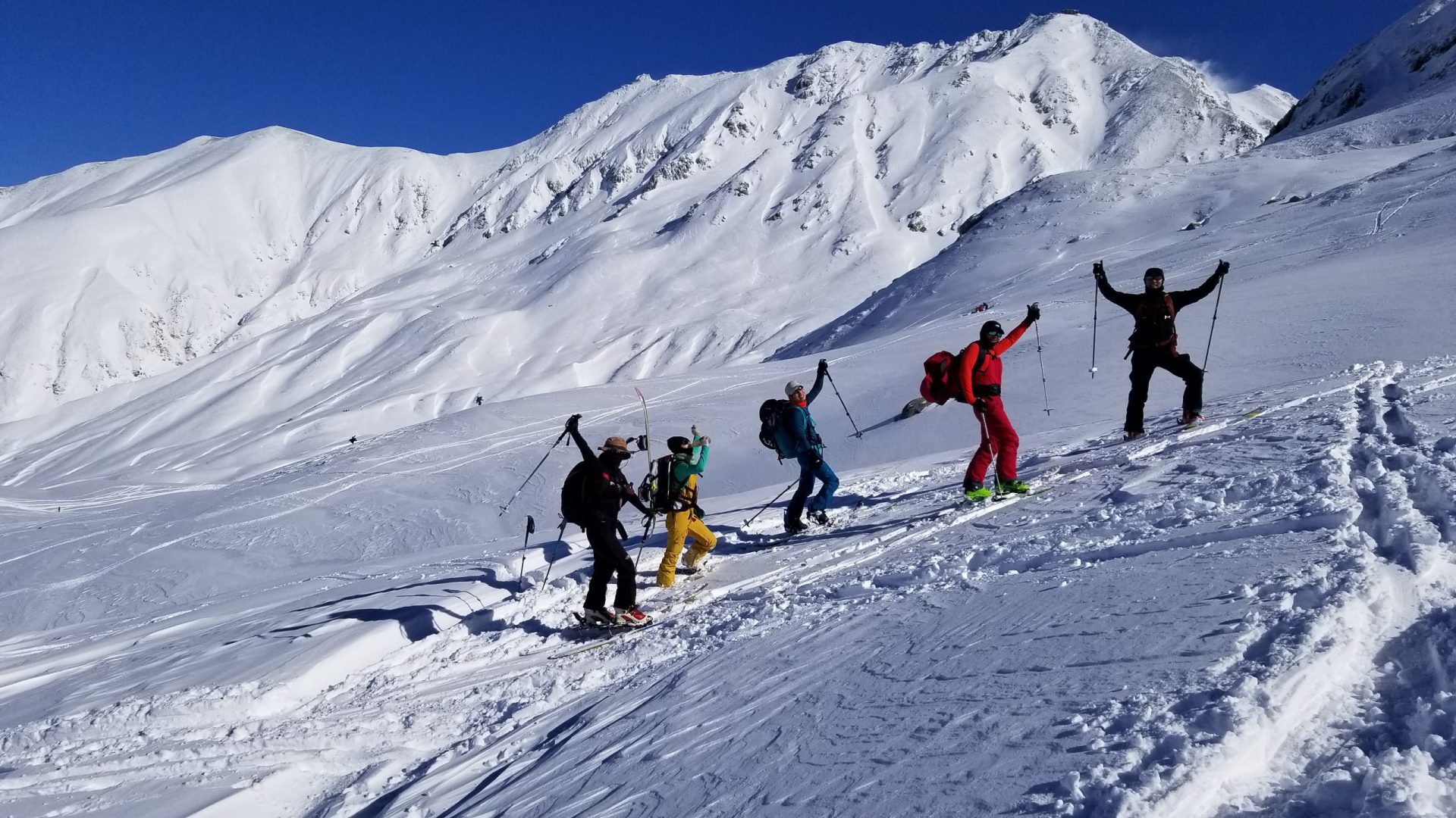
Use the Tateyama Kurobe Alpine Route to go straight up to a world above the clouds at an elevation of 2450 meters
Murodo is the central tourist area of the Tateyama mountains and the gateway to climbing mountains that stand at an elevation of 3000 meters. This area boasts one of the world’s heaviest snowfalls and its famous Snow Corridor is a popular tourist attraction in the spring. Snow gullies remain throughout the summer, and you can see several perennial snow patches (snow gullies where the snow never fully melts). In 2012, three of these snow patches were recognized as the first glaciers in Japan.
The season ski season is so long in this area it is said, “back country skiing starts and ends in Tateyama.” There are diverse route variations for all levels of skiers from the big route that starts at a 3,000-meter-high ridge, or the short route that takes approximately two hours, to the long cruising route that will take you from the Murodo plateau down into the Midagahara wetlands.
You can also stay in one of the hotels or mountain huts to enjoy a more leisurely and luxurious ski experience above the clouds.
There is nothing more wasteful than a simple day trip to Tateyama as the magical sunsets are medicine for the soul.
The area is a natural habitat for rock ptarmigans, which have been designated special national monuments, and they are often seen here. However, entry to protected areas is prohibited, so please check where those are beforehand.
Best season: November through the end of December and late April through the first half of May
・Murodo has two backcountry seasons in spring and autumn. The spring season starts when the Tateyama Kurobe Alpine Route opens in mid-April, and goes to the end of May, and the autumn season is from the middle to end of November during the time the route is not in operation.
The area around Murodo has an overwhelming amount of snow with countless diverse routes rich in variety allowing you to enjoy skiing here even after the Japanese Golden Week holidays end in May. In addition, you can taste the true flavor of backcountry skiing around mid-November in fresh fallen dry powder snow.
However, caution needs to be maintained at all times because depending on time of day and which direction the slope faces, sunlight, temperature, and wind can alter the comfort and risk level of skiing.
Please be especially careful of the risk of avalanches.
Backcountry beginners should participate in a guided tour.
Guide
Tomohiko Saeki (4th generation Heizo)
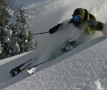
He was born in the foothills of Tateyama in a village called Ashikuraji into a family that have been mountain guides for generations. His great-grandfather, Heizo, was the first president of the Tateyama Guides’ Union (now known as the Tateyama Guide Association), and he is called the 4th generation Heizo carrying on in his footsteps as a hiking guide during green season and as a ski instructor during the snow season. Throughout the year, his life revolves around the mountains and snow. He is particularly passionate about popularizing backcountry skiing, which brims with the true allure of the mountains and skiing, and he strives to convey the safety and fun of backcountry skiing to as many people as possible from his Tateyama base.
He also works hard to bring nature activities to children conducting outdoor workshops and tours based on the keywords, “adventure” and “challenge.” In addition, he conducts informational activities that relate the history and culture of the Tateyama faith that flourished in the Edo period, planning and conducting original tours of the Tateyama mountains dressed as a Chugo*.
*Chugo – The name for an ancient guide who led pilgrimages of the Tateyama faith into the mountains. His great-grandfather, the first Heizo, was a famous guide and the namesake of Mt. Tsurugi-dake’s “Heizo Valley.”
- Winter: Tateyama Adventure Pro Ski School Director
Member of the Tateyama Guide Association
Sanzoku Club President
- 2009 Joined The Tateyama Guides Association
Japan Mountain Guides Association
Climbing Guide Stage 2, Backcountry Ski Stage 2 - 2015 Established the Tateyama Adventure Pro Ski School
(公)Professional Ski Instructors Association of Japan SIA Demonstrator Seasons 39 & 40 - 22016 Established the Sanzoku Club
- 2017 Established the NPO Shizen Yuiku Support Toyama
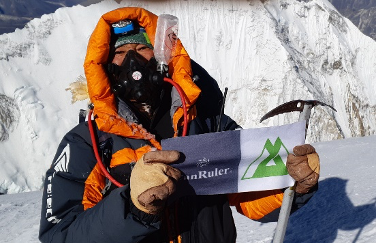
- May 22, 2019 Reached the summit of Mt. Everest!!
- Japan Avalanche Network (JAN) Avalanche Worker level1
- Ministry of the Environment National Park Advisor, Toyama Prefecture Nature Preservation Advisor, Tateyama Disaster Relief and Rescue Team Member
Trailhead vicinity weather
Weekly weather forecast zone:Eastern Toyama Prefecture
| DAY | WEATHER | LOWEST | HIGHEST |
|---|---|---|---|
| 7/16 | 26℃ | 35℃ | |
| 7/17 | 26℃ | 34℃ | |
| 7/18 | 26℃ | 36℃ | |
| 7/19 | 24℃ | 35℃ | |
| 7/20 | 25℃ | 35℃ | |
| 7/21 | 25℃ | 35℃ |
This is a publication of the calculated figures for weather predictions and is not the weather forecast. There are instances where there will be big differences in the values stated for the mountains, in accord with the topography as well as sunlight, etc. so please take care.
72 hours weather information:Murododaira, Tateyama, Ashikuraji, Tateyama-cho, Nakaniikawa-gun, Toyama Prefecture
| Date and time |
7/15 7:00 |
7/15 8:00 |
7/15 9:00 |
7/15 10:00 |
7/15 11:00 |
7/15 12:00 |
7/15 13:00 |
7/15 14:00 |
7/15 15:00 |
7/15 16:00 |
7/15 17:00 |
7/15 18:00 |
7/15 19:00 |
7/15 20:00 |
7/15 21:00 |
7/15 22:00 |
7/15 23:00 |
7/16 0:00 |
7/16 1:00 |
7/16 2:00 |
7/16 3:00 |
7/16 4:00 |
7/16 5:00 |
7/16 6:00 |
7/16 7:00 |
7/16 8:00 |
7/16 9:00 |
7/16 10:00 |
7/16 11:00 |
7/16 12:00 |
7/16 13:00 |
7/16 14:00 |
7/16 15:00 |
7/16 16:00 |
7/16 17:00 |
7/16 18:00 |
7/16 19:00 |
7/16 20:00 |
7/16 21:00 |
7/16 22:00 |
7/16 23:00 |
7/17 0:00 |
7/17 1:00 |
7/17 2:00 |
7/17 3:00 |
7/17 4:00 |
7/17 5:00 |
7/17 6:00 |
7/17 7:00 |
7/17 8:00 |
7/17 9:00 |
7/17 10:00 |
7/17 11:00 |
7/17 12:00 |
7/17 13:00 |
7/17 14:00 |
7/17 15:00 |
7/17 16:00 |
7/17 17:00 |
7/17 18:00 |
7/17 19:00 |
7/17 20:00 |
7/17 21:00 |
7/17 22:00 |
7/17 23:00 |
7/18 0:00 |
|---|---|---|---|---|---|---|---|---|---|---|---|---|---|---|---|---|---|---|---|---|---|---|---|---|---|---|---|---|---|---|---|---|---|---|---|---|---|---|---|---|---|---|---|---|---|---|---|---|---|---|---|---|---|---|---|---|---|---|---|---|---|---|---|---|---|---|
| Weather | ||||||||||||||||||||||||||||||||||||||||||||||||||||||||||||||||||
| Temperature | 16℃ | 16℃ | 17℃ | 18℃ | 17℃ | 17℃ | 18℃ | 20℃ | 21℃ | 20℃ | 19℃ | 19℃ | 18℃ | 17℃ | 16℃ | 15℃ | 15℃ | 15℃ | 15℃ | 15℃ | 15℃ | 15℃ | 16℃ | 16℃ | 16℃ | 16℃ | 17℃ | 19℃ | 20℃ | 20℃ | 20℃ | 20℃ | 20℃ | 20℃ | 18℃ | 17℃ | 17℃ | 16℃ | 16℃ | 16℃ | 16℃ | 17℃ | 17℃ | 17℃ | 16℃ | 16℃ | 16℃ | 16℃ | 16℃ | 16℃ | 16℃ | 16℃ | 16℃ | 16℃ | 16℃ | 16℃ | 16℃ | 16℃ | 16℃ | 16℃ | 15℃ | 15℃ | 15℃ | 15℃ | 15℃ | 14℃ |
| Precipitation | 1mm/h | 3mm/h | 2mm/h | 1mm/h | 0.4mm/h | 0.4mm/h | 0mm/h | 0mm/h | 0mm/h | 0mm/h | 0mm/h | 0mm/h | 0mm/h | 0mm/h | 0mm/h | ※ 16時間以降は表示されません | ||||||||||||||||||||||||||||||||||||||||||||||||||
| Wind direction |
south-southeast 3m/s |
south-southeast 2m/s |
south-southeast 3m/s |
south-southeast 3m/s |
south-southeast 1m/s |
south-southeast 1m/s |
south-southeast 2m/s |
south-southeast 1m/s |
south-southeast 1m/s |
south-southeast 1m/s |
south-southeast 1m/s |
south-southeast 1m/s |
south-southeast 1m/s |
south-southeast 1m/s |
south-southeast 1m/s |
south-southeast 2m/s |
south-southeast 2m/s |
south-southeast 2m/s |
south-southeast 3m/s |
south-southeast 2m/s |
south-southeast 2m/s |
south-southeast 2m/s |
south-southeast 2m/s |
south-southeast 2m/s |
south-southeast 2m/s |
south-southeast 2m/s |
south-southeast 2m/s |
south-southeast 2m/s |
south-southeast 2m/s |
south-southeast 2m/s |
south-southeast 1m/s |
south-southeast 1m/s |
0m/s |
south-southeast 1m/s |
south-southeast 1m/s |
south-southeast 2m/s |
south-southeast 2m/s |
south-southeast 2m/s |
south-southeast 2m/s |
south-southeast 2m/s |
south-southeast 2m/s |
south-southeast 2m/s |
south-southeast 2m/s |
south-southeast 2m/s |
south-southeast 2m/s |
south-southeast 2m/s |
south-southeast 2m/s |
south-southeast 2m/s |
south-southeast 3m/s |
south-southeast 2m/s |
south-southeast 2m/s |
south-southeast 2m/s |
south-southeast 3m/s |
south-southeast 3m/s |
south-southeast 3m/s |
south-southeast 3m/s |
south-southeast 3m/s |
south-southeast 3m/s |
south-southeast 3m/s |
south-southeast 3m/s |
south-southeast 3m/s |
south-southeast 3m/s |
south-southeast 3m/s |
south-southeast 2m/s |
south-southeast 2m/s |
south-southeast 2m/s |
※The weather information will be information on 5km square including the relevant point.
※天気予報マークは一次細分区域から表示しています
Route Information
Route information and ski routes listed here are overviews meant to be used as a reference. They can change significantly depending on the skill of the person climbing the mountain or weather, and snow conditions. Please participate in a tour or go with a well-experienced guide when you go into the mountains. Please also confirm the route details with your tour host or guide. In particular, this area is a natural habitat for rock ptarmigans, which have been designated special national monuments, and they are often seen here. However, entry to protected areas is prohibited, so please check where those are beforehand with your guide.
An Introduction to the Tateyama Backcountry Ski Fields
【Murodo Short Route】Physical ★☆☆ Technique ★☆☆
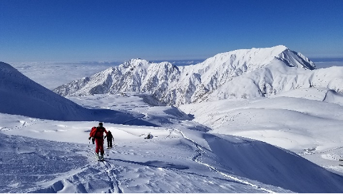
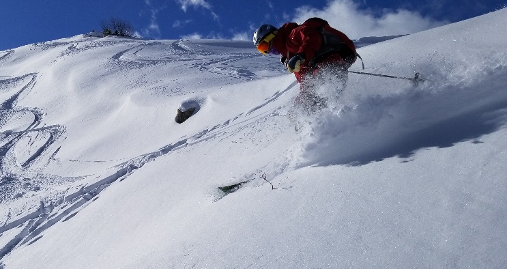
Best season: mid-April – mid-May, end of November Expected course time: Approx. 1 – 1.5 hours
From the Murodo Terminal, if you are looking at the Tateyama mountain range in front of you, Mt. Murodo is the hill that sprawls to your right (south) at an elevation of 2,668 meters. It is crowded with skiers during the season.
To get there, follow the summer hiking trail toward Mt. Oyama and Ichino-koshi from the Murodo-sanso mountain hut, and from there, climb the northern slope on the right-hand side. Along the way, it will get quite steep, but gradually the slope will become gentler and wider, and you should reach the peak of Mt. Murodo in about one hour. The south side of the summit is a sharp drop straight into the Tateyama caldera. The view here is amazing! If the weather is good, you will have a panoramic view of the Yari and Hotaka mountain ranges, Mt. Kasa-gatake, Mt. Yakushi-dake, and the Toyama plain, and in the opposite direction, the Dainichi mountains and Mt. Tsurugi-dake. However, you will want to be careful when skiing down to the Tateyama caldera. The area around the summit is expansive, and when the fog is thick, you need to pay attention to which direction you are headed.
It is about a 200-meter elevation drop to the Murodo plateau that can be enjoyed in a pleasant 10-minute run. When the snow quality is good, you will want to ski this easy, short route over and over.
【Oyama/Yamazaki Curl Route】Physical ★★☆ Technique ★★★
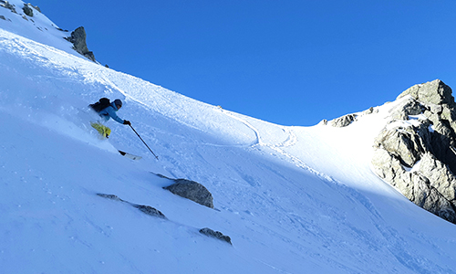
Best season: mid-April – mid-May Expected course time: Approx. 5 hours
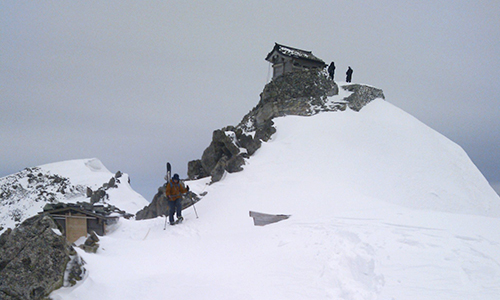
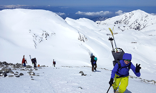
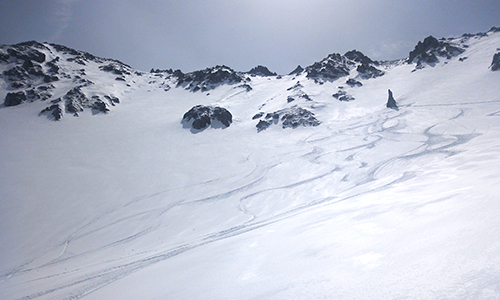
The popular route is a dynamic run from the Tateyama mountains’ Mt. Oyama at an elevation of 3,003 meters to Yamazaki Curl, which is a nationally designated natural monument. To access the run, stay on the summer hiking trail that heads to Mt. Oyama. You have to be extra careful of avalanches coming from above when you traverse the north face of Mt. Jodo-san. You can climb up to Ichino-koshi using skins, but from Ichino-koshi it is a steep, rocky ridge. Put your skis on your hiking pack and continue onto the rocky ridge from here using crampons and an ice axe. You will arrive at the Mt. Oyama summit approximately 3 – 4 hours after leaving the Murodo Terminal. A 360-degree panoramic view will spread before you. If the weather is good, you may be able to admire Mt. Fuji to the southeast. It is finally time to start your drop into the Yamazaki Curl!! You will want to be careful in the area directly below the summit as it is often wind scoured and icy. Once you begin your drop, you will soon see the symbol of the Yamazaki Curl, Rosoku-iwa, which means “candle rock.” The expansive terrain of the curl starts here allowing you to enjoy a dynamic run on an overwhelming scale.
【Mt. Jodo-san Oyama Valley – Tanbo-daira Route】Physical ★★★ Technique ★★★
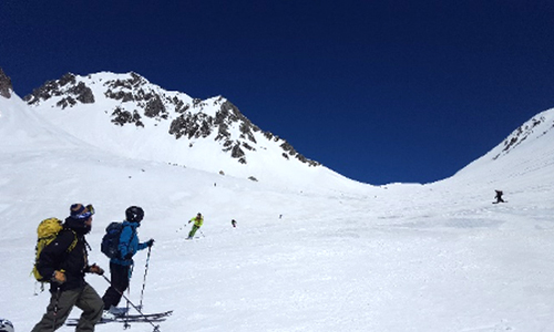
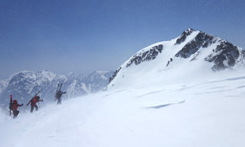
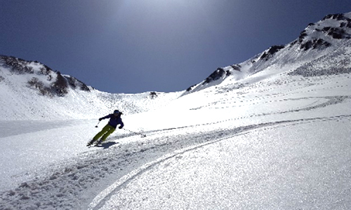
Best season: mid-April – mid-May Expected course time: Approx. 8 hours
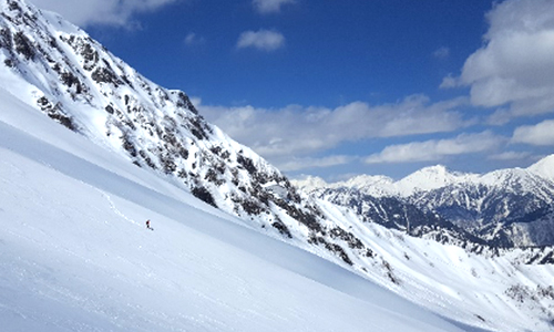
This is a day-long extended route with two runs across expansive inclines from the Murodo plateau to the back side of the Tateyama mountain range. From Murodo Terminal, head toward Ichino-koshi, and from Ichino-koshi follow the ridge that stretches along the southwestern side heading to Mt. Jodo-san. Depending on how much snow has accumulated, you may have to carry your skis at some point, but for the most part, you should be able to ascend all the way to the southern summit with skins on. The University of Toyama has a research facility at the summit. The peaks of the Tateyama range spread before your eyes here creating a spectacular view. The drop in point is the saddle (col) between here and Mt. Ryuo-dake to the south. The initial drop is so steep you can’t see what is coming, but a nice, big, bowl-shaped slope spreads below it. As you make turn after turn, the incline becomes gentler, and you will soon find yourself merging into the large Oyama Valley slope. You will ski down this expansive, stress-free slope using big, generous turns until you reach an elevation of 2,200 meters. You can continue all the way down to Lake Kurobe, but this time we will make the steep ascent on the east side to Higashi Ichino-koshi. Once you reach the top, you will be treated to a fantastic view of the Tateyama mountains and Lake Kurobe and the second broad slope, Tanbo-daira, spreads at your feet. Enjoy the grand scale of the slope while paying attention to changes in the quality of the snow. Finally, ski down the gentle incline along the ropeway all the way to Kurobedaira Station. Looking behind you, the view of the rugged east face of the Tateyama mountains is enough to wash away all of your fatigue from the day.
