Kamikochi Route
Kamikochi ~ Tashiro bridge ~ A trailhead ~ Yake-dake-koya Mountain hut ~ Mt. Yake-dake (the north peak) ~ Yake-dake-koya Mountain hut ~ a trailhead ~ Kamikochi
Technical level: C
Physical strength level: 3
Difficulty level: ⛰️⛰️
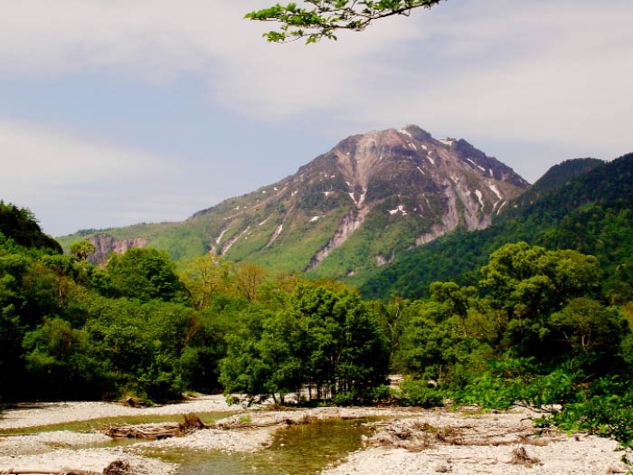
The mountain of wild rocky slopes and the smoke of the volcano
The wild rocky mountain comes into your sight first when you arrive at Kamikochi via the local bus and fuels ones’ motivation to climb to the summit.
●Hiking Data
Schedule: One day
Walking hours: 6 hours 40 minutes
(Up: 3 hours 55 minutes/Down : 2 hours 45 minutes)
Walking distance: 12.7 km
Difference in elevation: 1,189 m
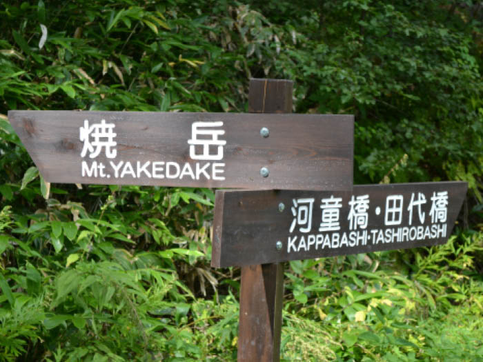
Kappa bridge

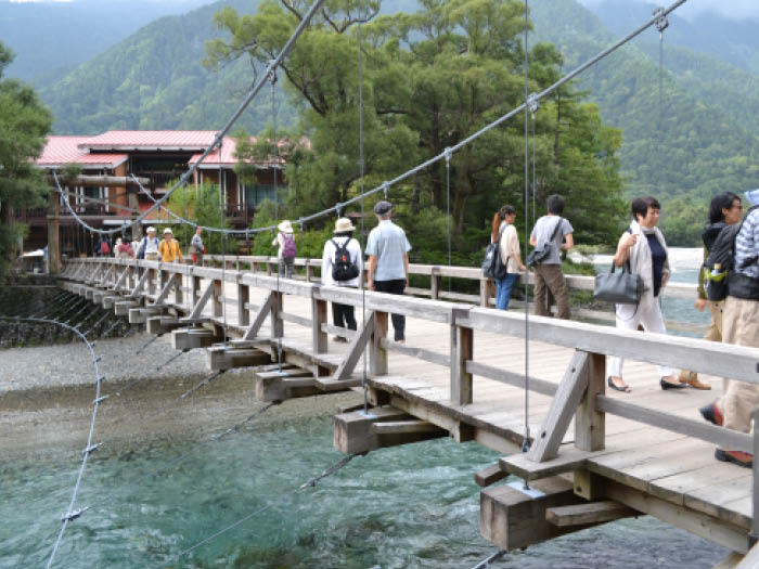
Elevation 1,500m
↓ 10 minutes
Tashiro bridge
Elevation 1,498m
↓ 5 minutes
A trailhead
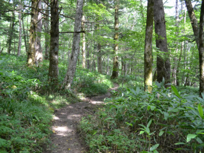
Elevation 1,500m
↓ 2 hours 30 minutes
Yake-dake-koya Mountain hut
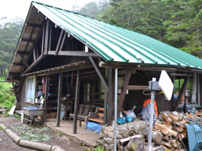
Elevation 2,090m
↓ 1 hour 10 minutes
Mt. Yake-dake (the north peak)
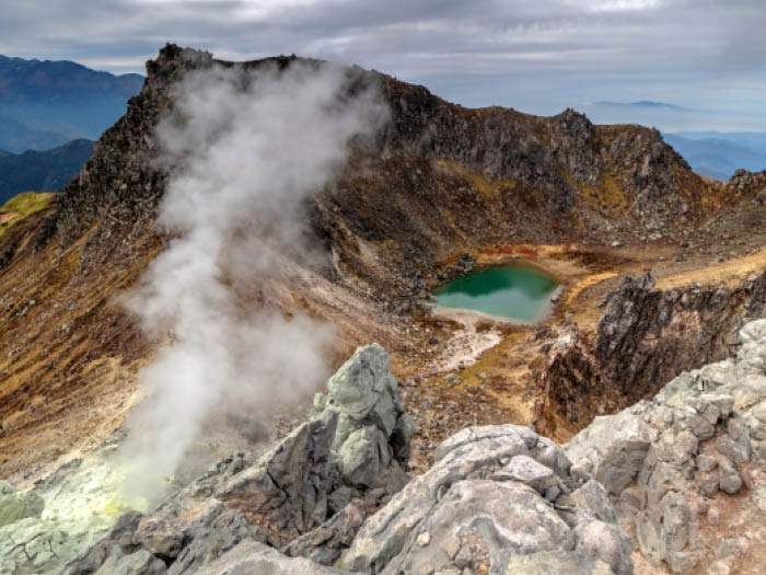
Elevation 2,444m
↓ 40 minutes
Yake-dake-koya Mountain hut
Elevation 2,090m
↓ 1 hour 50 minutes
A trailhead
Elevation 1,500m
↓ 15 minutes
Kappa bridge
Elevation 1,500m
Route Guide
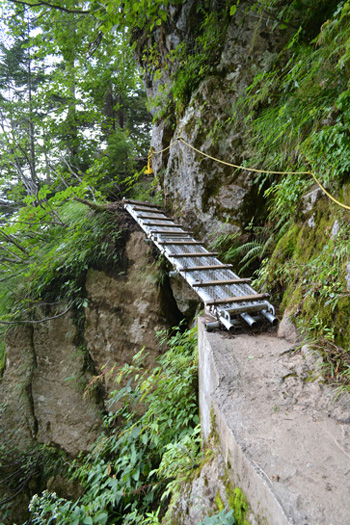
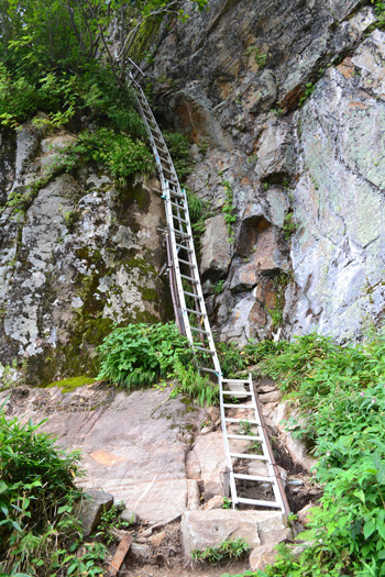
Cross Kappa bridge then turn left on a trail along the right bank of Azusa river. After passing a relief of Weston, a trailhead is reached. The trail becomes covered by bamboo leaves. Continue on the flat trail for a while. The trail begins to gradually grow steeper. After crossing a small stream, the trail becomes rocky and you will need to lift your legs high to overcome rocks. The trail comes to the zone where it requires the use of steel ladders. The slope is steep between ladders. Climb up a 10m length ladder and the rock by using a chain, a part of the trail with a series of ladders ends.
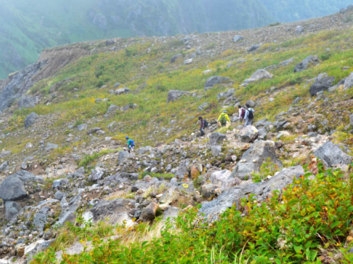
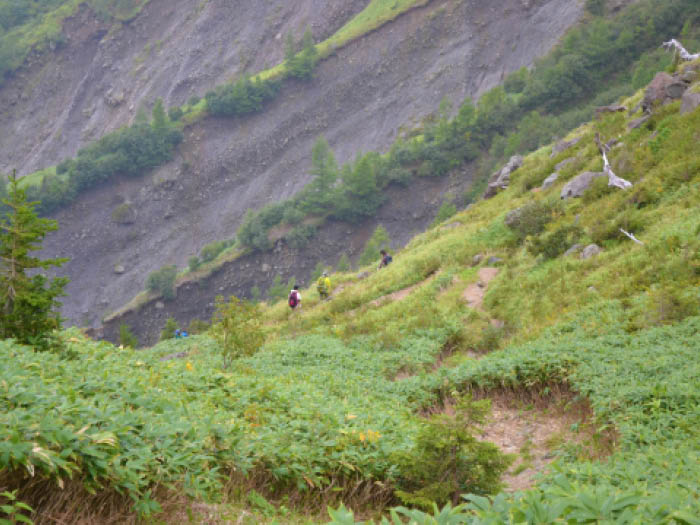
Take a zigzag pattern while climbing up a slope covered by bamboo leaves. There will be rocks marked with numbers which match with footsteps to Yake-dake-koya Mountain hut. It might be fun to see if those numbers match with your footsteps! Take a break on a bench in front of the hut. After passing the hut, the view changes drastically.
After an uphill from Yake-dake-koya Mountain hut, the summit can be seen. Descend to the saddle and the trail climbs back up on the rocky slope. Repeat a small and big zigzag pattern from time to time to climb up. Be careful not to slip on the graveled trail. There will be no resting spot so take a break while standing.
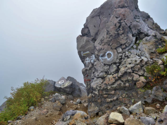
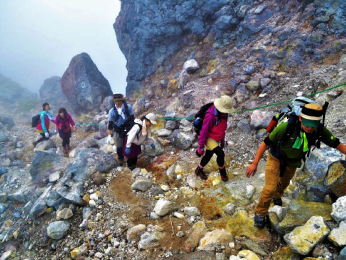
At the upper right corner facing front, a steam vent just below the summit becomes in sight. When you climb up to a shoulder, you can see the junction where a trail from Shin-naka-noyu route merges into. Proceed to the right slope to ascend. The end of this trail reaches the north peak of Mt. Yake-dake. There is a wide open view with nothing to block your sight. Especially the view from Mt. Nishi-hotaka-dake to Mt. Oku-hotaka-dake is impressive. Depending on the direction of the blowing wind, the sulfur gas might smell stronger. Descend the trail used for ascending immediately.